For years I have wanted to walk the “Camino de Santiago”. This is a pilgrimage route that ends in the city Santiago de Compestela in western Spain. The route dates from the middle ages. But after my bad fall, and the reconstruction of my ankle, I decided it would never happen.
The summer of 2012 when we were in Xàtiva, I rejoined the local exercise group “Ruta Sana”, which involves three walks of an hour every week, followed by some stretching exercises. The first time back with them was difficult, and my ankle ached afterward. I was sure I couldn’t continue. But I did. And my ankle got stronger and stronger. It was good medicine.
By mid-July, I decided I was ready to go and at least look at where the Camino de Santiago crosses the border from France, and enters Spain. And I thought that perhaps I could at least walk a mile
or so of it for fun.
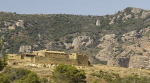
I took the train to my old friend, the city of Zaragoza, and then got on another train that went through the city of Huesca and on toward the Pyrenees. Soon after Huesca, the scenery began to get dramatic. We passed by the “Mallos de Riglos”- a group of huge rock formations jutting skyward.
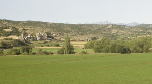
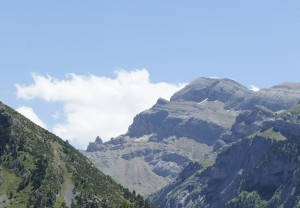
Soon the peaks of the Pyrenees came into sight beyond lush farmland and forests.
I got off near the end of the line, in Jaca, and checked into a comfy hotel near the town center. Although it was July, as evening approached the air became chilly (the elevation of Jaca is 2,690 ft above sea level). I asked about local transportation, and
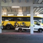
discovered that there is a bus that heads up toward the French border, stopping at small towns along the way, as well as a couple of ski areas near the top of the Somport Pass. Jaca – Castello de Jaca – Villanua – Canfranc (town), Canfranc Station, Candanchu (ski resort), Astún (ski resort). The next morning, I headed out on the yellow bus.
I had already mapped out an itinerary that involved a stop partway up, where I could amble along a less brutal section of the trail to see if I could handle it. But for the purpose of this account, we will jump forward, to my arrival at Somport pass.
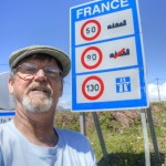
The bus stopped in a turn-off right below the border, before continuing onward to the ski resort of Astún. The main highway to France passes through a tunnel, but there is still a roadway that crosses over the top of the pass. Like most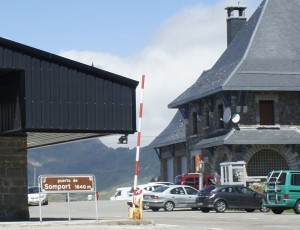 borders within the European Union, this is no longer guarded, no passport is needed to cross, and the gate remains in its open position.
I walked fifty meters into France and admired the view into the country. (remember that you can click on any of these pictures for a larger view!)
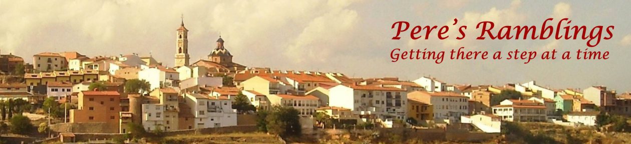
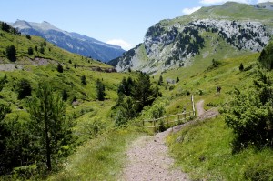
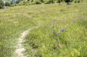
 At the top of the pass is a shrine that marks the crossing of the Camino de Santiago into Spain, and then the trail heads down the mountain. This route is very well marked and the trail is well traveled.
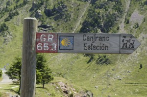
In addition to its status as the “Camino de Santiago” the trail within Spain is one of the designated “Long routes” for hiking, and this is indicated with a route number and red/white trail markings
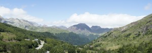
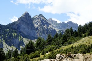
Onward I go heading down the mountain toward Canfranc Estación! The scenery and mountain views were, of course, stunning. I have spent lots of time in the Rocky Mountains, which are beautiful. The Pyrenees have a quite different feel to them.
Some who walk “The Camino”, move along at a fast pace, with the ultimate destination in mind.
On the other hand, I am a rambler. Constantly stopping to look around and take in the scenery.
I try to see every little thing, and all the big things too!
On a trail like this, it is impossible for me to just forge ahead, eyes glued only to the path in front of me.
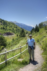
In places the trail was easy, and gentle. In other places it got a bit rugged. But my ankle held out!

One difference between the part of the Rockies with which I am familiar, and this area of the Pyrenees, is that it is pastoral. Along the way I encountered a large flock of sheep with their little tinkling bells. I first heard, then saw a small group of cattle, their deep cowbells clanking.
There was also a pair of horses in a small corral. They sported colorful leather bridles festooned with round, silver colored jingly bells.
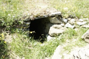
My eyes always searching, I saw this small tunnel. What was it for? When was it built? On one hand, there was a likelihood due to its rather small cross-dimension, that it was for irrigation, or control of water. But on the other hand, in the location where
I saw it, there was really nothing to irrigate. In my mind I imagined some obscure use by partisans of the civil war, hiding close to the border.
In the saddle of the mountain shown on the left, there is something that looked to be perhaps a ruined castle. Certainly there is no shortage of ruined castles in Spain! But when I got a better look, it was clear that it was only a “castle-like” outcropping.
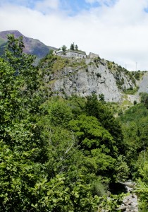
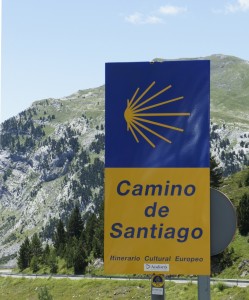
Not too far from Canfranc Estación, as I walked along the trail, I could see this ruined building up on a rocky outcropping. Is is the “Fuerte de coll de Ladrones”- a fort dating to the 19th century, built over the remains of an earlier fort from the16th century. Given the depredations by Napoleon’s troops during their occupation of Spain, the Iberian nation had a sense of urgency to protect the border from its northern neighbor. But, as you saw in earlier pictures, the two countries now share an open border. This fort was auctioned off to private ownership in 1990. (What do you think Rhonda? could we put a Bed and Breakfast there?)
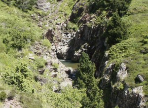
Getting closer to Canfranc Estación, the trail passes next to some deep ravines of the Áragon River, and there are signs providing guidance to those who practice the sport of climbing there.
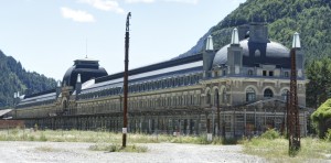
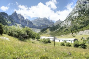
Finally the Camino reaches Canfranc Estación. The now derelict building was inaugurated, in the presence of the king of Spain and the President of France, in 1928 as an international train station, controlling traffic between France and Spain. Various conflicts, including the Spanish civil war caused periodic closure of the route. The station included both Spanish and French portions, and during the Second World War, when France was controlled by Nazi Germany, the Nazi’s used the French portion of the station, and there are even tales of Nazi gold being smuggled through the station. Apparently the station appeared in the movie “Doctor Zhivago”. Sounds like a good excuse to watch that great film again!
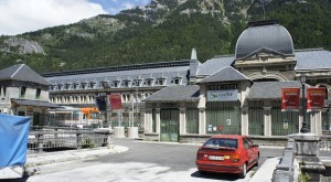
In 1970 a freight train derailed on the section of track in France, destroying an important bridge. International traffic was stopped and has not resumed. There are periodic calls to make repairs and reopen the route. The station itself has been declared a national historic site. There have been various plans to rehabilitate the structure as a hotel, as a railroad museum… But today it stands vacant. That same small regional train that I rode from Zaragoza terminates at this spot, using the tiny building you can see at the extreme left in the photo as the ticket station.
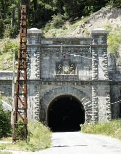
The the left you can see where the railway used to enter a tunnel to head under the mountain peaks and get to France. You can take a chilly walk a little way into the tunnel before reaching a barricade that seals it off.
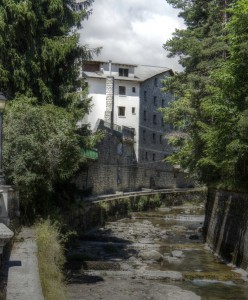
The Áragon River runs right through the narrow town of Canfranc Estación.
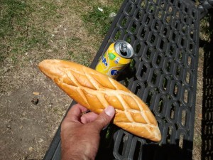
One of the big differences between backpacking in the wilderness of the Rockies, and walking the Camino, is that on the Camino you constantly pass through towns, where you can grab a bite to eat- either dining there, or slipping something into your pack for later. Ahhh… a small loaf of very tasty bread and a “Limón” soda.
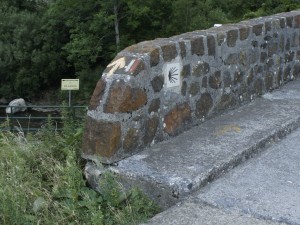
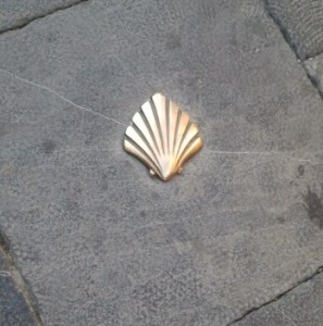
As I previously mentioned, the trail is well marked. Here on the end of a bridge, you can see the “shell” logo of the Camino, the yellow arrow- another marking for the camino, and the red and white stripes marking the “Grand Route” within Spain.
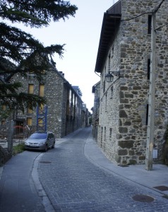
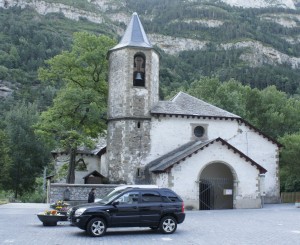
A couple miles down the trail from Canfranc Estación, you arrive at the town of Canfranc. It is a fairly small town, of solid stone buildings, situated in a narrow strip between the highway and the river.
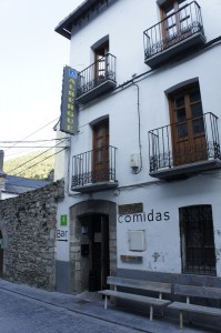
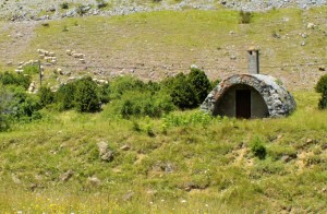
Most “Peregrinos” (pilgrims) who walk the Camino de Santiago stay in inexpensive, spartan lodgings called “Albergues”. Just before I passed this one, a small knot of Peregrinos headed out from it, preceding me down the trail toward the next town.
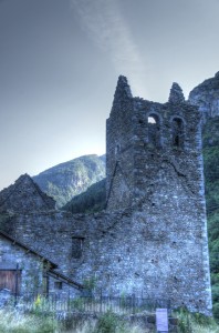
I spotted this ruined building, and have added it to my list as a potential Bed and Breakfast!
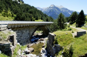
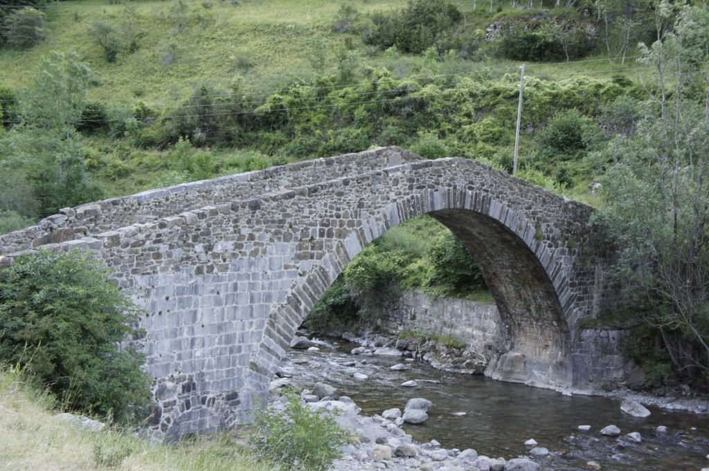
Just past the town of Canfranc, you come to this picturesque bridge rather interestingly known as the “new” bridge. Well, it is new in the sense that it replaced an older one! In terms of Spanish history, I suppose it is rather new, dating to 1599.
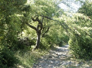
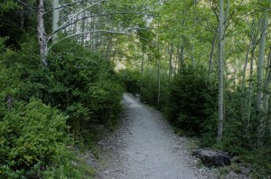
This part of the Camino is a truly lovely trail, with a wide variety of scenery. Much of the trail is remote from roads. These are examples of tranquil forest segments.
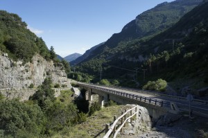
At this point the trail was roughly following the river, and since the river passed under the highway, so did the trail!
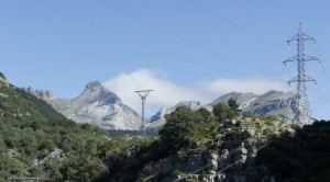
Looking back I was rewarded with a beautiful view of the peaks of the Pyrenees.
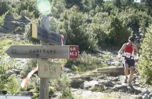
The next town, after Canfranc, is Villanua. The day I was there, townsfolk were participating in a mountain trail run. I had to keep carefully to the side after the point when their circuit joined the Camino.
Villanua seems to be a place that warrants a return trip. Nearby there is an interesting grotto, and also a “Dolmen” -remnant of an earlier Celtic settlement.
Well, I am not ready to really “walk the Camino,” but I am ready to continue traversing its route, one segment at a time. Weather and ankle permitting, I hope to be back for a little more in 2013! Paso a paso, even a cojo like me can eventually make it the whole way!