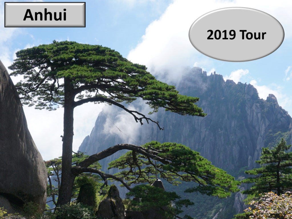
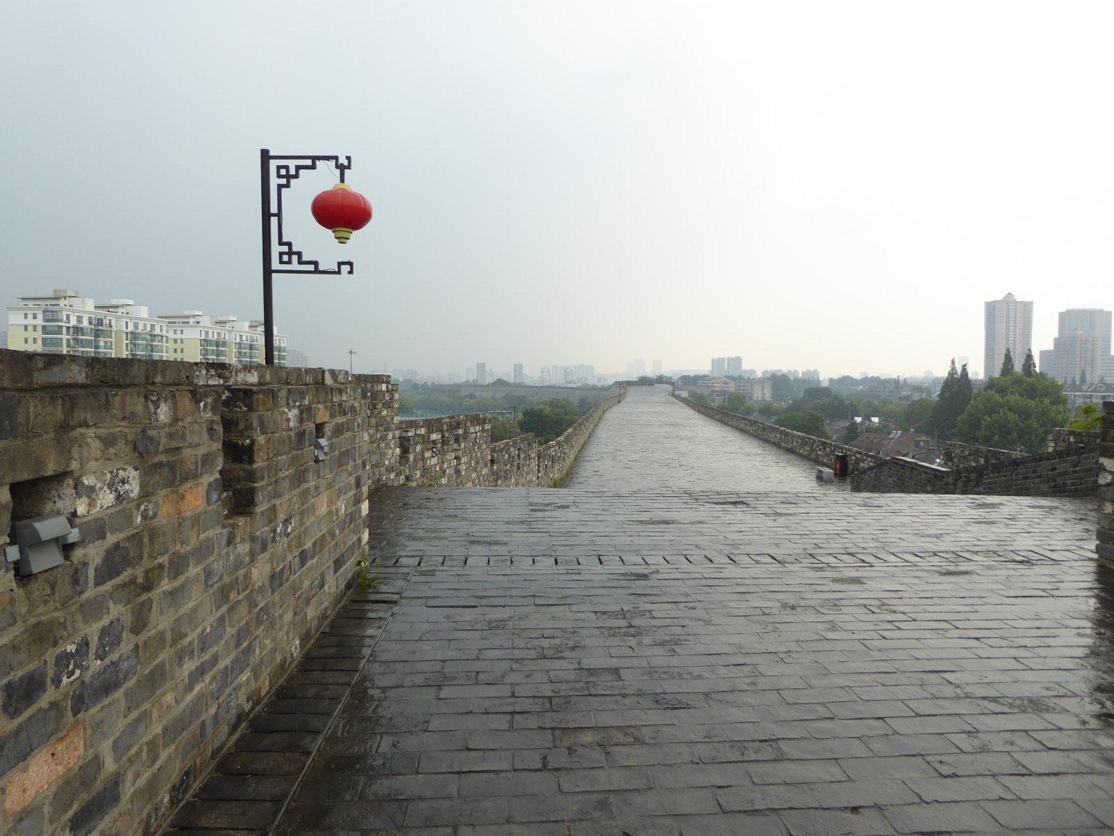
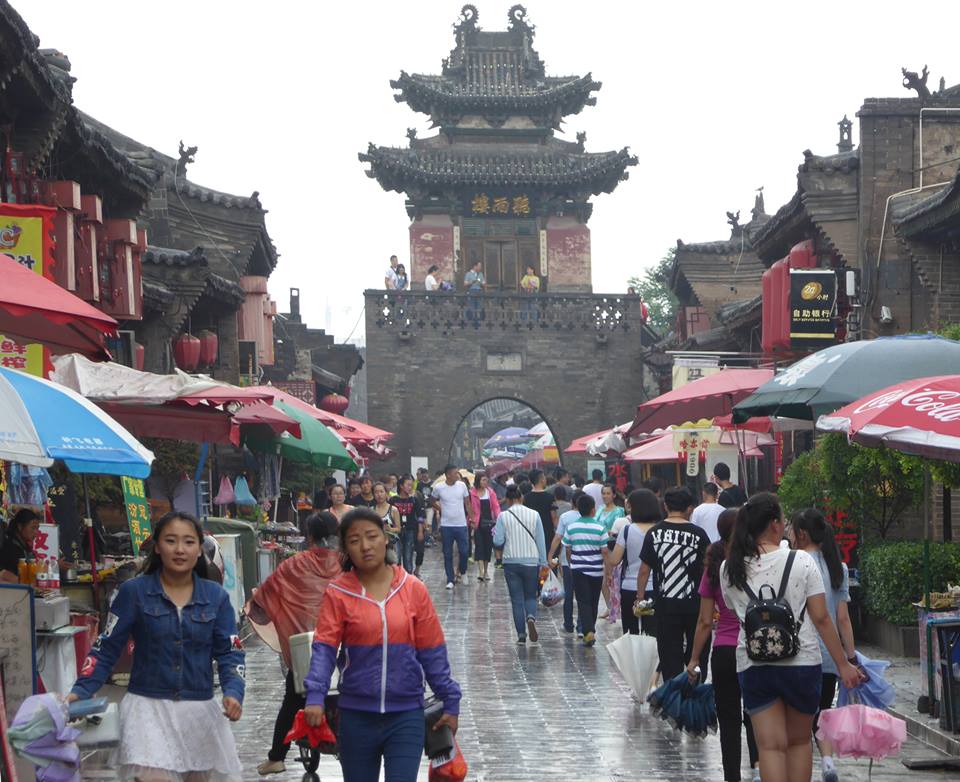
In September 2019 I visited the lovely province of Anhui. Clicking the photo will take you to a video travelogue of that trip. (The video is also posted on Vimeo and YouTube)
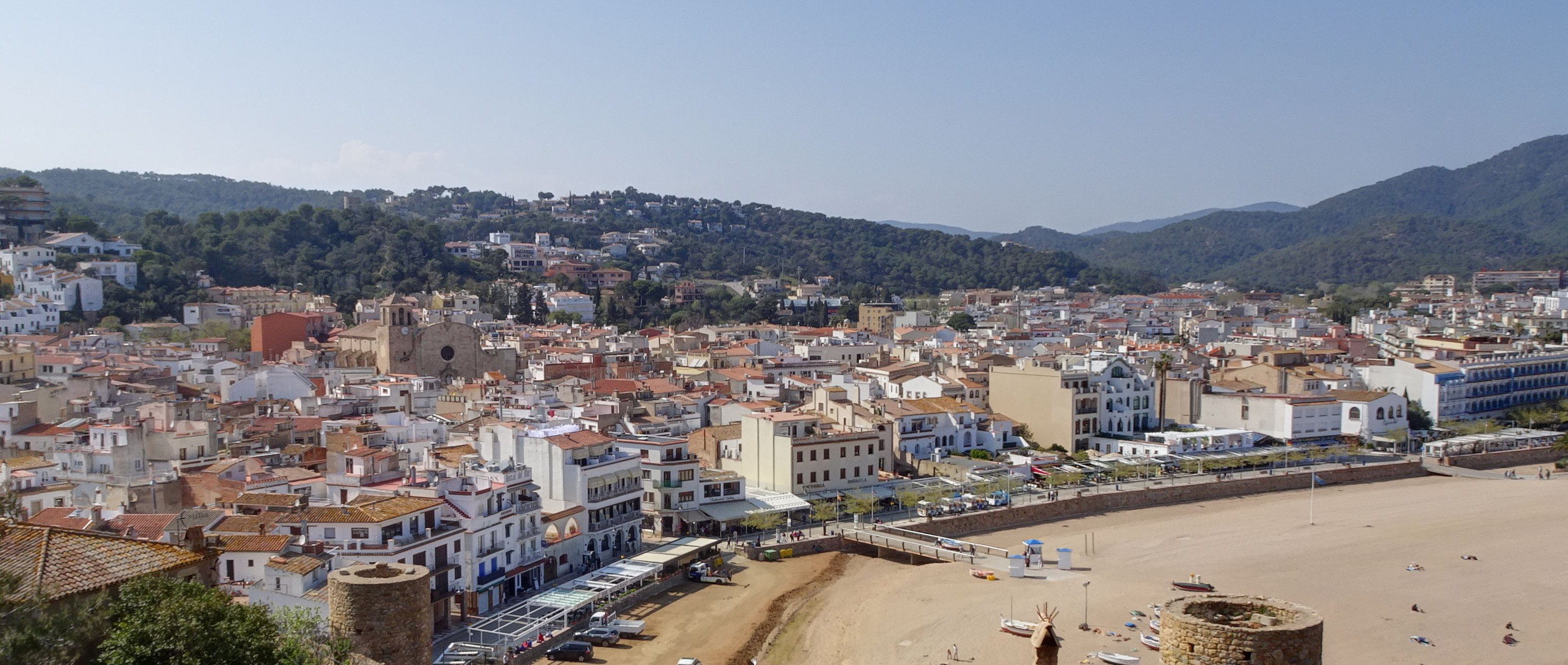
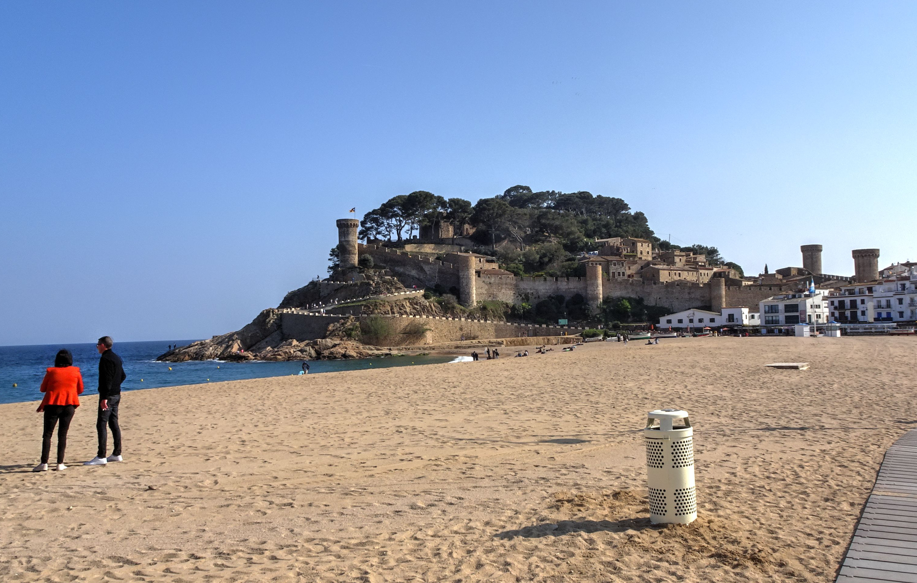
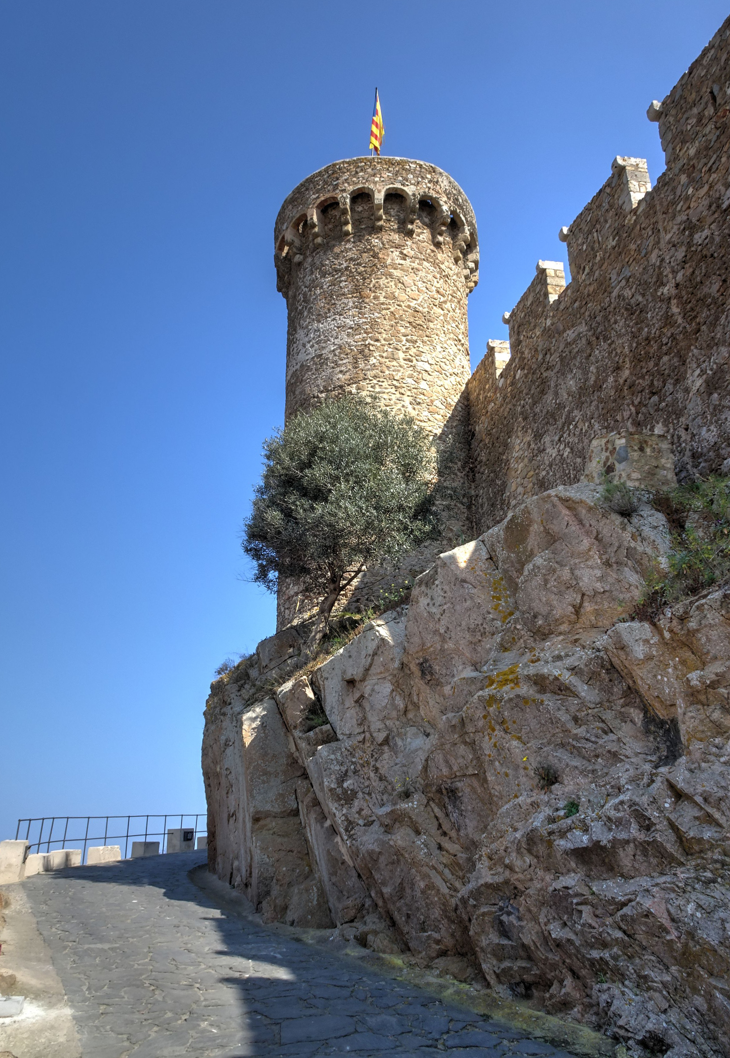
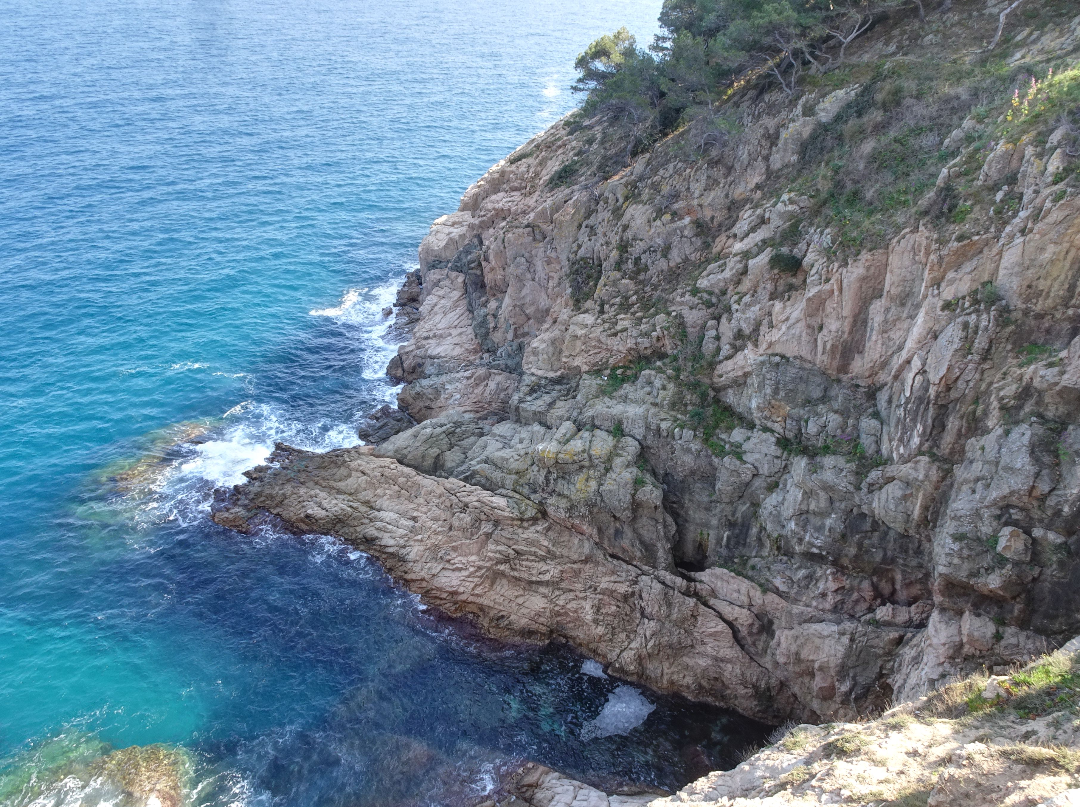
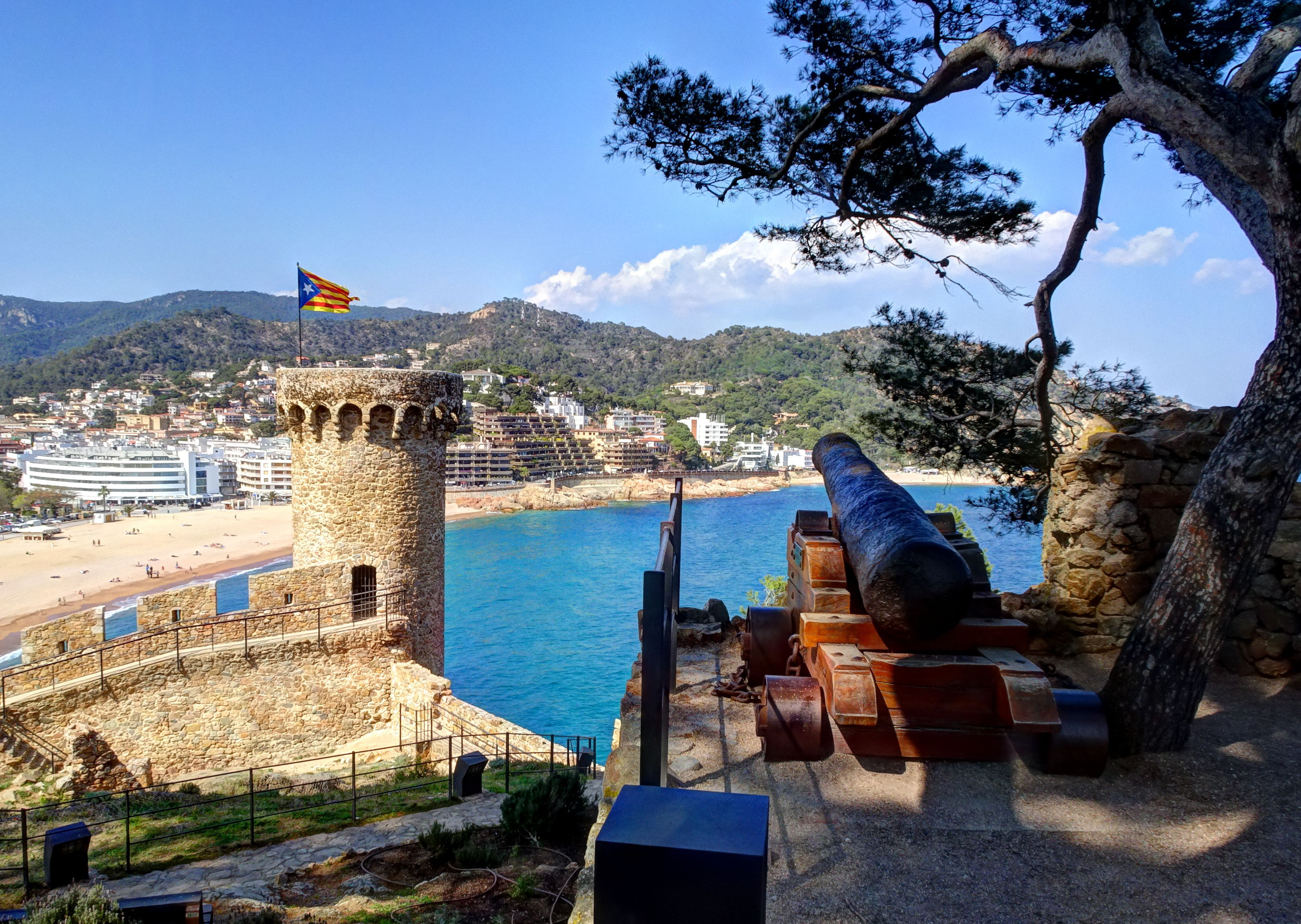
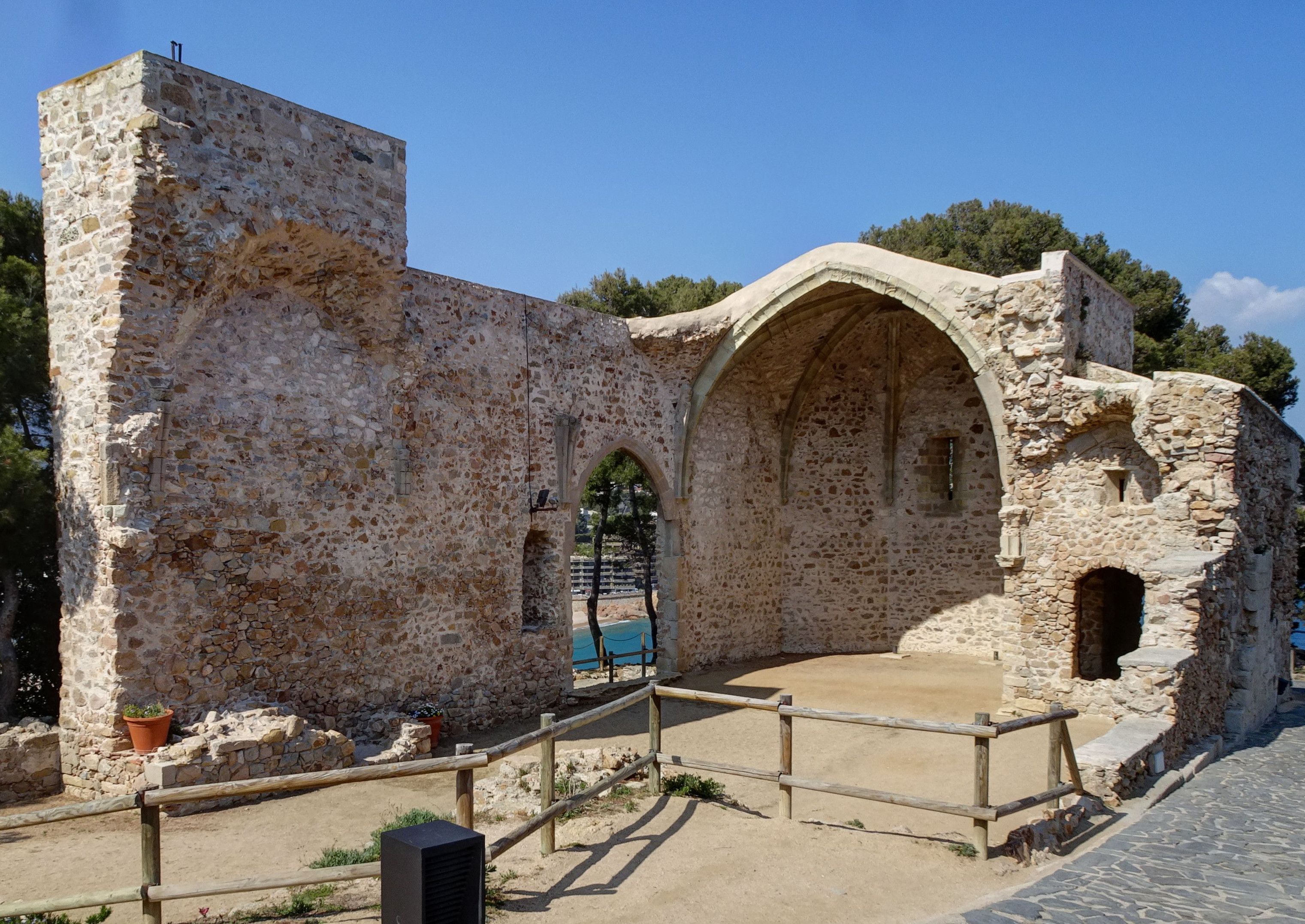
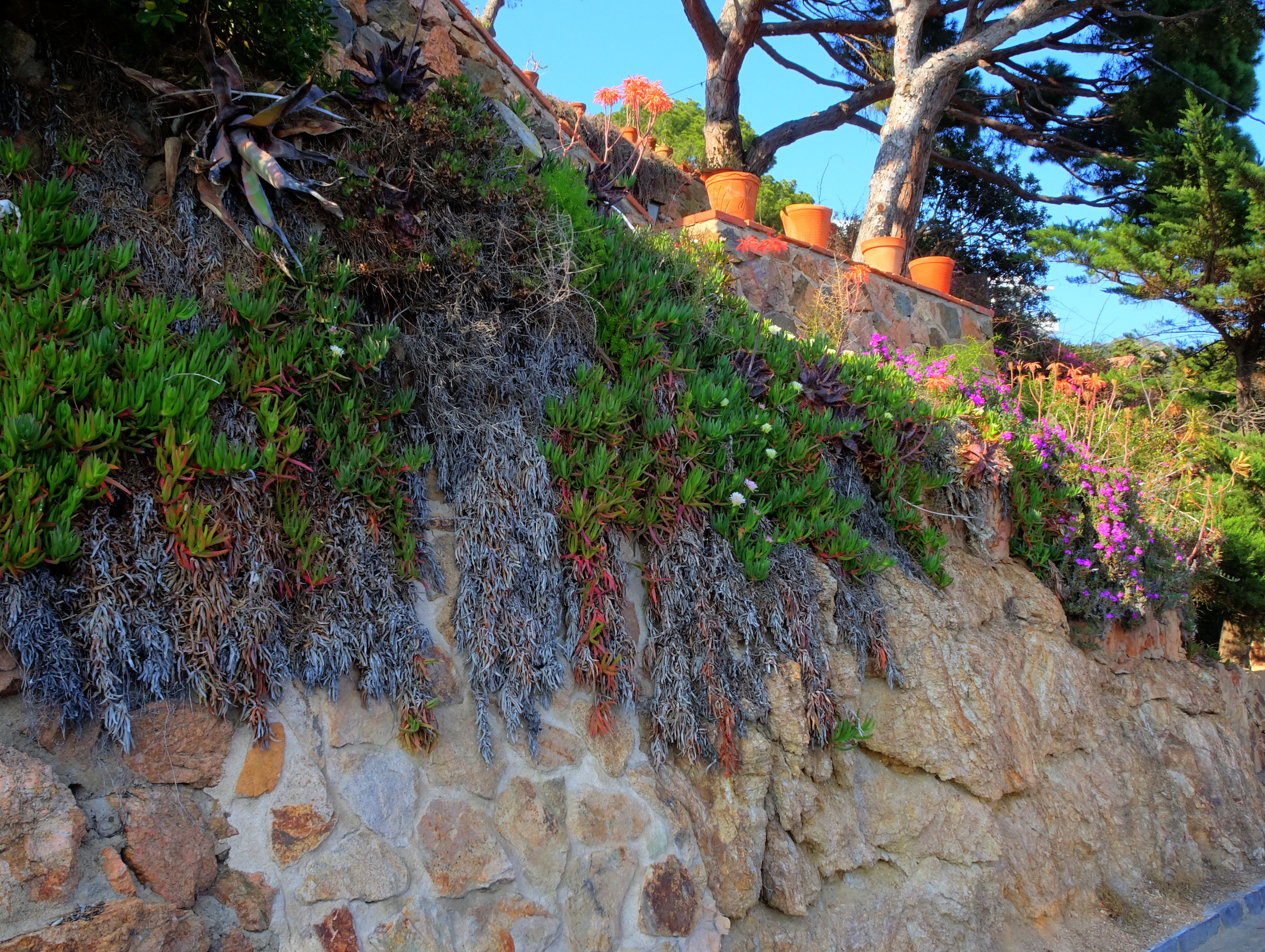
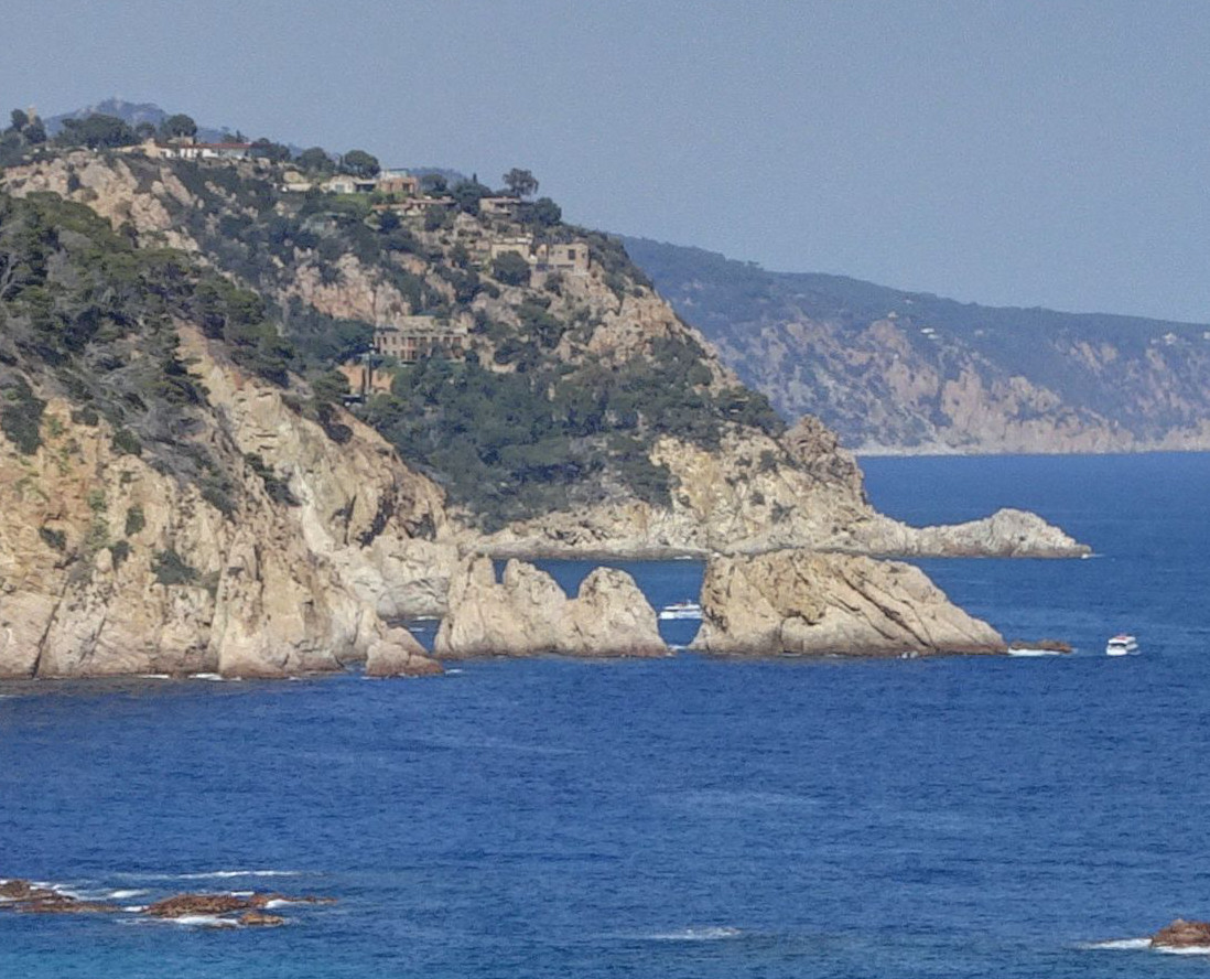
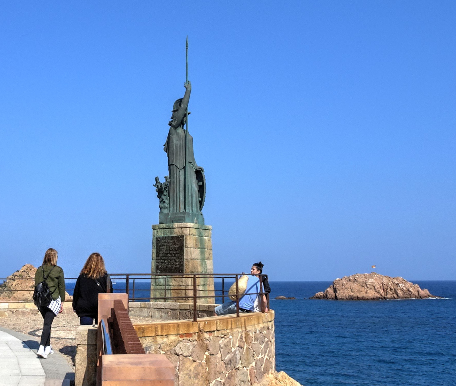
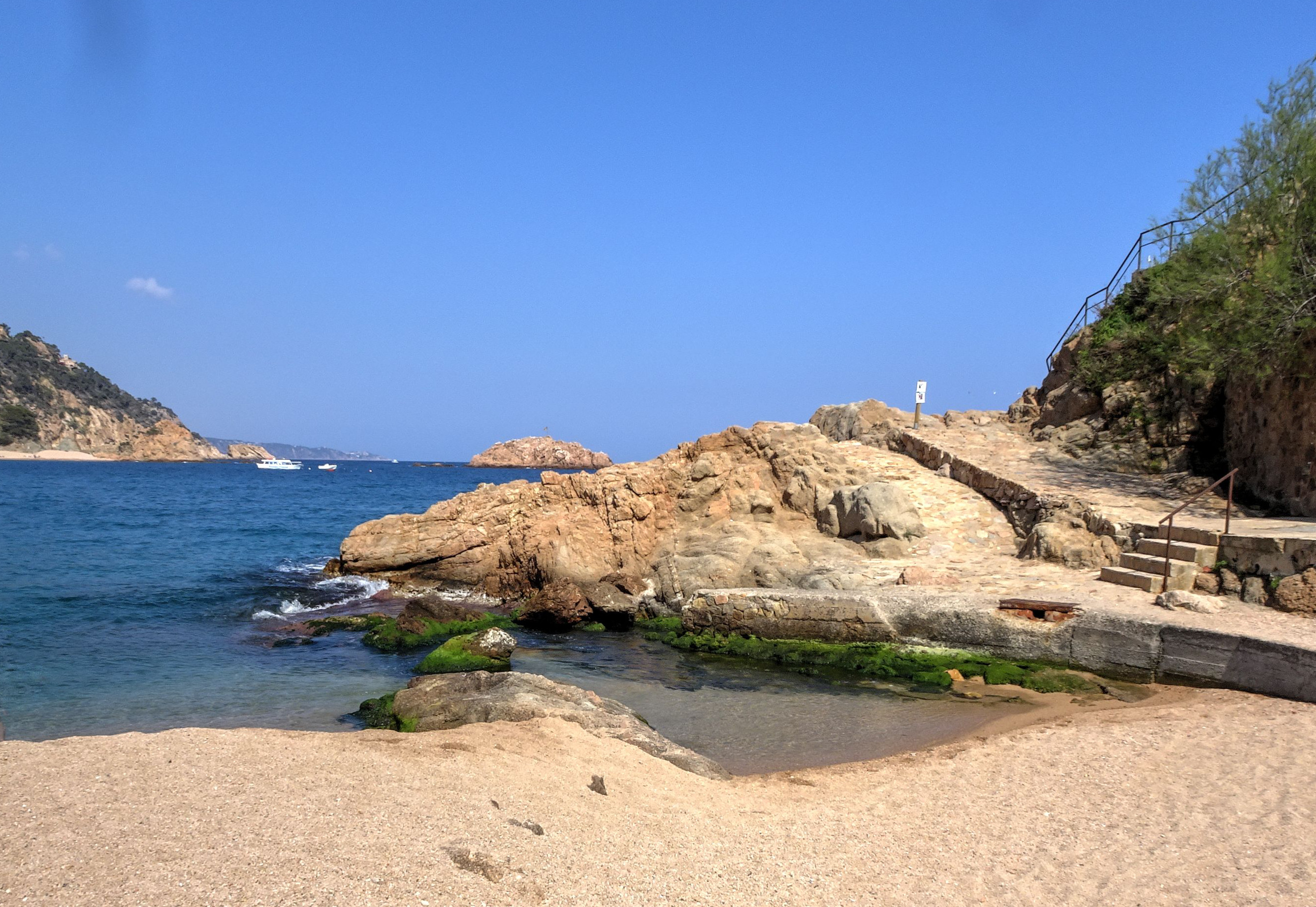
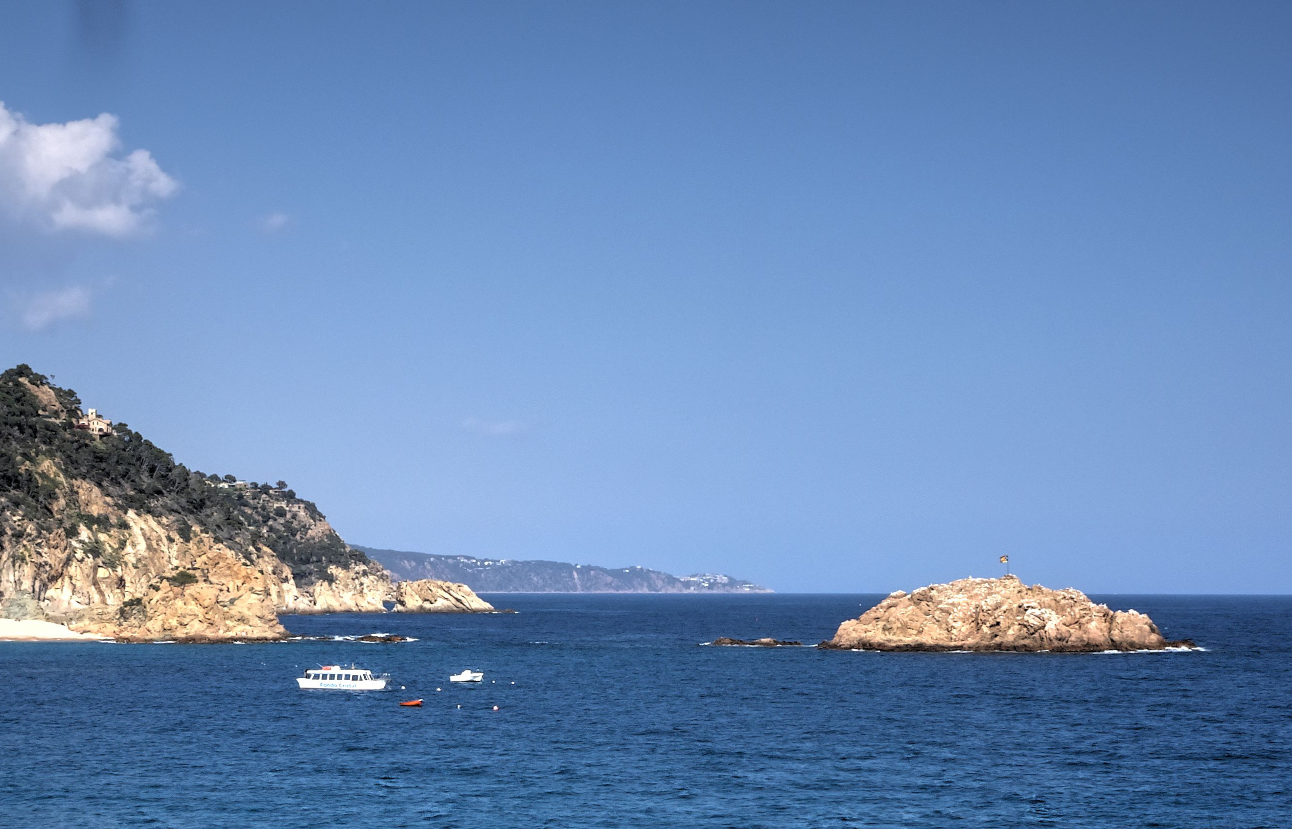
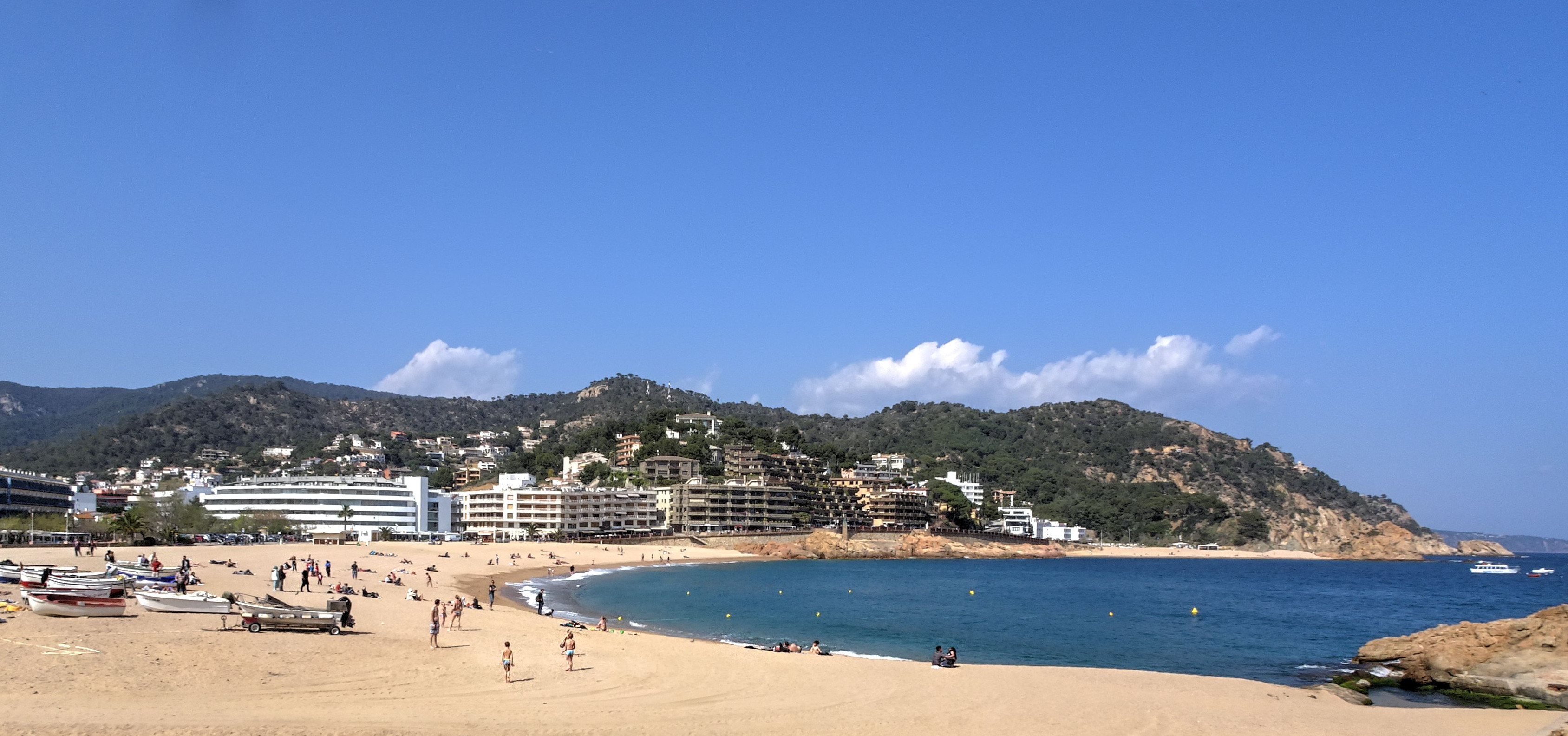
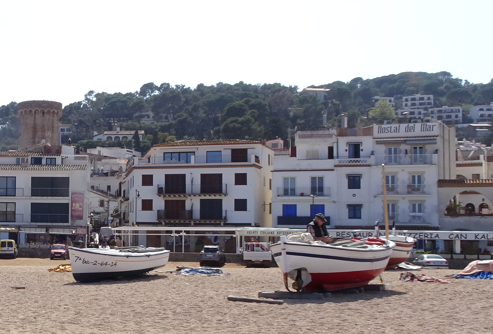
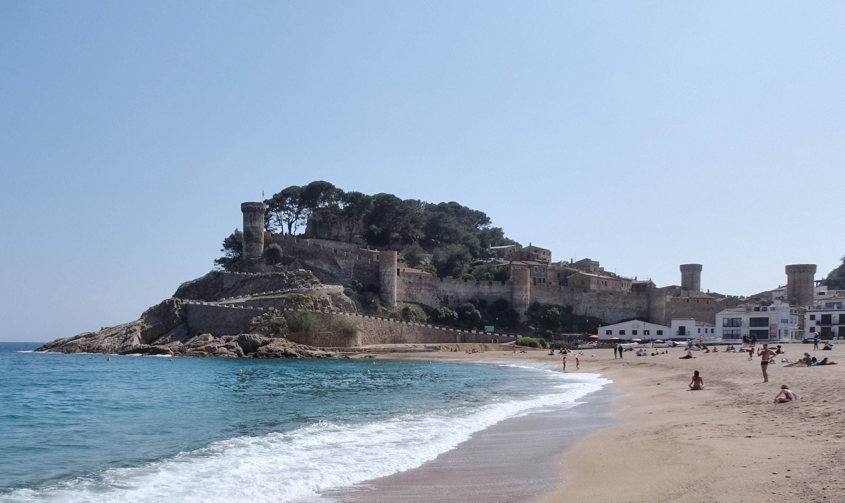
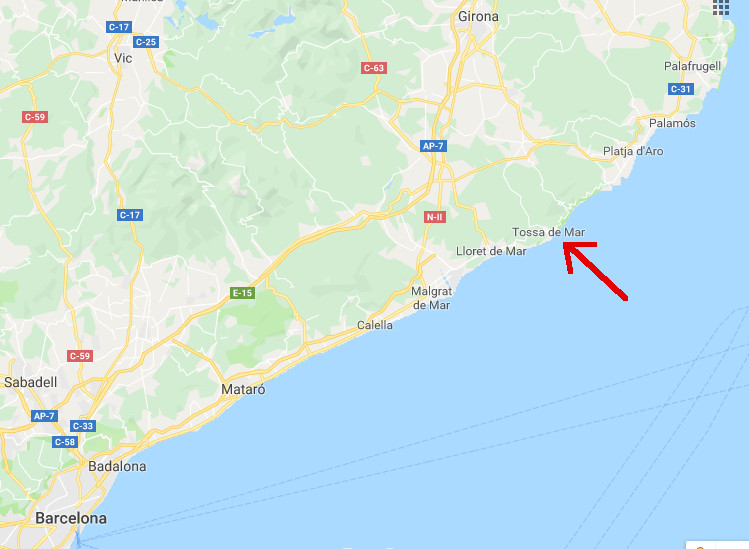
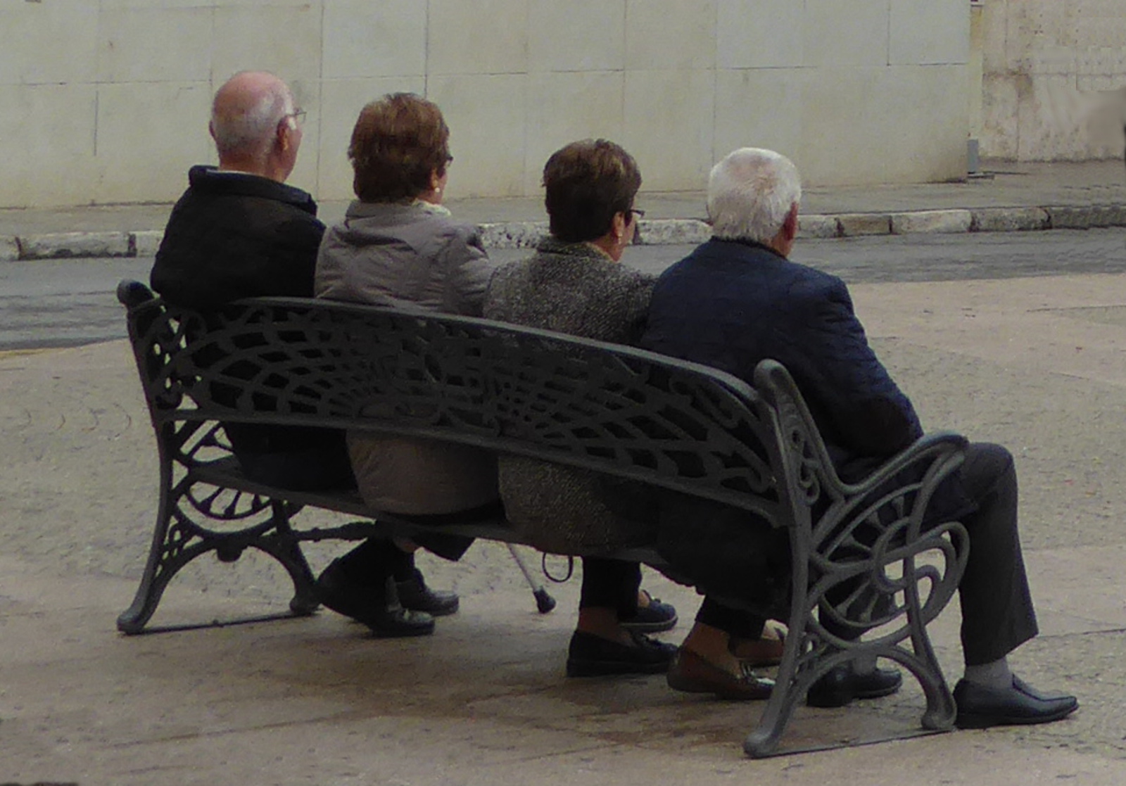
Mid-April during a short stay in Barcelona, I took a day trip by bus to Tossa De Mar. This is an old, pleasant town on the ‘Costa Brava” northeast of Barcelona.
My timing was good. The day was warm but it was too early in the season to be overly crowded with (other!) tourists.
This spot was inhabited as far back as the neolithic period. But the existing “old quarter” of the town dates to the 12th century. It was built on a hill, surrounded by a protective wall.
Now I will quit gabbing, and let the photos speak for themselves. (Remember that if you click on a photo, you will see an enlarged version.)
This could be a nice spot for a return visit and a hotel overlooking the beach and sea!
Chinese paper currency features images of some popular travel destinations.
In late 2017 I realized that I had been to all the places depicted on the current bills, except the “Three Gorges” of the Yangtze (Changjang 长江) river.
So, I thought, why not “follow the money”, and add a cruise through the Three Gorges during my 2018 trip to China! So I did!
As a preparation to posts about my 2018 adventures, here is a review of China’s one yuan to 100 yuan notes, and photos from my visits to the scenic spots shown:
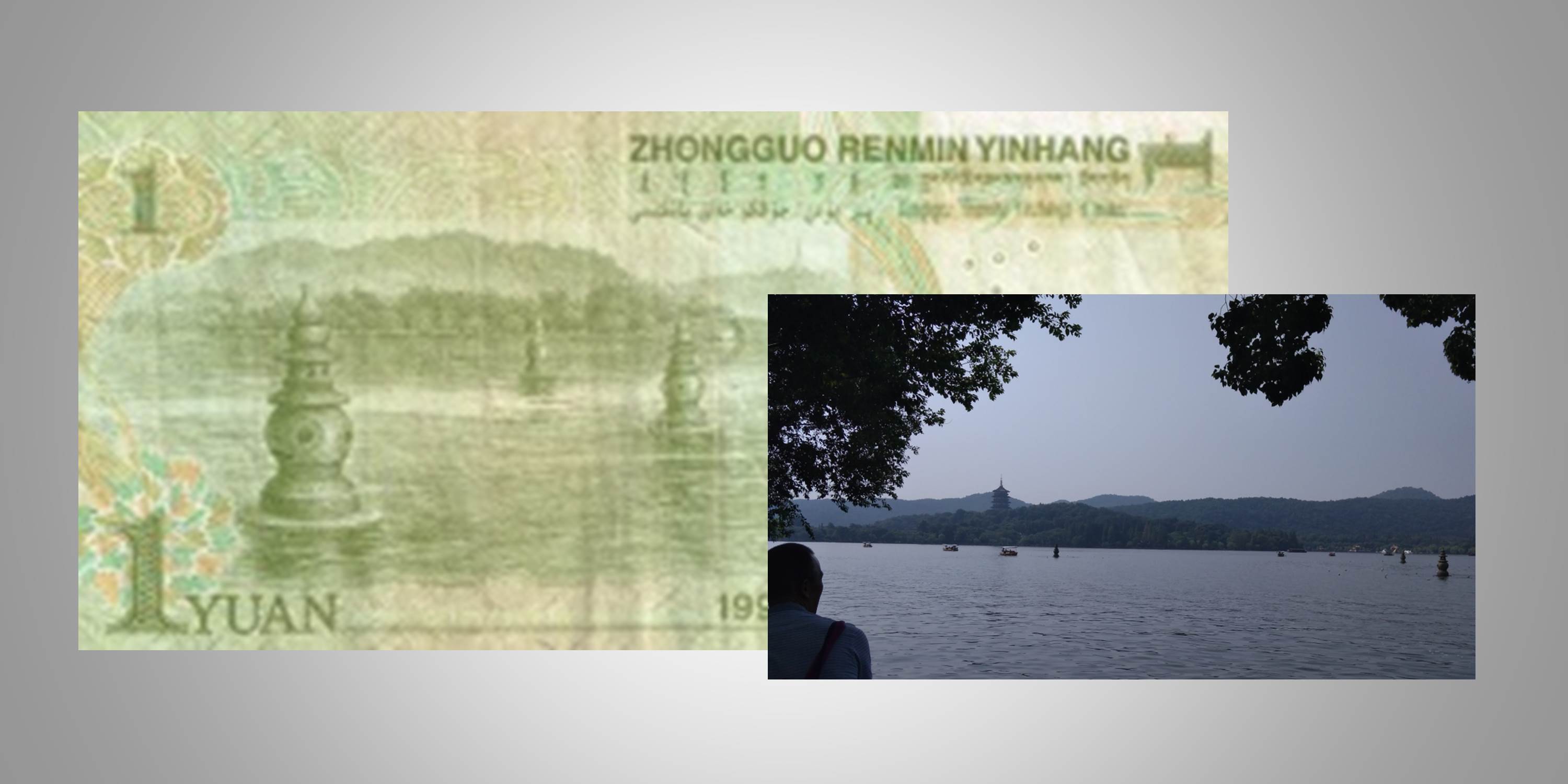
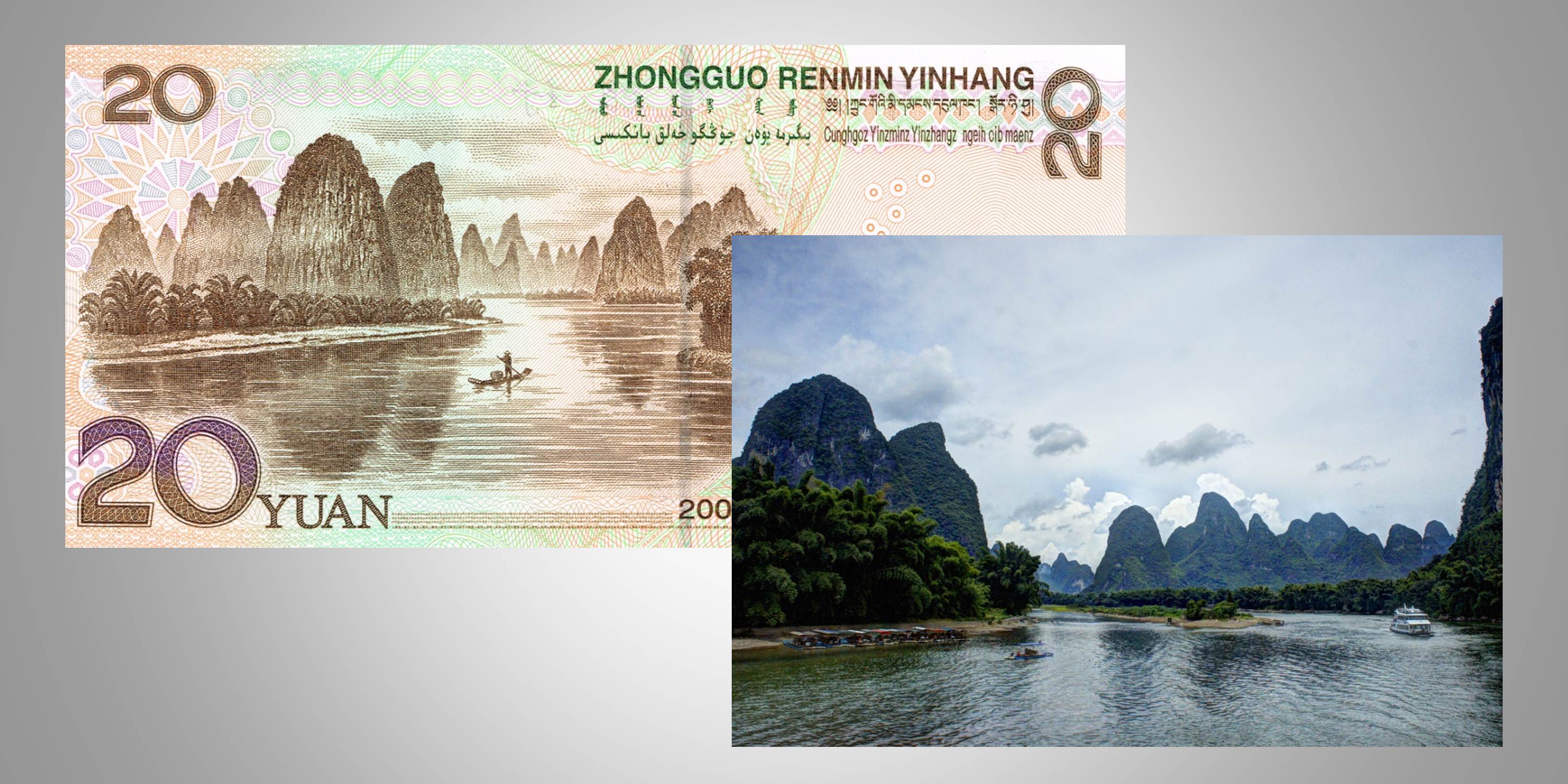
One Yuan: Hangzhou – West Lake
(Hangzhou: Visited in 2017)
Hangzhou is a beautiful city in Zhejiang province on the east coast of China. One of the most famous attractions of the city is West Lake. The one yuan note has a close-up view of the three stone pagodas on the lake. Here is a description from visithangzhou.com:
“There are four beautiful islands in West Lake and the largest one of called named Three Pools or The Lesser Yingzhou Isle. The isle itself is a man made landscape from 1607 and its beauty is almost beyond imagination. The delightfulness and richness of gardening and harmony is astonishing. The islet itself has a minor lake so it’s an islet in a lake with a lake you are entering when here…
At the southern part on the island, rising from the water, there are three 2-meters high and hollow stone pagodas from the late 11th century. On a full moon night people can row out to the pagodas, place a candle in the stone and a light will come out of the five equally spaced windows reflecting the moon into the water and making it look like there were several magic moons in the water.”
Additional information can be seen at: China Daily Justgola
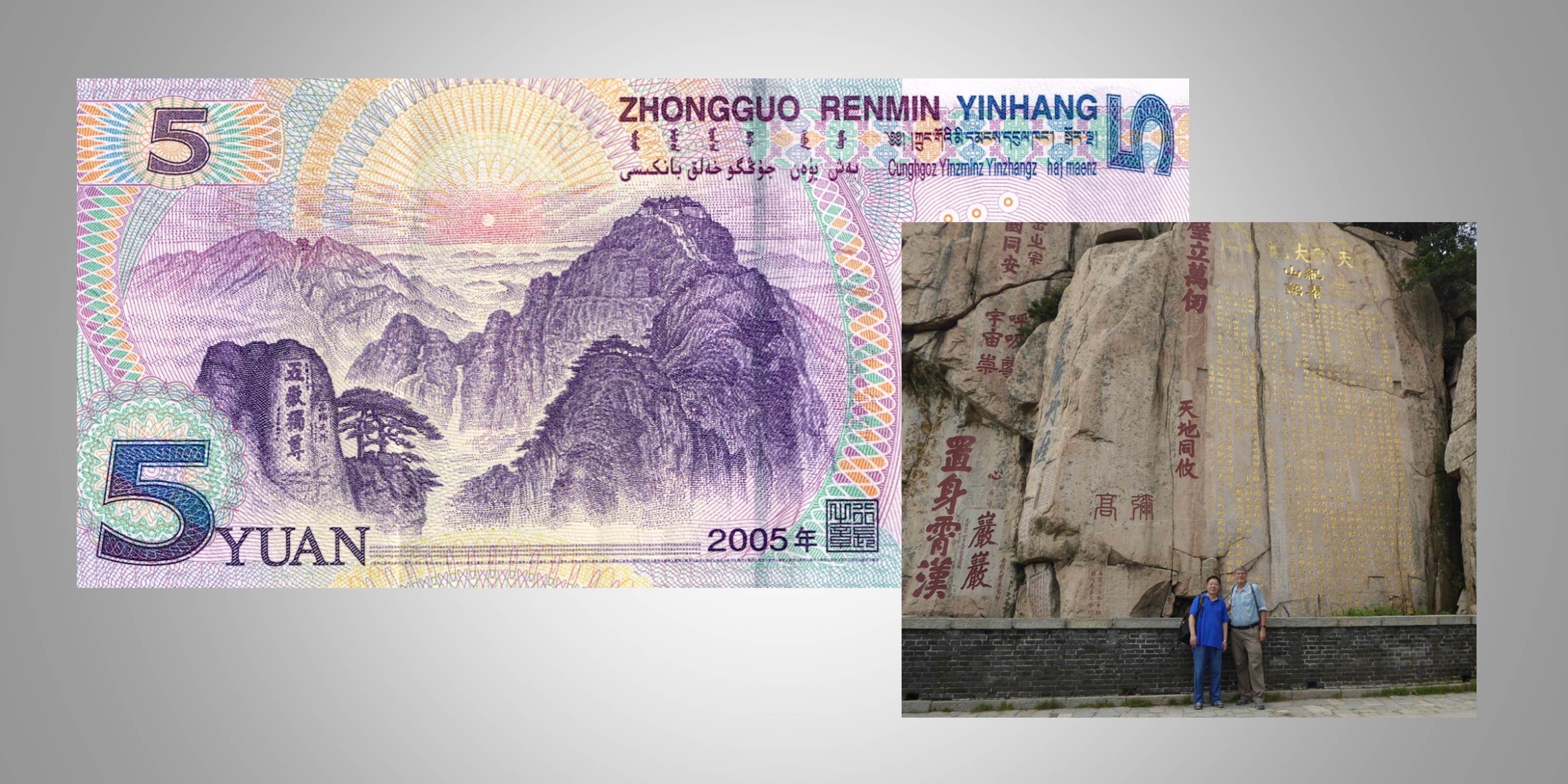
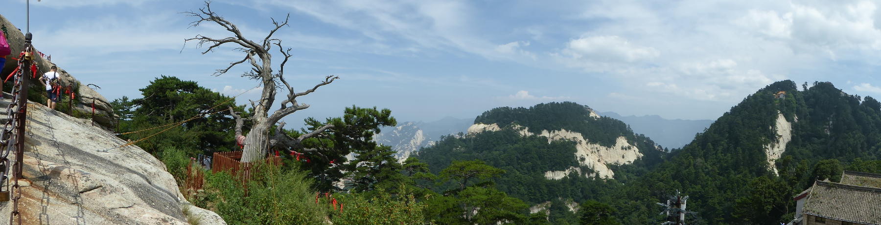
Five Yuan: Taishan (Mount Tai)
(Taishan: Visited in 2017)
(No my friends, contrary to the assumption of many in the XJTU program, the image is NOT Huashan!)
Taishan (Mount Tai) is located in Shandong province near the city of Jinan.
Of China’s “Five Sacred Mountain”, Taishan is considered the most important. Ascending the mountain was a ritual for Chinese emperors. Located in eastern China, from its heights they say you get the first view in China of the sun’s rays at dawn.
On a visit to Jinan, my friend (and calligraphy teacher) Xu Gang was kind enough to accompany me to the top of the mountain. The mountain has been the scene of pilgrimages by Confucius, Laozi (Lao Tze), many Chinese Emperors, and even Mao Zedong. Information on the UNESCO site
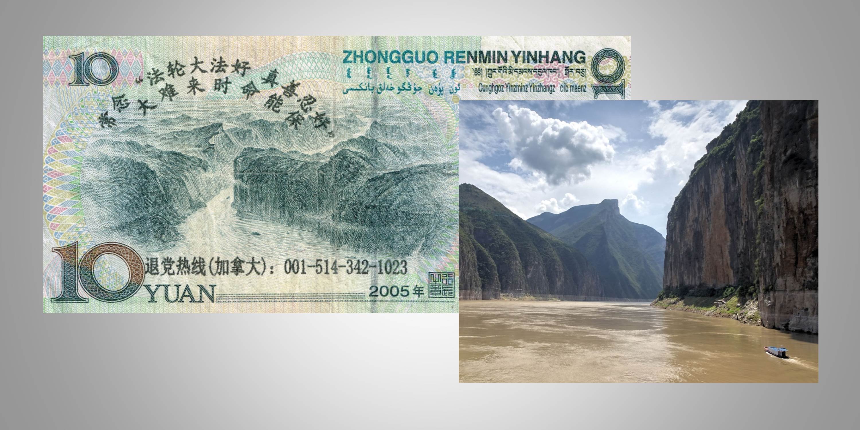
Ten Yuan: Three Gorges
(Three Gorges: Visited in 2018)
Spectacular scenery of the mighty Yangtze (Chiangjiang) river. The region’s water level rose with the completion of the Three Gorges Dam. Leisurely cruises either upriver or downriver provide an opportunity to enjoy beautiful views and to pass through history. With my friend Marlene Miyamoto, I was a passenger on the “Victoria Selina”, embarking in Chongqing. The trip ended with a visit to the impressive Three Gorges Dam and a drop-off point of Yichang. Along the way we visited interesting historic sites, some connected with the Three Kingdoms period of Chinese history.
(Li River: Visited in 2015)
Famous sections of the Li River lie between Guilin and Yangshou in Guangxi province. The scenery is beautiful whether you travel on the river in a small boat or a cruise ship. You pass small villages, and see stunning karst mountains. Highly recommended! Also, from Guilin you can visit picturesque agricultural areas and traditional towns of China’s ethnic minorities. In 2018 I returned to see the Longsheng/Longji rice terraces and the Dong community in Changyang.
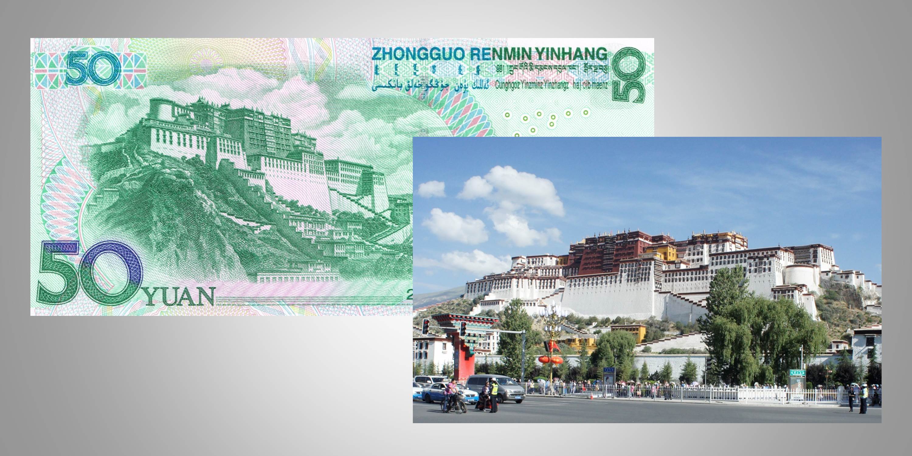
(Lhasa: Visited in 2015)
The Potala Palace is an imposing landmark. It is said that it so inspired the American architect Frank Lloyd Wright, that he kept a photograph of it in his study.
The inside of the building is filled with incredible treasures of sacred Buddhist artwork. I was stunned that so much had survived the destructive “Cultural Revolution” (1966 – 1976).
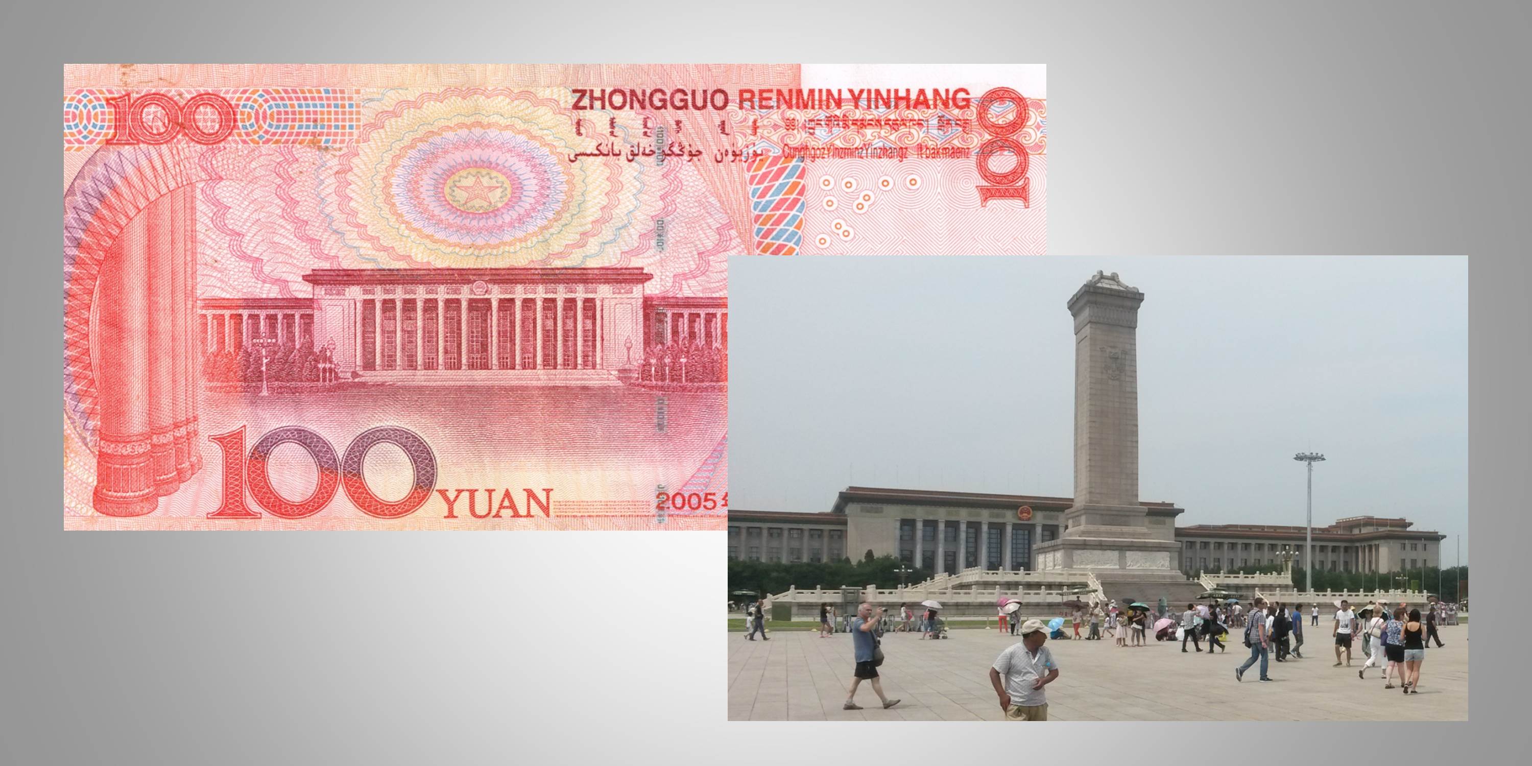
One Hundred Yuan: Great Hall of the People – Beijing
(Beijing: visited in 2015 and 2018)
The Great Hall of the People stands on the west side of Tianamen Square. I must confess that on both my visits to Beijing, I was more focused on the Forbidden City than on the landmark shown on the 100 yuan note. There is a lot so see in Beijing. Maybe I will have to visit again!
(Clicking on any of the images will enlarge it. In many cases, clicking a second time will make it even bigger)
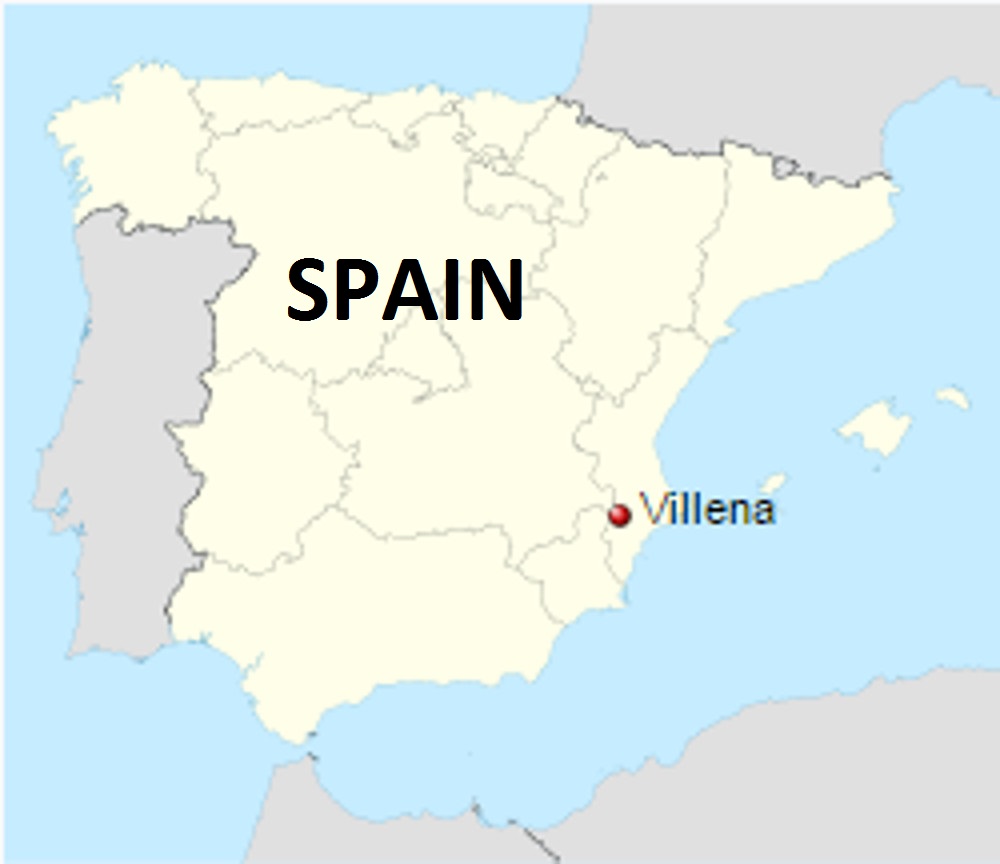
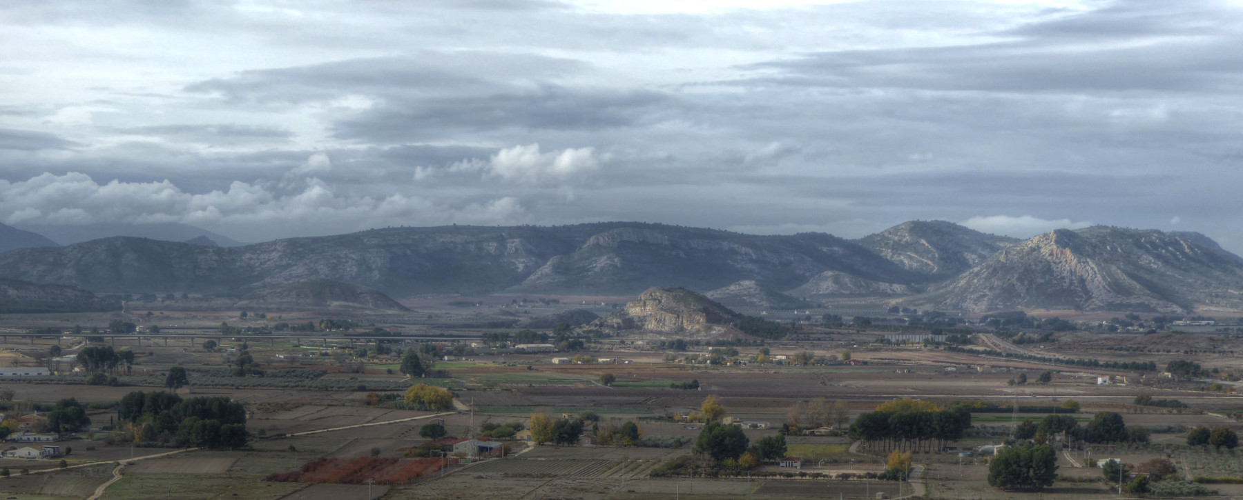
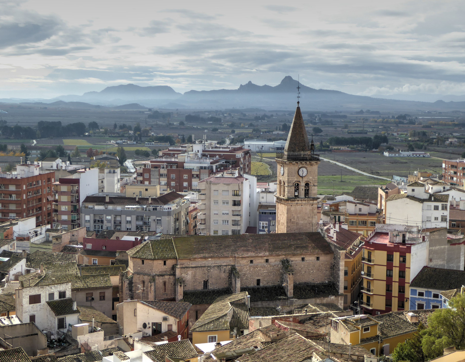
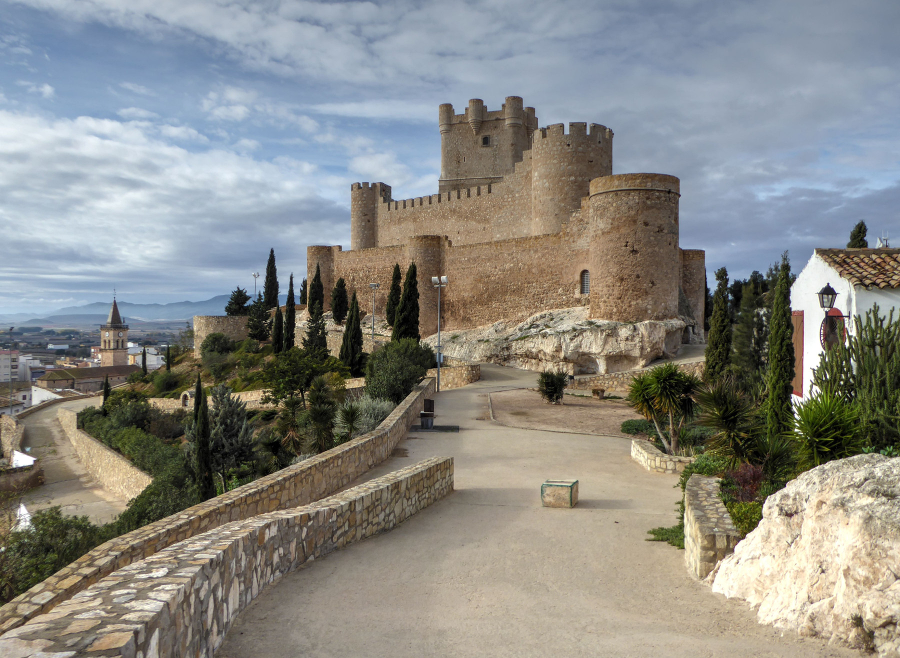
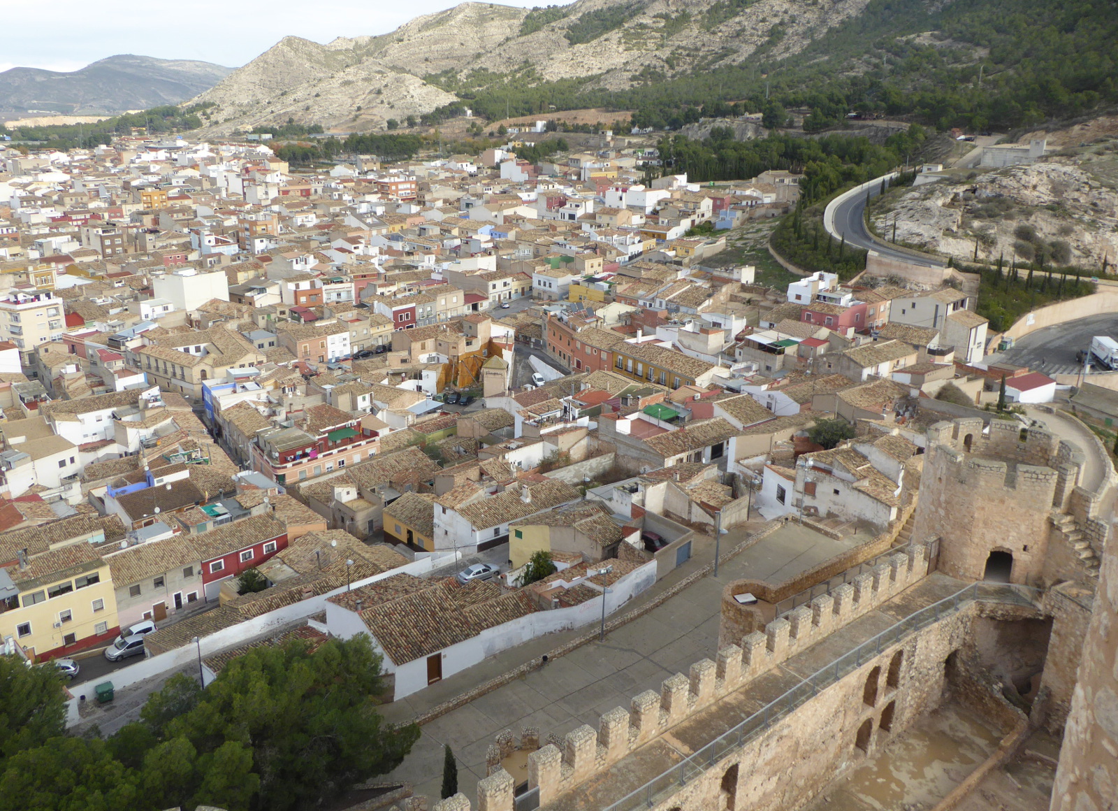
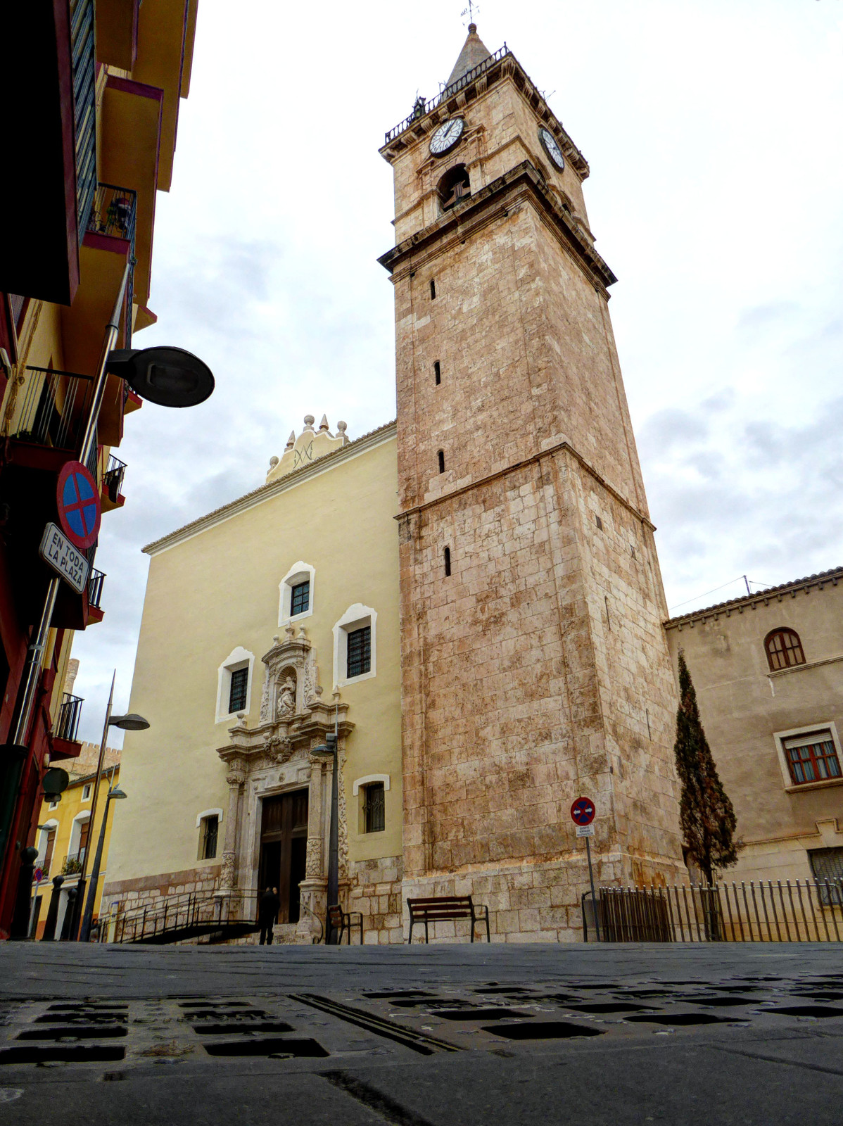
At the end of November (2016) I had a chance to visit Villena.
The town is located in the province of Alicante, but is just over a half hour distant from Xàtiva by train.
Those who are familiar with Spanish literature might know of the nephew of King Alfonso X “el Sabio”, Don Juan Manuel. Living in the 14th century, this Prince of Villena wrote a number of books and is considered one of the most important authors of his era. His series of stories involving the “Conde Lucanor” are delightful.
Villena also has some fame for footwear and wines produced in the area. It was the birthplace of Ruperto Chapi, composer of symphonies and zarzuelas (a Spanish cross between a musical and opera).
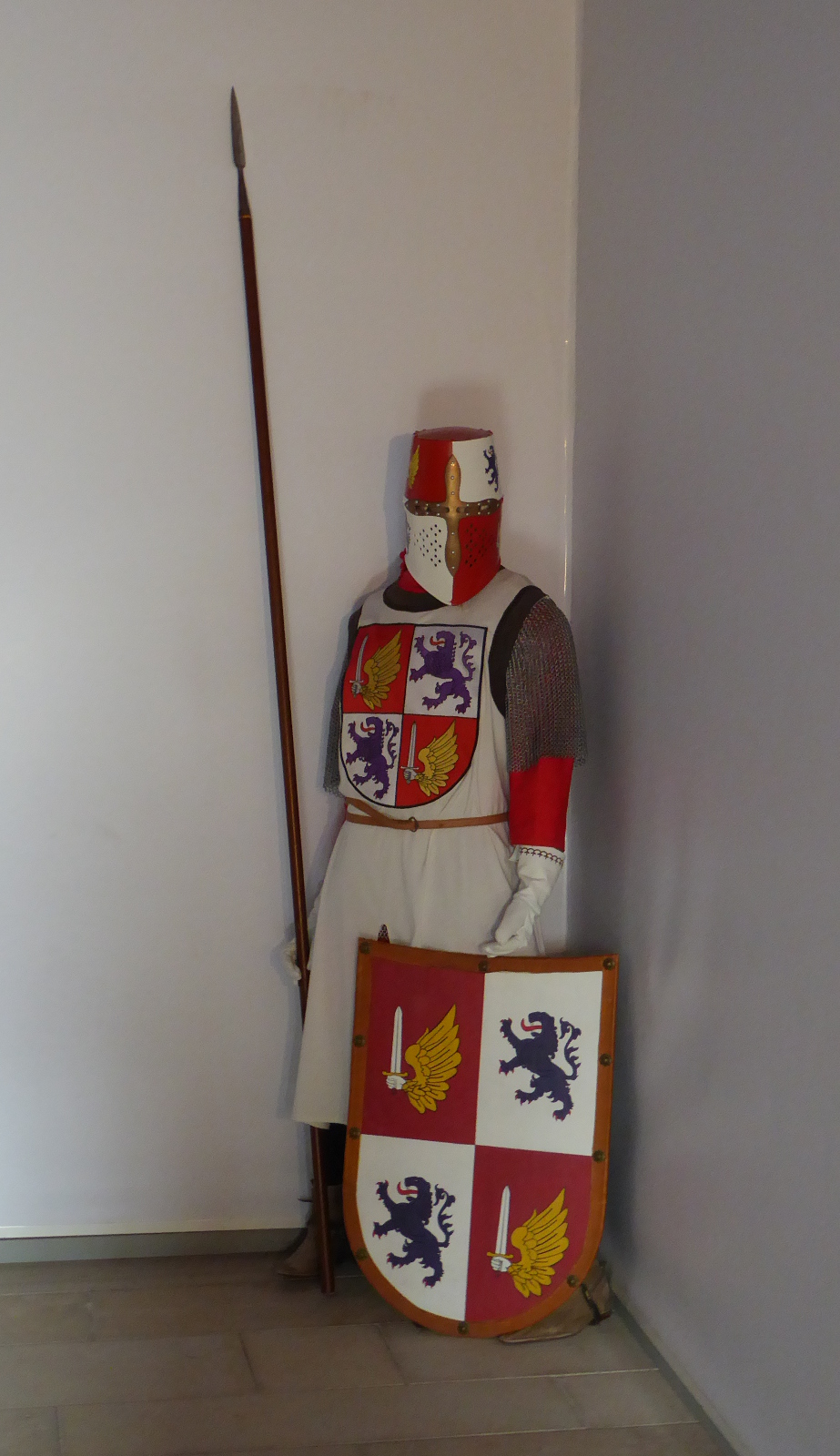
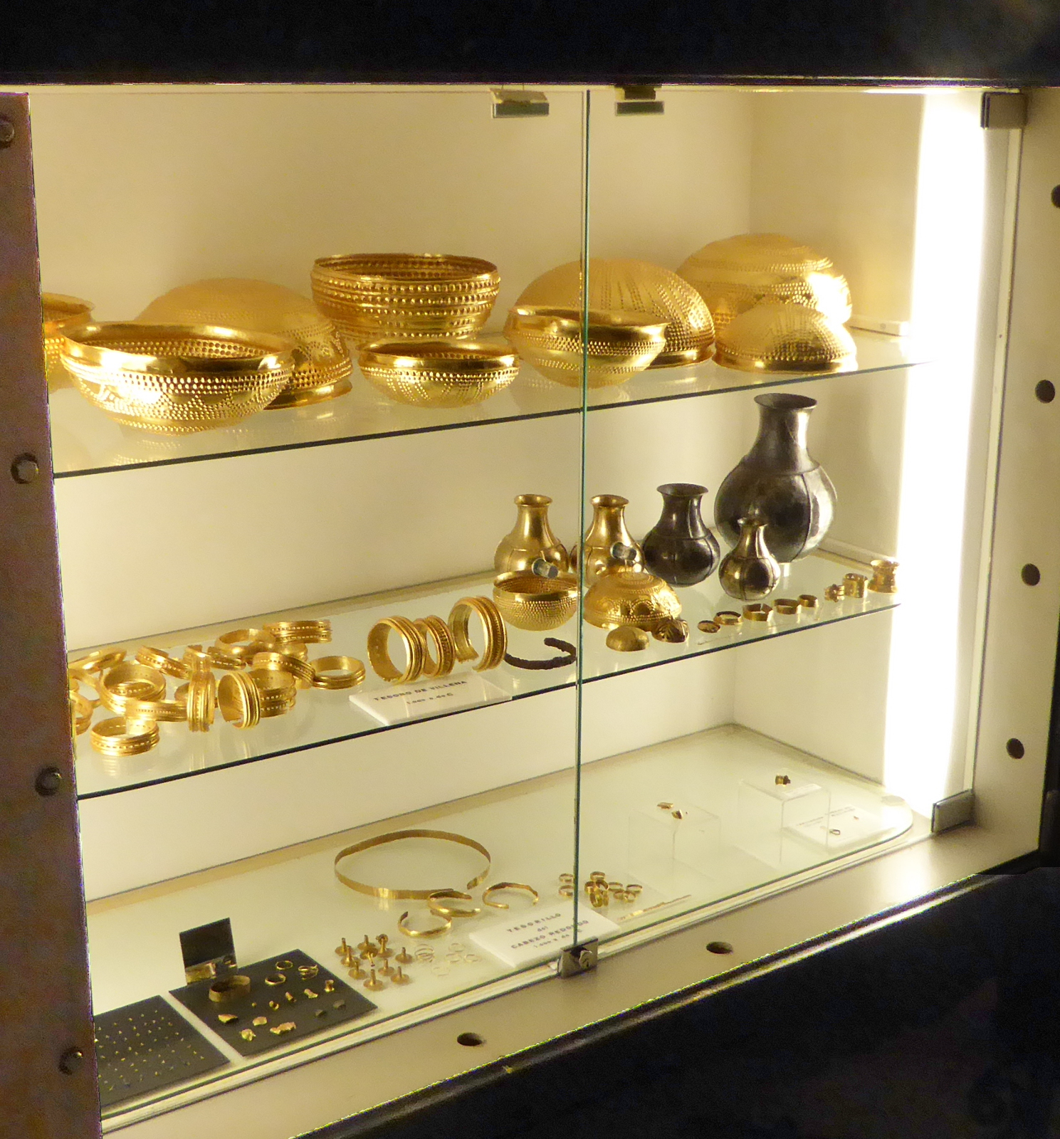
Tourist attractions in the town include a lovely 11th century castle, and the “Tesoro de Villena” (treasure of Villena), which was a trove of gold bowls and bracelets that have been dated to the bronze age 3,000 years ago.
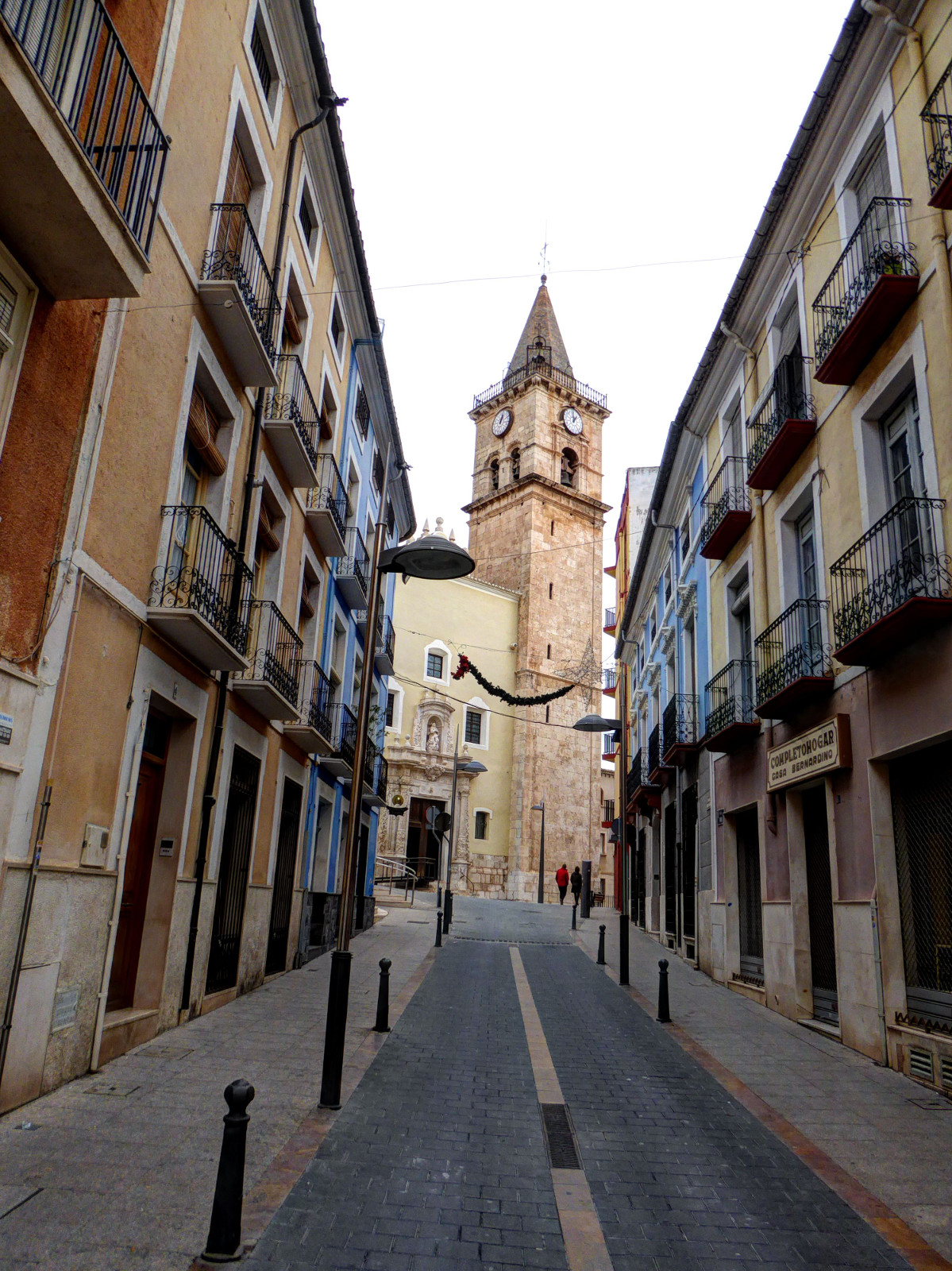
Heading into town, I encountered the church of Santiago (Saint James) and a small plaza with municipal buildings
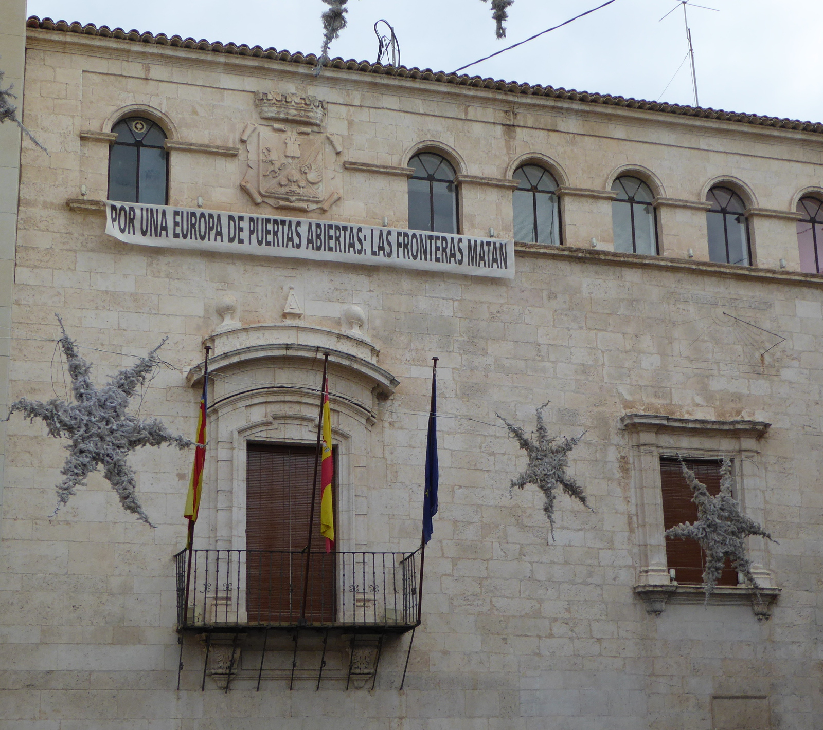
It was pleasing to see a banner hanging from the town hall which read: “In favor of a Europe with open doors. Borders kill”.
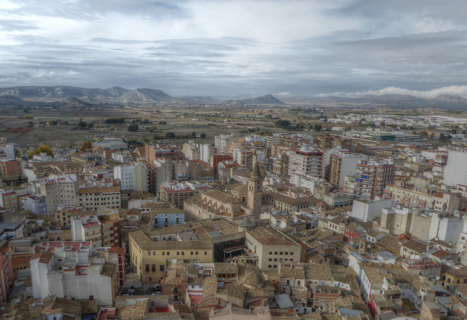
On this stormy day, the view of the Santa Maria church (15th century) with its mountain backdrop was stunning.
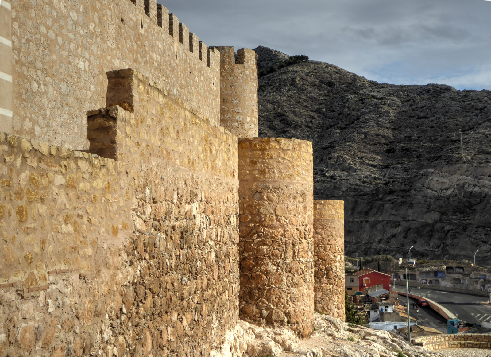
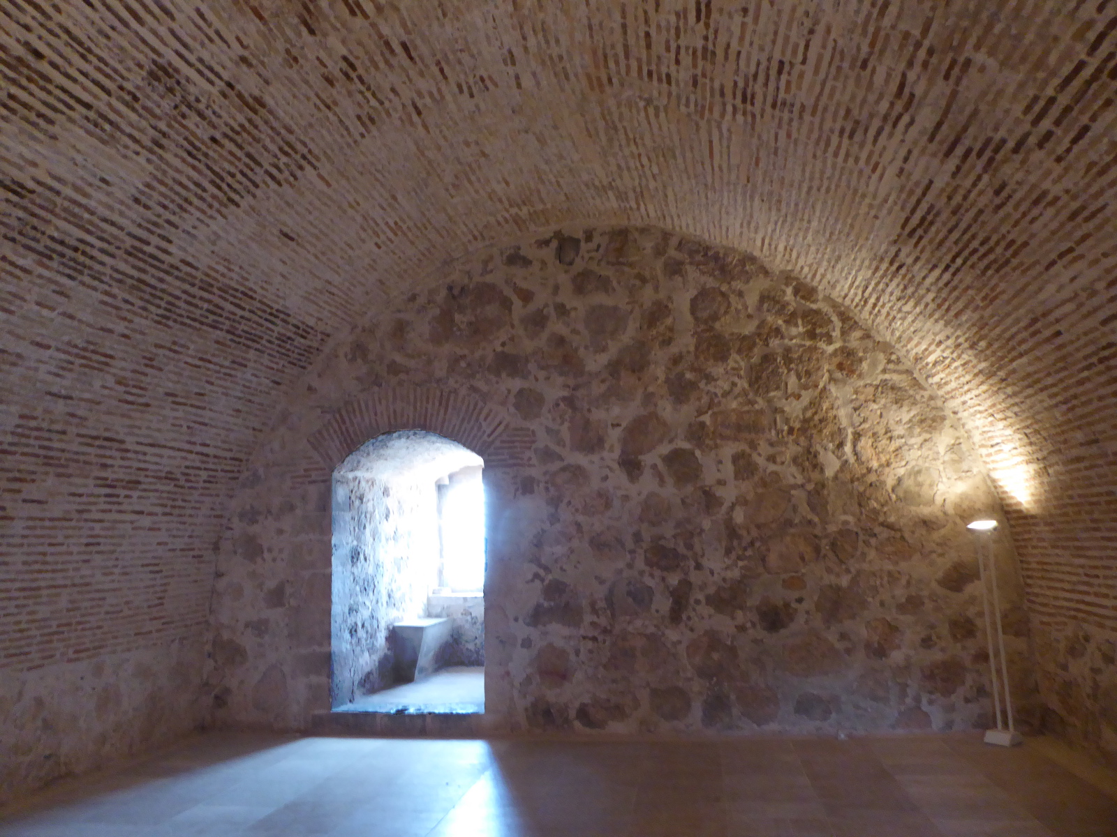
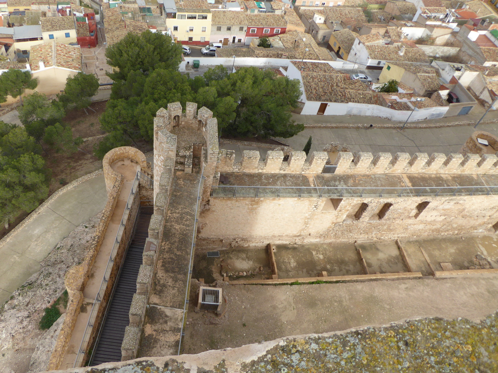
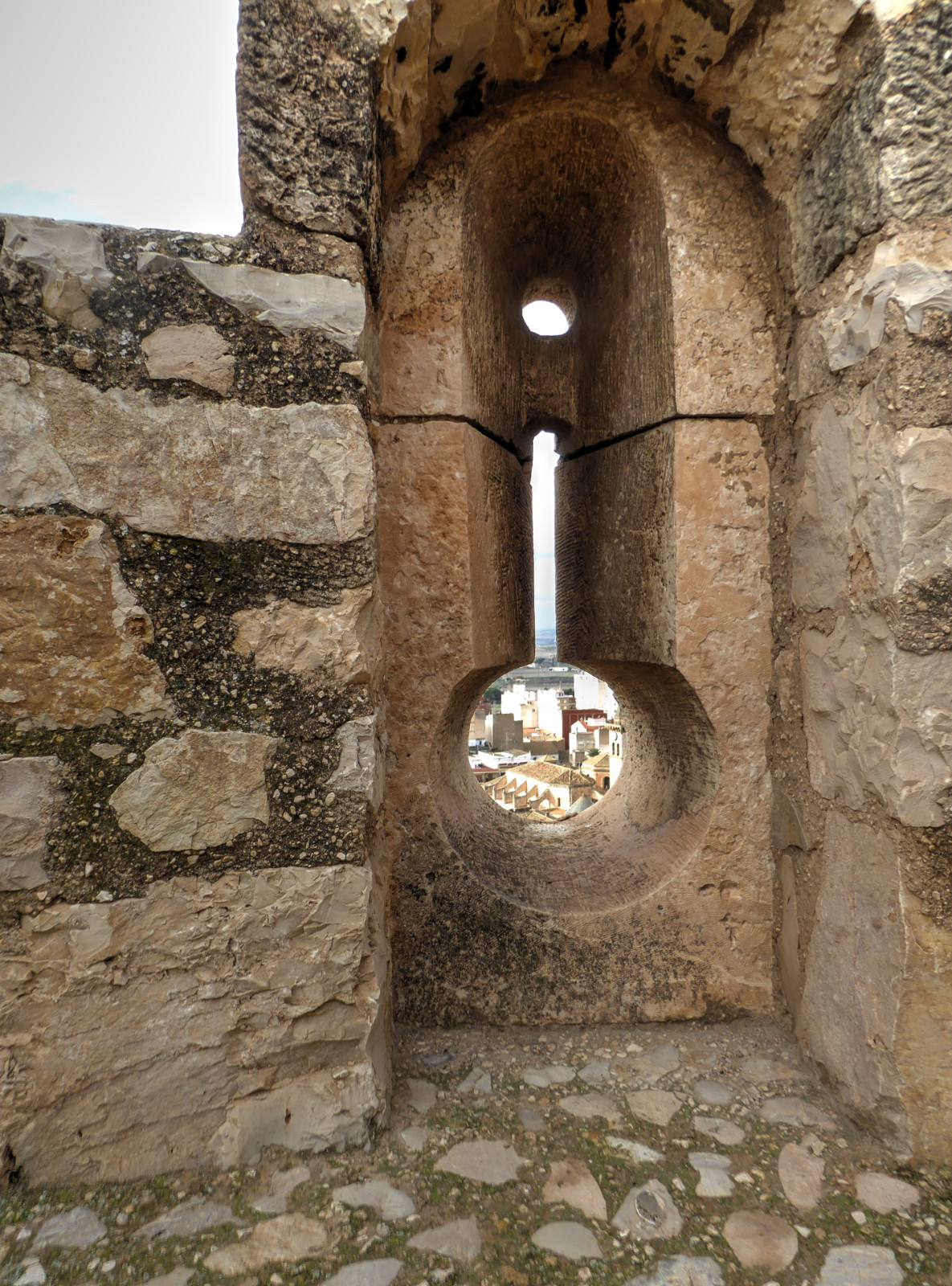
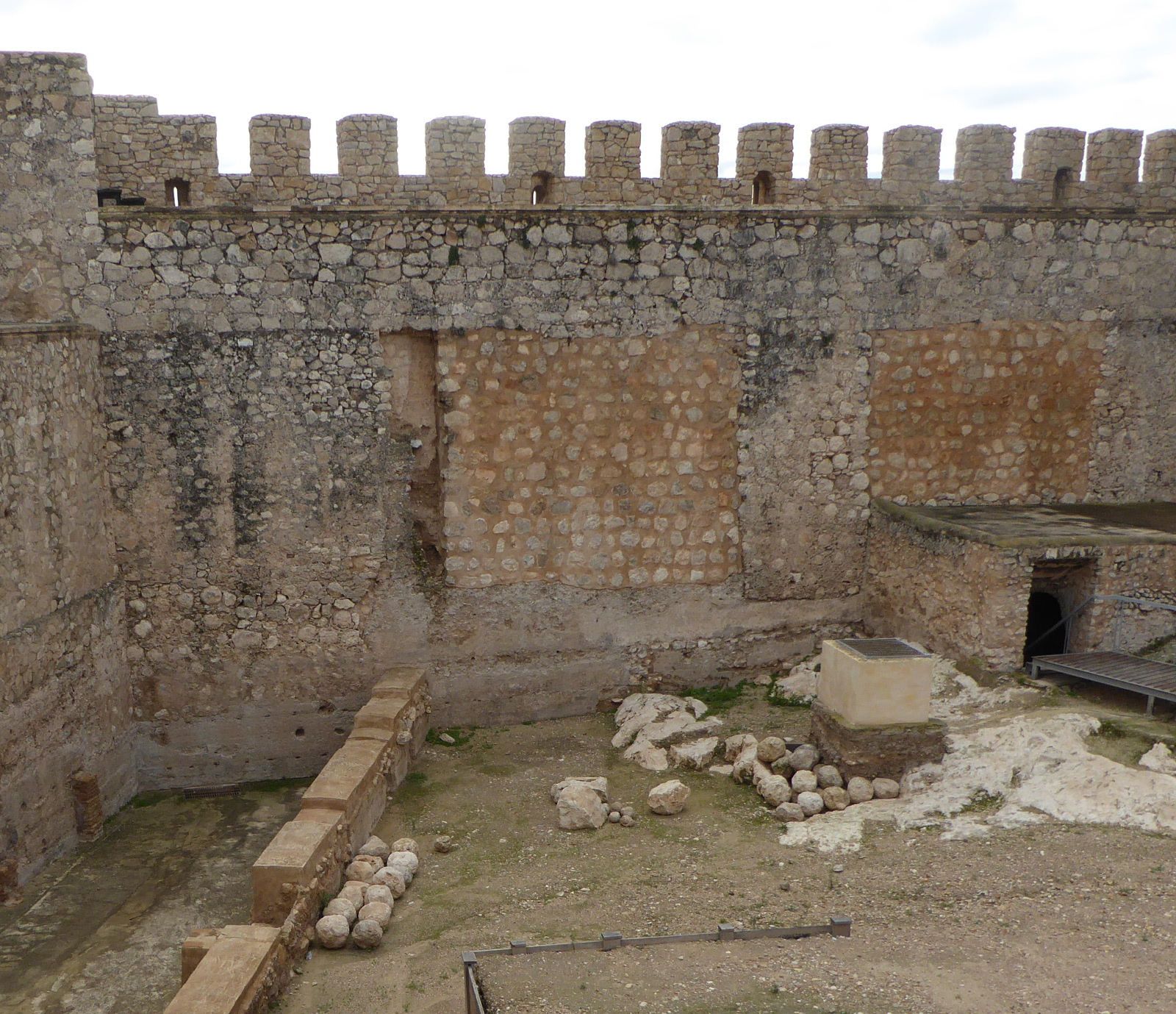
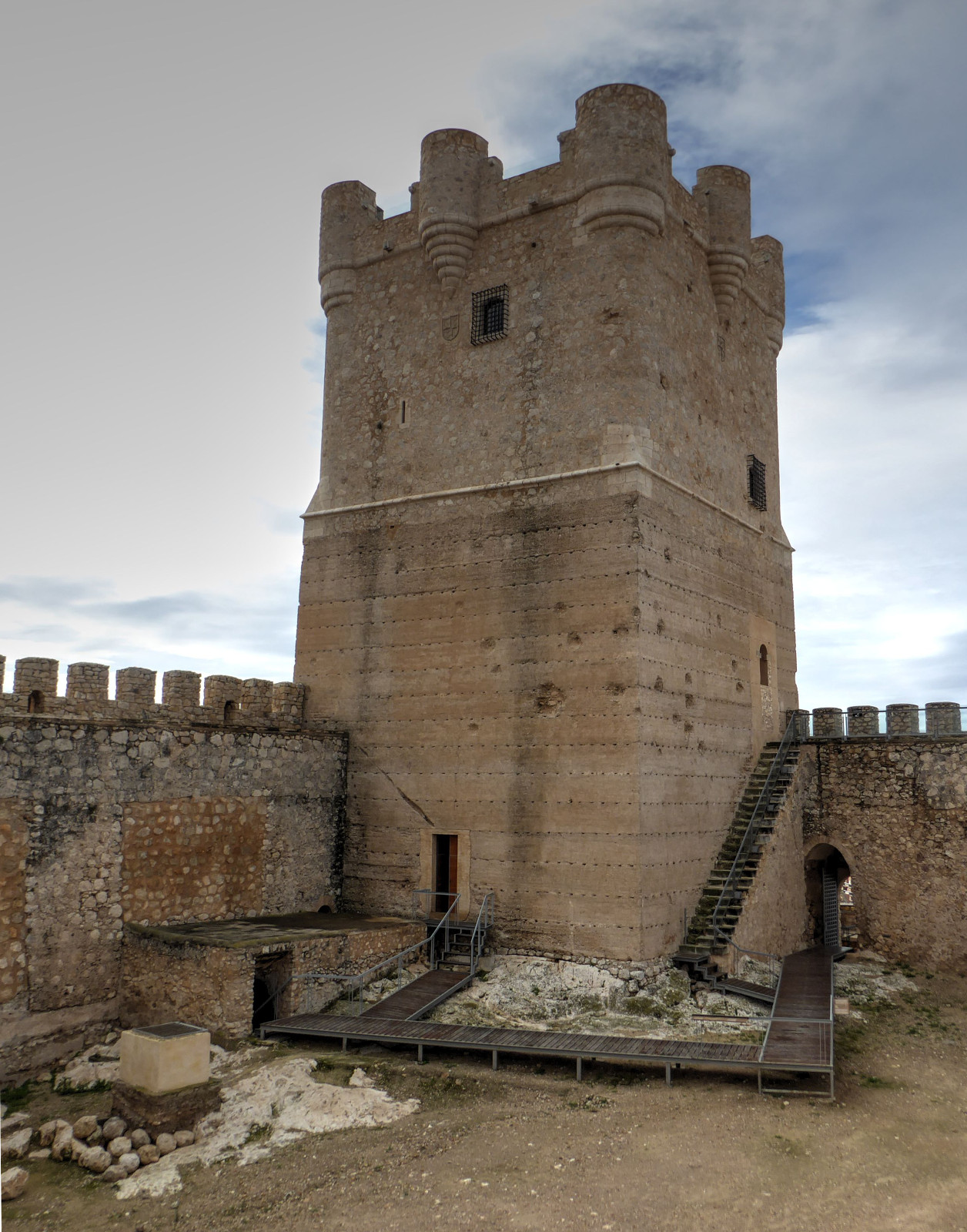
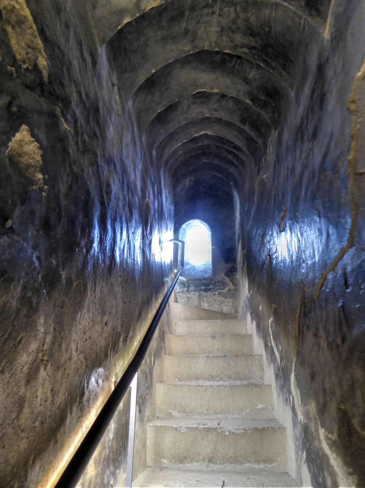
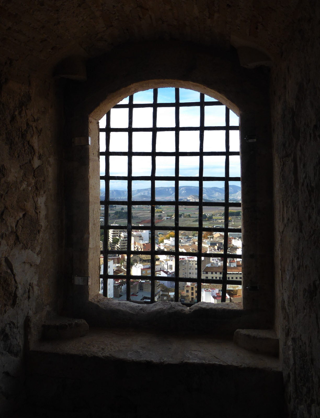
The Atalaya Castle was built in the eleventh century by the Islamic rulers of Spain. It sits on a hill more or less in the middle of town.
(Rhonda and I had attempted to visit the castle several years earlier. But at that time it was closed due to damage from an earlier lightning strike.
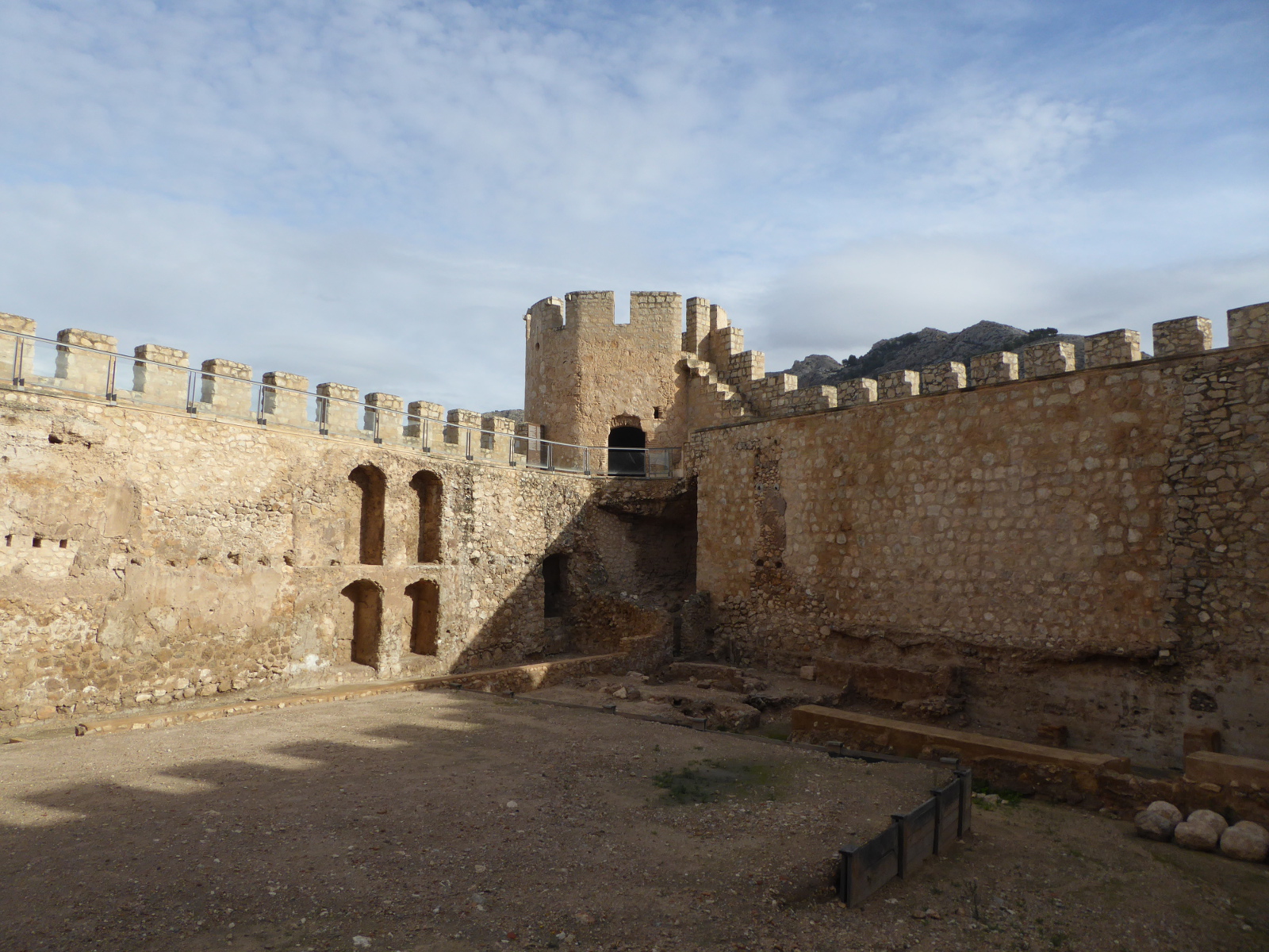
“Torre de Homenaje” or “Castle Keep”
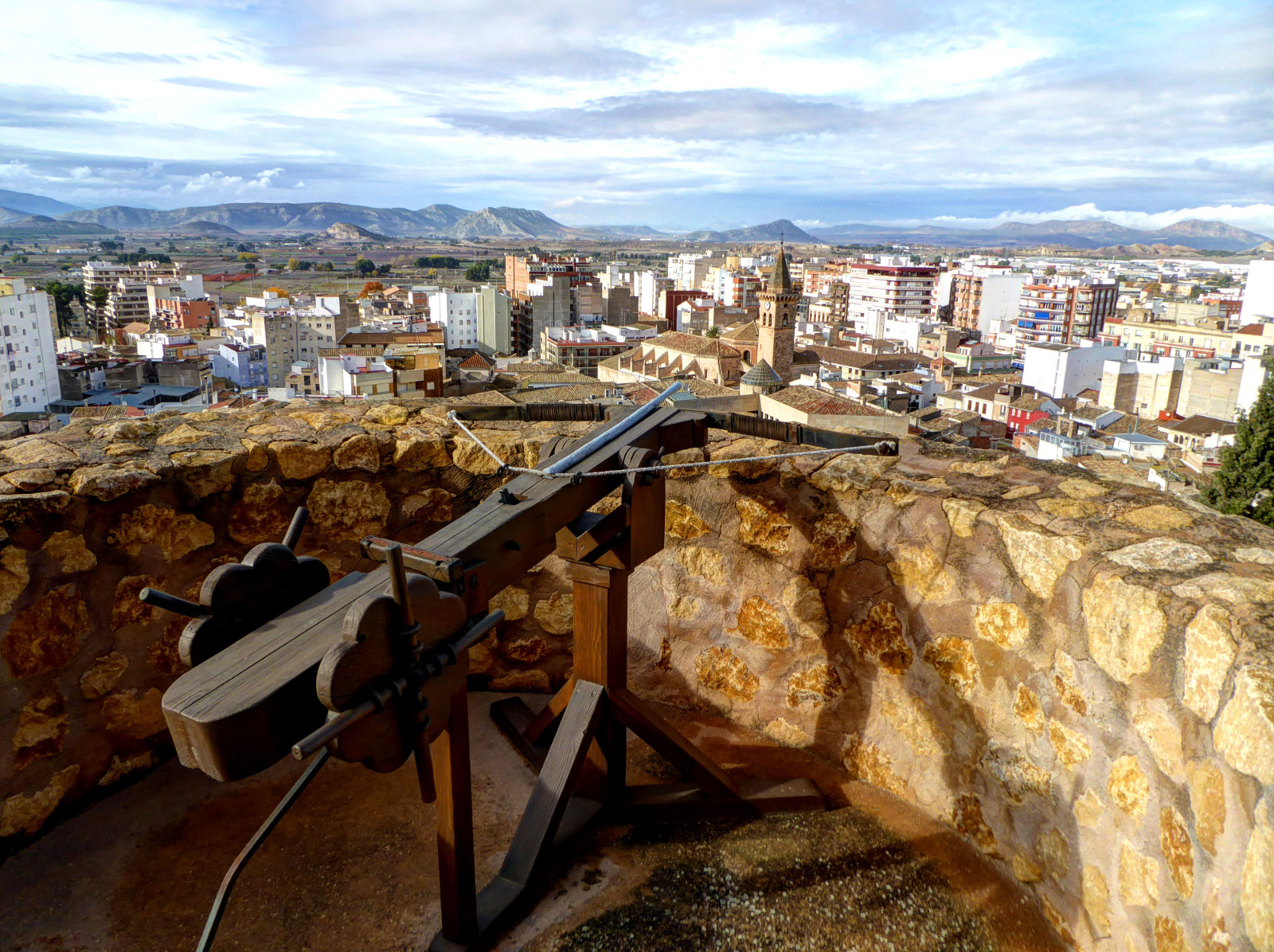
Interior stairs led to the top of this inner tower, and from the top the views were phenomenal.
Treasure Discovery Video
After enjoying the castle, I went to see the “Tesoro de Villena” (Treasure of Villena) which is housed in the José Maria Soler museum within the municipal building. The “Treasure” is a trove of (mostly) gold objects over 3,000 years old that were found in a large clay container. This incredible find came to light in 1963 when a worker found a large pure gold bracelet in some gravel fill being used in conjunction with the construction of a building.
The initial thought was that someone in town had dropped it. But then it was taken to authorities and the town archaeologist got involved. In conjunction with the workers, the origin of the fill material was located and excavation revealed the clay vessel which contained 28 bracelets, 11 bowls, and other miscellaneous objects. Today this valuable collection is in a locked case in the museum.
My visits to the castle and museum completed, I had enough time left in town to enjoy wandering around, exploring side streets and people watching.
(Clicking on any of the images will enlarge it. In many cases, clicking a second time will make it even bigger)
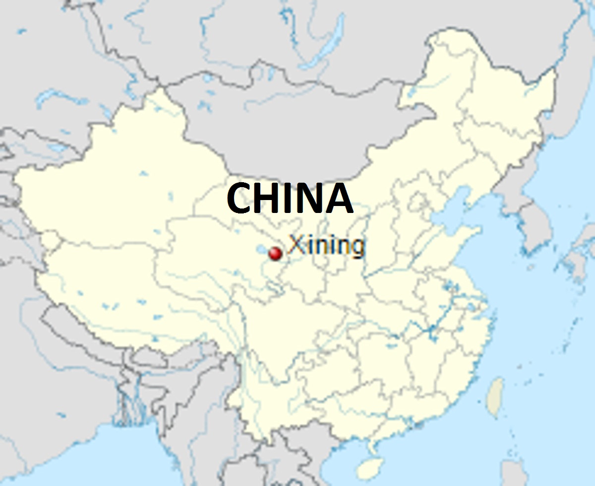
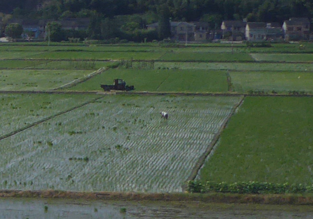
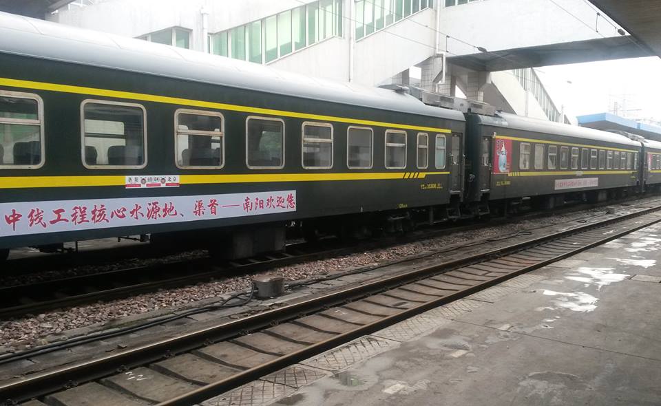
Once the program had ended, the various teachers headed off home, or for excursions in China. Last year Marlene and I went to a variety of spots, including Lhasa and Chengdu. So we decided to spend a week on the road before she was due to return to Colorado. This took us to Dunhuang, Jiayuguang, and Xining. Then we parted company and I continued on to Xiamen, Nanjing, Dalian, Dandong, and Shenyang.
First Stop: Dunhuang 敦煌
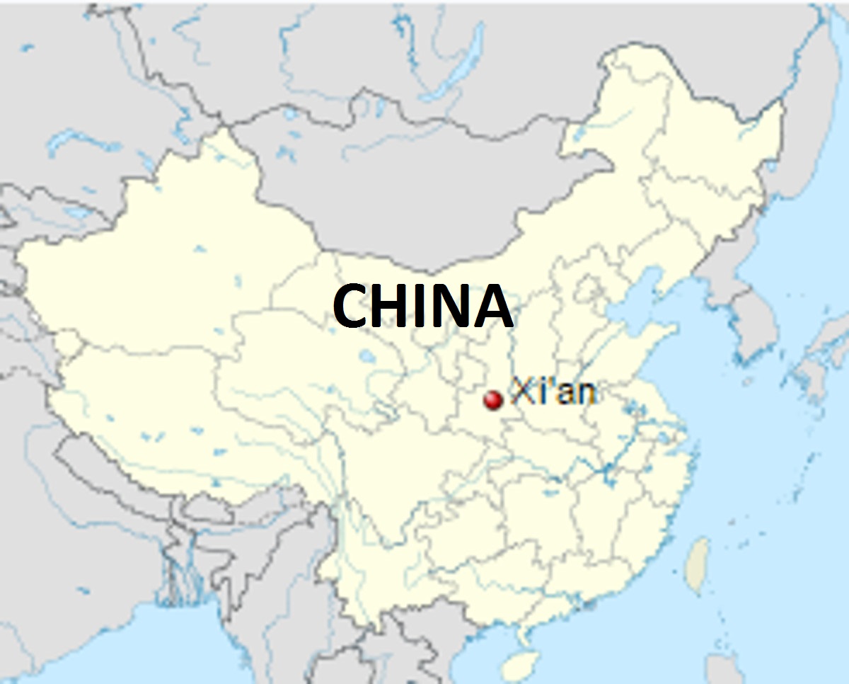
West of Xi’an in Gansu province, at the edge of the Gobi desert, is the small oasis city of Dunhuang.
(Adapted from www.thefullwiki.org)
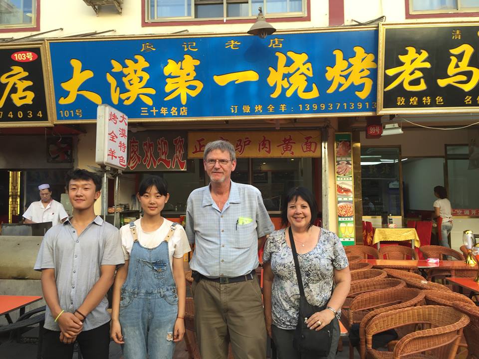
It was a wonderful place to visit. Our hotel was right in town, near a bustling night market. There was a seemingly endless number of restaurants within a short walk from our lodging. We labored over the decision of which restaurant would be best and decided on a small place with skewered meat. After our meal, two members of the staff insisted on posing for a photo with us.
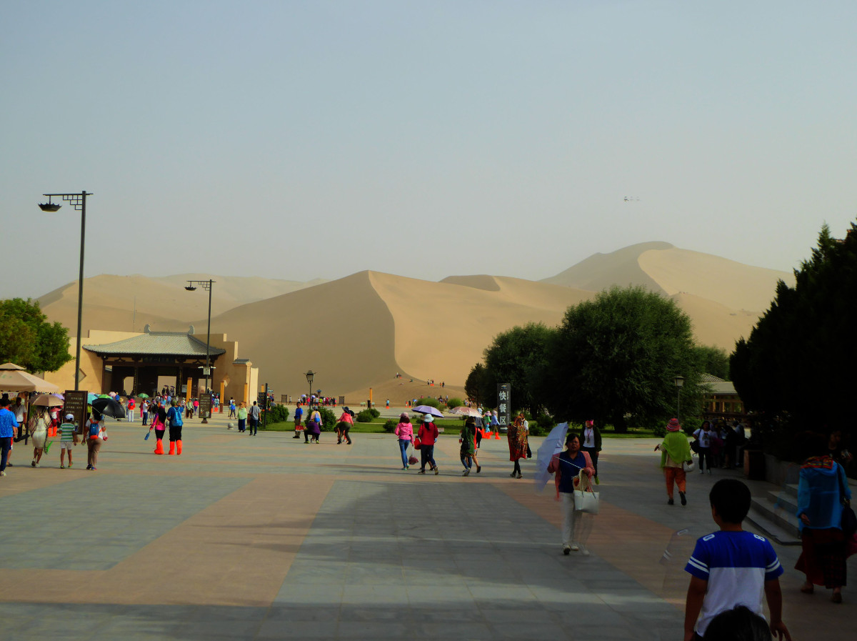
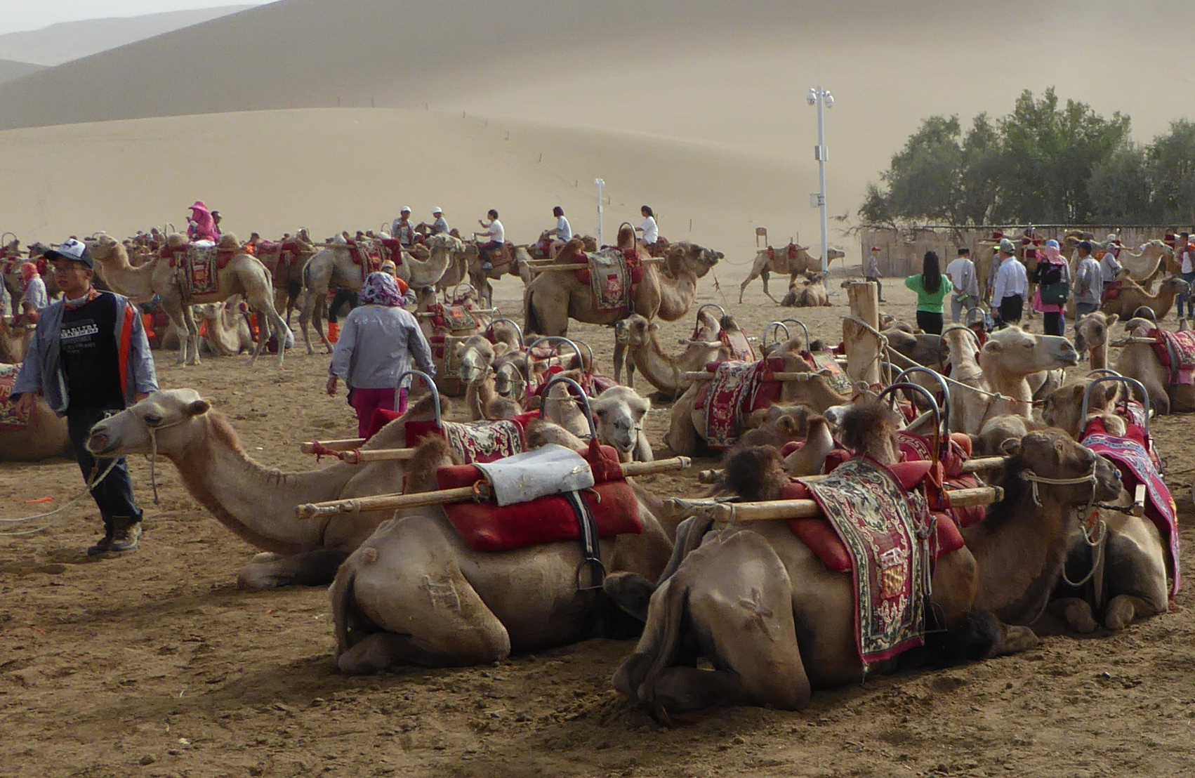
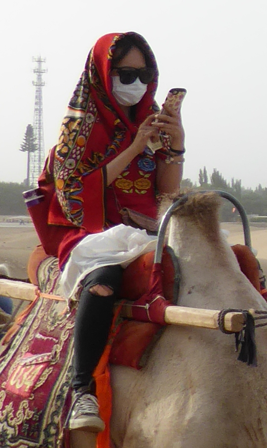
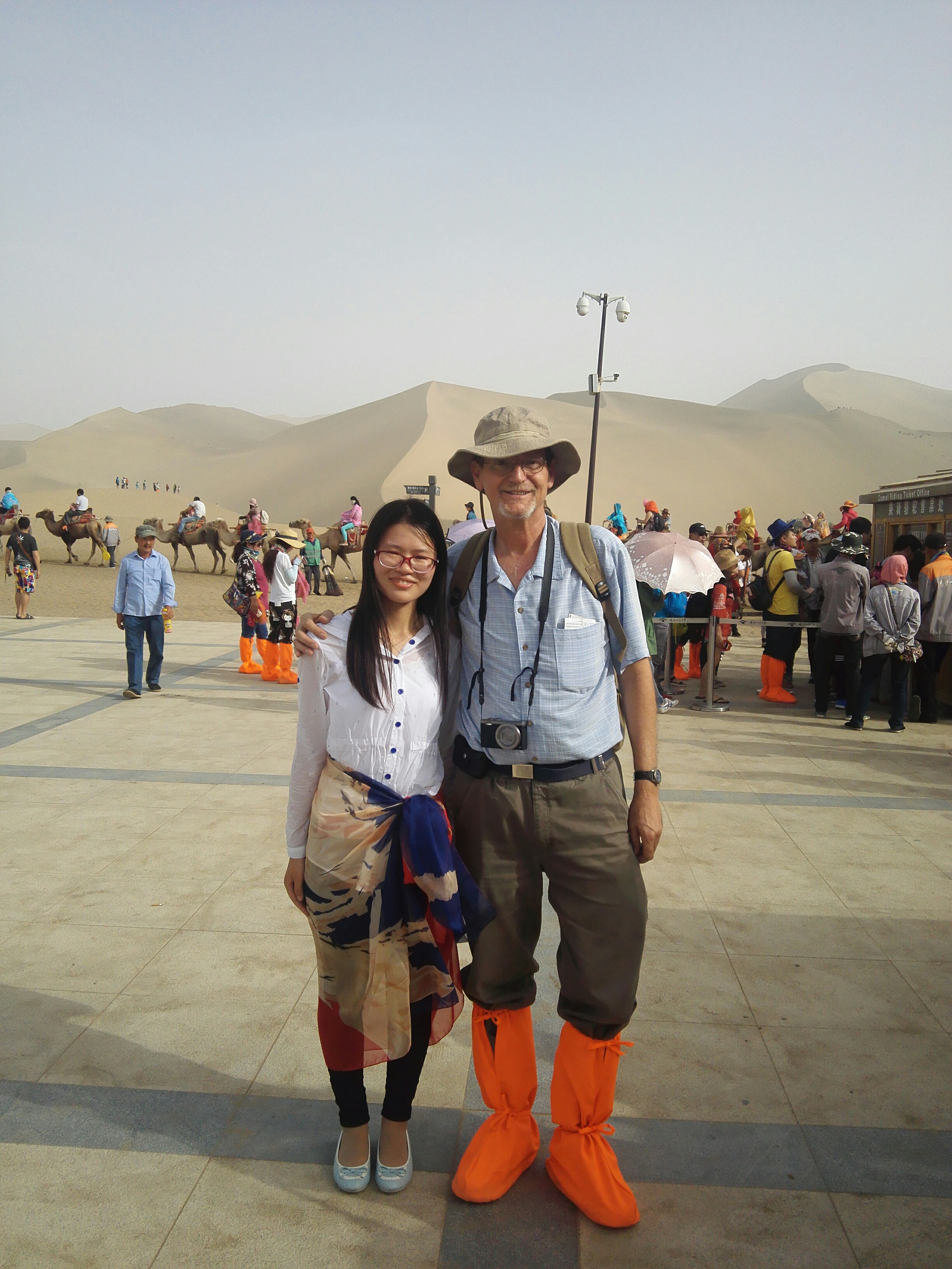
Mingsha shan 鸣沙山 (Singing Sand Mountain)
Not far from town, the desert begins. Mountain-sized dunes of sand provide a stunning backdrop to the area of of a small oasis called Crescent Lake. Somehow we managed to miss the lake itself, but it was impossible to miss the mountains! There were various recreational opportunities, including tiny one-person aircraft, jeeps, etc. We chose to ride camels.
A small world-
Near the base of the sand mountain there was a remarkable occurrence. I heard a voice speaking in English: “Are you Peter?” I turned around to see a young Chinese couple. The woman was “Cherry”, one of my students from the previous year’s classes in Xi’an. We were a thousand miles from Xi’an. China has a population of 1.4 billion people (that is 1,400 million to any Brits tuned in…) What are the chances of a casual encounter with someone you know? Well, it is a small world! 🙂
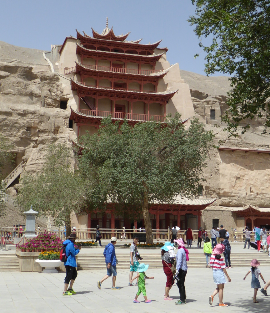
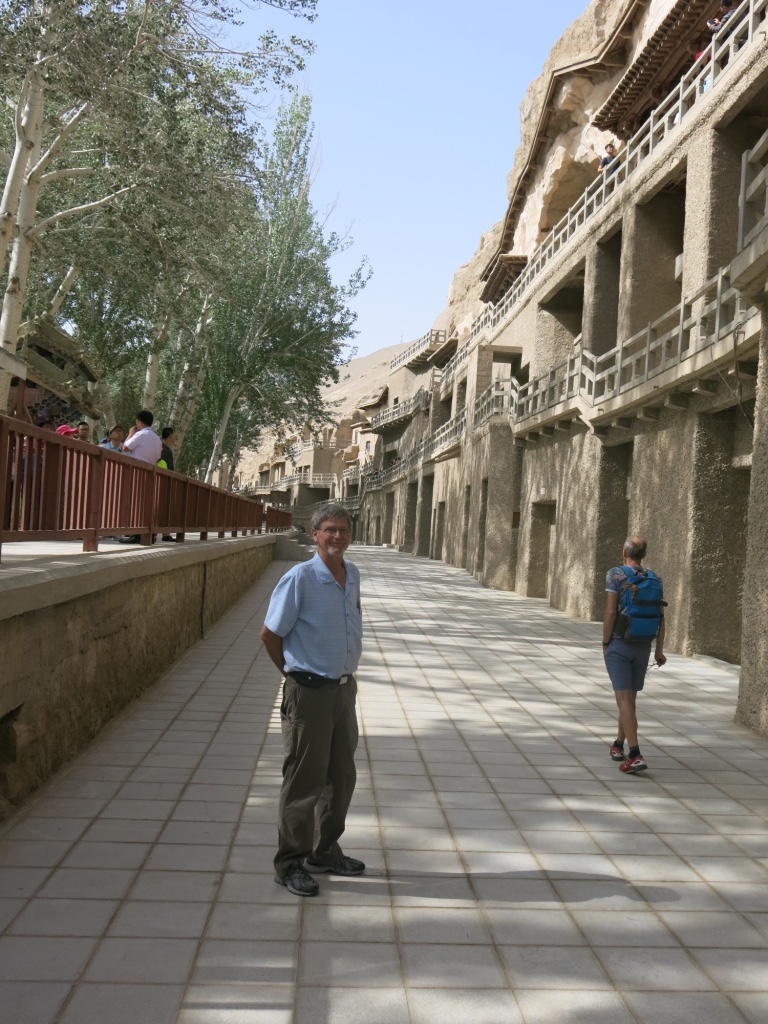
Mogao Caves 莫高窟
The mountains of sand were beautiful, but I was drawn to this location after reading an article six months previously in the New York Times about the fabulous Buddhist artwork in a series of hundreds of caves near Dunhuang.
I’m sorry that I have not included any photos of the wonderful art inside the caves. Taking pictures inside was strictly prohibited, and I respected that rule.
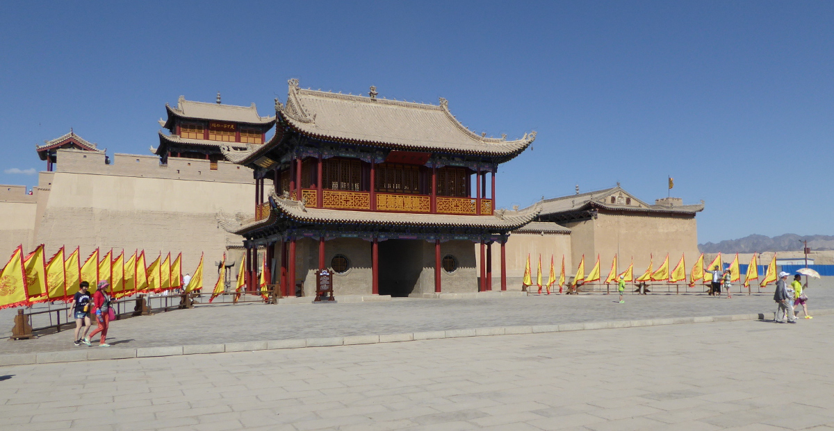
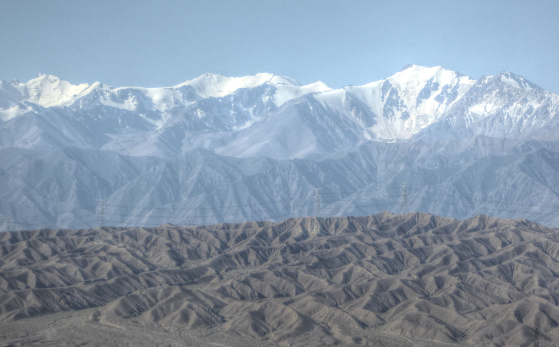
Jiayuguan 嘉峪关 (Jiayu Pass)
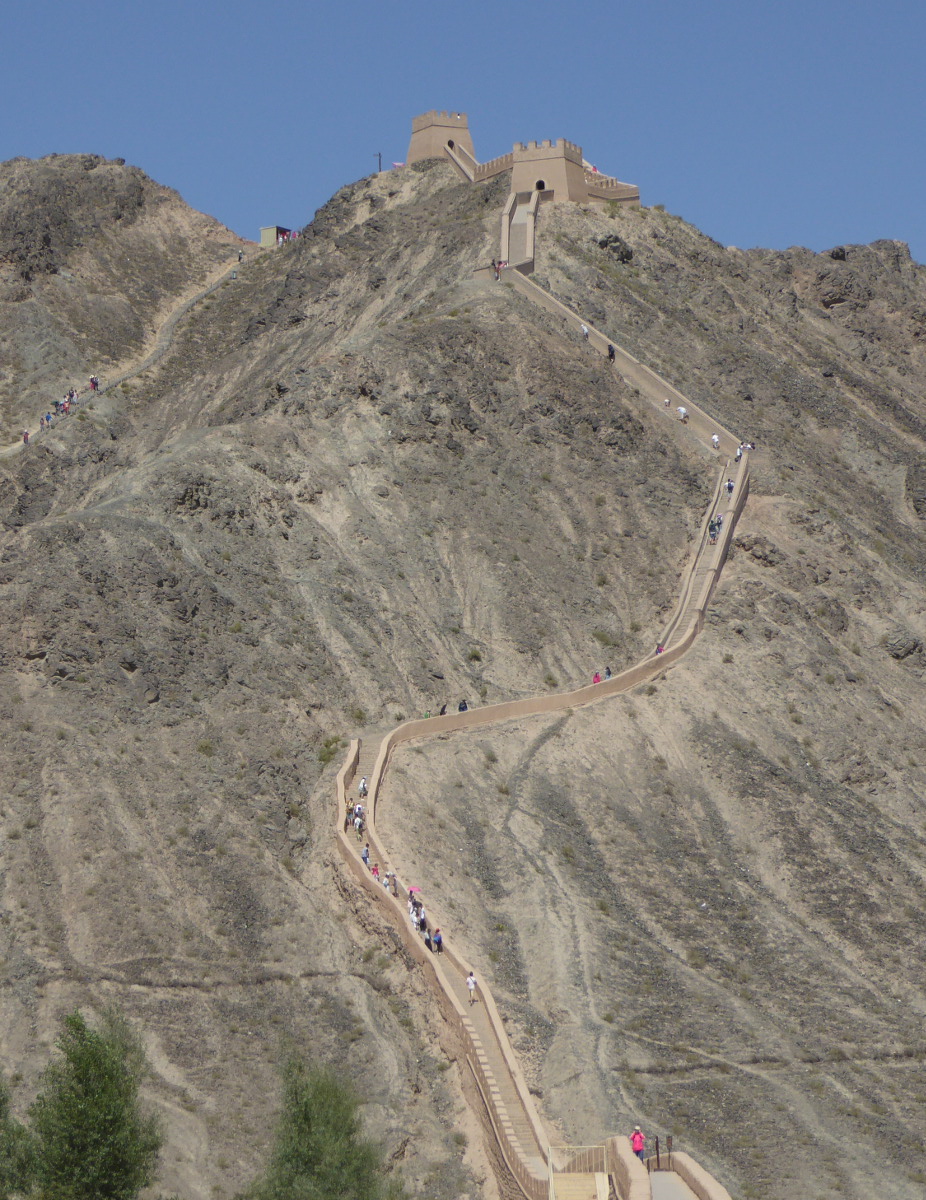
We took a train north and a bit east to Jiayuguan. Centuries ago, this was considered by the Chinese to be the furthest west point of civilization. It was a way-point on the silk road, and is the site of a surviving fortification from the Ming Dynasty (late 14th century). The fortress served as a sort of gateway through this western most extent of China’s “Great Wall.” You can see sections of the wall running off into the distance from the fort. You also have a fantastic view of mountains. There is also a rebuilt section of the wall (the “hanging” great wall), that climbs steeply up a mountain. It includes rebuilt towers.
Xining 西宁
(Adapted from Wikipedia)
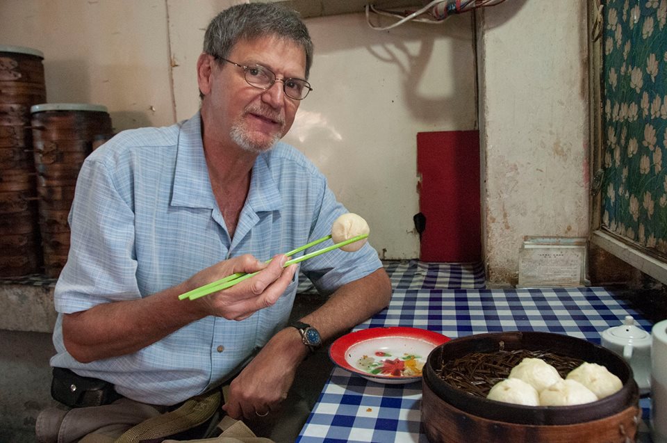
We traveled from Jiayuguan to Xining (in Qinghai province) on a comfortable high speed train. Once again we had a hotel near a thriving night market. Somehow I overlooked the fact that our stay at the hotel included breakfast. So the first morning we wandered off in search of some local food. We ate in a tiny “greasy spoon” and had wonderful food. In the photo I am savoring Baozi, a type of stuffed doughy bun that I had fallen in love with over many breakfasts in Xi’an. The variety in Xining included shaved carot strips inside along with meat.
Photo by Marlene
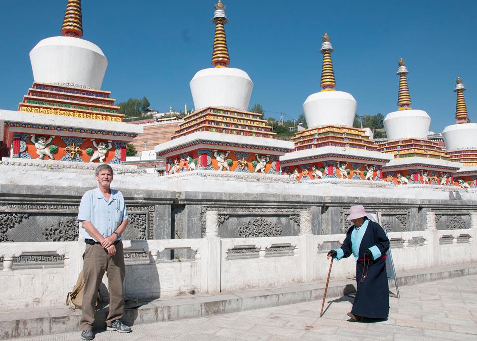
I wanted to see two places druing our stay in Xining: The Kumbum Monastery and the Great Mosque of Xining
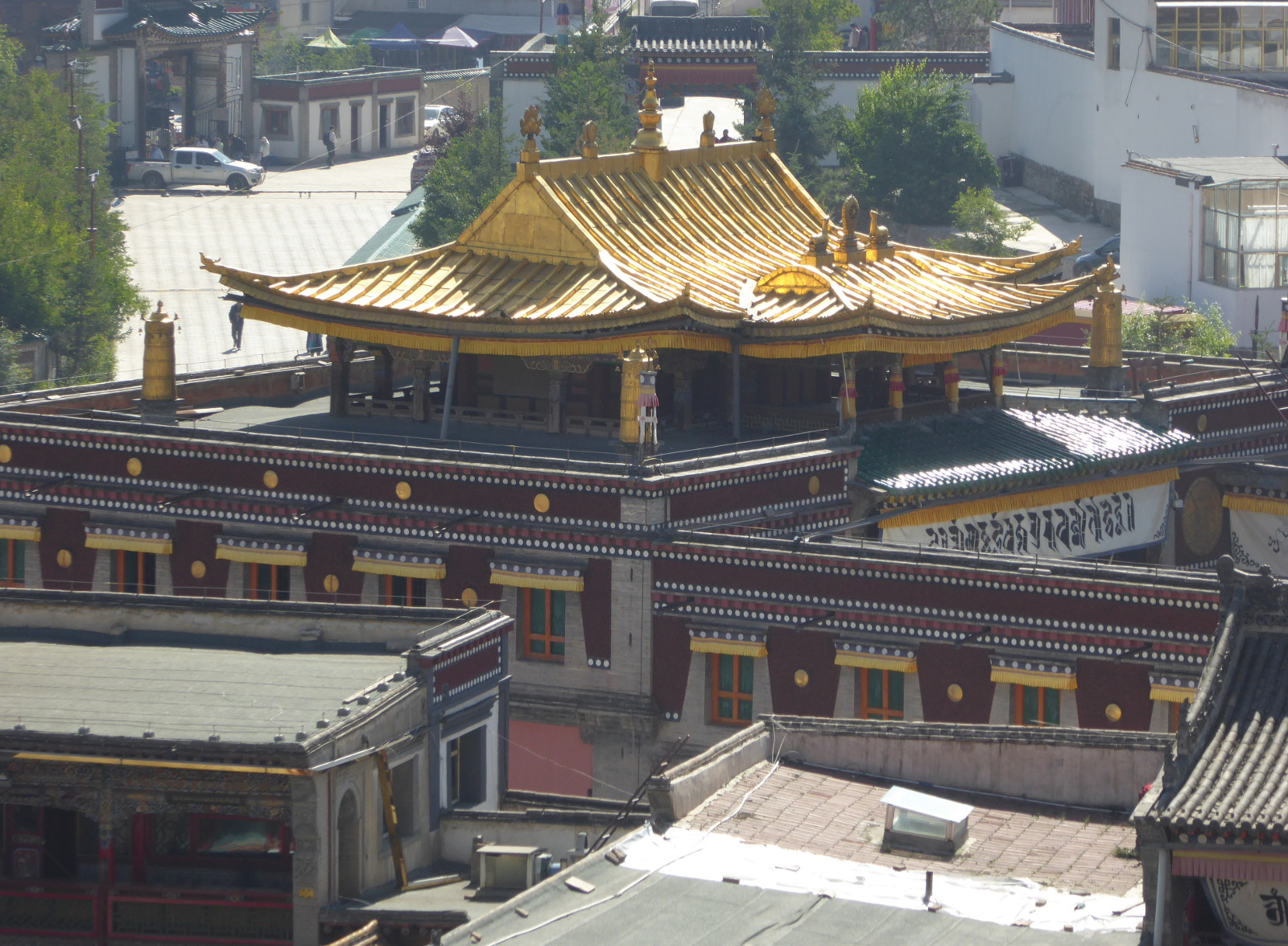
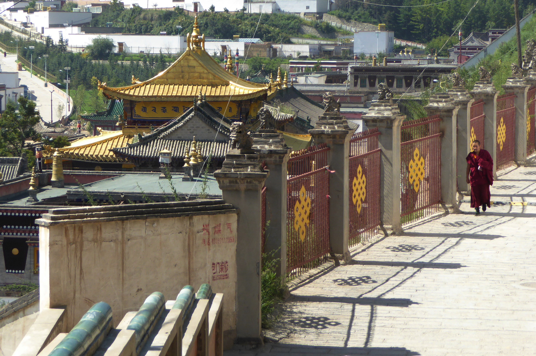
Kumbum Monastery སྐུ་འབུམ་བྱམས་པ་གླིང་
The Kumbum Monastery (Known in Chinese as Ta’er Si 塔尔寺) is one of the most significant religious communities of the “Yellow Hat” (Gelug) sect of Tibetan Buddhism.
Getting to the monastery was a wild adventure of its own! And the return trip was no simpler. But I will save the details for a post that will more specifically focus on our visit to Kumbum Monastery.
(Photo by Marlene)
This site reminded us in many ways of our visit to temples and monasteries in Lhasa. The Tibetan architecture, holy images, feeling of spirituality, and also the hoards of visitors!
Dongguan Mosque 东关清真寺
The Dongguan mosque (sometimes called the Great Mosque of Xining) was originally built toward the end of the 14th century. It is one of the most important mosques in this part of China.
Photo by Marlene
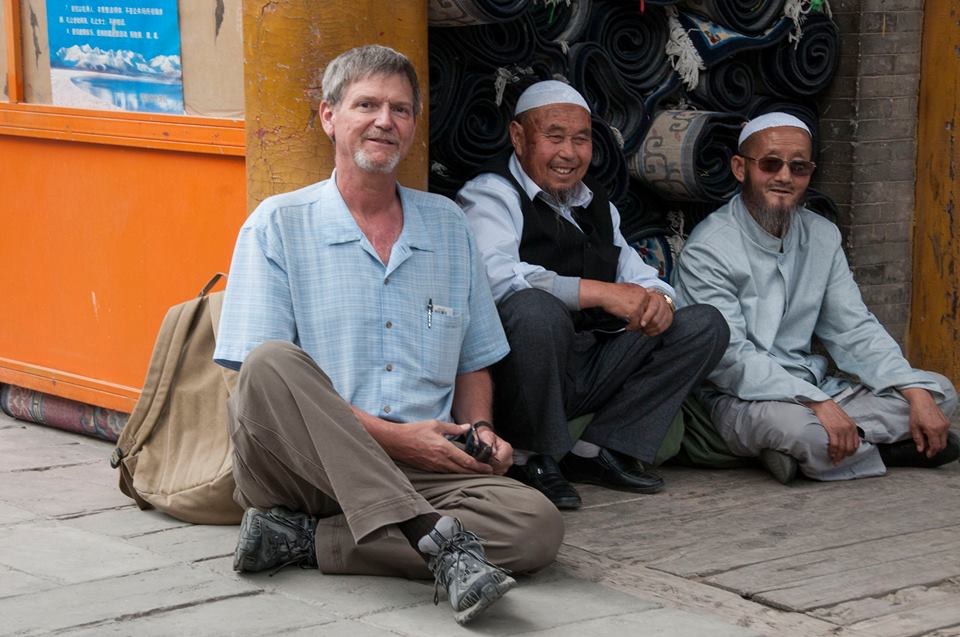
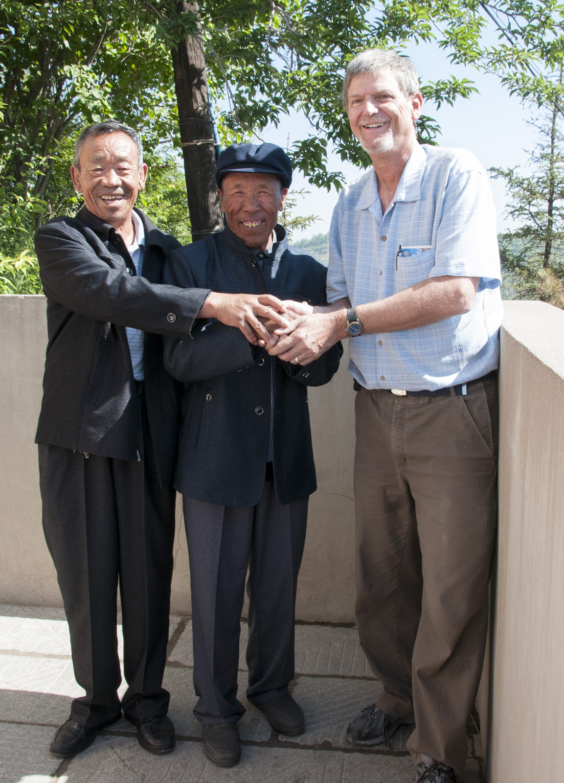
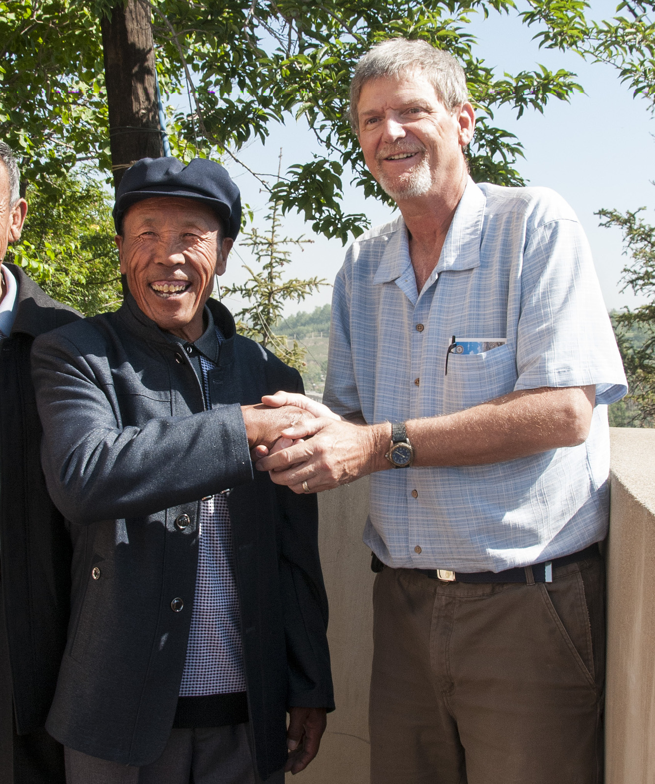
I made a bit of small talk with these two men within the mosque compound. They were friendly, and agreed to have their photo taken.
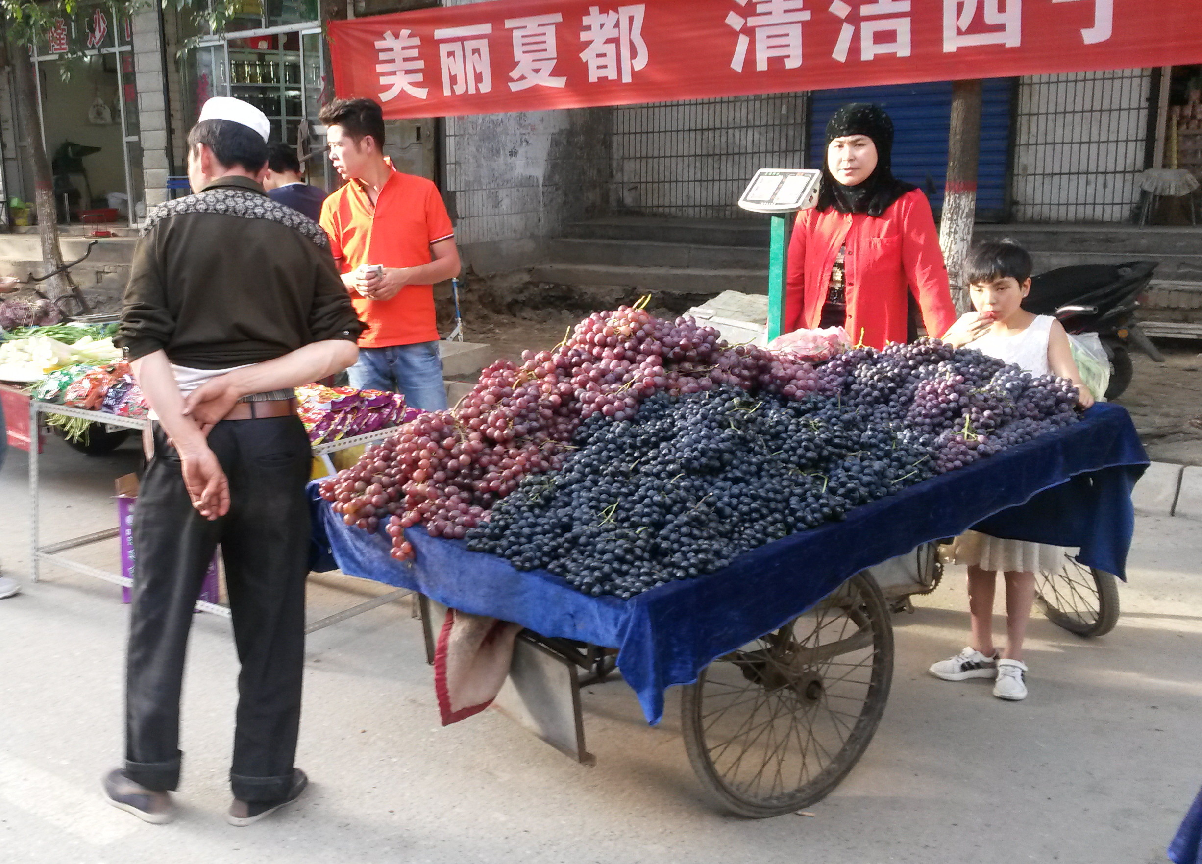
Not far from the mosque was a market street with a wide variety of foods and other items.
Xining- Encounters with friendly people
Photo by Marlene
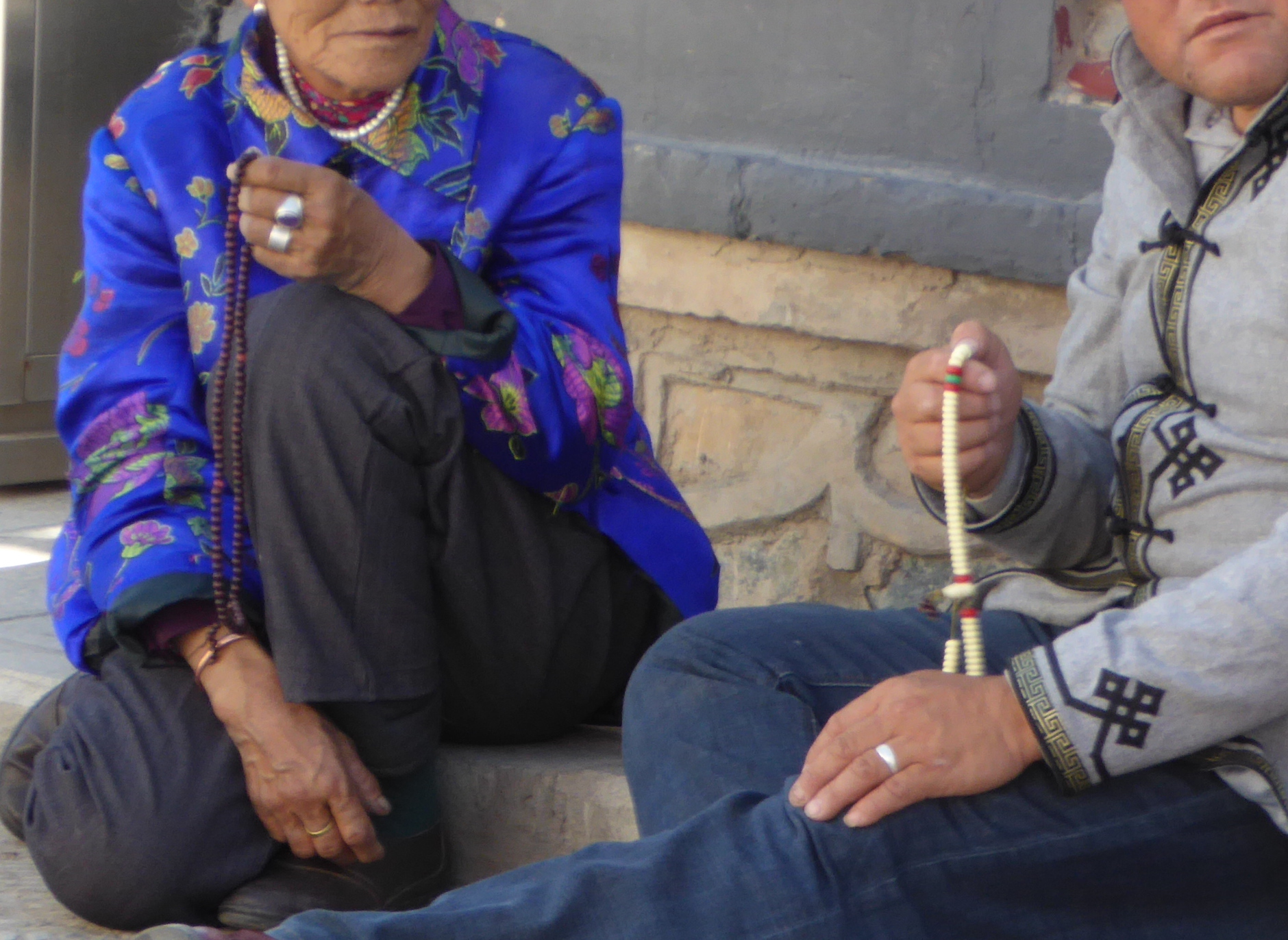
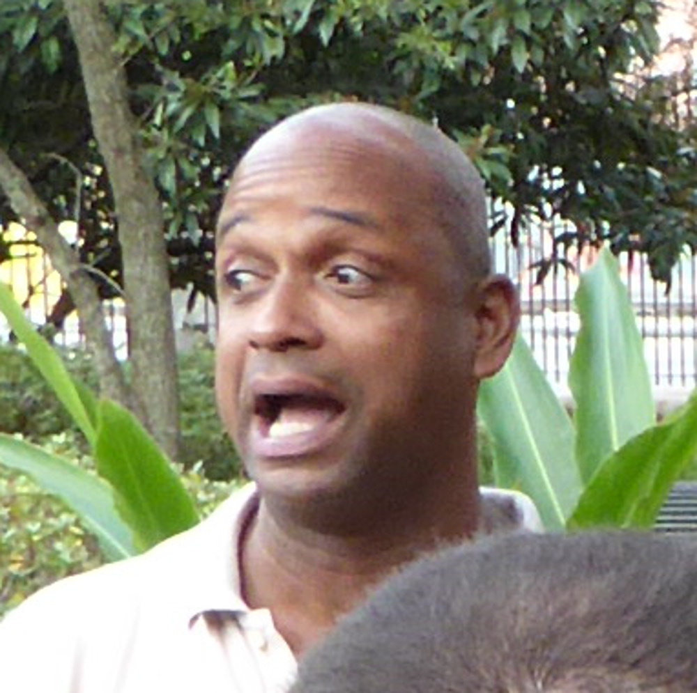
So very many people in China are friendly. Strangers you encounter often greet you and are eager to help if you need any. Also, in many areas westerners are a bit of an oddity, and people often want to have their photo taken with me.
At one point during our visit to the Kumbum monastery, we encountered these two men. They asked how old I was. We exchanged a few words and many smiles. They were with some friends and wanted their photo taken with me. (So Marlene took a few photos as well!)
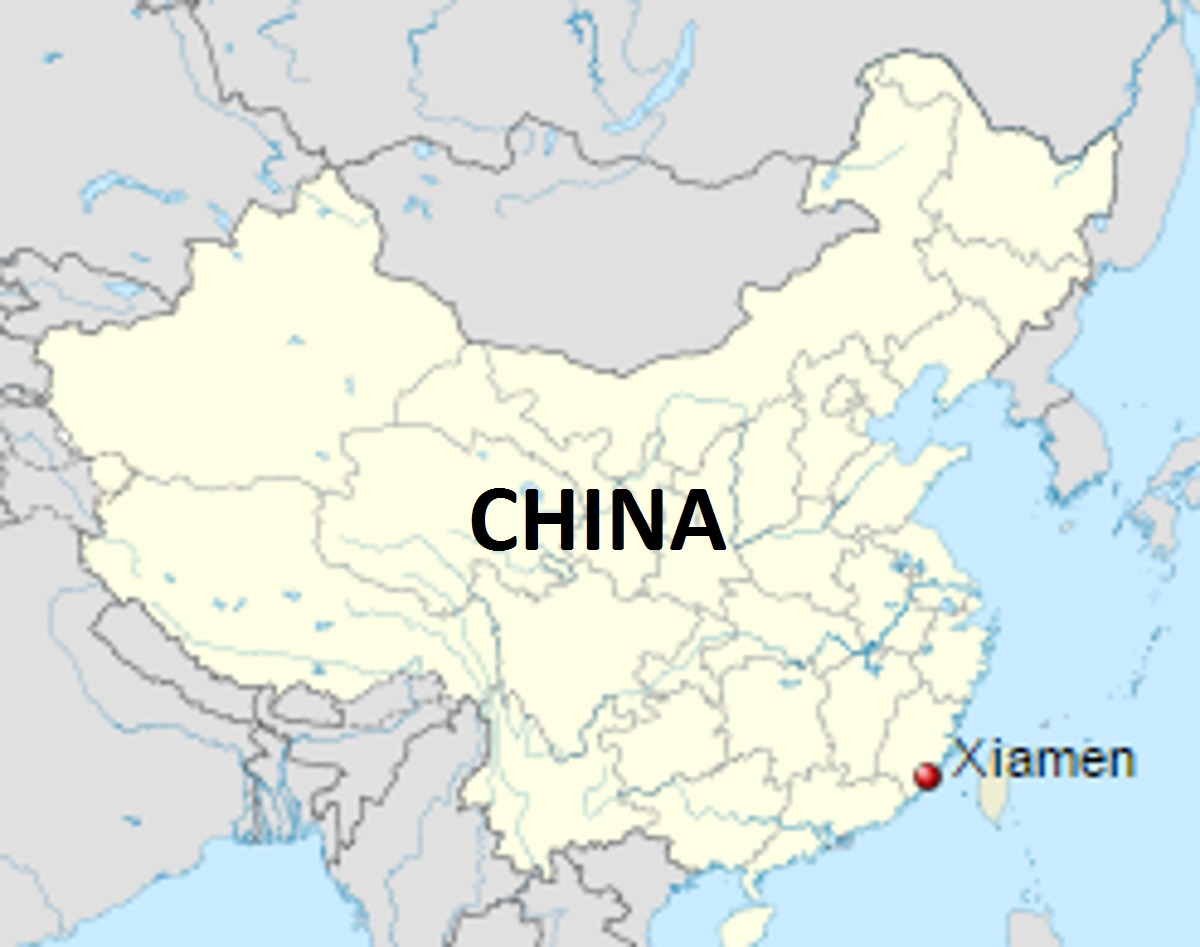
Onward to Xiamen city 厦门市
(Adapted from Wikipedia)
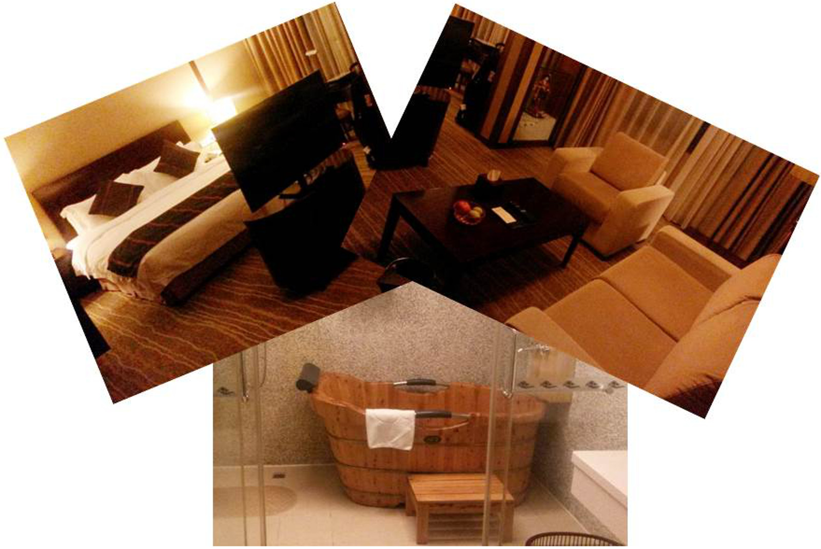
Hotel-wise, I hit the jackpot in Xiamen. I had a reservation and they upgraded my room at no cost to a luxurious suite which, besides having a shower, had a fabulous free standing wooden tub. And yes… I did enjoy a wonderful soak in that tub!
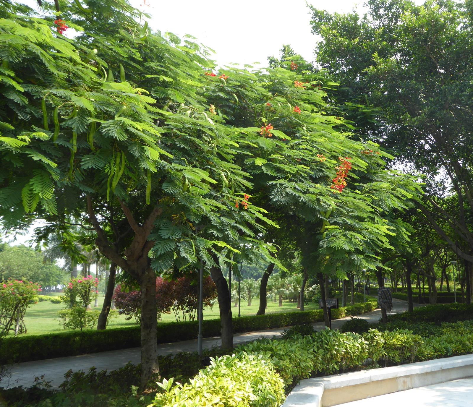
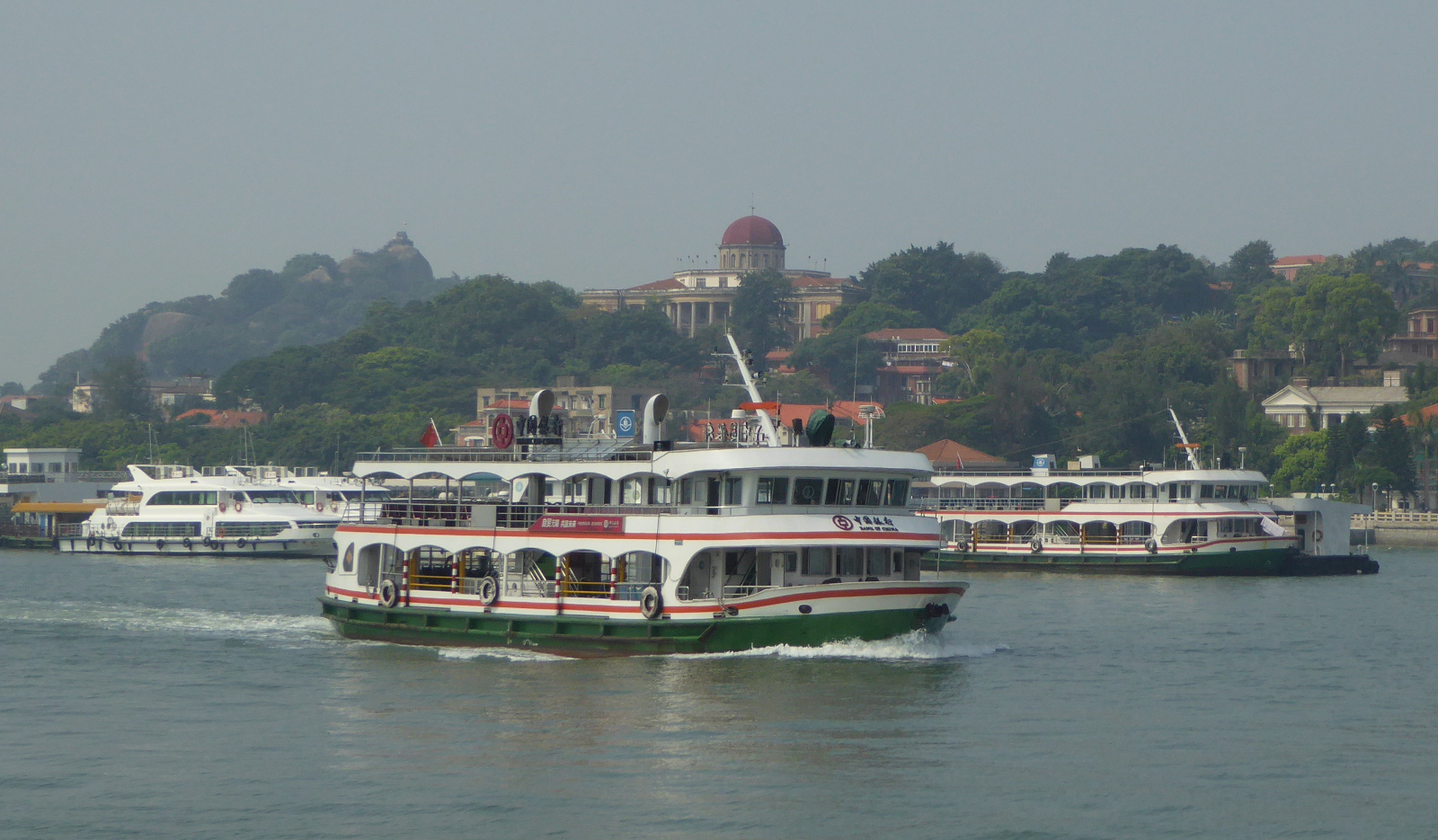
Gulangyu Island 鼓浪屿
The city of Xiamen consists of an island connected to the mainland by a variety of bridges. Quite near Xiamen is a smaller island called Gulangyu. It is a popular tourist destination among the Chinese, and is an oasis of greenery and varied architectural styles. Based on the advice of a student from one of my classes, I took a morning ferry to the island. I got a ticket for a hop-on, hop-off transport and worked my way around the island.
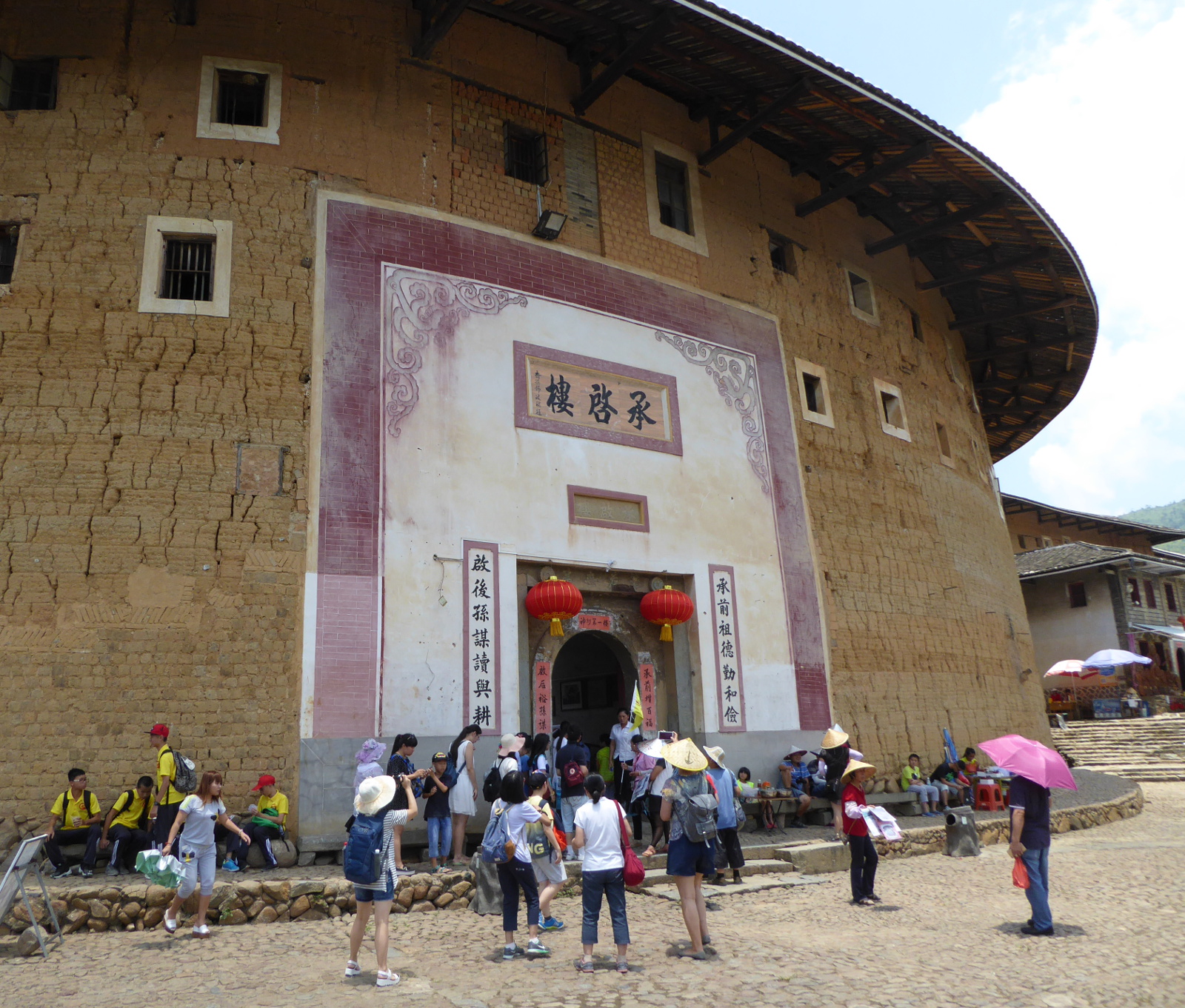
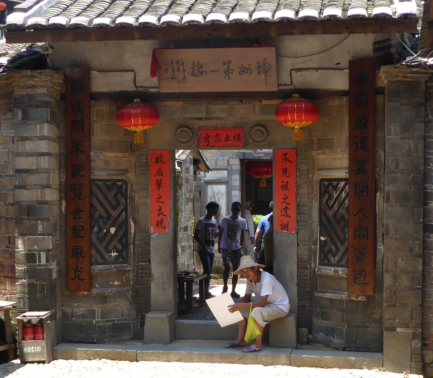
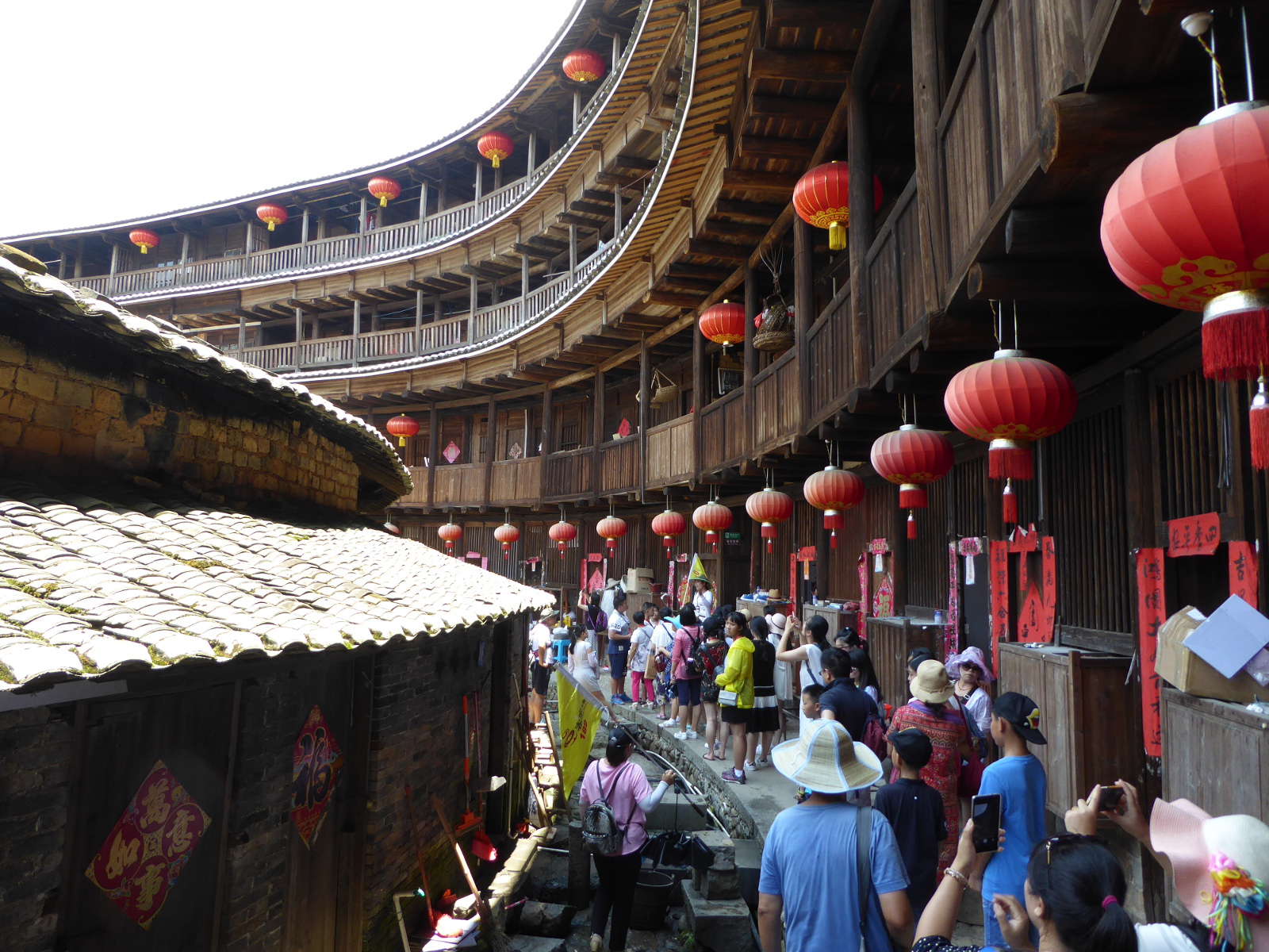
Tulou 土楼 (earthen buildings) of Fujian
Large fortress-like buildings that housed entire clans are a typical architectural style in Fujian province, with roots dating to the 17th century. The majority are round, multi-storied structures, but there are also some rectangular examples. I arranged to participate in a bus tour from Xiamen to see these. Truly fascinating.
(Jesen, one of my students from 2015 was born in this tulou. I was interested in seeing these because of his suggestion I pay a visit to Fujian.)
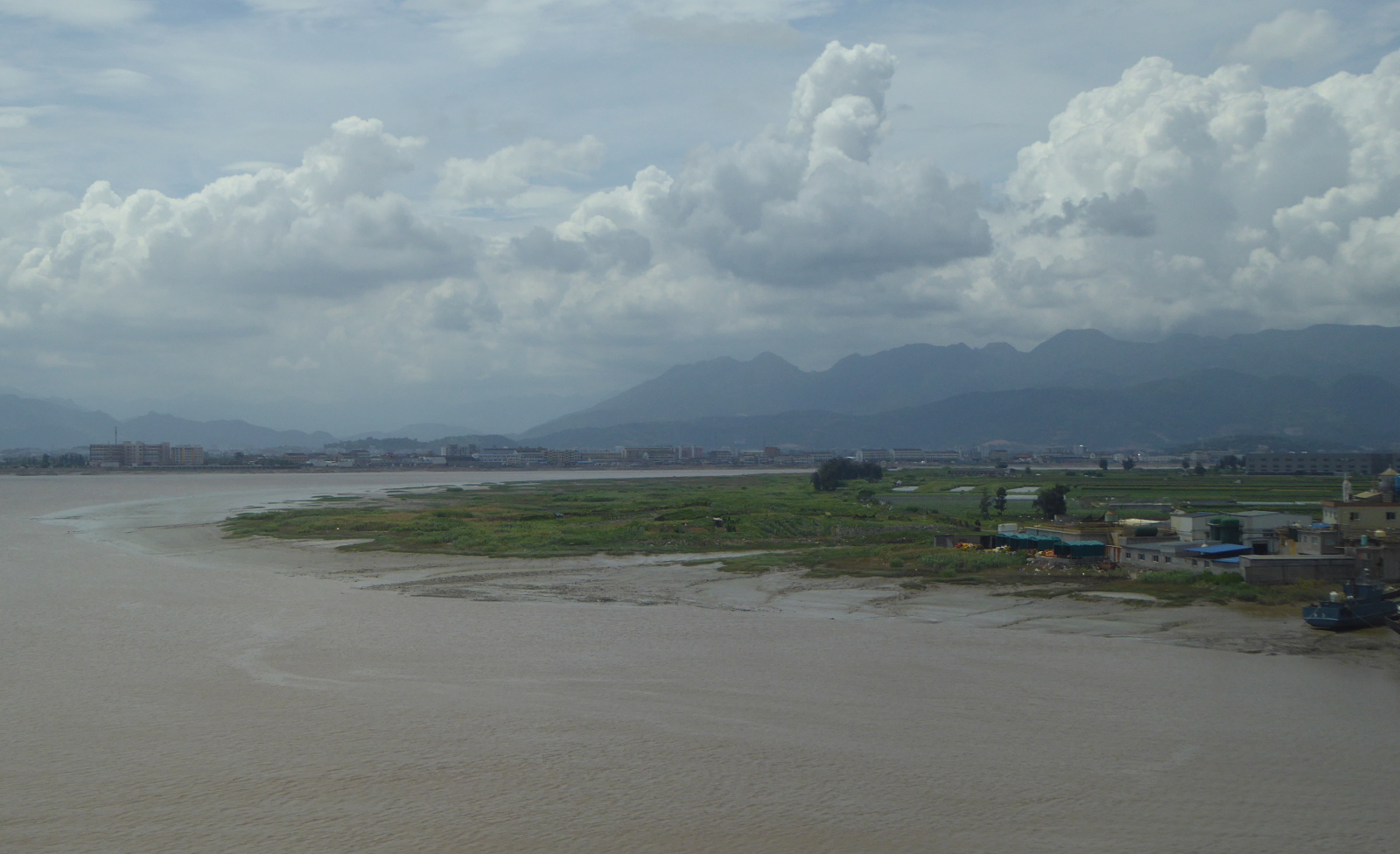
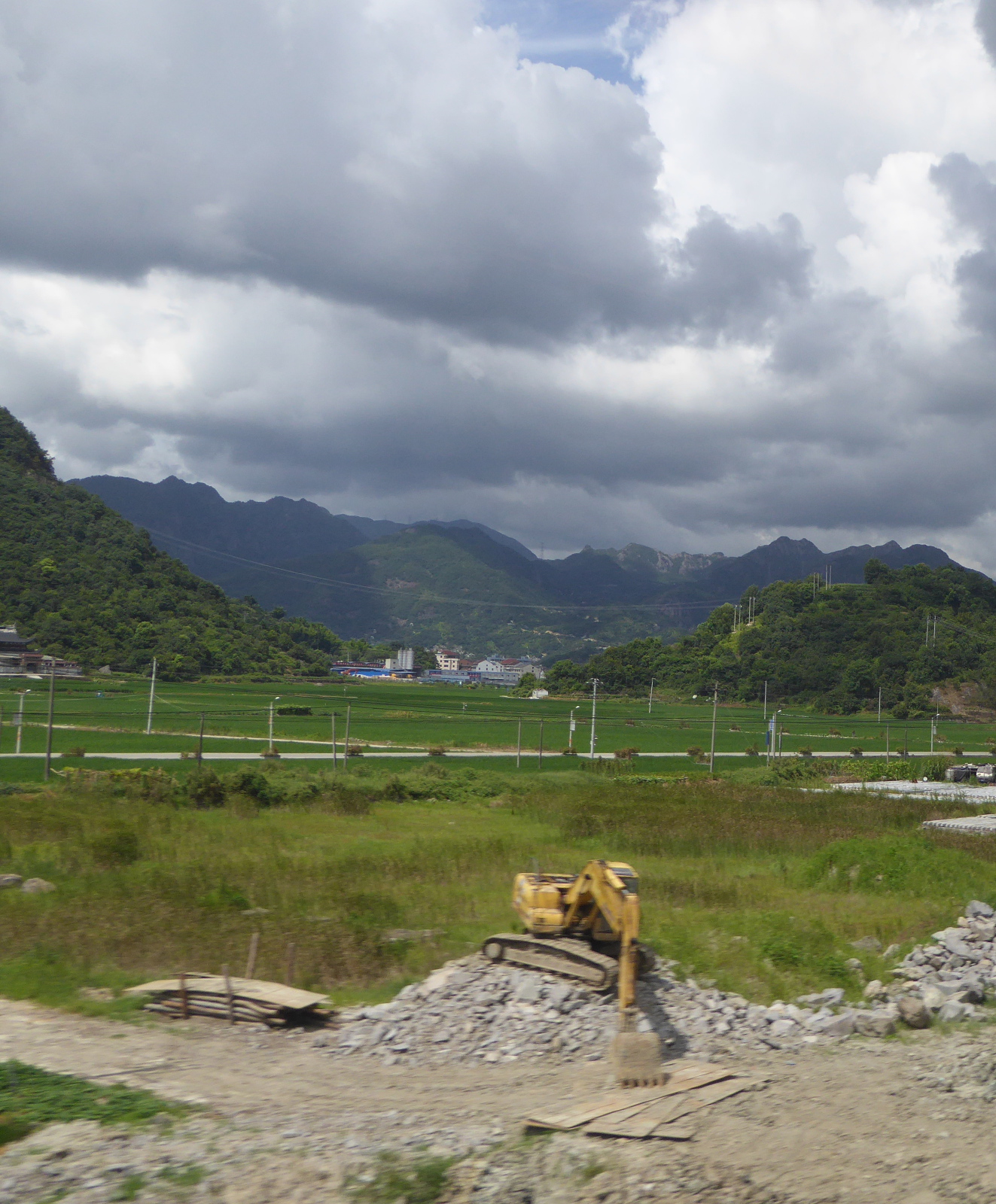
Xiamen to Nanjing by Train
Although sometimes I cannot avoid traveling by air, my favorite transport is the train. From Xiamen I took a high speed train to Nanjing. The scenery was beautiful, and we passed mountains, terraced hills, the broad Qiantang river, and even the grand canal of China.
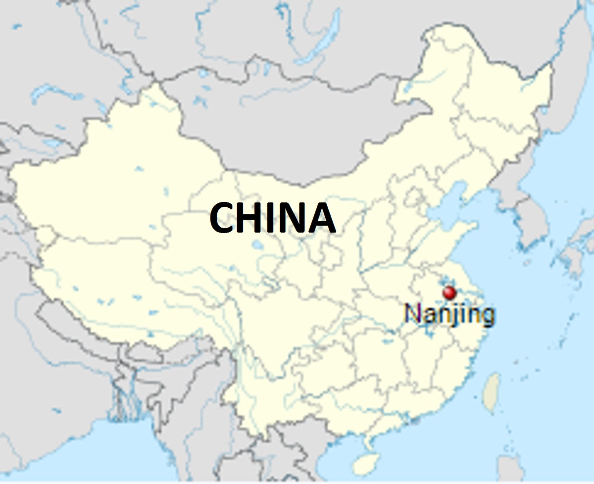
Nanjing 南京市
(Adapted from Wikipedia)
Nanjing (meaning southern capital) lives up to its current name, having been (under a variety of names) the seat of power for a variety of dynasties, and also the capital of the Chinese republic.
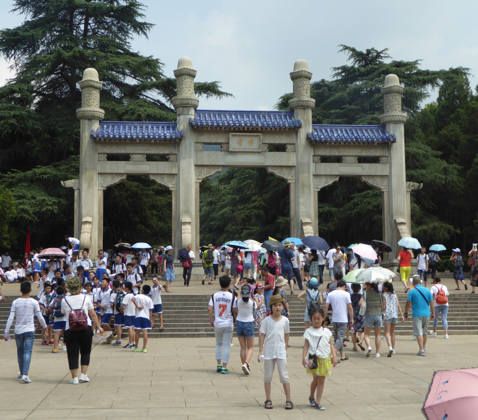
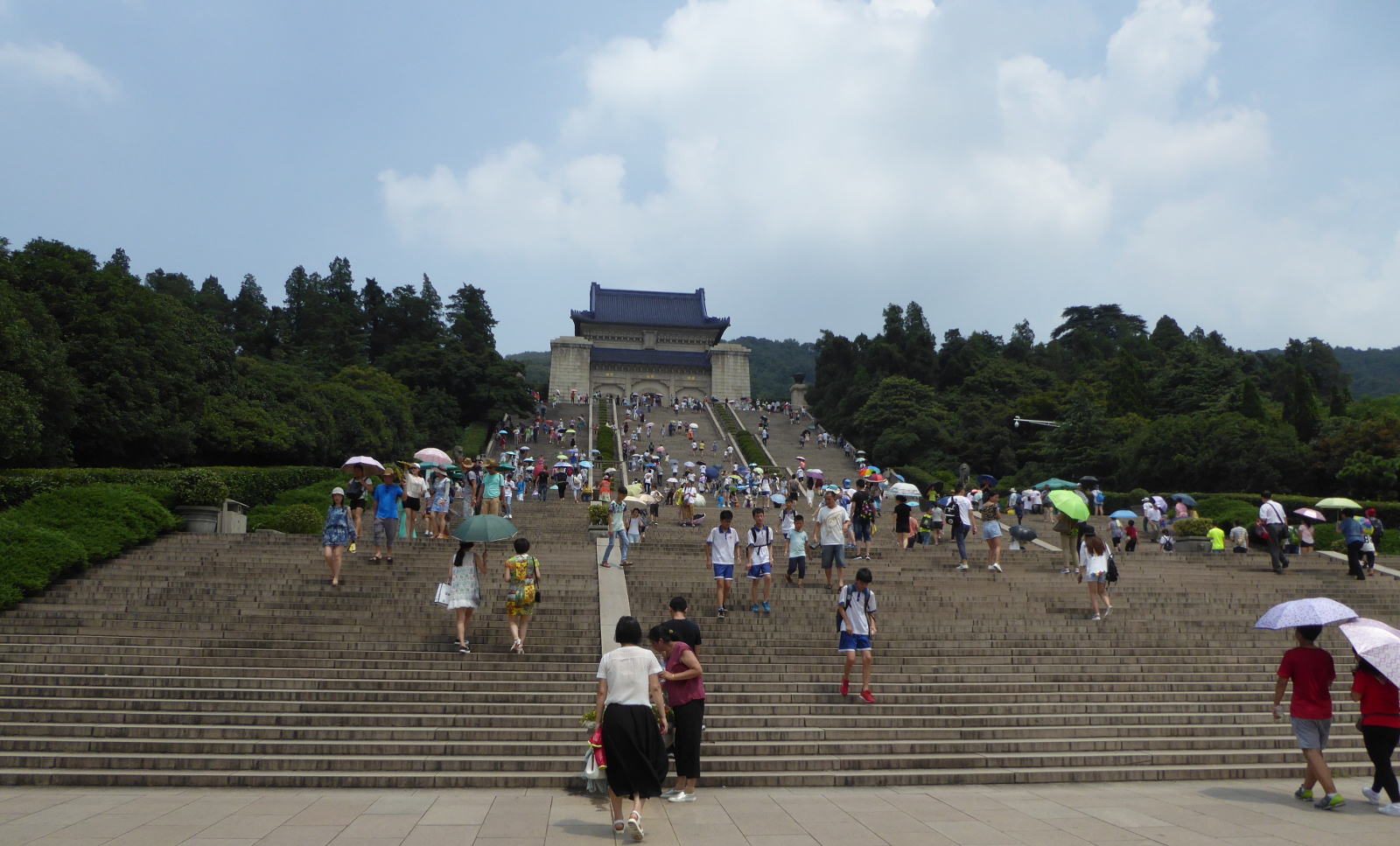
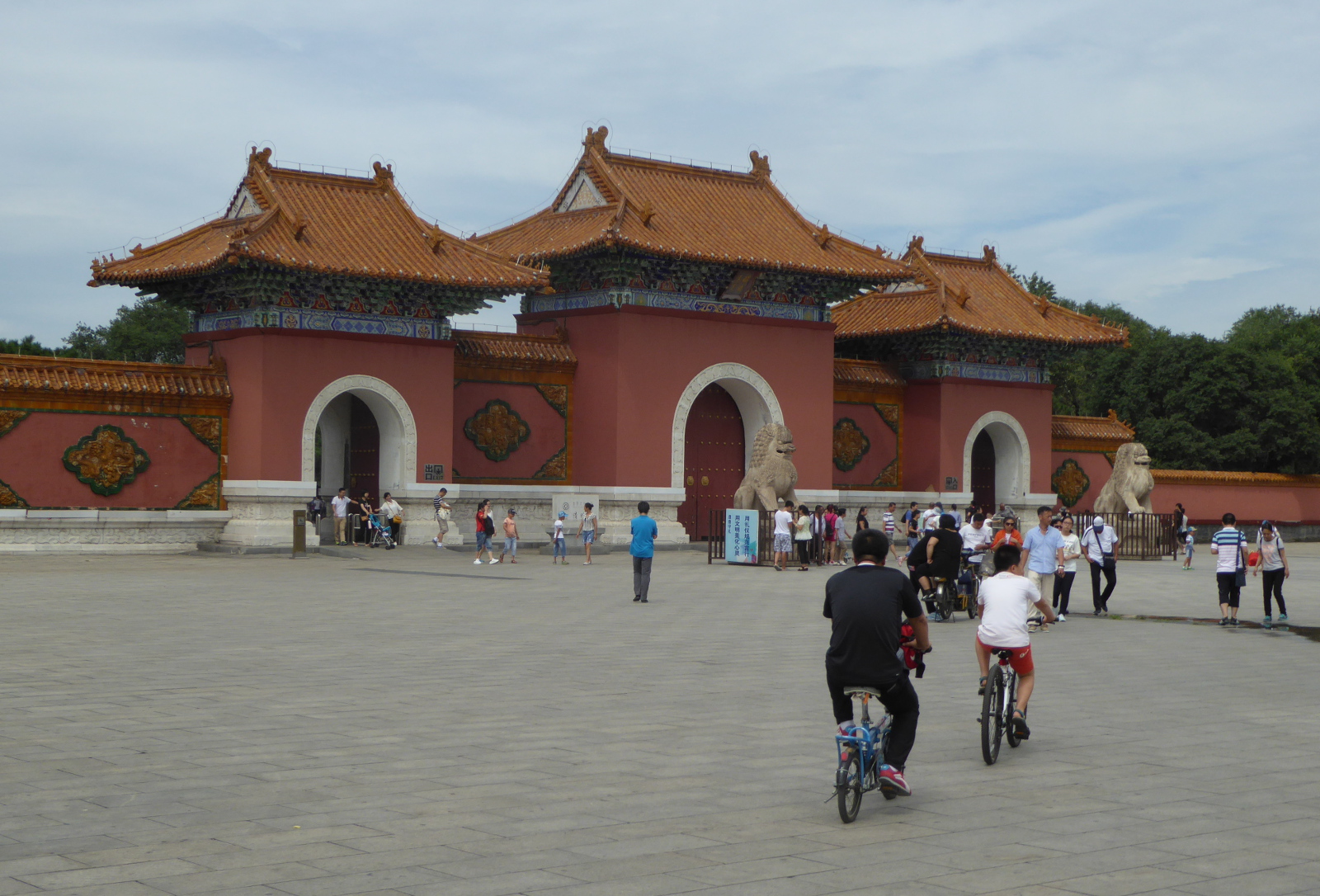
SunZhongShan – The Sun Yat-Sen mausoleum
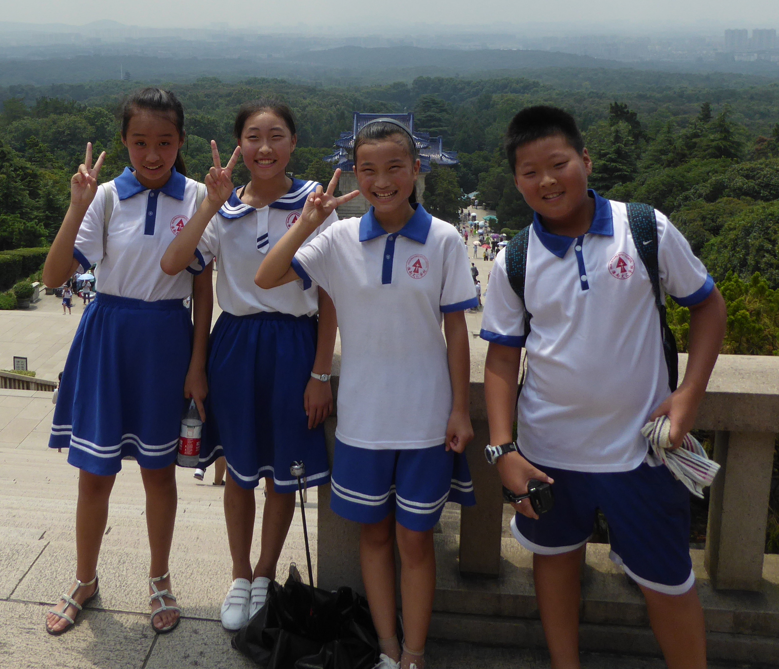
Sun Yat-Sen (Sun Zhongshan 孫中山) was a Chinese revolutionary who helped lead the struggle that overthrew the Chinese imperial government at the beginning of the 20th century. He can be thought of as the George Washington of the nation. He is buried in an elaborate complex on a hill in Nanjing.
A group of school children attached themselves to me and saw a chance to practice their English. They wanted endless photos with me, so I thought it appropriate to in turn take a photo of a few of them.
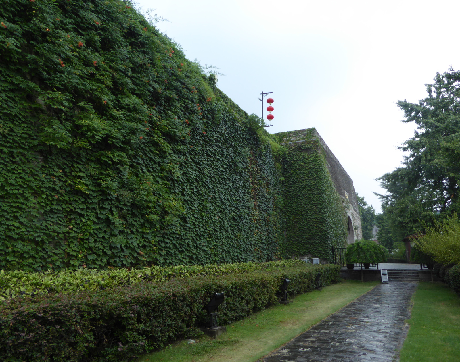
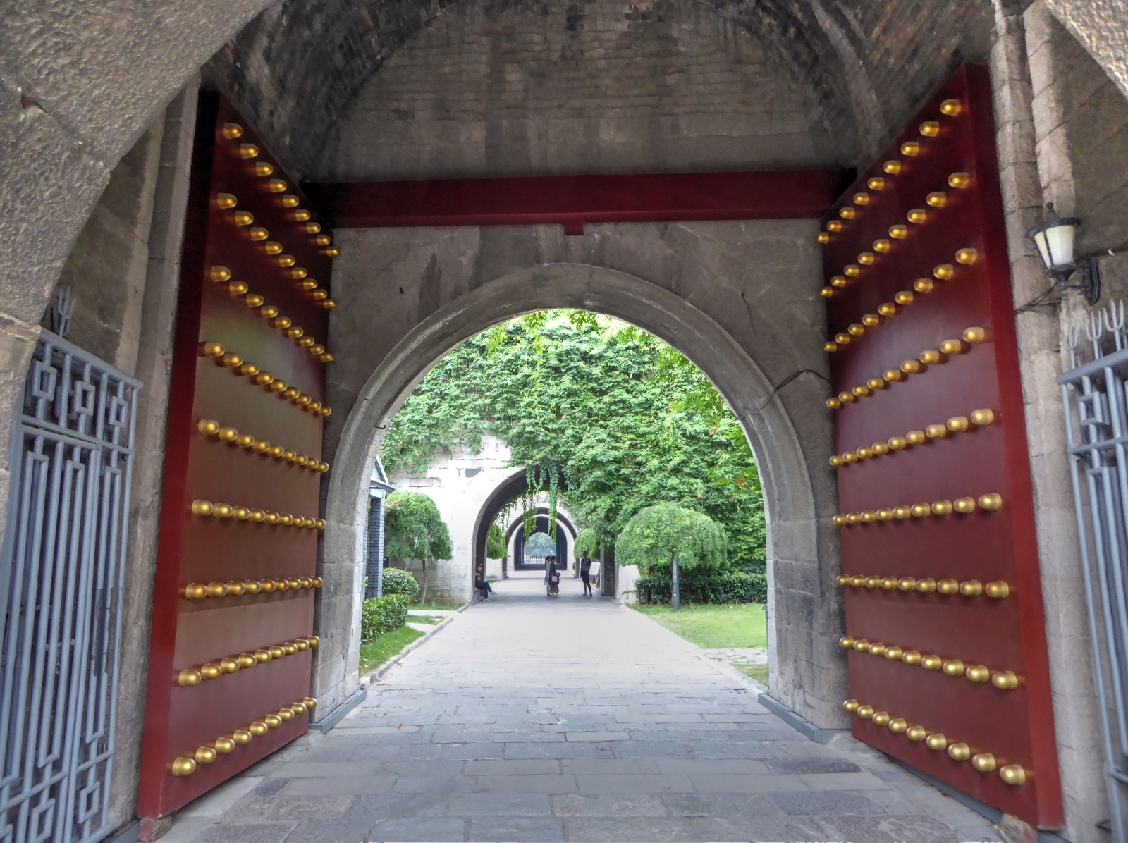
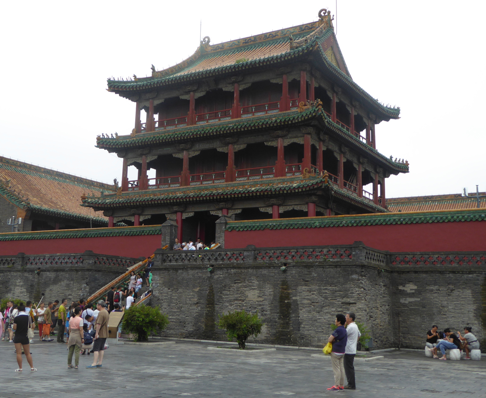
City Wall of Nanjing 南京城墙
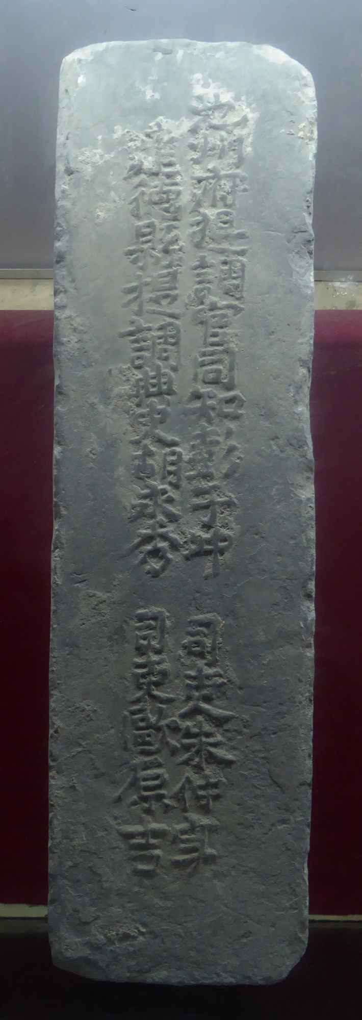
Nanjing’s city wall, completed in 1386 under the Ming Dynasty, is a high defensive structure about 22 miles long. I visited it at the famous Zhonghua Gate
An interesting aspect of the wall’s construction was that the bricks were each marked with information about the supplier etc as a form of quality control / accountability.
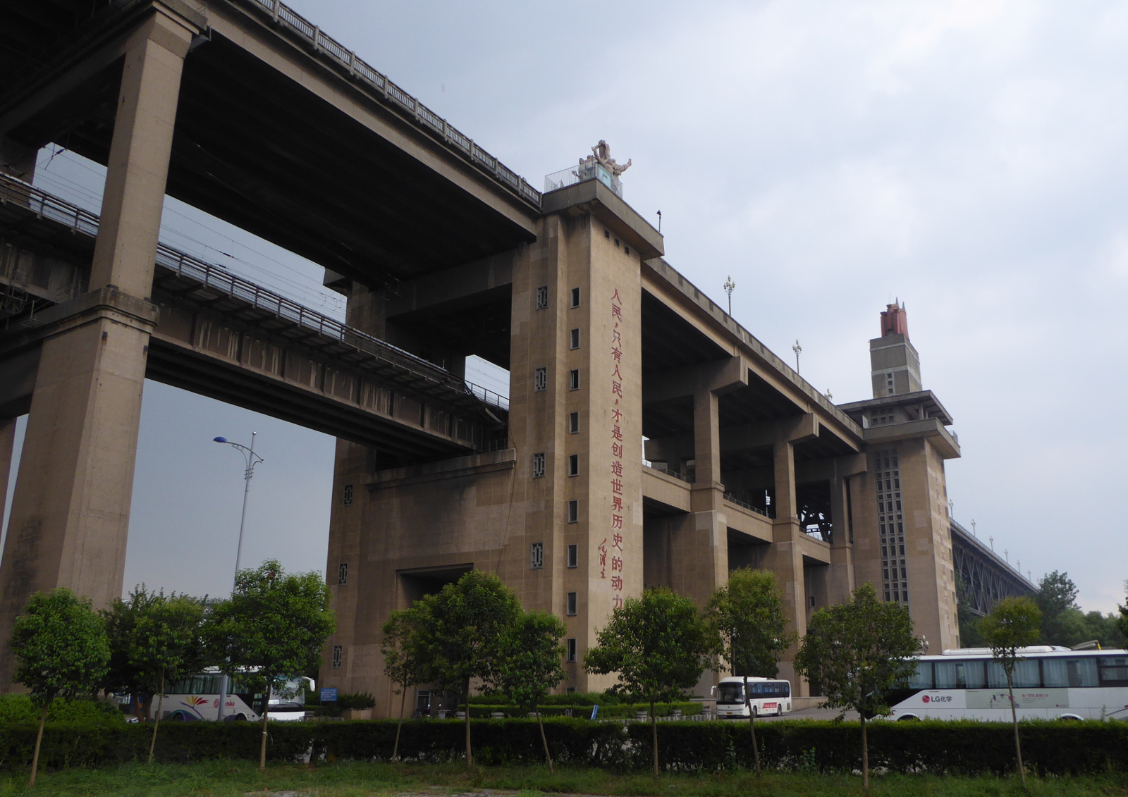
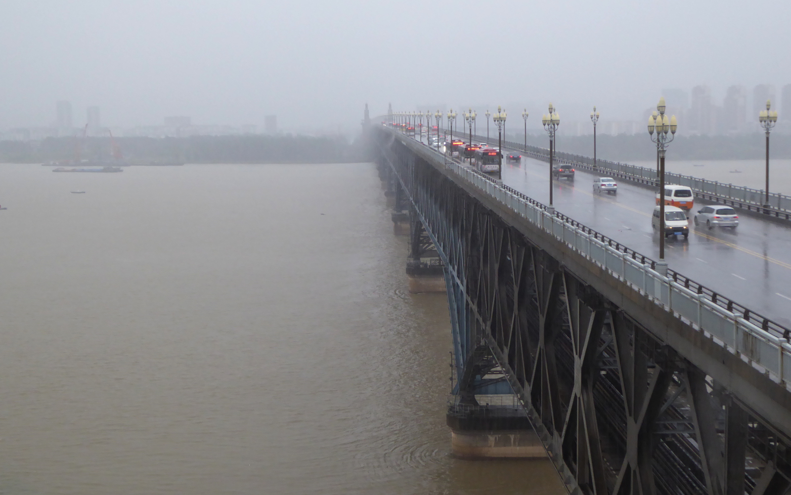
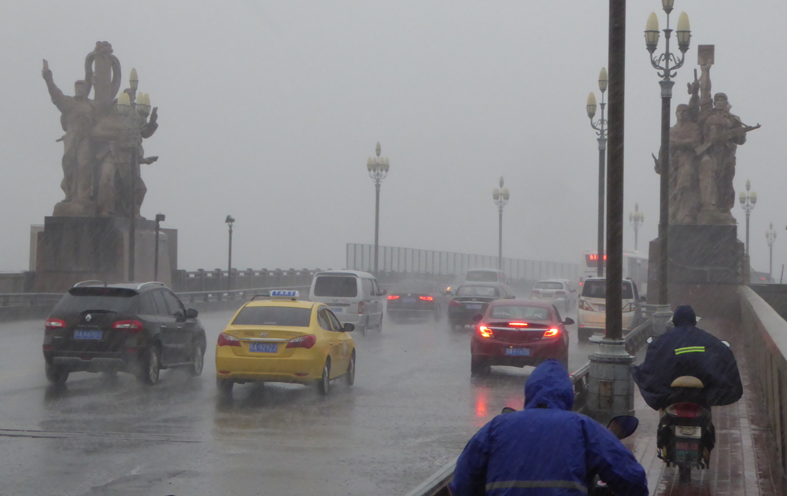
Nanjing’s Bridge over the Yangzi (Yangtze) 南京长江大桥
This double-decked bridge was completed in 1968. The upper level carries automobile/bus/motorcycle traffic, while the lower level is for trains. The project was designed and built exclusively by the Chinese and was understandably a source of great pride. In 1976 when I worked on highway bridges on Vail pass I remember a book about bridges in China and how impressed I was by this bridge.
Well, I am glad I visited it when I did. According to traveler information on the Internet, bridge traffic was shut down starting in October 2016 for a two year renovation project!
Dalian 大连市
(Adapted from Wikipedia)
(From Wikipedia)
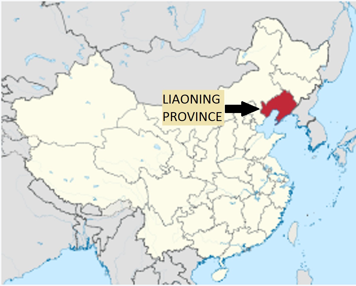
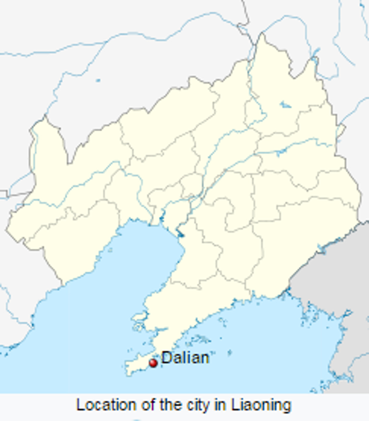
From Nanjing, I flew northeast to the port city of Dalian at the southern tip of Liaoning province. Due to the city’s strategic location, Dalian was coveted by the British, Russians, and Japanese, and suffered occupations by all three of those imperial powers. About 20 miles distant from Dalian is the town of Lushun whose “sights” include the old Japanese-Russian prison, complete with torture chambers. I decided to skip that side trip!
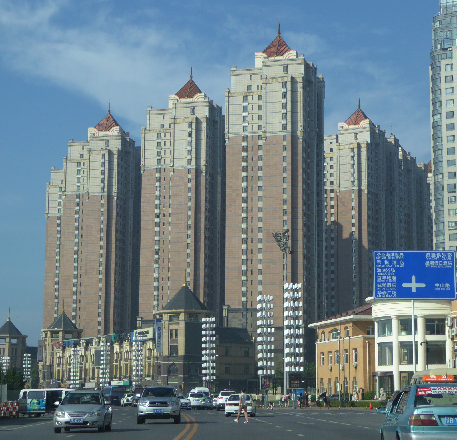
Dalian is fairly modern with many tall buildings. As you see in the photos, the air is clean.
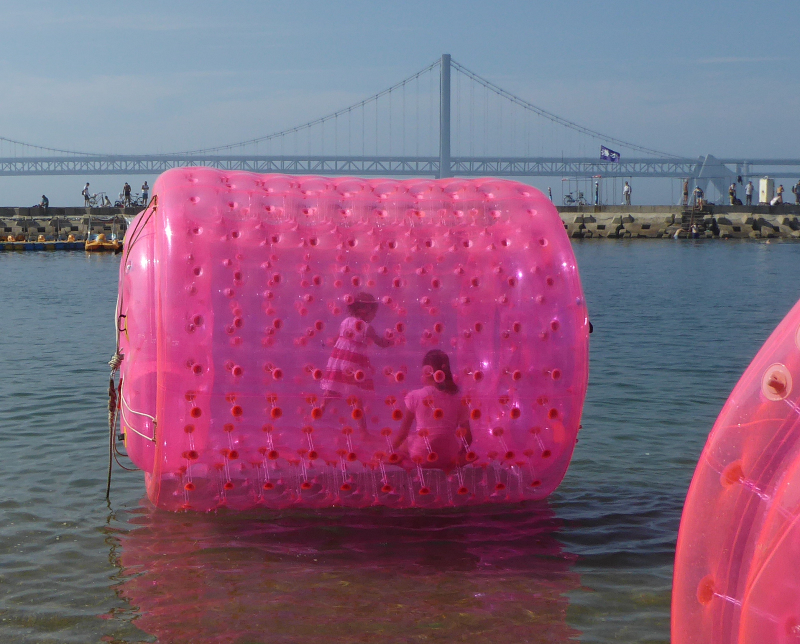
There are a number of beaches and boardwalks in Dalian. Lots of fun activities for families!
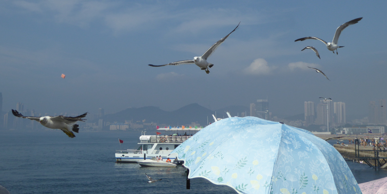
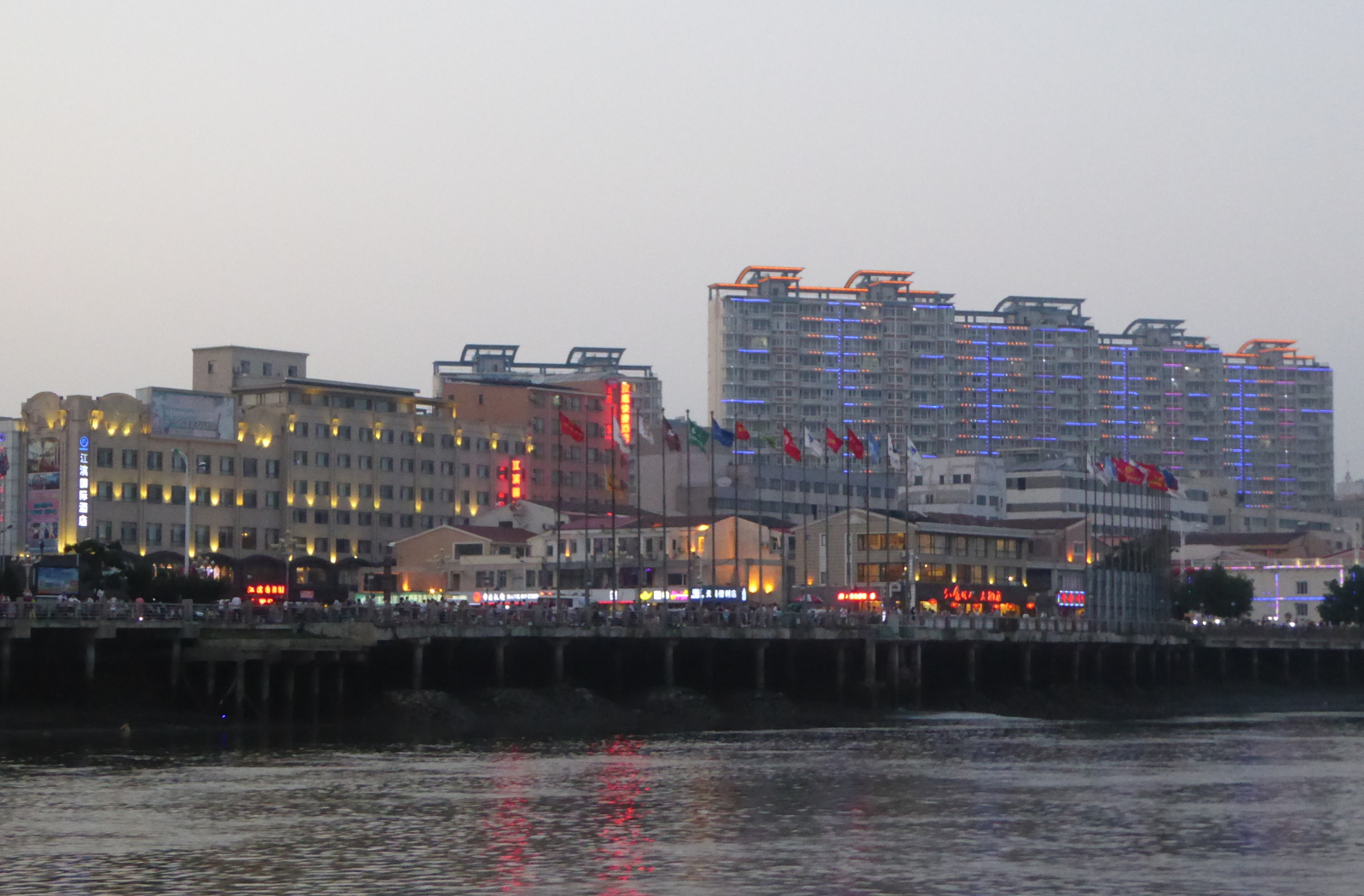
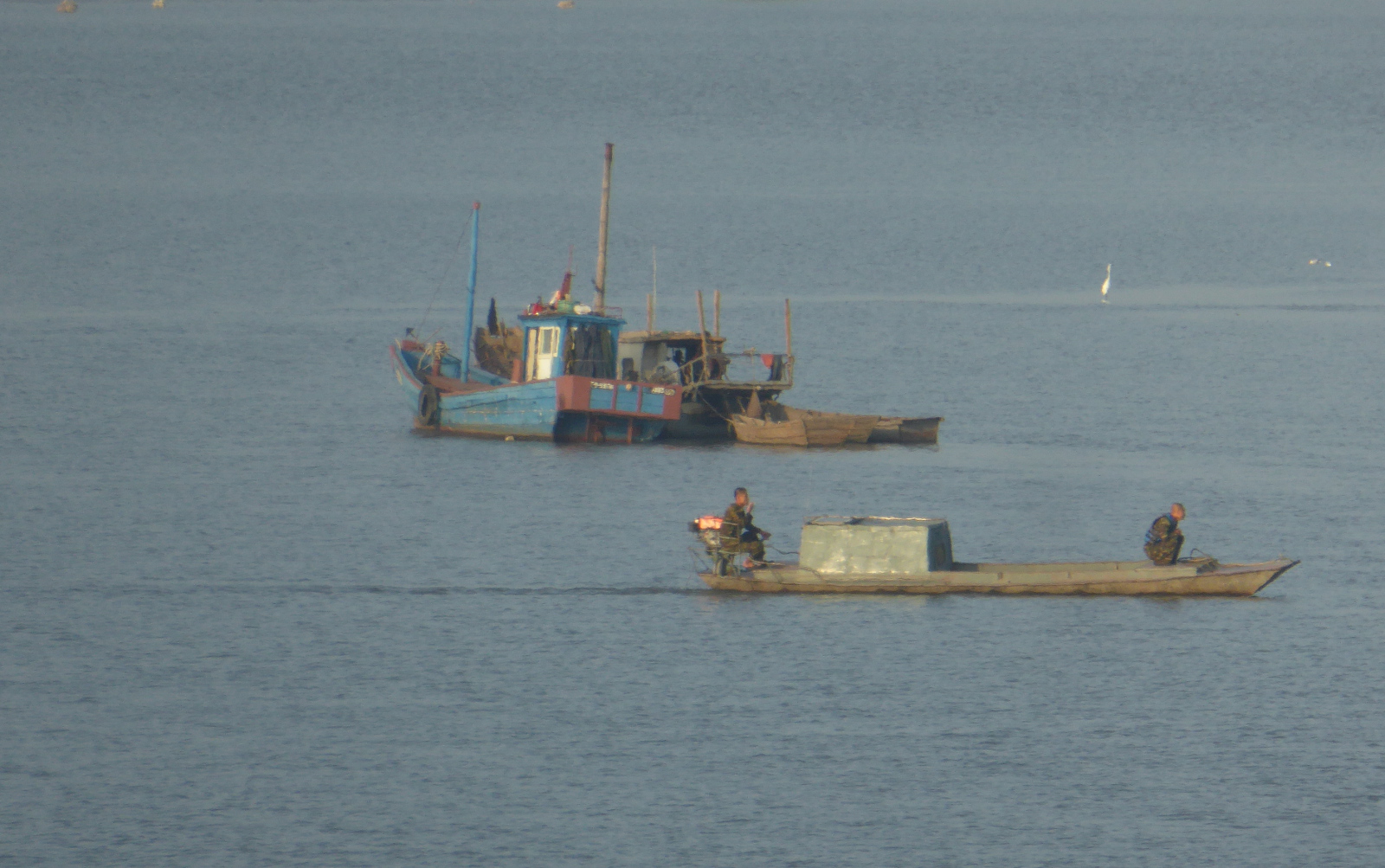
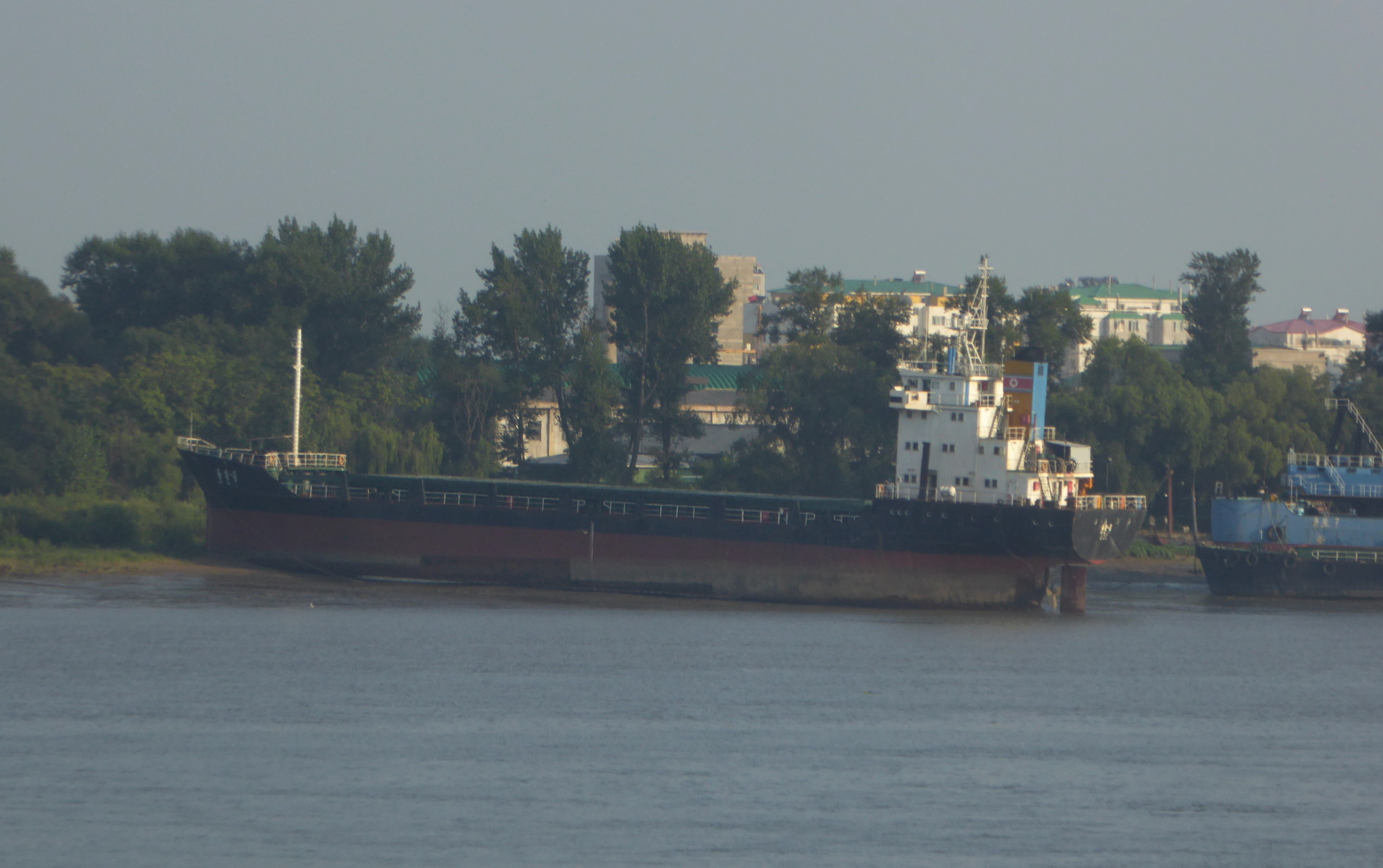
Dandong 丹东
Dandong is a bustling and prosperous city right at the border with North Korea.
(From Wikipedia)
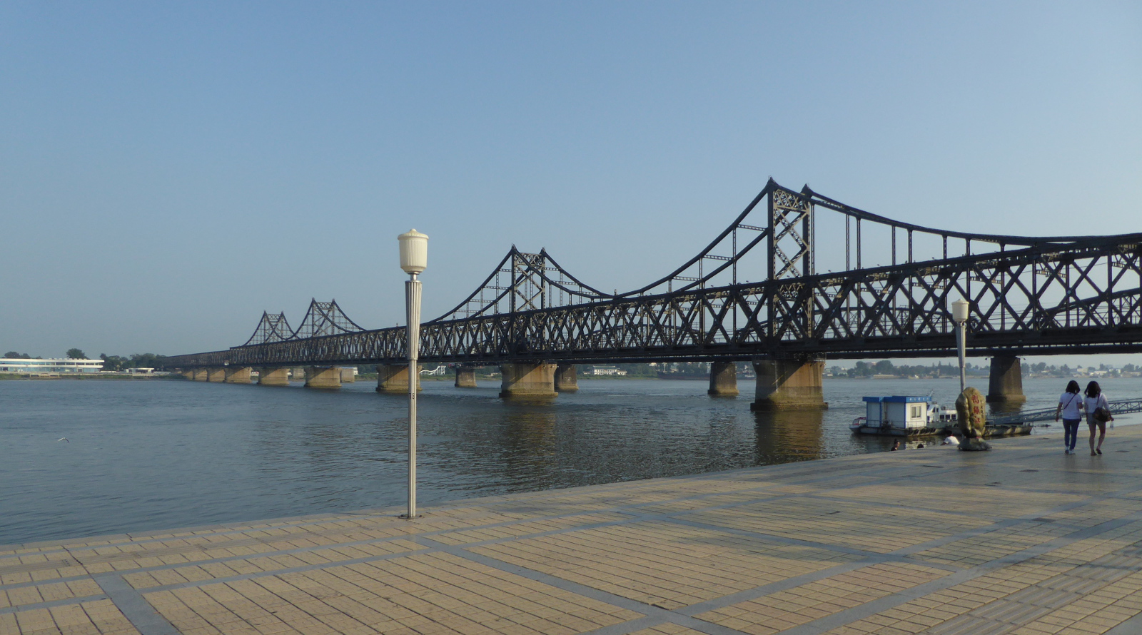
North Korea (Democratic People’s Republic of Korea) 조선민주주의인민공화국 and the Yalu River 鸭绿江
A steel bridge crosses the Yalu river, connecting Dandong with North Korea. While I was there I saw occasional trucks lumbering slowly across the bridge from Korea.
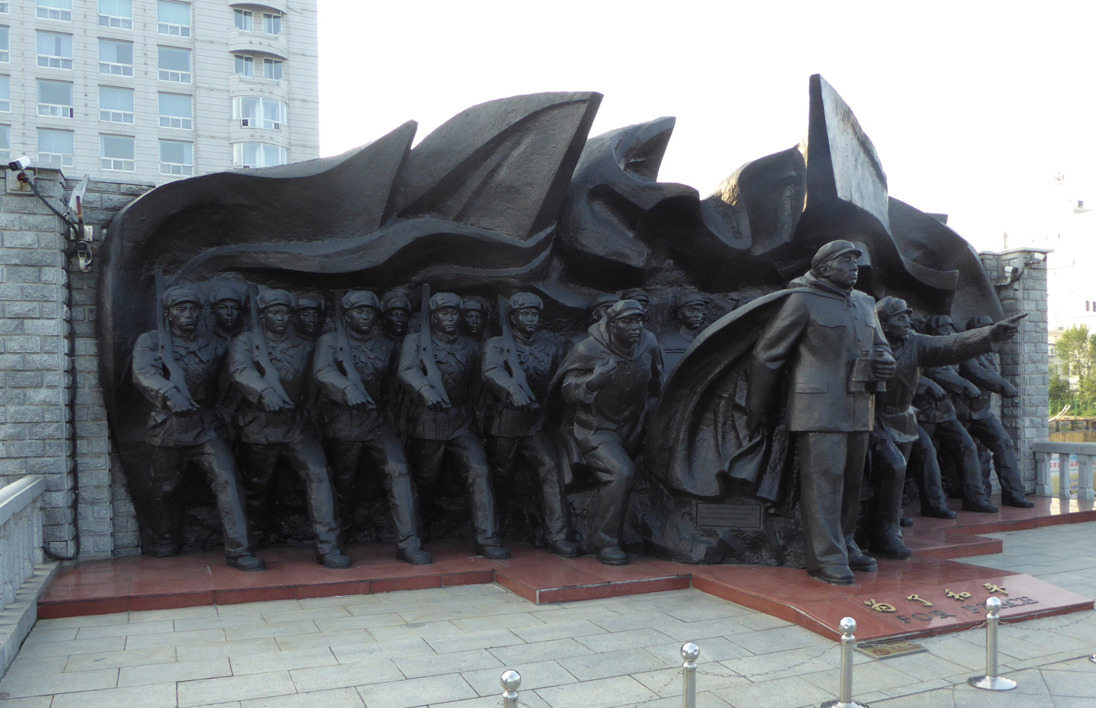
The Yalu river as it passes by Dandong provides a historical backdrop and evokes memories and memorials related to the Korean War. An American push to take control of the entire Korean peninsula was further complicated by American general McArthur’s posturing in favor of additional broadening of the war. As American troops raced up to the Yalu river, China intervened on behalf of the North Koreans. This helps explain the riverside displays of vintage anti-aircraft weapons and this sculpture of troops facing the border with Korea.
I took a tourist boat ride that looped down then back up the river. Views included North Korean fishing boats, and rusty ships beached on the Korean bank of the river.
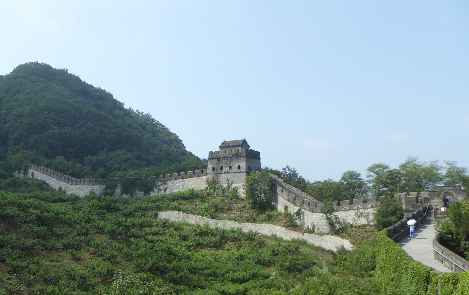
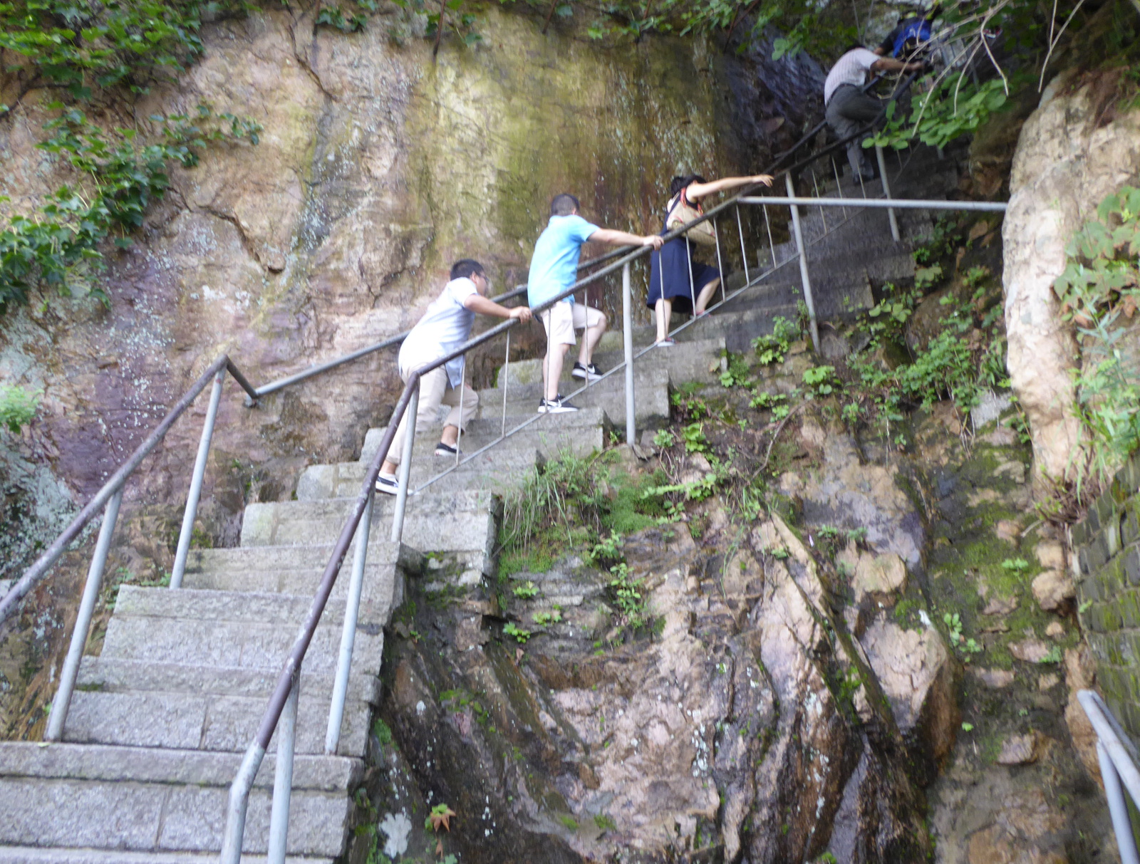
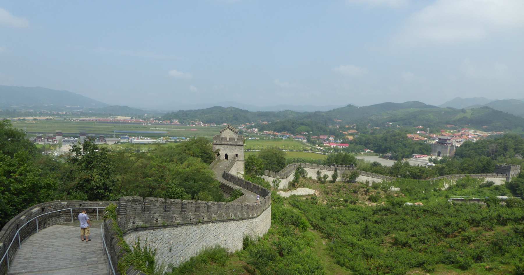
Tiger Mountain (Hushan) Great Wall 虎山长城
Just north of Dandong city is a restored Ming Dynasty section of the Great Wall, said by some to be the furthest east part of the wall. Although there were other tourists (Chinese) there, it was not as overrun with visitors as some sections near Beijing.
The guide books speak of a museum at the other side of the mountain, but I cannot vouch for that. The day was extremely hot, and I was dripping sweat. At a certain point, the wall runs right into the mountain, and you continue to the other side by climbing steep stairs. I went far enough up those stairs to reach a spot where a young woman had collapsed from the exertion. I realized I had reached my limit, and after a short rest, returned to the starting point!
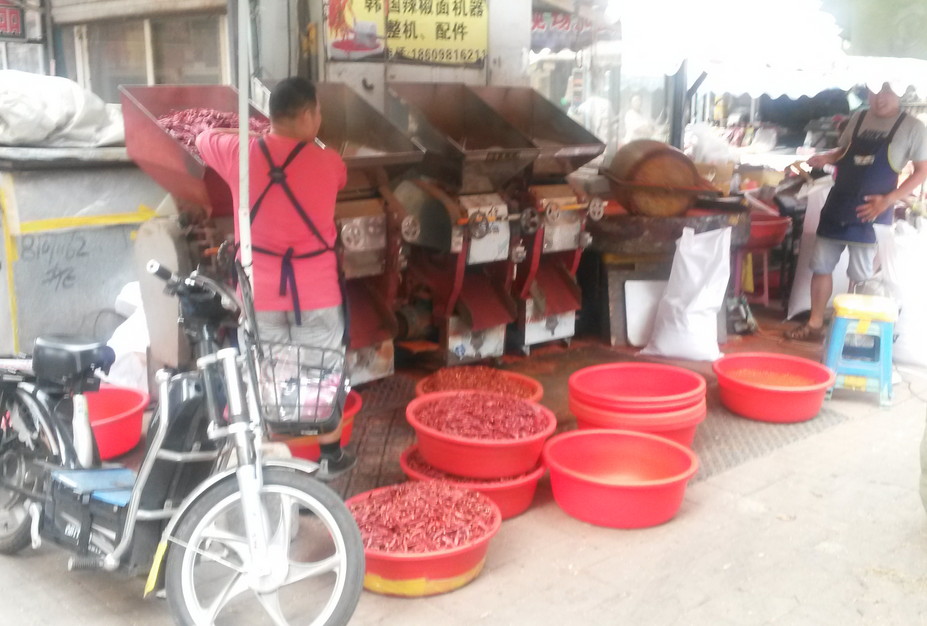
Shenyang 沈阳市
Another train ride through lovely landscape took me from Dandong to Shenyang, the provincial capital. It is a large industrial city of over six million inhabitants. Shenyang is also full of history.
(From Wikipedia)
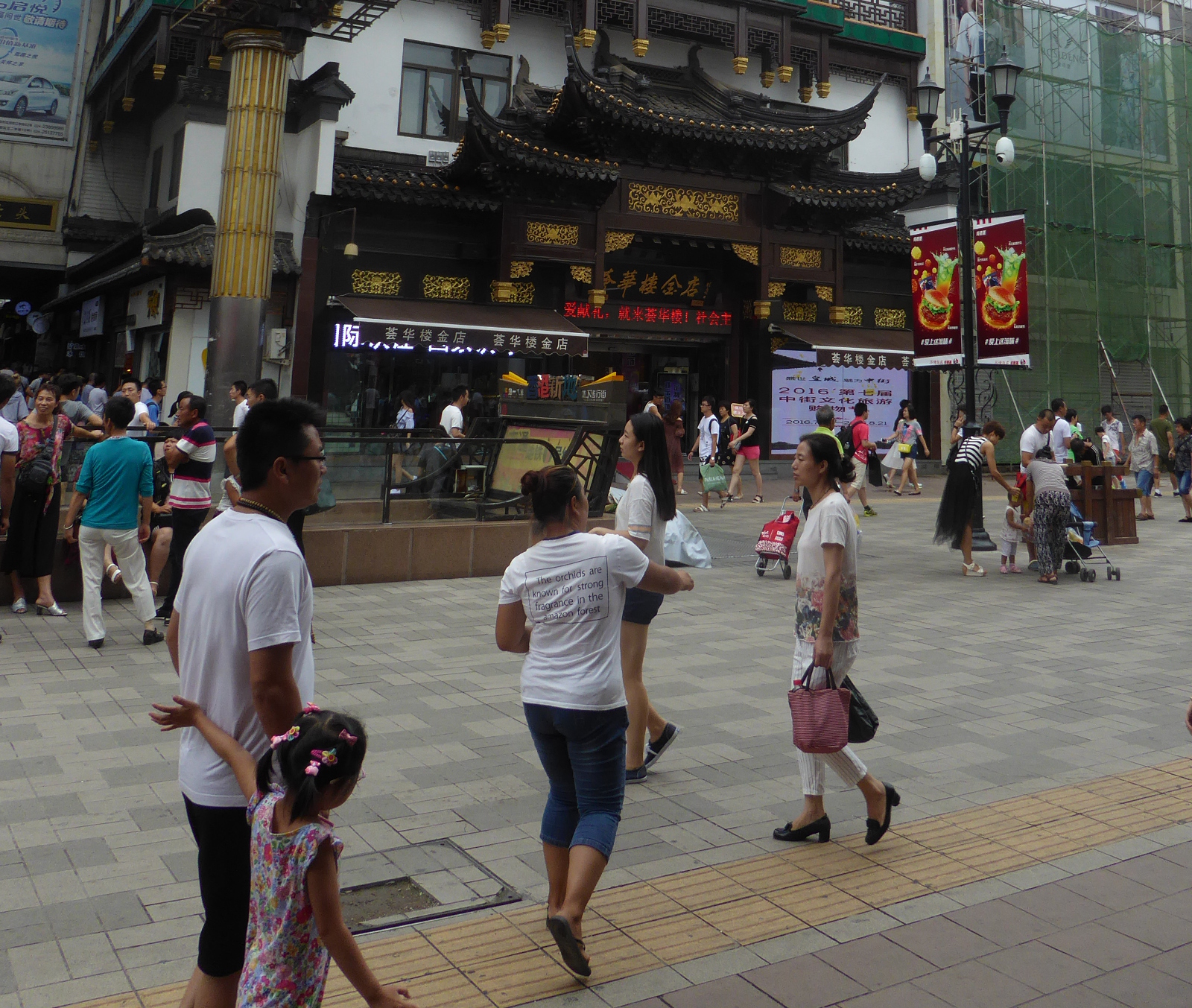
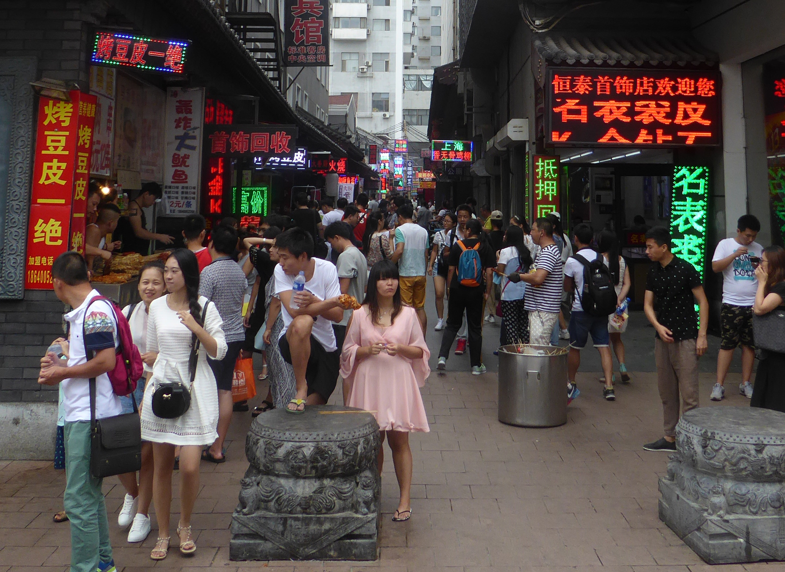
Streets of Shenyang
The broad “Zhong Zie” pedestrian street in the middle of town:
A side street with bright neon signs offers a variety of foods.
Near the Korean section of town I encountered a small street with a variety of foodstuffs, including this stand where the process of grinding dried red chili peppers was in progress.
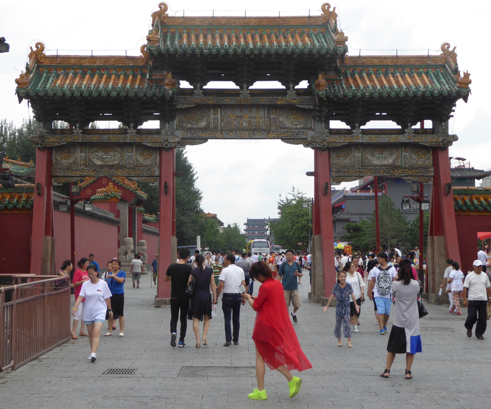
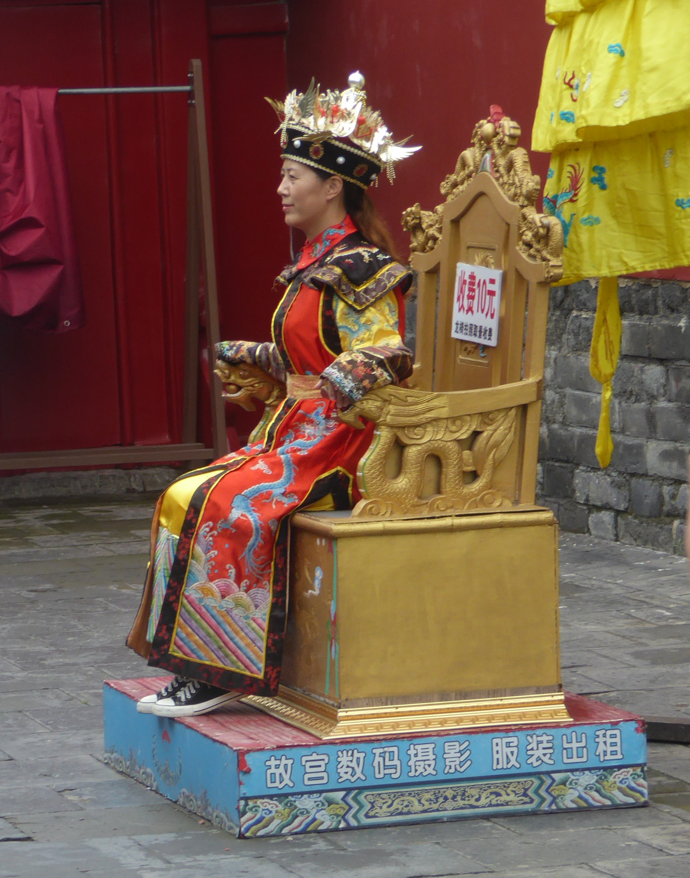
Mukden Palace 盛京宫殿
This part of China was the home turf of the Manchu people who took control of the rest of the country as the Qing (Ching) dynasty. The ancient name of the city is “Mukden”, and the sprawling palace of the Manchus, said to be patterned after the Forbidden City in Beijing, still bears the old name of the city.
Generally the genuine Manchu nobility did not wear sneakers.
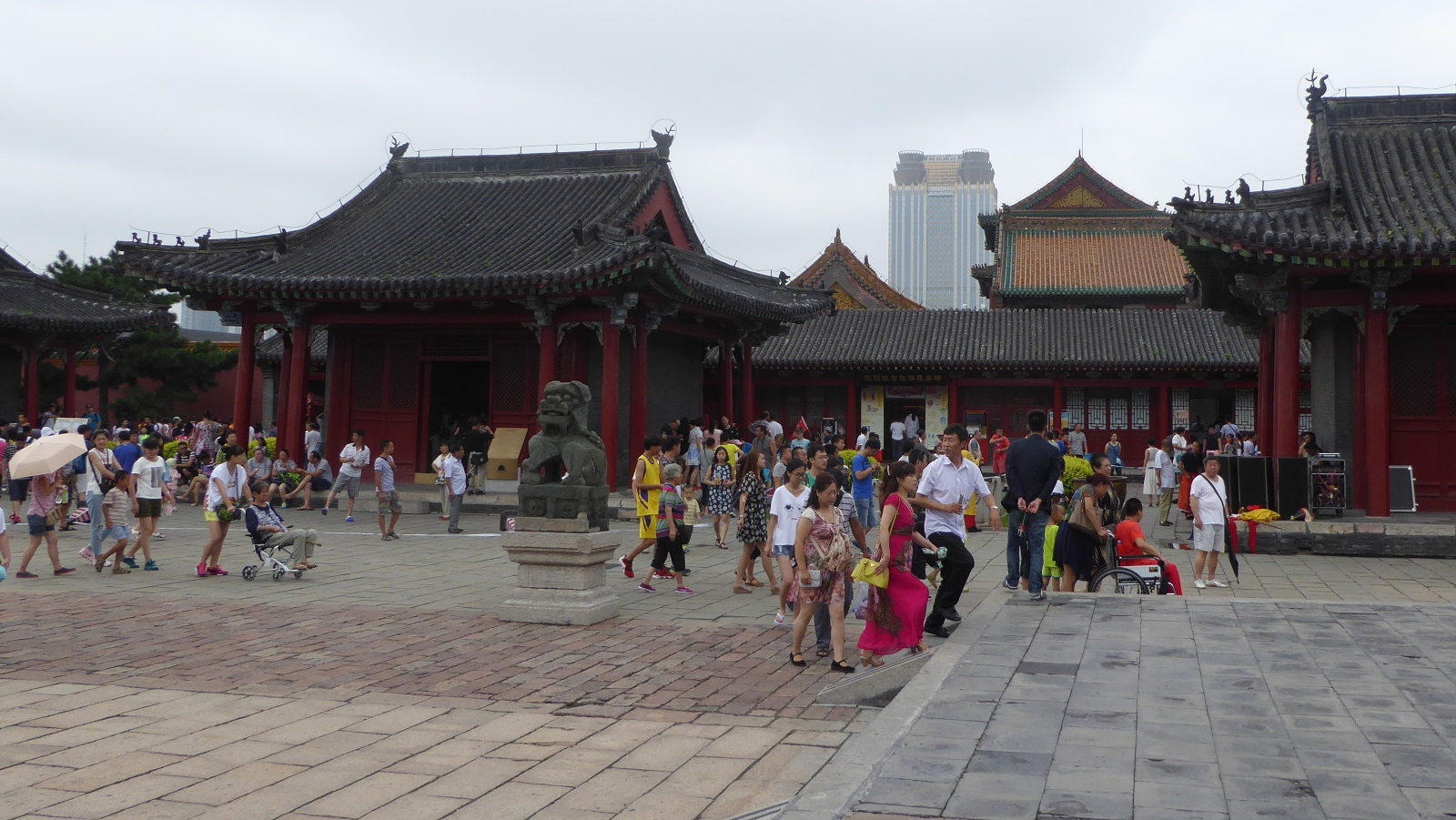
Beiling Park 北陵
At the northern edge of Shenyang is a lovely park that also includes the tomb of the second Manchu emperor. The park itself is tranquil and full of townspeople relaxing- families, couples strolling… and… your occasional western tourist!
China- I hope to return very soon! 中国 – 我会回来的!
After Shenyang, I returned to Xi’an where I reclaimed bags I had left at the hotel. The next day it was off to the airport and a flight back to San Francisco, and then Denver.
I had a lovely time in China. The energy and excitement of the students at the university was gratifying, the landscapes were awe-inspiring, and the people genuinely friendly. To that mix throw in historical sites from one of the oldest civilizations on Earth.
Xi’an 西安 and the Summer English program at Xi’an Jiaotong University
(Clicking on any of the images will enlarge it. In many cases, clicking a second time will make it even bigger)
This year (2016), I once again went to China!
The “Summer English” program was well received last year, and Xi’an Jiaotong University decided to repeat it.
Back in China I was happy to see wonderful people I had met the previous year. This included a number of fellow teachers from 2015 as well as my friend and colleague Shirley, classroom support assistants Laura and Ruby and some students including Asteria, Sure, Gavin, and Jesen.
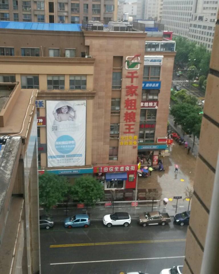
In the city of Xi’an, I stayed at the (very comfortable) Citadines Hotel again. Here was the view from my hotel window:
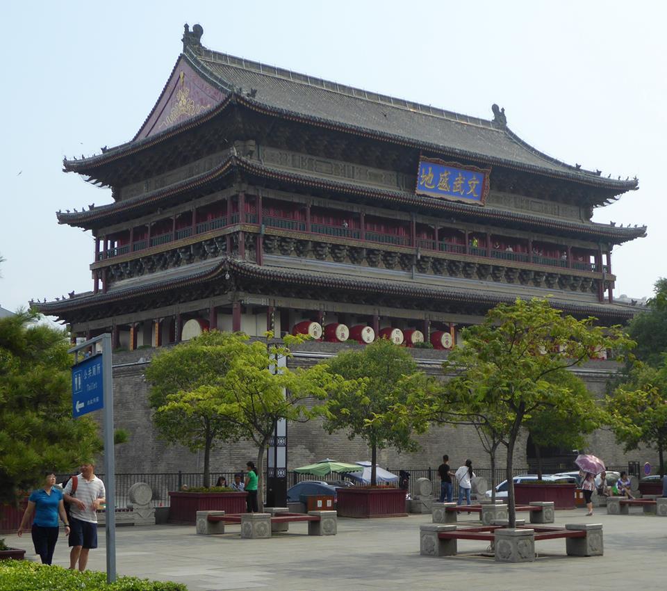
The “Drum Tower” in the old city center:
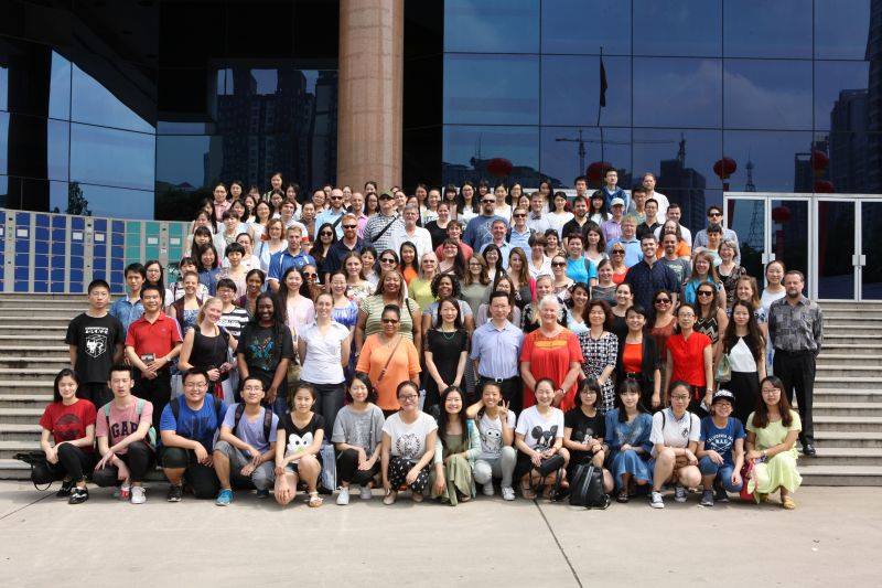
There were a few program adjustments from the previous year, and this time we had twice as many teachers- “Guest Speakers”. Most of us were from the United States, but our ranks were supplemented by some from other “English-speaking” countries. This year, our classroom helpers were Chinese students with English majors. The following photo was the official program staff photo taken by the University:
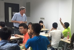
The students were great to work with, and they seemed to genuinely enjoy the classes. The summer program focused on listening and speaking skills. The format of the classes was very different than English classes taught by Chinese professors. We deliberately made the classes very interactive. A student written article (linked here) that appeared in an online school publication did a good job of explaining the difference. From a student’s perspective, the normal model was “You are teaching, we are listening.” In our summer program, this was replaced by a model where “We are communicating”.
In my classes, I outline “rules” meant to encourage students to take risks, and learn by doing. One of my rules, “Mistakes are OK” was quoted in the student article. Mistakes are an important part of the language learning process! But the concept was a huge break from the Chinese norm.
Weekend excursions
This year, the university again offered Saturday excursions to the major sites near Xi’an to teachers in the program. As a returning teacher, I had already been to the chosen locations. So, along with some other teachers, we created our own week-end getaways.
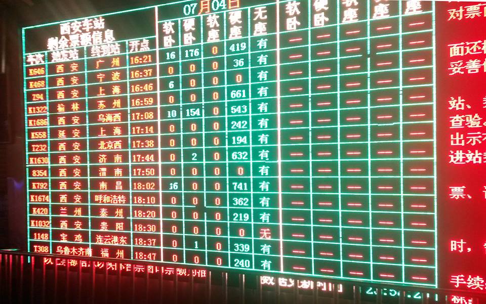
Night train to Luoyang 洛阳
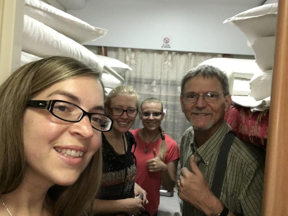
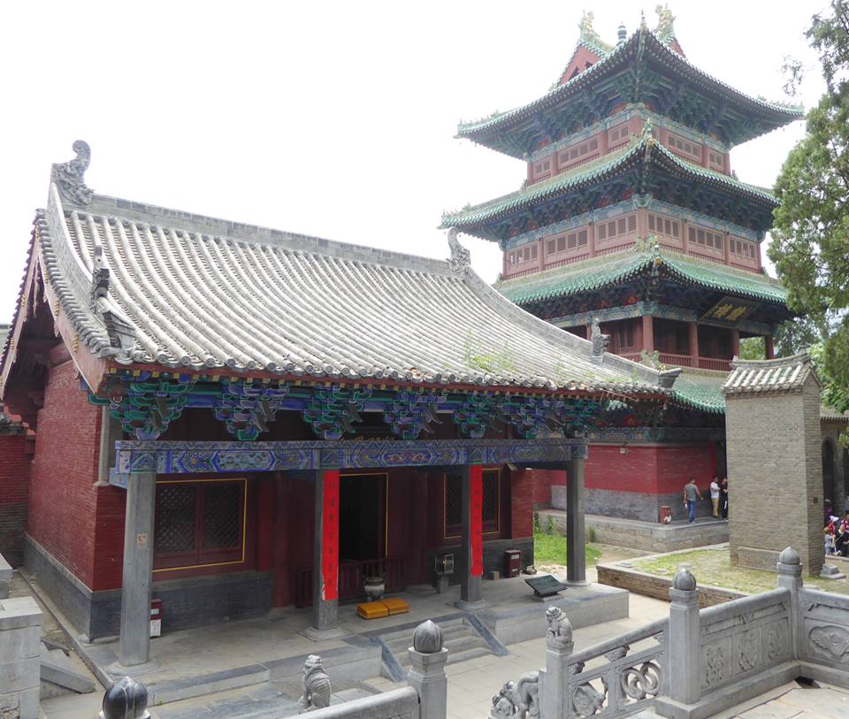
For our first weekend’s excursion we decided to go to the Longmen Grottos and Shaolin Temple. The trip started with a night-train ride from Xi’an to the city of Luoyang.
Four of us crammed into a sleeper compartment and from our midnight departure until our mid-morning arrival we dozed on the bunks.
Photo by Alexandria
In Louyang we eventually found a tour bus that would take us to our two selected destinations. As the bus raced around mountain curves and through small settlements, we passed all sorts of other vehicles
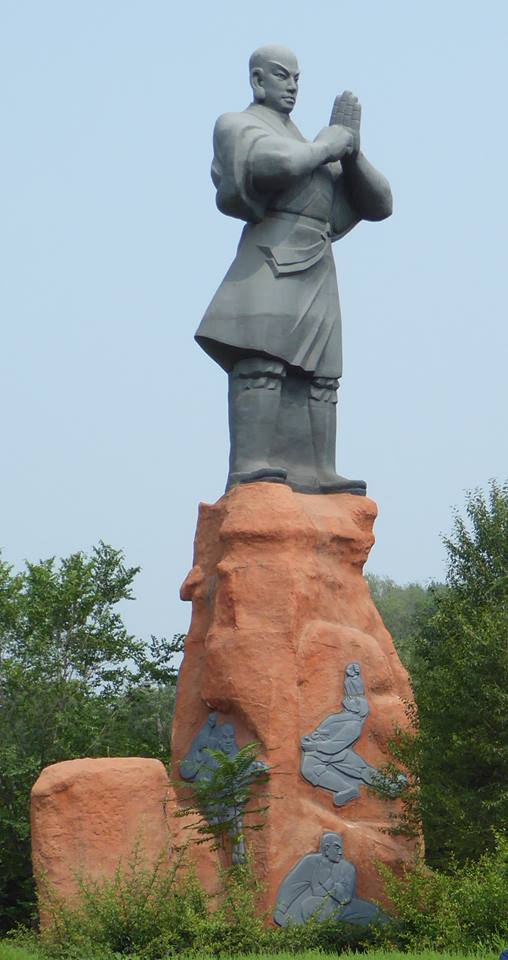
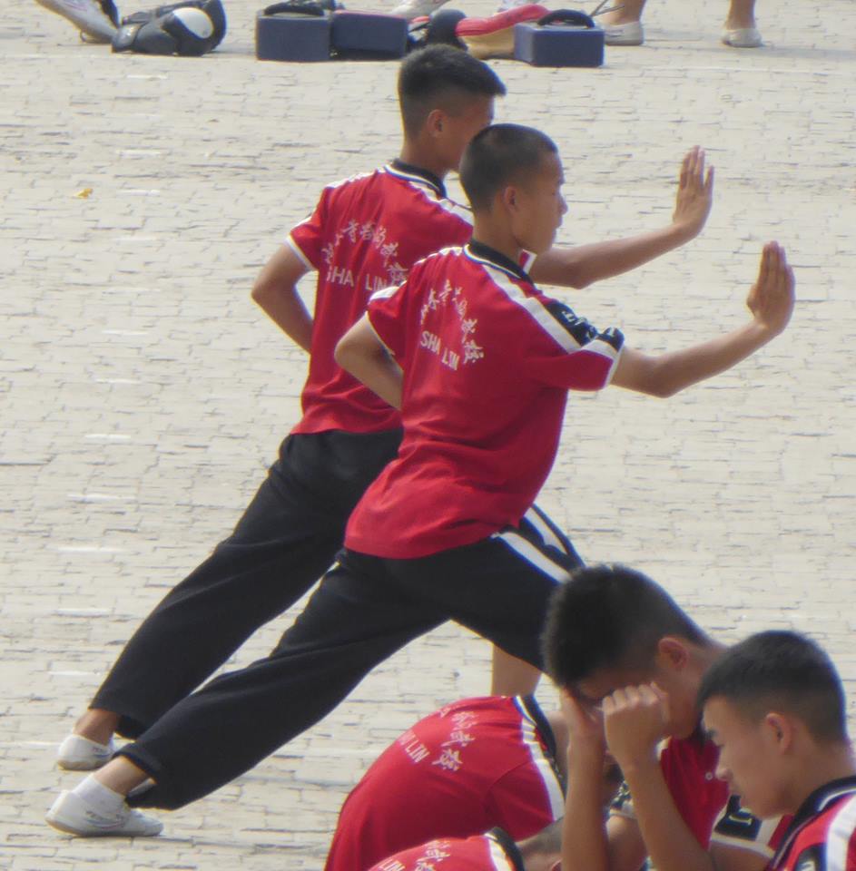
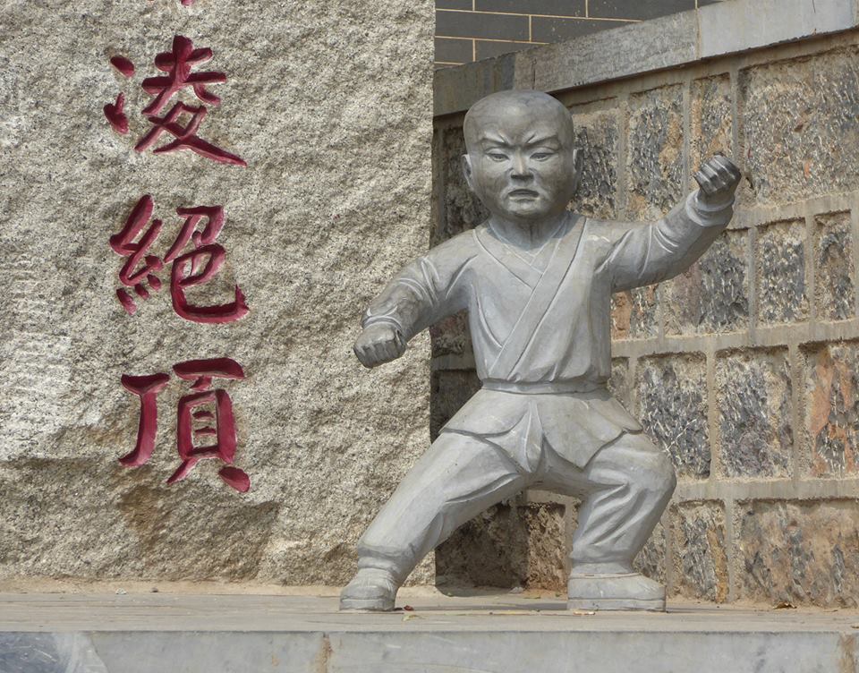
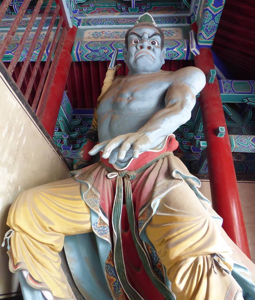
The Shaolin Temple/Monastery (少林寺) is famous as the home of noble, selfless monks who used kung-fu skills to protect the populace from bandits, thugs, and repressive warlords. In recent years the site has become a major tourist draw, and it has taken on a bit of a theme park atmosphere. But it was still interesting.
This fierce, colorful statue at Shaolin is one of the “Temple Guardians”.
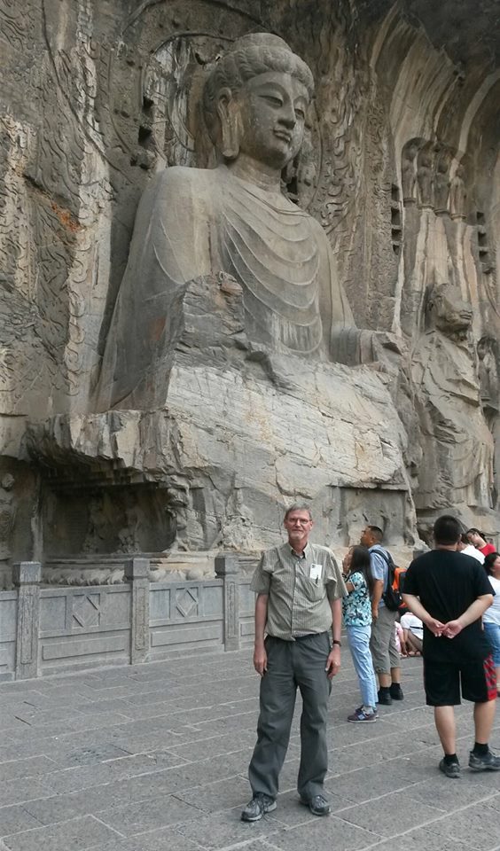
Our other destination were the “Longmen Grottos” (龙门石窟). This site is famed for its Buddhist artwork consisting of thousands of carvings and statues, ranging from tiny to huge. Alexandria, from our group, had studied the site during her graduate program. It was fascinating, and we really could have spent an entire day there.
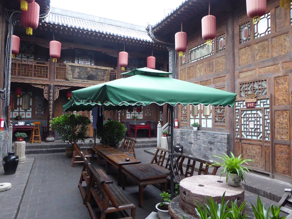
Pingyao 平遥
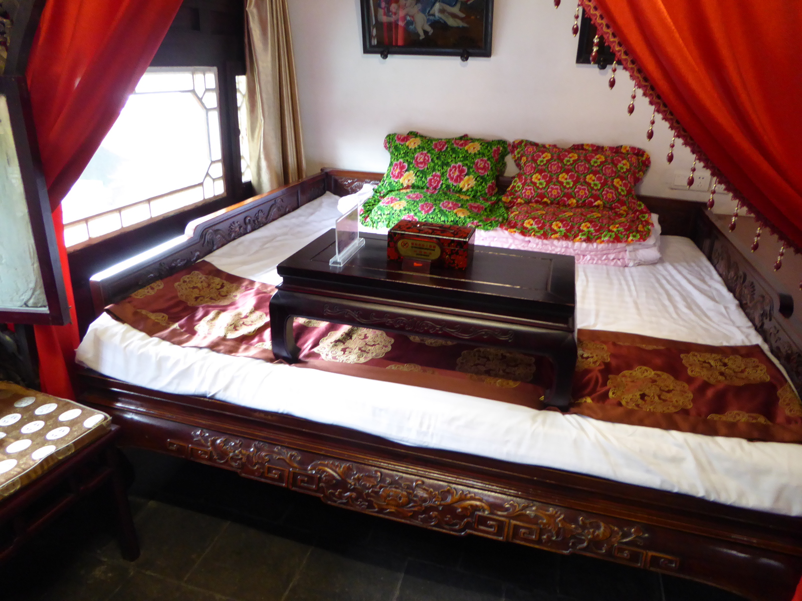
The next weekend spawned several trips to different destinations. Along with my colleagues Megan and Marlene, I opted for an overnight stay in the beautiful, ancient, walled city of Pingyao. One notable thing about this city is that within the city walls, the traditional architecture has been conserved. (Quite a contrast to Xi’an where “within the walls,” tall modern buildings compete for space with historical structures.
In Pingyao, even our hotel was in a lovely building- The compound reminded me of scenes from the famous movie “Raise the Red Lantern”, which was filmed near Pingyao.
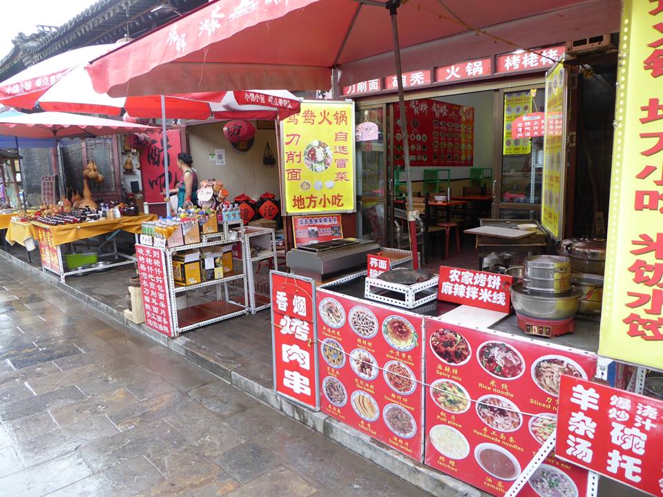
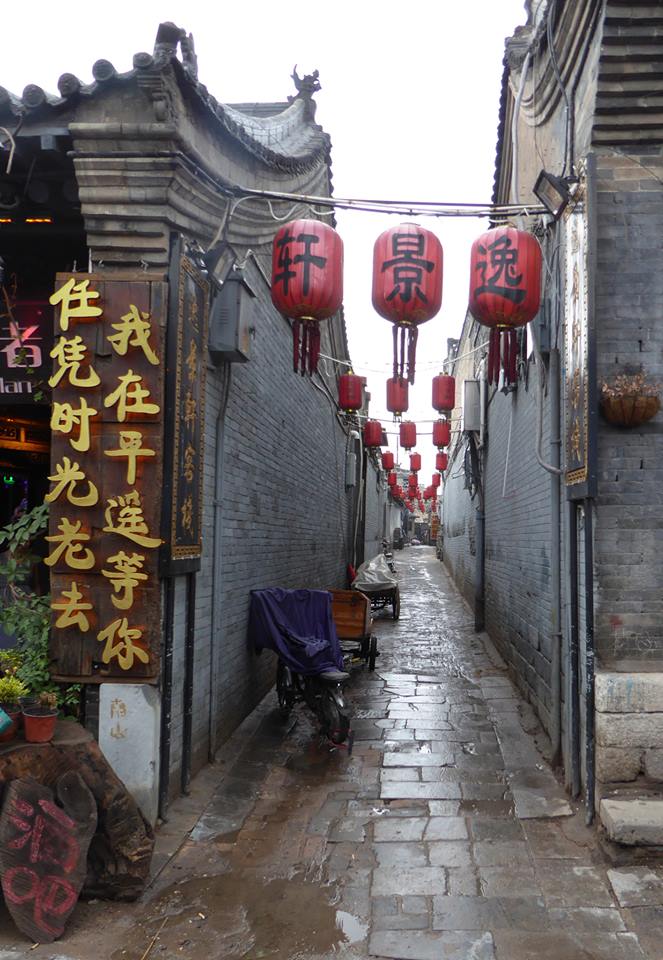
Scenes from Pingyao
One of my students had recommended taking a morning walk outside the city walls. So bright and early Megan, Marlene, and I worked our way through quiet streets to the West Gate. Passing through the wall, we encountered a lot of activity.
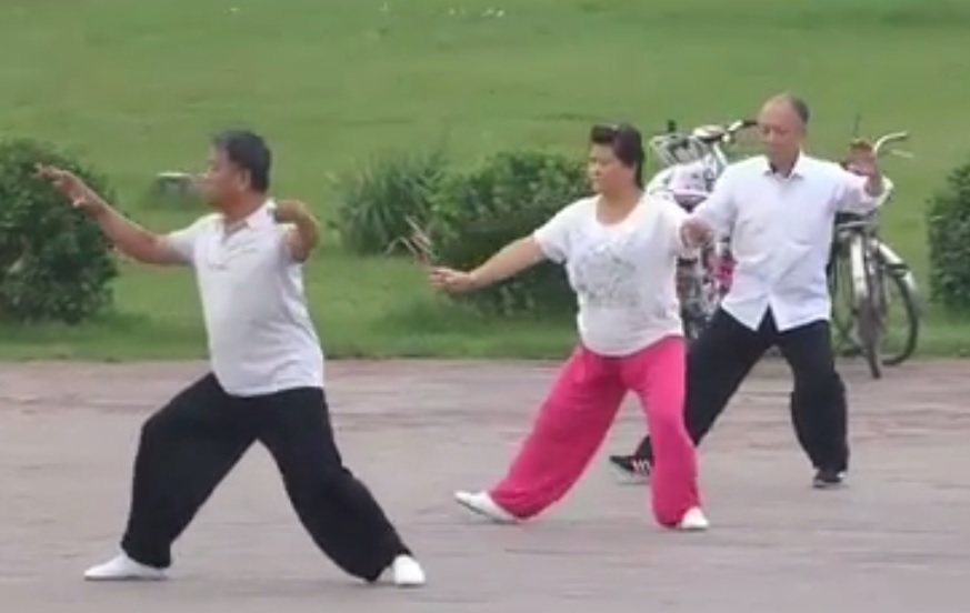
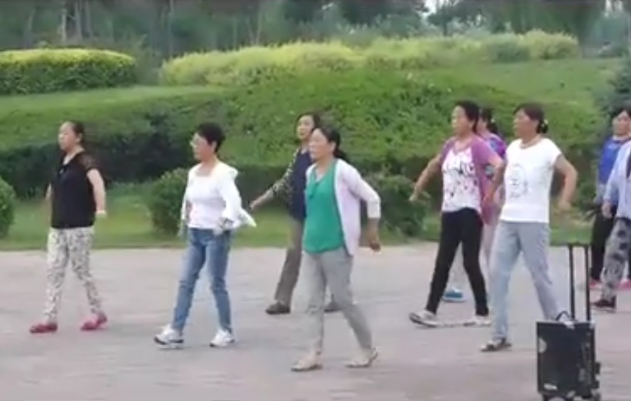
People were jogging, or walking, or just slowly strolling. As we headed counter-clockwise along the wall, there were more and more people. In the extended area outside the South Gate, individual activities had coalesced into various forms of exercise by about a dozen different groups. There was a tai-chi group, a marching group, others danced with swords or large red fans, some danced. It was fascinating.
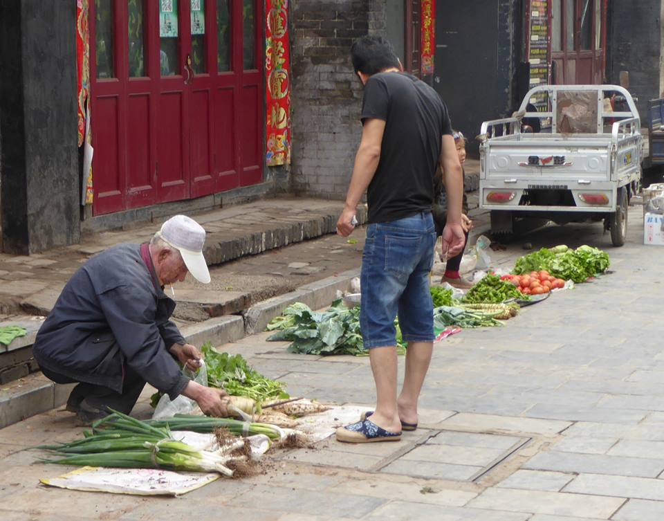
After watching for a while, we headed back into the walled city, where street vendors had begun to spread out their goods.
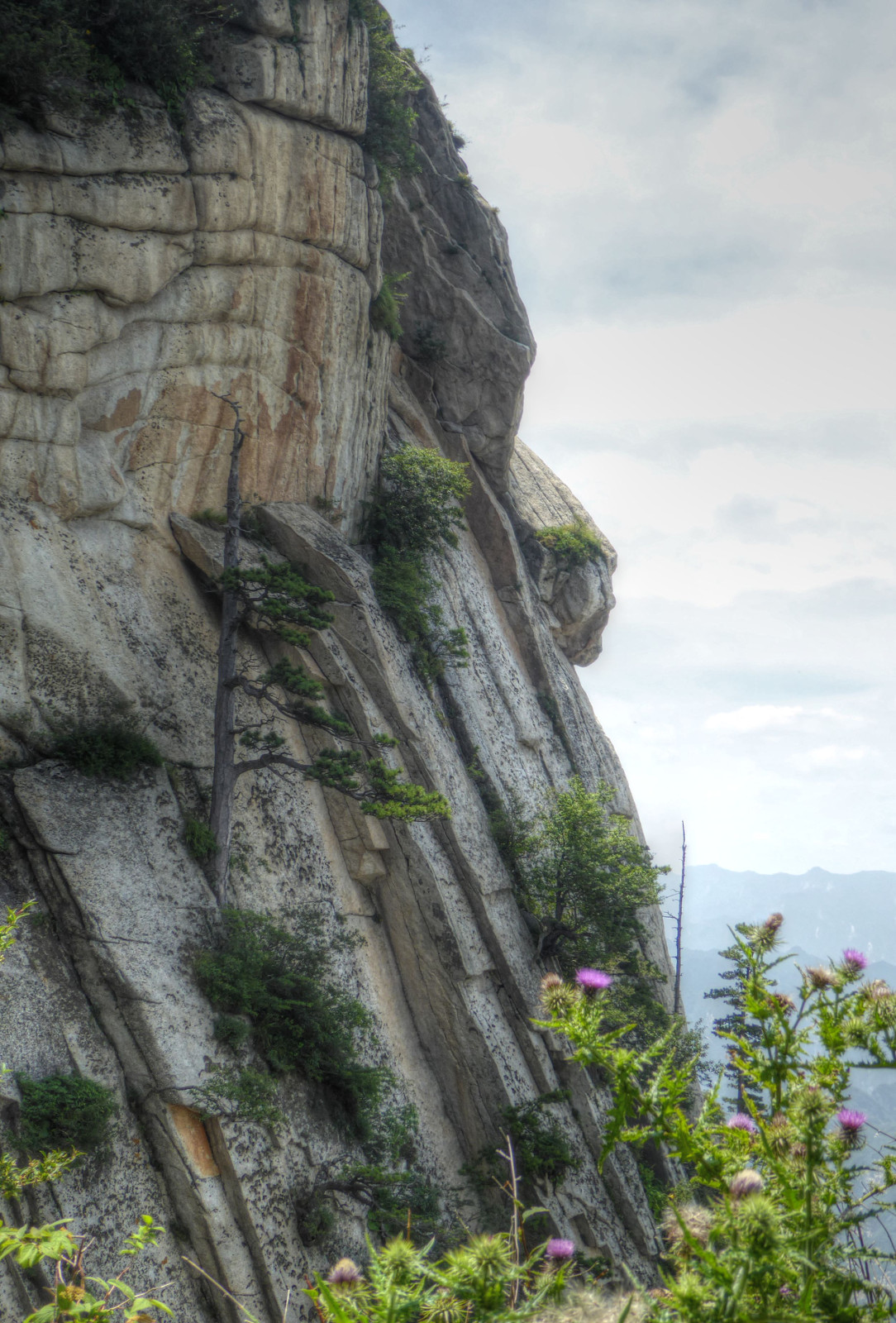
Huashan 华山
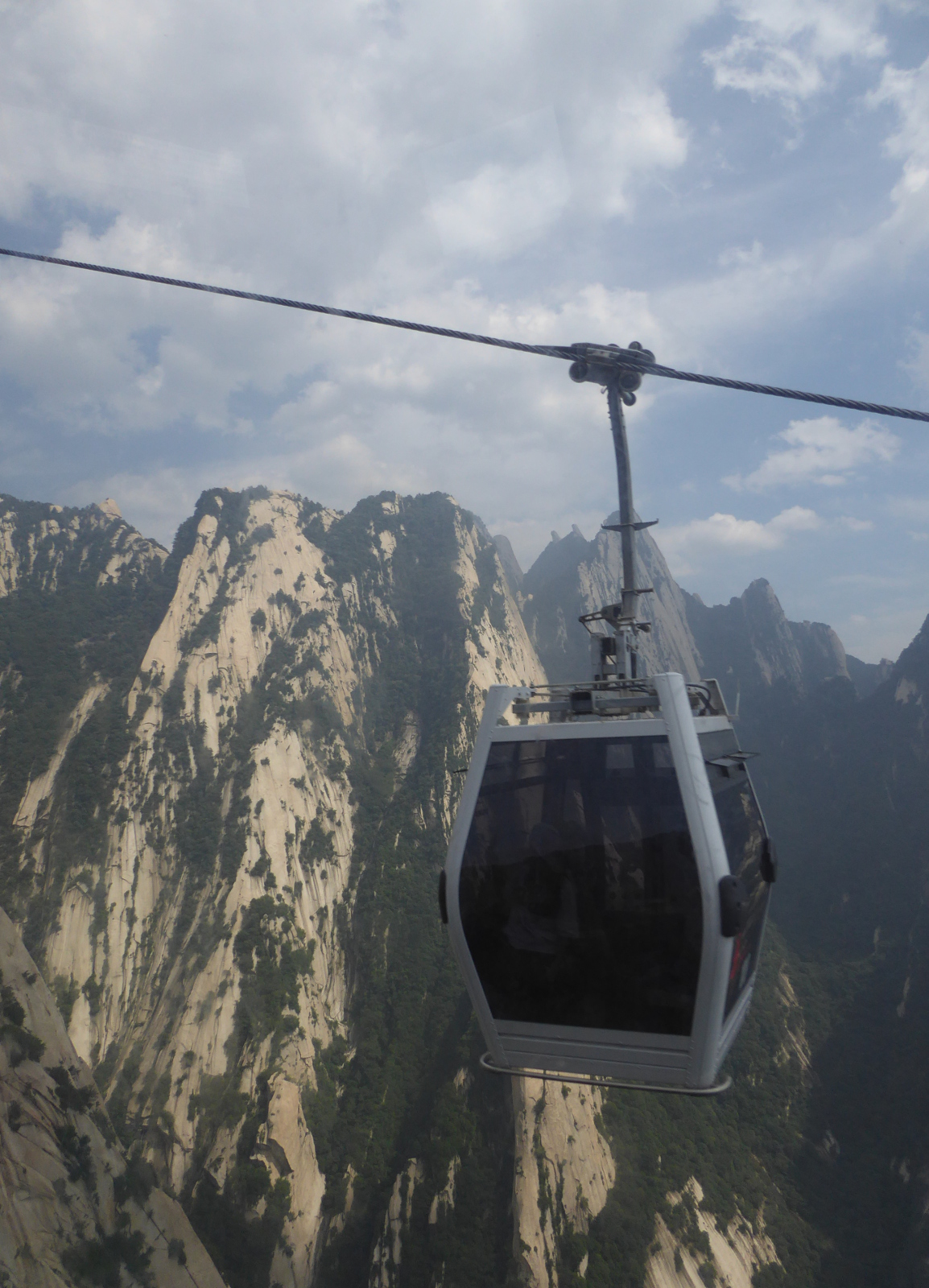
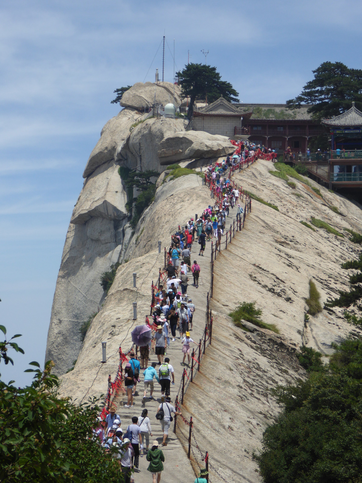
The following weekend, under Megan’s leadership, a group of about a dozen of us took the train to visit Huashan. This sacred peak is one of the “five great mountains” of China. Apart from its history as a religious retreat, it has gained a reputation among adventurers for a harrowing path along narrow hanging planks. Huashan can be enjoyed in many different ways. Some in our group were there for the daredevil trail. I was there to enjoy the mountain in a tame, peaceful way. We all began by a long, breathtaking ascent by cable car to the “West Peak”.
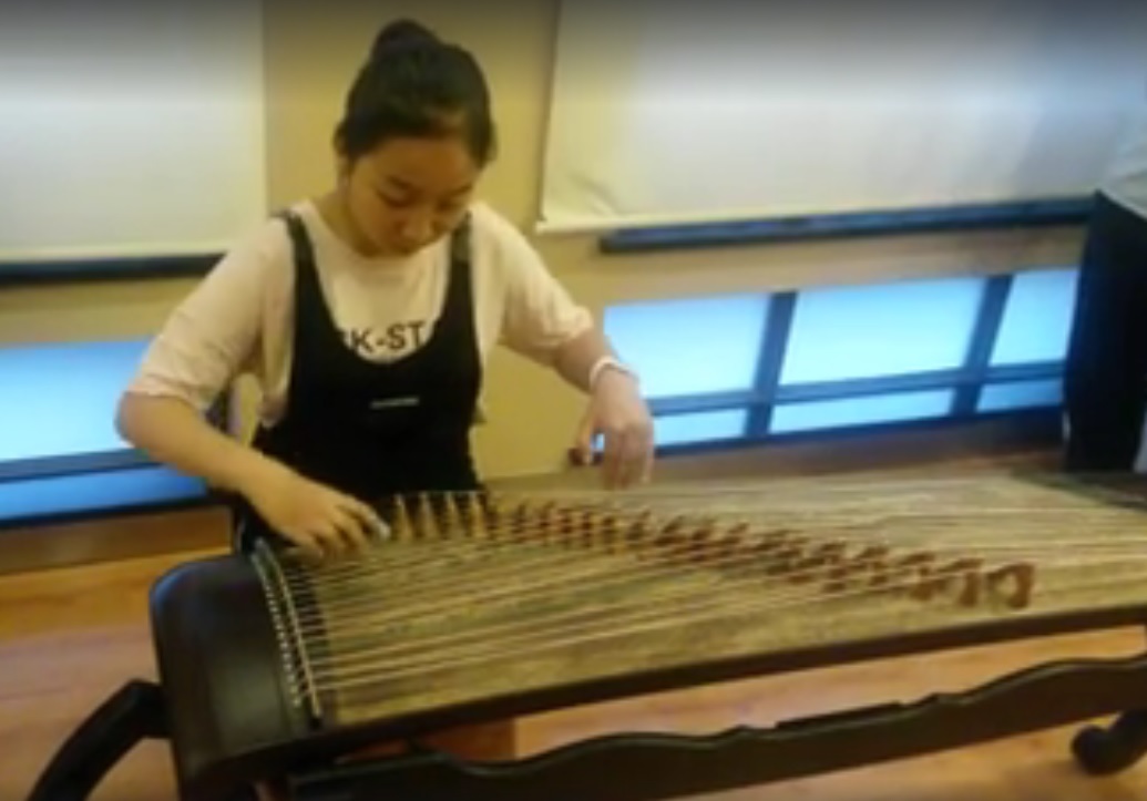
“Culture Night”
Before leaving Xi’an, we were treated to the 2016 edition of “culture night” at our hotel, with music, demonstrations of folk art, calligraphy, etc.
In the photo you can see a woman playing the Guzheng (古箏) a sort of Chinese harp that originated about 2,500 years ago!
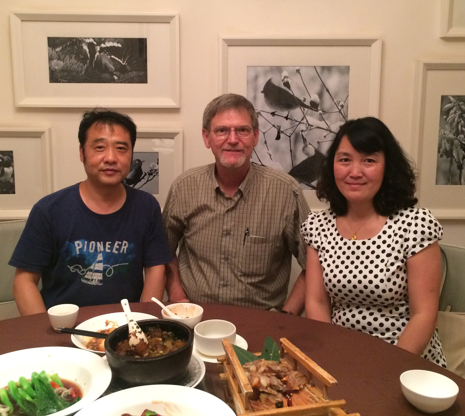
Farewell Xi’an
Before I left Xi’an, My friend Shirley (Xie Liqun) and her husband invited me to a nice restaurant for dinner. Wonderful food, wonderful conversation, and wonderful company.
To celebrate our 20th wedding anniversary, we decided on a nice, long train trip. For us, time on the train itself is always one of the most enjoyable aspects of a trip.
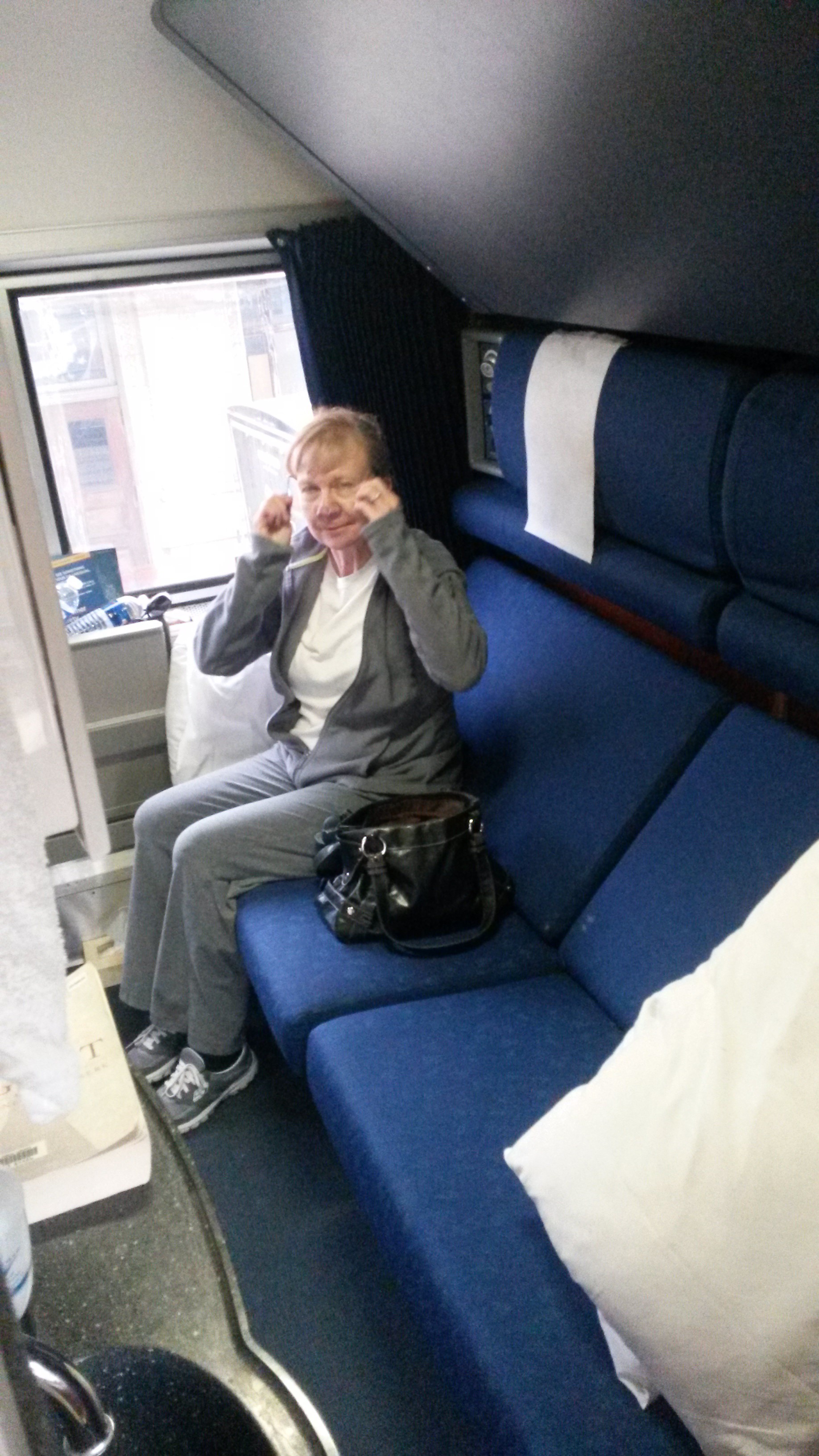
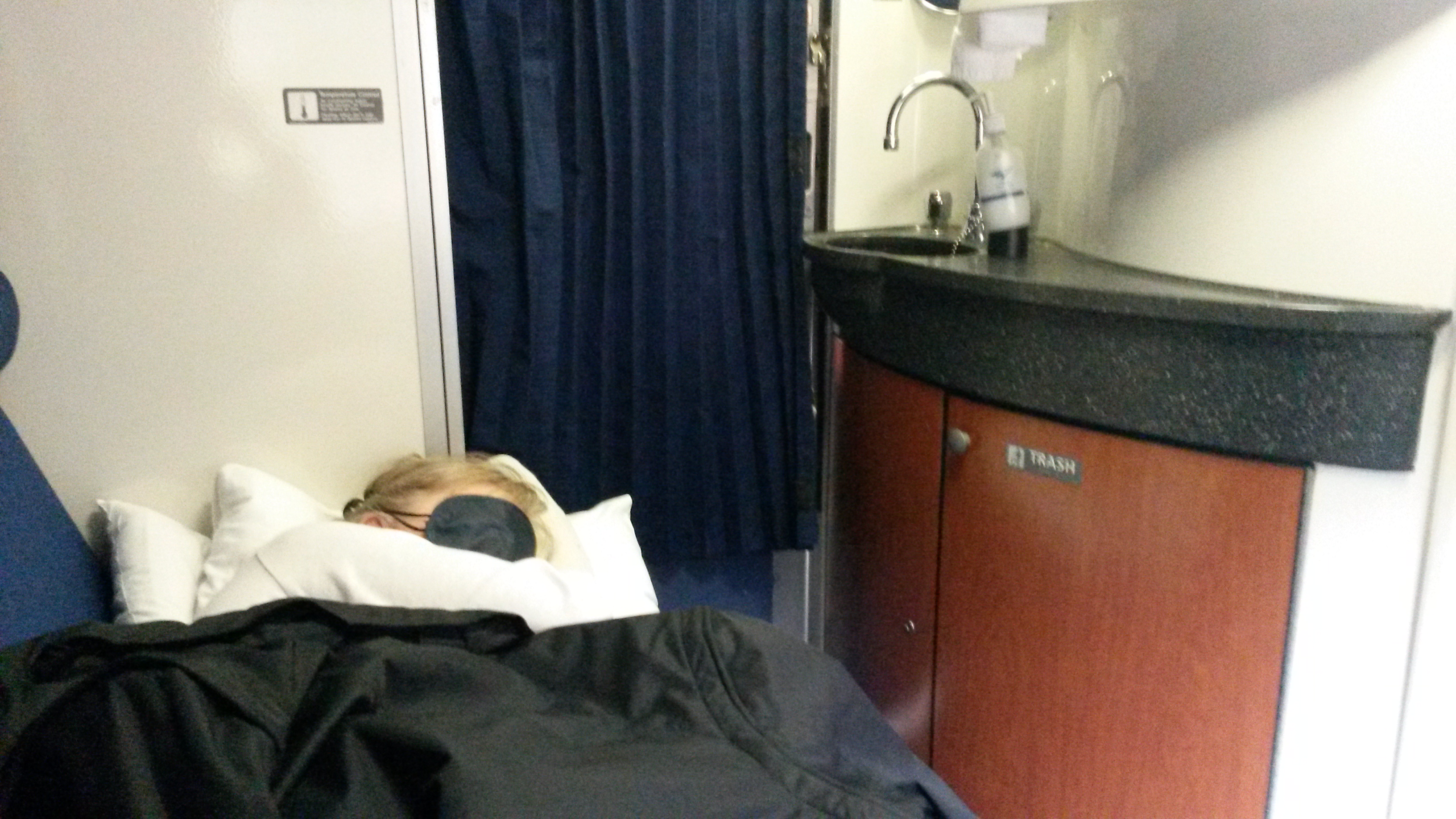
To spoil ourselves we arranged to have rooms (not the more spartan “roomettes”) on sleeper cars.
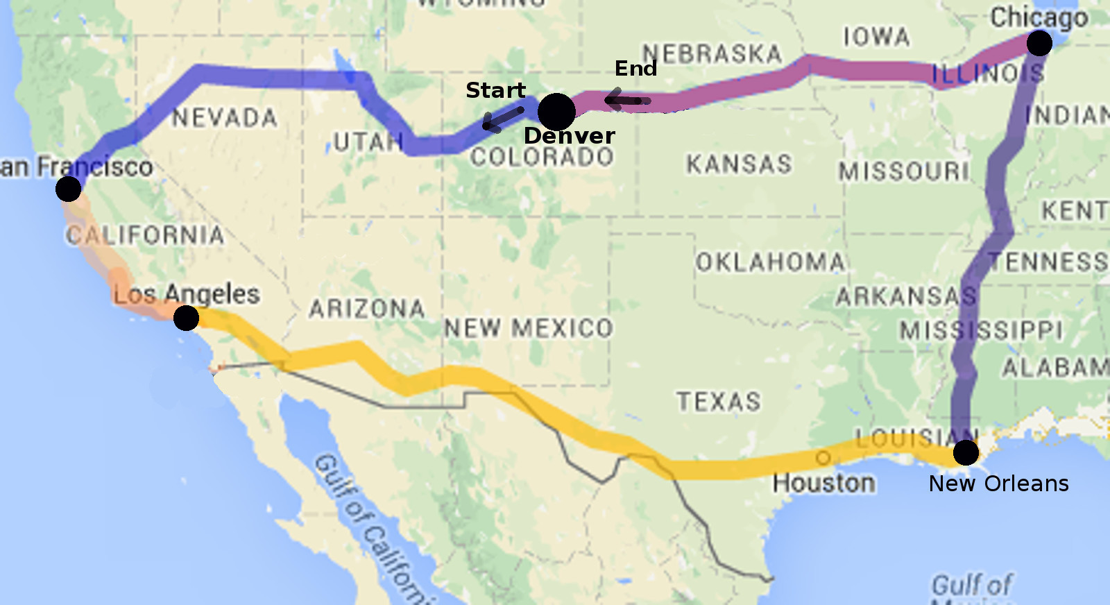
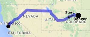
Our trip was a loop encompassing Western and Midwestern parts of the United States. This map shows the territory covered.
Denver to San Francisco
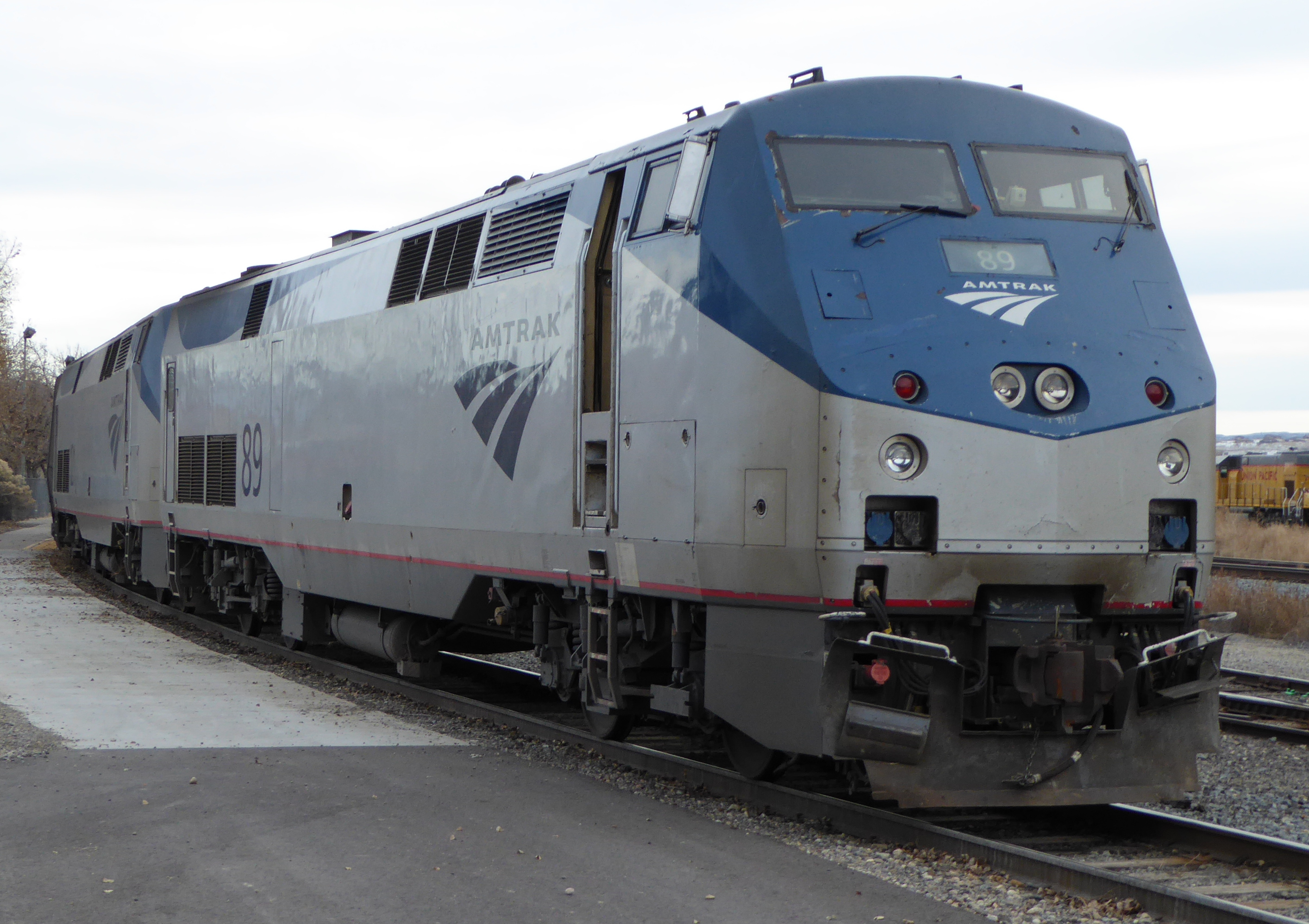
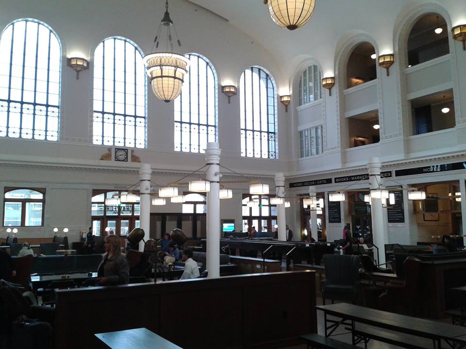
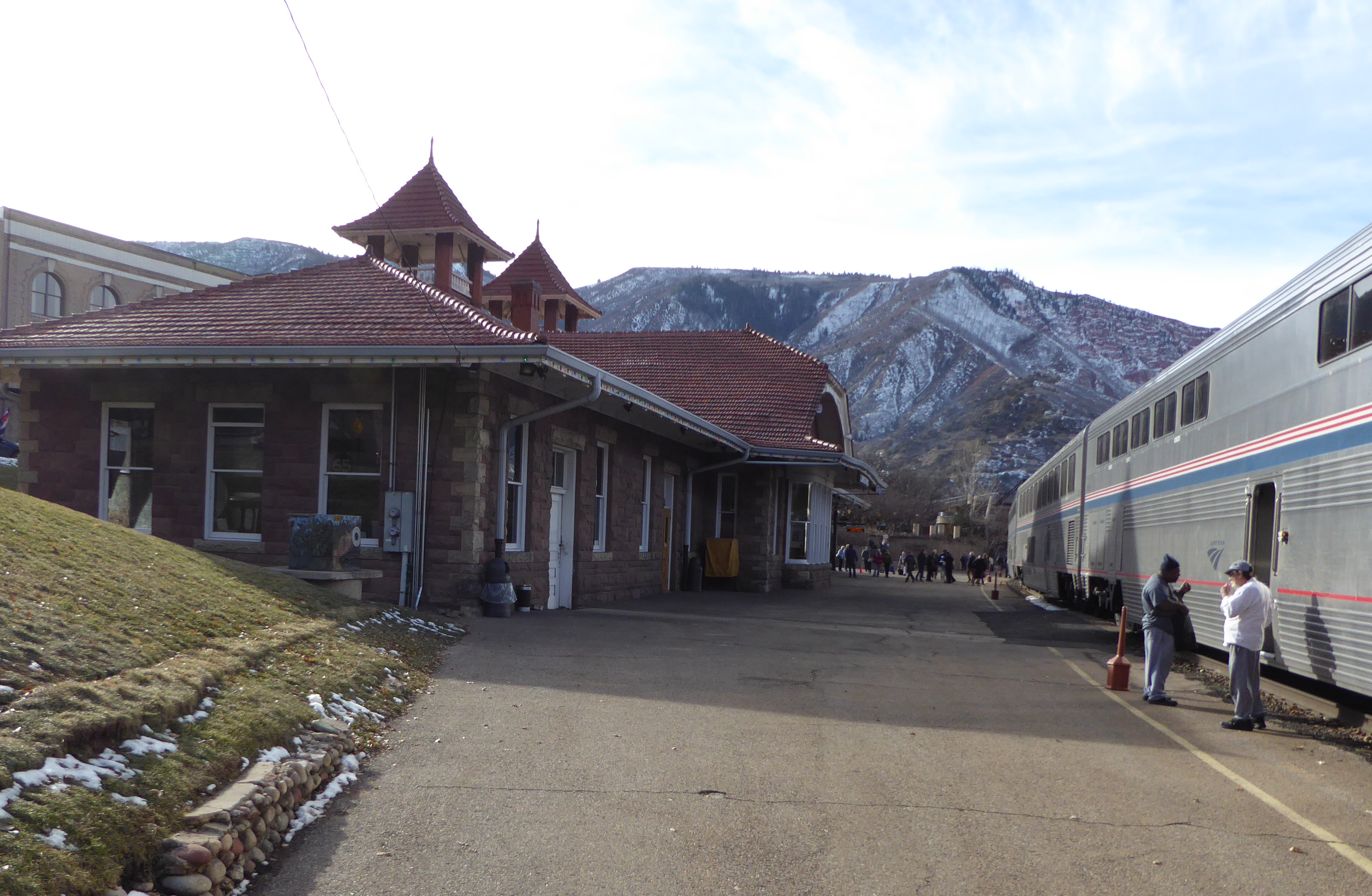
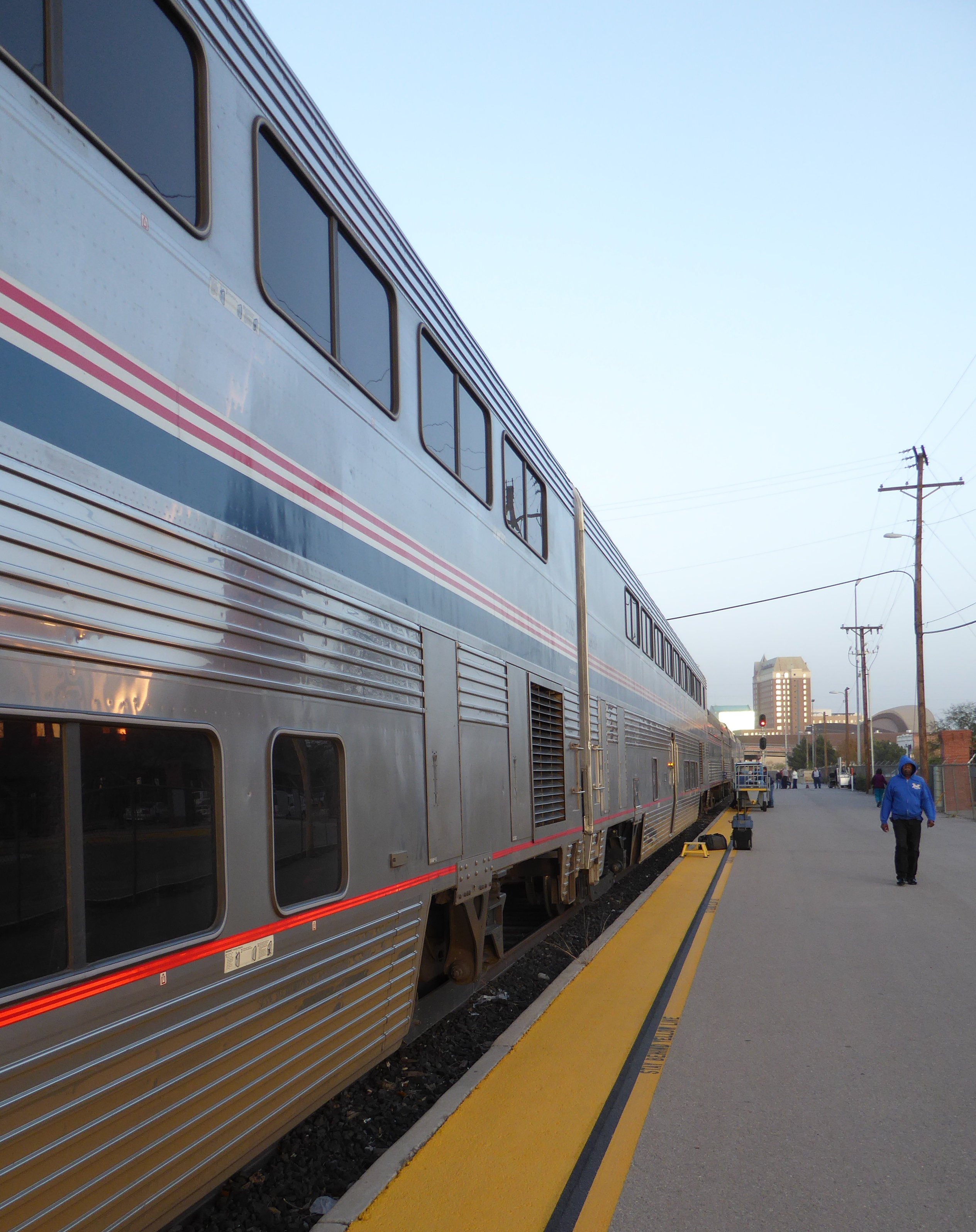
The morning of Wednesday, December 9th we headed to Denver’s remodeled Union Station to board the westbound “California Zephyr” train, midway in its journey from Chicago to Emeryville California.
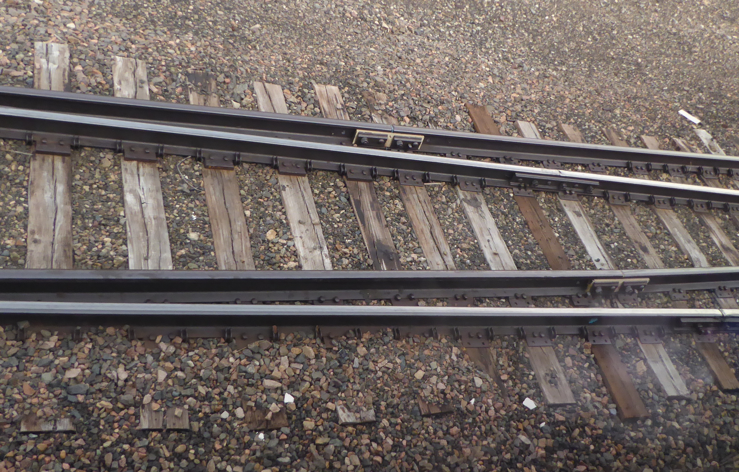
We have taken the Zephyr from Denver to California several times. In my opinion it is the most scenic of Amtraks remaining long distance routes.
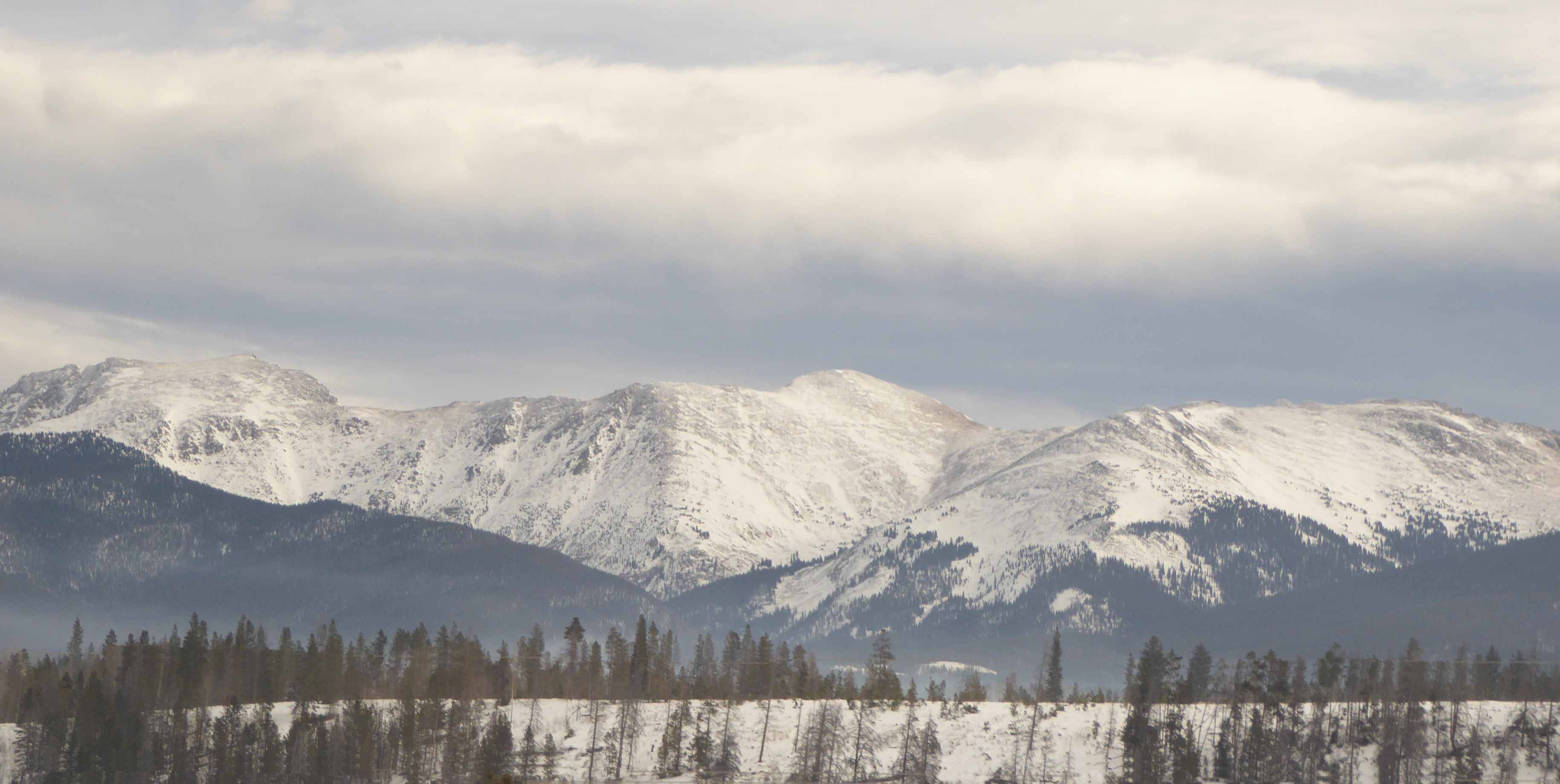
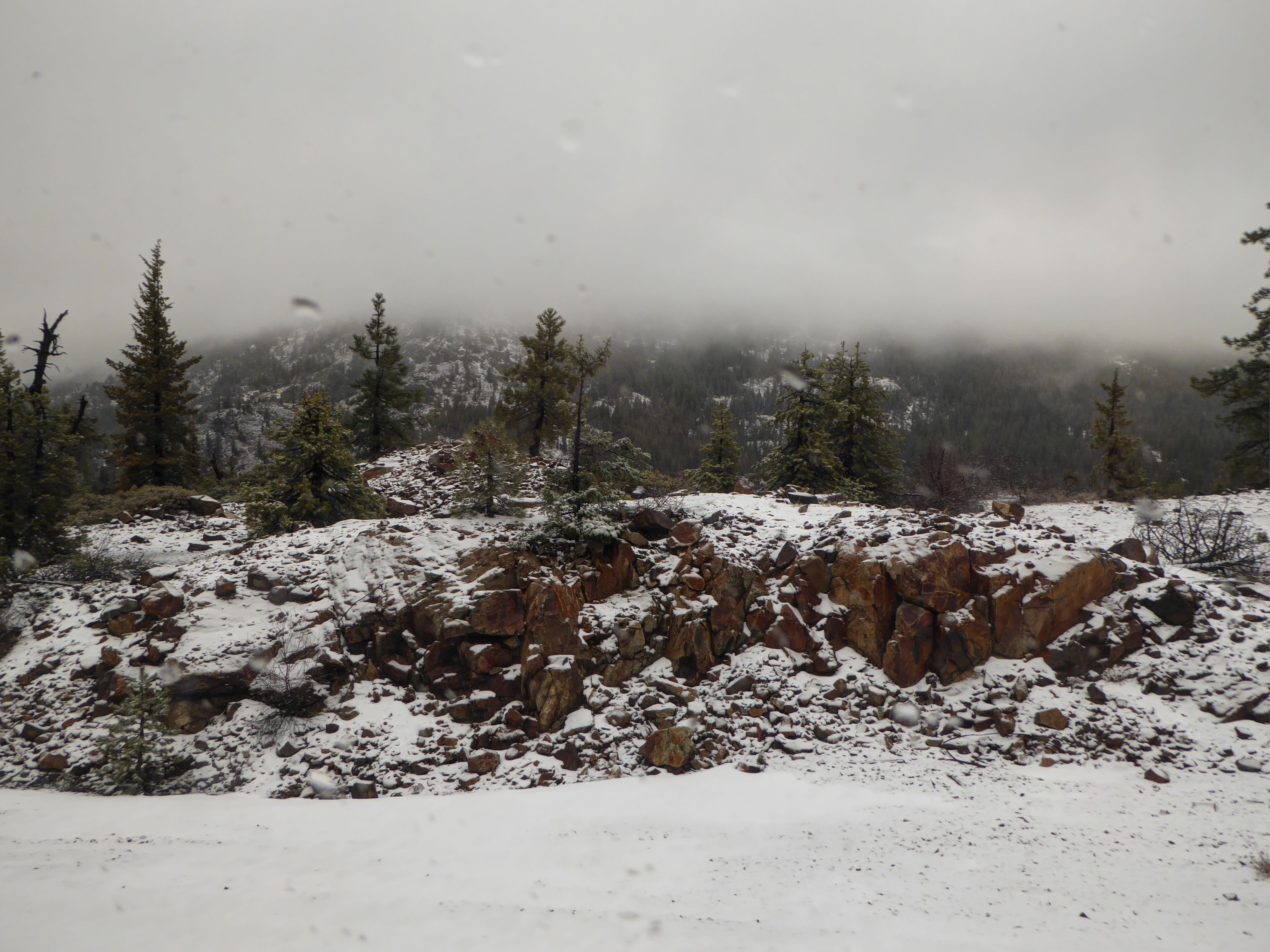
After leaving Denver, it slowly works its way up the foothills, passing within sight of Eldorado Canyon, where we took Kaden hiking a few months ago. We began to see snow as we approached the 10 km (6.2 miles) Moffat tunnel which runs under the Continental Divide. Once we passed through the west end of the tunnel, nearing Winter Park, more snow was present.
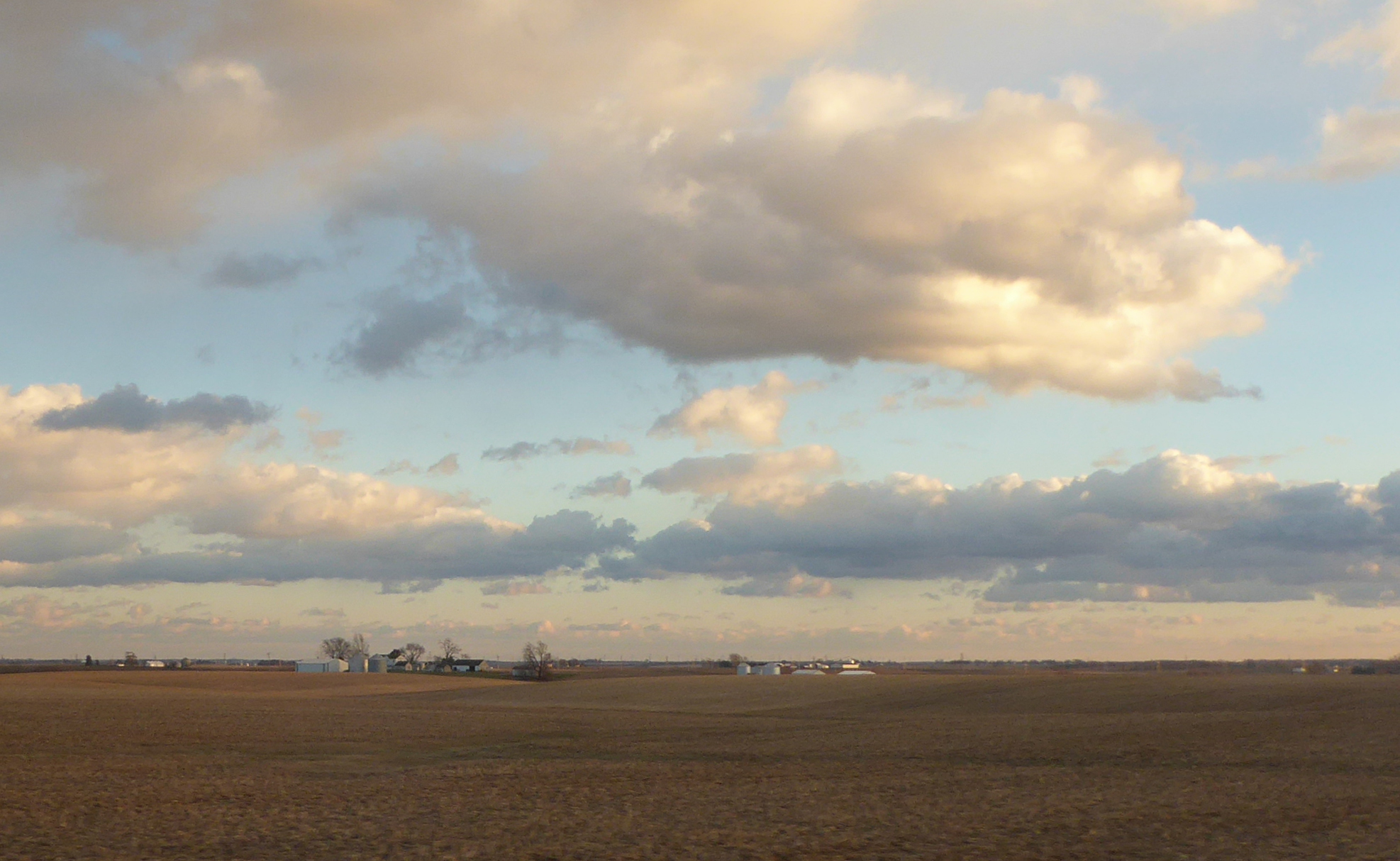
After the town of Granby, the train begins to curve along, following the Colorado River.
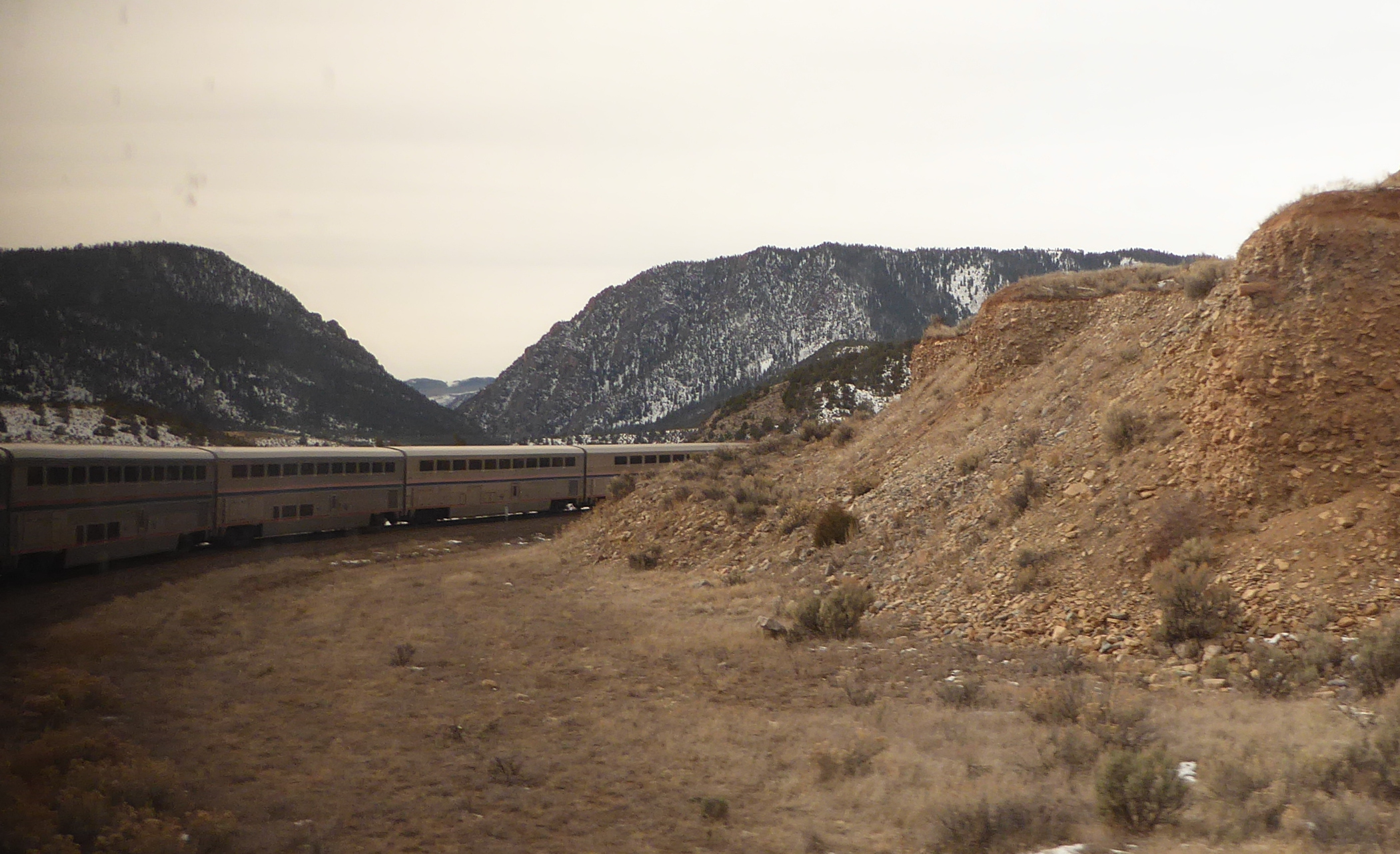
The rail line passes through a number of lovely canyons.
(A note to my friends in Spain and China- This is the same river that flows through the incredible “Grand Canyon”. But that natural wonder almost 1,000 km downstream, in the state of Arizona.)
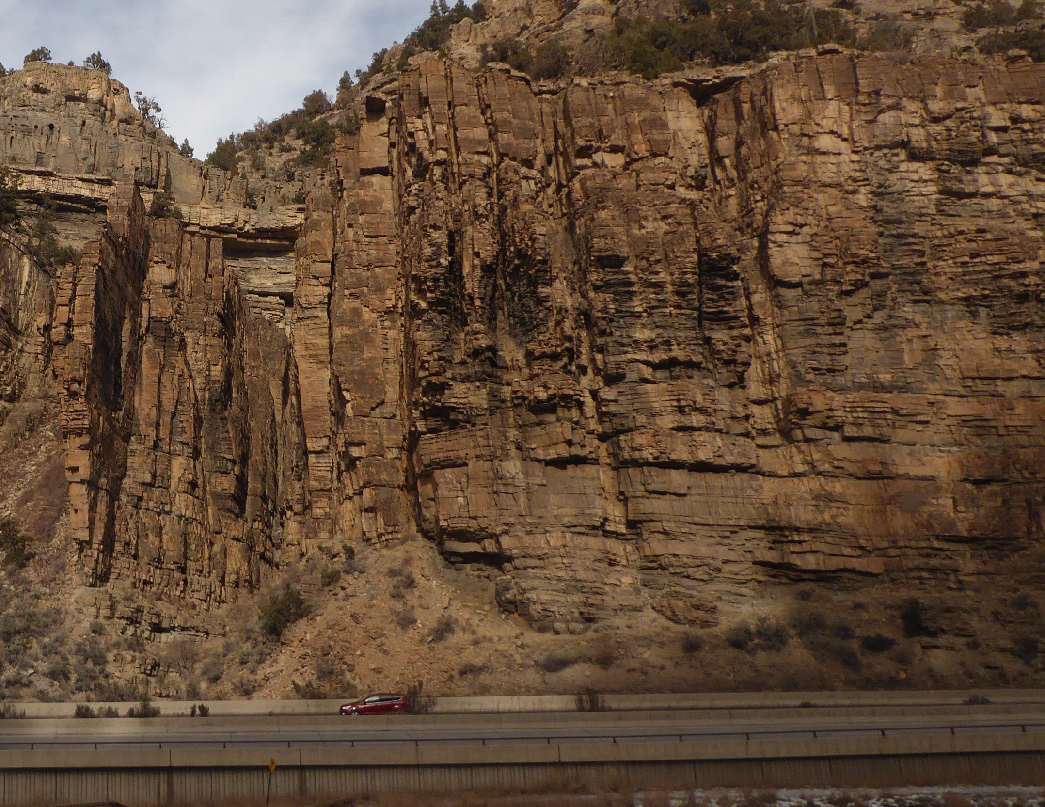
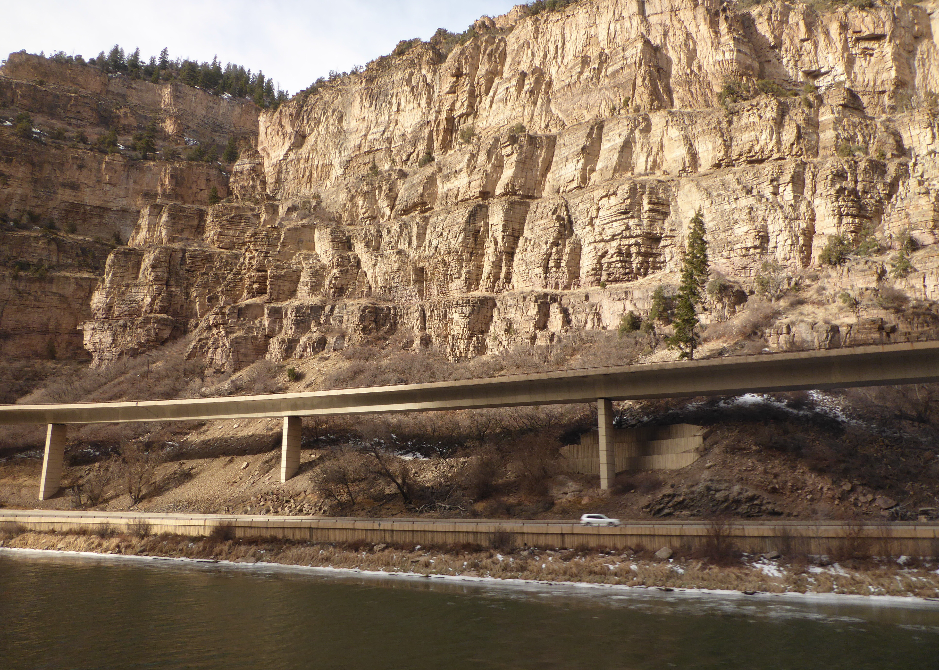
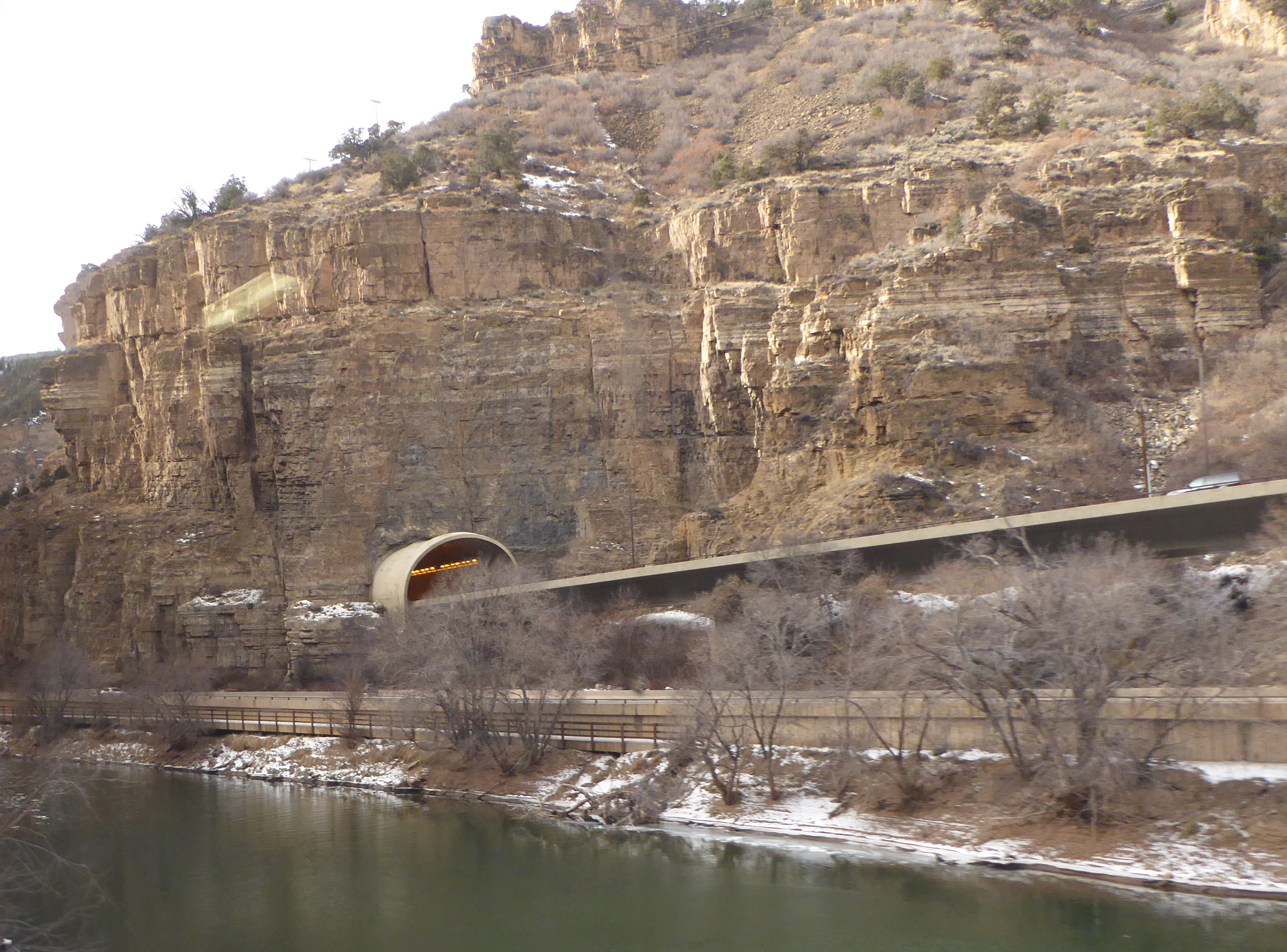
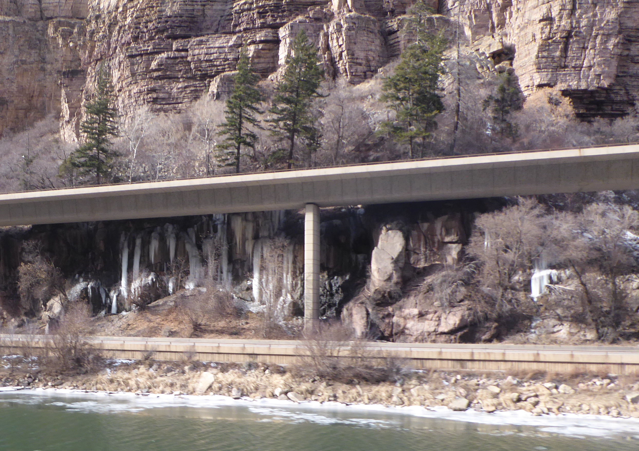
One of the most picturesque rail stretches in Colorado is where the Zephyr passes through Glenwood Canyon. As it hugs the canyon wall, it provides a nice view of a section of Interstate 70 known as the “crown jewel of the Interstate system”. (I gave a talk about this project to a group of engineering students at Xi’an Jiaotong University in July. A 2004 article that outlines the importance of the project was pubished in “Public Roads” and can be viewed online by following this link: Glenwood Canyon Highway
After passing through Glenwood Canyon we reached the station at Glenwood Springs, home of the famous themal pool.
Evening followed afternoon, and it was close to dark by the time we went through Ruby Canyon near the Colorado-Utah border. The rock formations there were fascinating. One day we will have to go back and explore that area more.
The train passes through Salt Lake City in the night, and Winnemucca, Nevada before dawn. The latter town was important for its role during the construction of the intercontinental railway. Chinese immigrants who had worked on that project had their own section of town, and were visited by Dr. Sun Yat-Sen in 1911 as he toured the United States raising support for the overthrow of the Chinese imperial system.
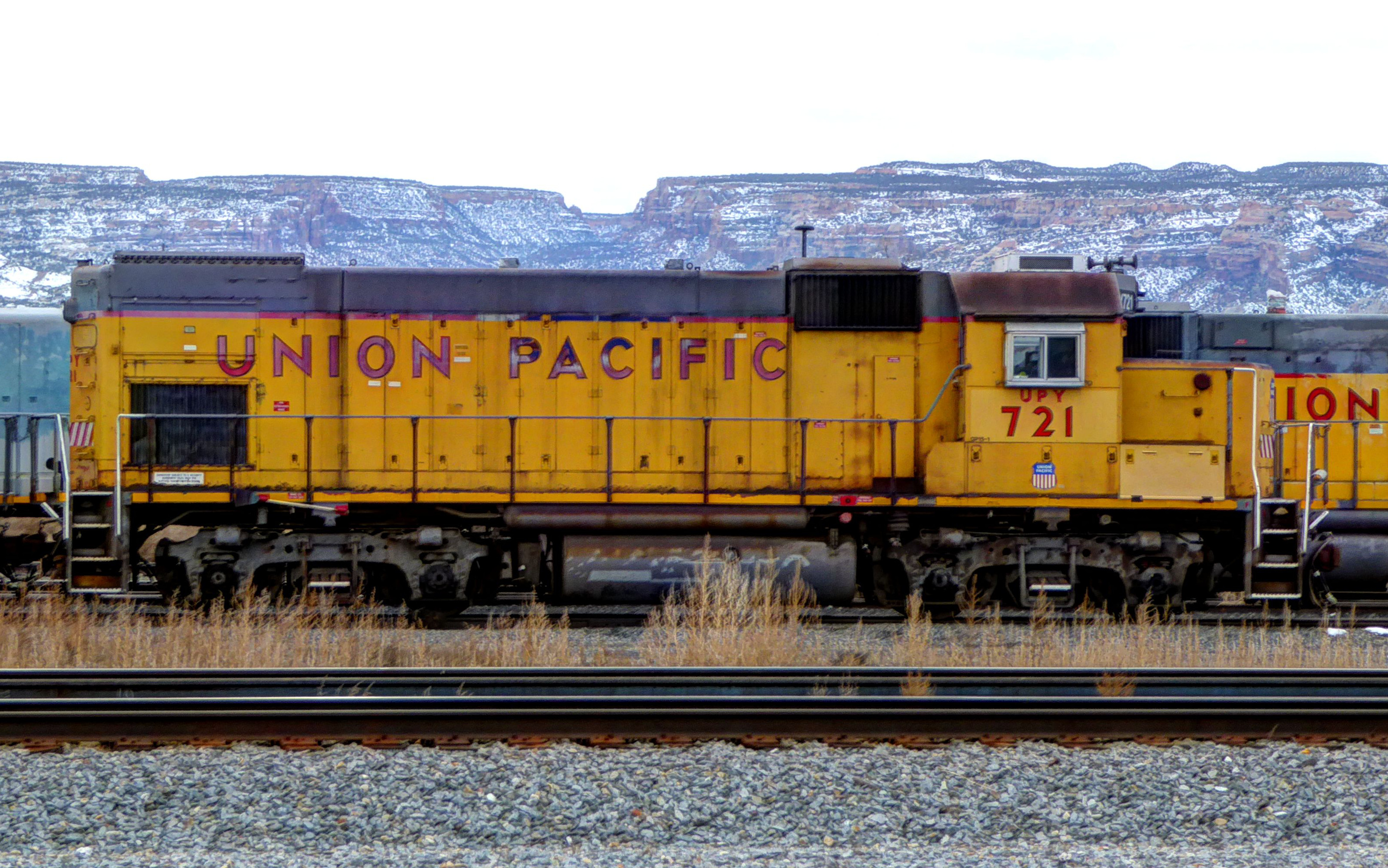
UP locomotives resting nearby
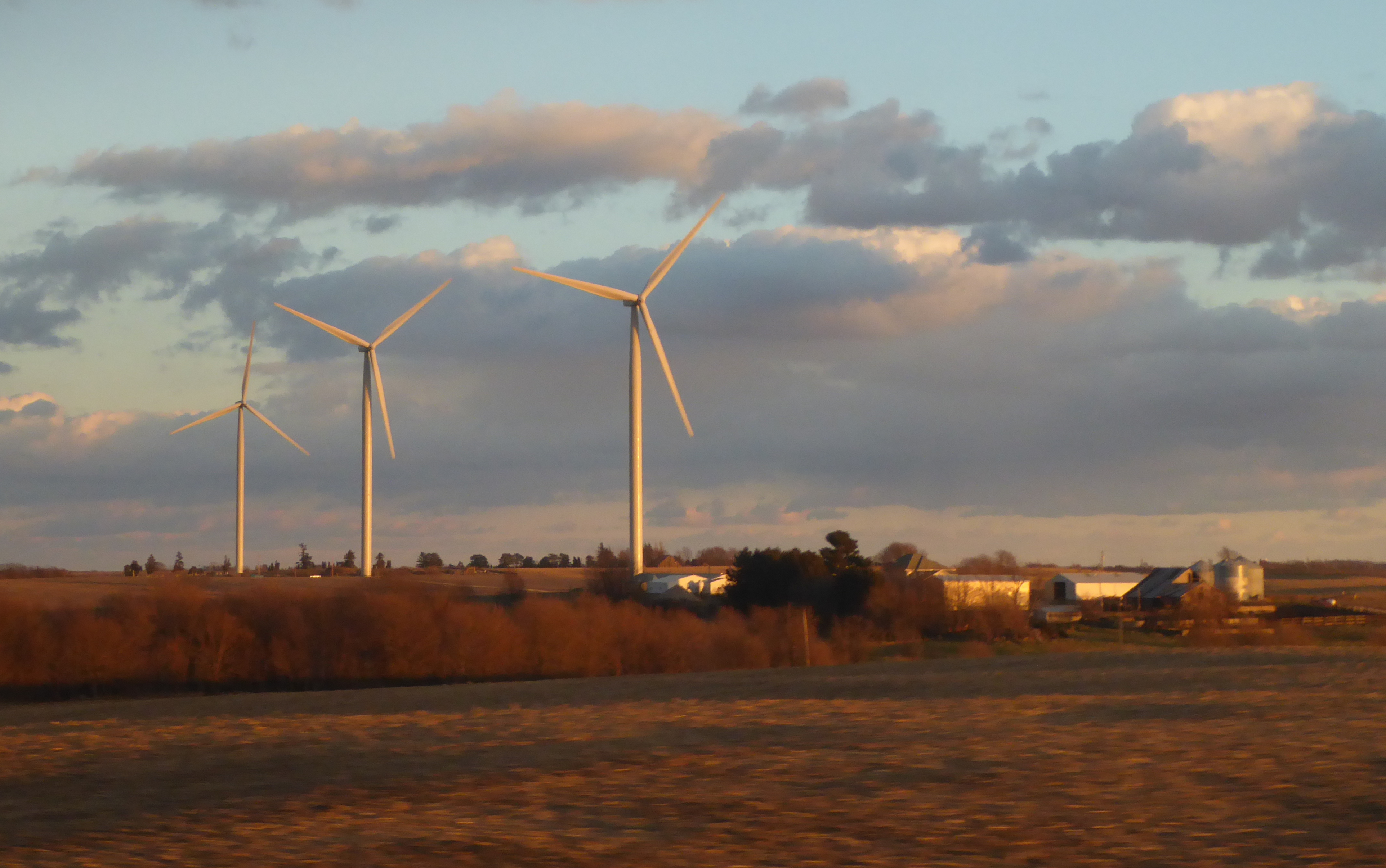
The train was passing though mile after mile of Nevada’s barren desolation when we awoke and headed to the dining car for breakfast.
Arrival at the station in the gambling city of Reno is an indicator that soon we will leave Nevada behind and enter California. Here volunteers from the railroad museum in Sacramento board the train and provide historical narration in the sightseeing car attached next to the dining car.
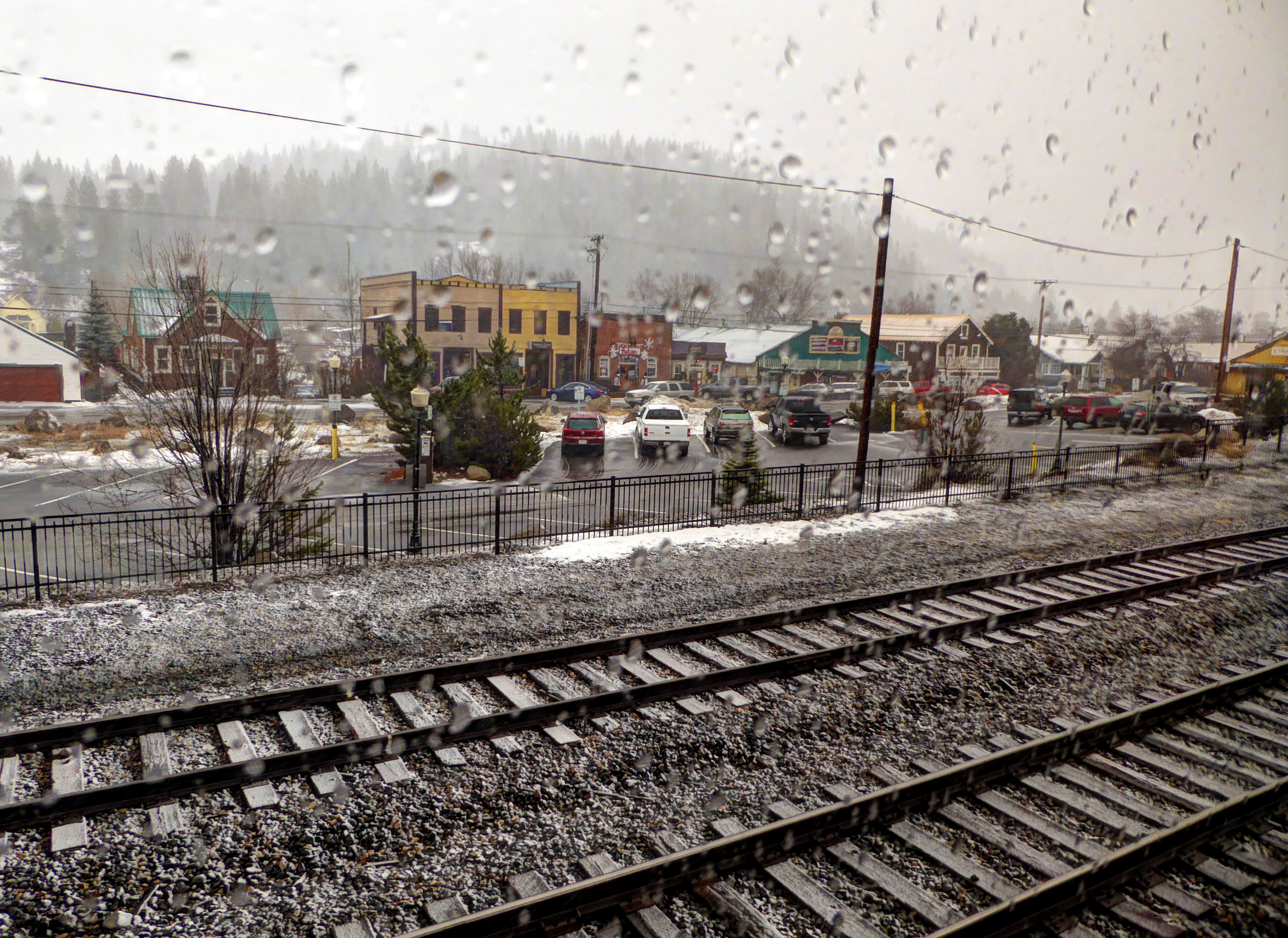
The train begins to follow the Truckee River upstream and we enter the forests of the Sierra Nevada Mountains. It is raining as we pass through the little town of Truckee. The old sawmill kiln that was always a landmark for me is now nothing more than a collapsed relic covered with graffiti.
We begin the climb up to Donner Pass. This is rugged country. Before the railroad, settlers had to laboriously travel by horse and wagon to reach the eastern side of the mountains. In places they even had to disassemble wagons and lower them piece by piece down steep ravines.
In the winter of 1846-7 the “Donner Party” of 81 emigrants were stopped by bad weather and camped on the east side of the mountains, waiting for springtime. Of the group only 45 survived, some resorting to cannibalism.
Having crossed Donner Pass the train begins its descent toward Sacramento passing through heavily forested hills above the American River.
San Francisco
Sacramento, Davis, Martinez, and then Richmond pass by. Finally we reach Emeryville, the end of the line. We boarded an uncomfortable and overcrowded bus provided by Amtrak. There was no place for luggage, and everyone squeezed on with suitcases on seats or in laps. The bus took us through heavy traffic across the bay into San Francisco where it dropped us off at Fisherman’s Wharf. We walked to our hotel which quite appropriately was called “The Zephyr”.
It was dark by the time we stowed our bags, and there was a light drizzle. We meandered to Pier 39. Ignoring all the shops selling cheap and expensive trinkets, we sat down and ate fish and chips. Seagulls kept sneaking through the door and we had to chase them off our table.
For dessert we went to a Johnny Rocket restaurant that, unlike the one in Denver, was configured like a classic diner. A milkshake for Rhonda and chocolate malt for me!
It began to rain harder, and we ducked into a store to buy cheap umbrellas. Like a couple of crazy youngsters we dodged raindrops and made our way to the corner of Taylor and Bay streets where we hopped on a cable car.
This form of transportation has become one of the classic symbols of San Francisco and its steep hills. The concept is a bit crazy. A humming series of steel cables are constantly in motion under the street. The driver of the cable car works a series of great levers with which the hidden cable can be grabbed or released to control the car’s movement. Clutching the cables, the vehicle lumbers up and down steep inclines. Read more details about this at: How Cable Cars Work.
It was a wild and wet ride in what had become heavy rain. When we reached the end of the line at Market and Powell, we huddled under an awning until the car was ready for the return trip toward our hotel. Loads of fun!
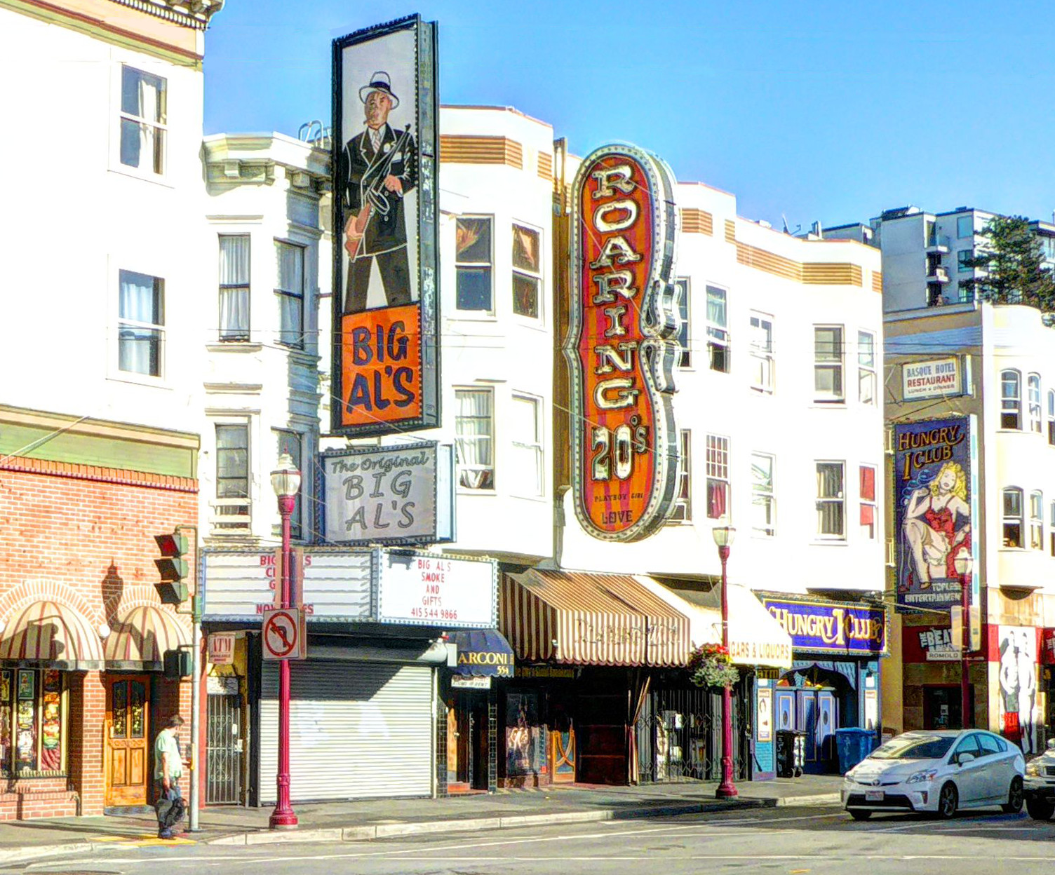
San Francisco landmark on the other side of the street: Once a topless club, Big Al’s is now a cigar shop.
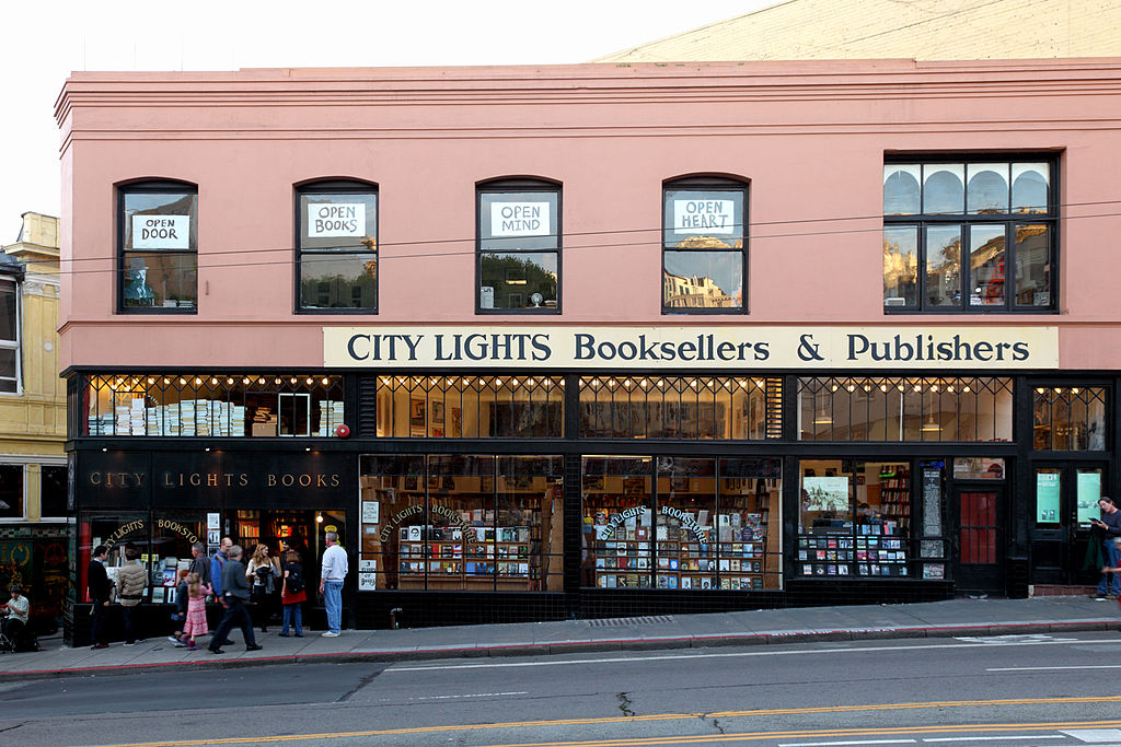
The next morning we ate a delicious, extremely overpriced breakfast at an iHop near the hotel, and then made our way on foot toward the corner of Columbus Avenue and Broadway on a pilgrimage to City Lights Bookstore.
(Photo from Wikipedia)
Across the street from the faded and derelict remains of the seedy side of San Francisco, City Lights is a beacon of literature and free thought. The store was founded in 1953 by the poet Lawrence Ferlinghetti and its fame includes ties to “Beat” poets and authors including (besides Ferlinghetti himself) Alan Ginsburg and Jack Kerouac.
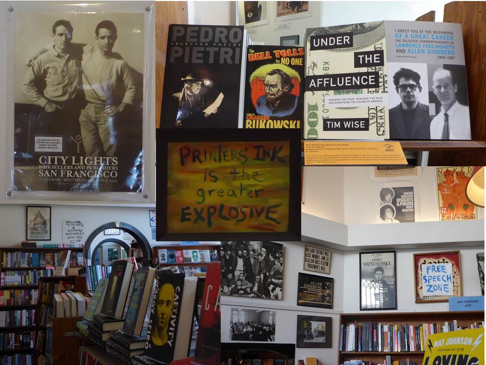
Inside City Lights Bookstore
We spent a few hours browsing the stacks considering the depth of thought represented by the volumes available there. In the end we realized that we couldn’t carry it all back home with us. So I bought a copy of Patti Smith’s “Just Kids”, and we moved on.
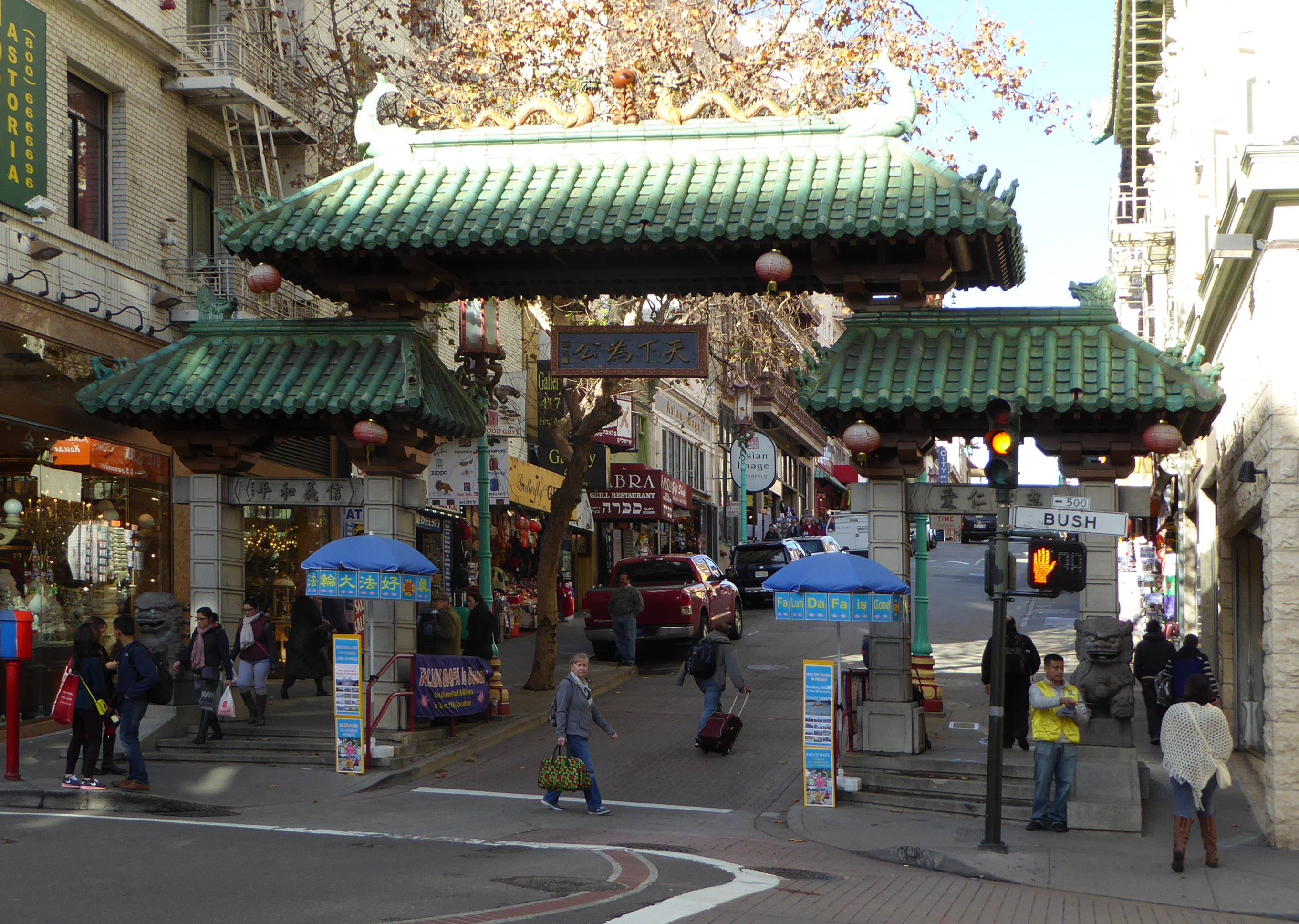
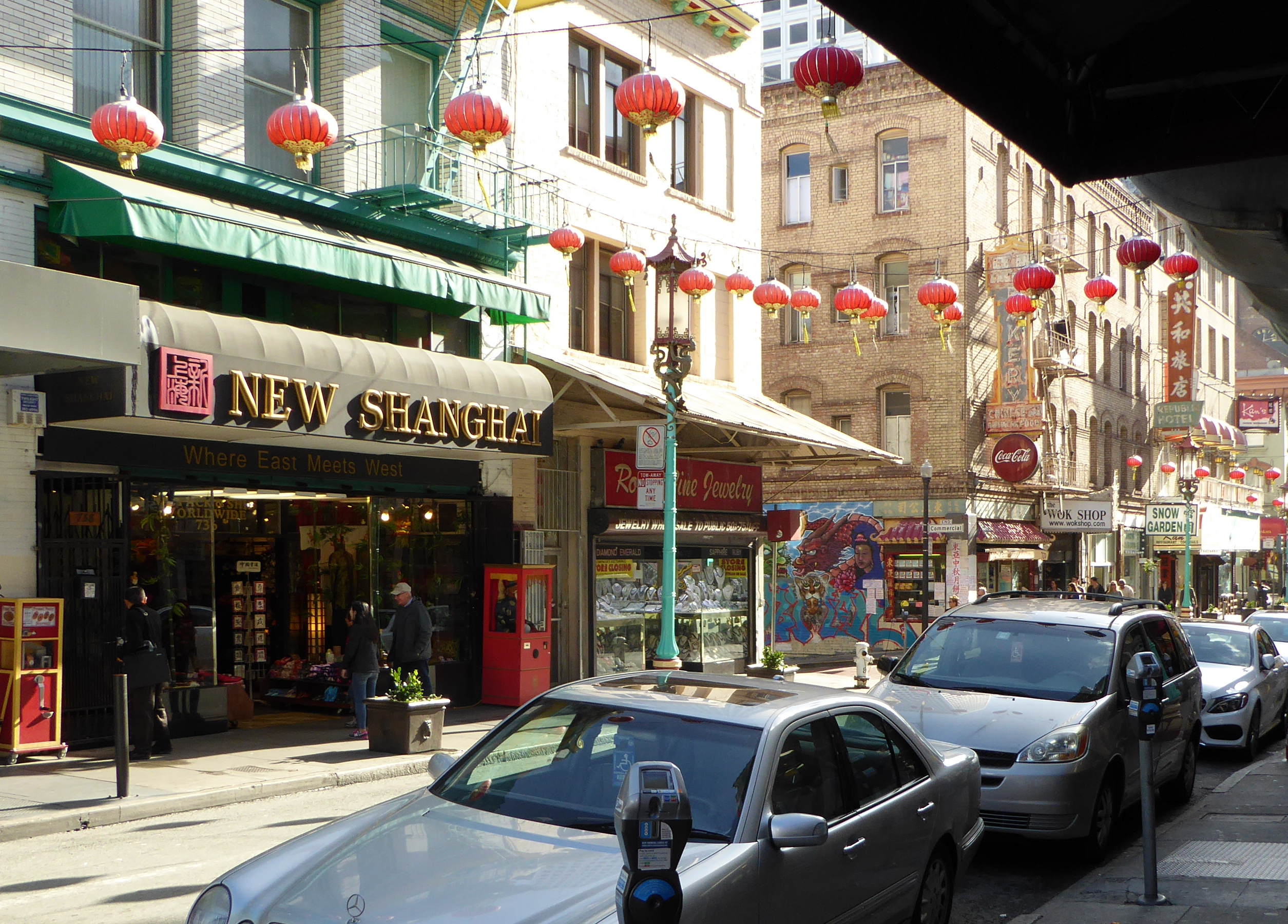
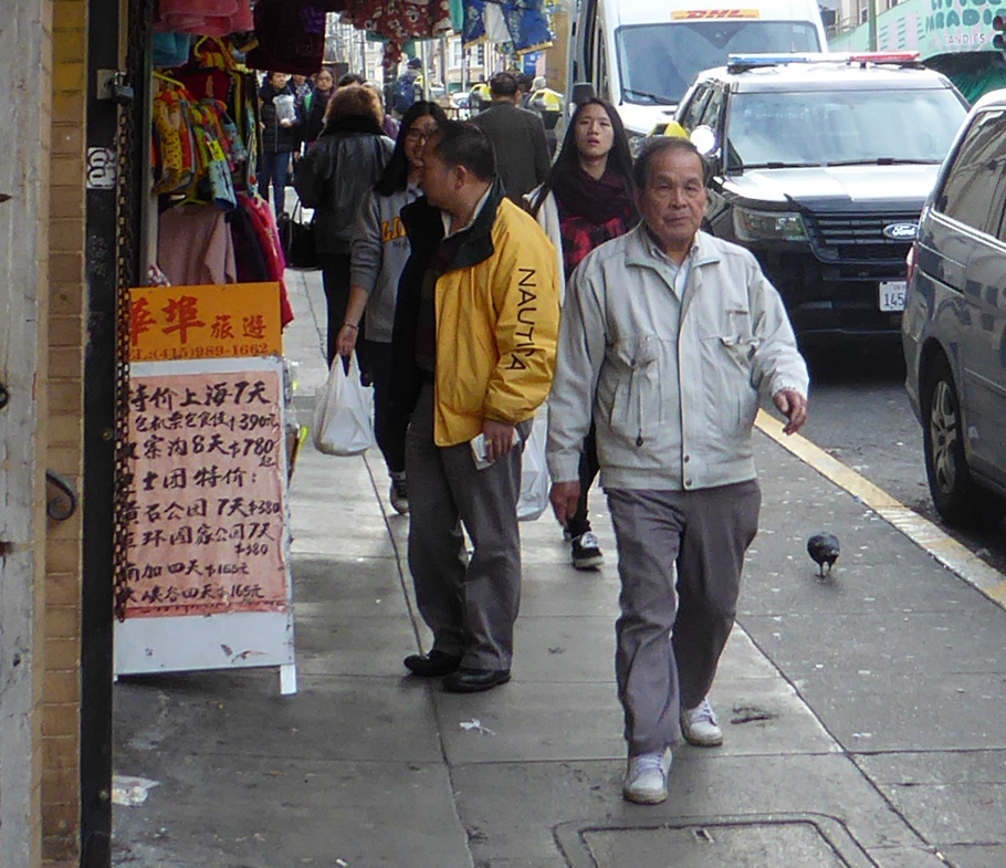
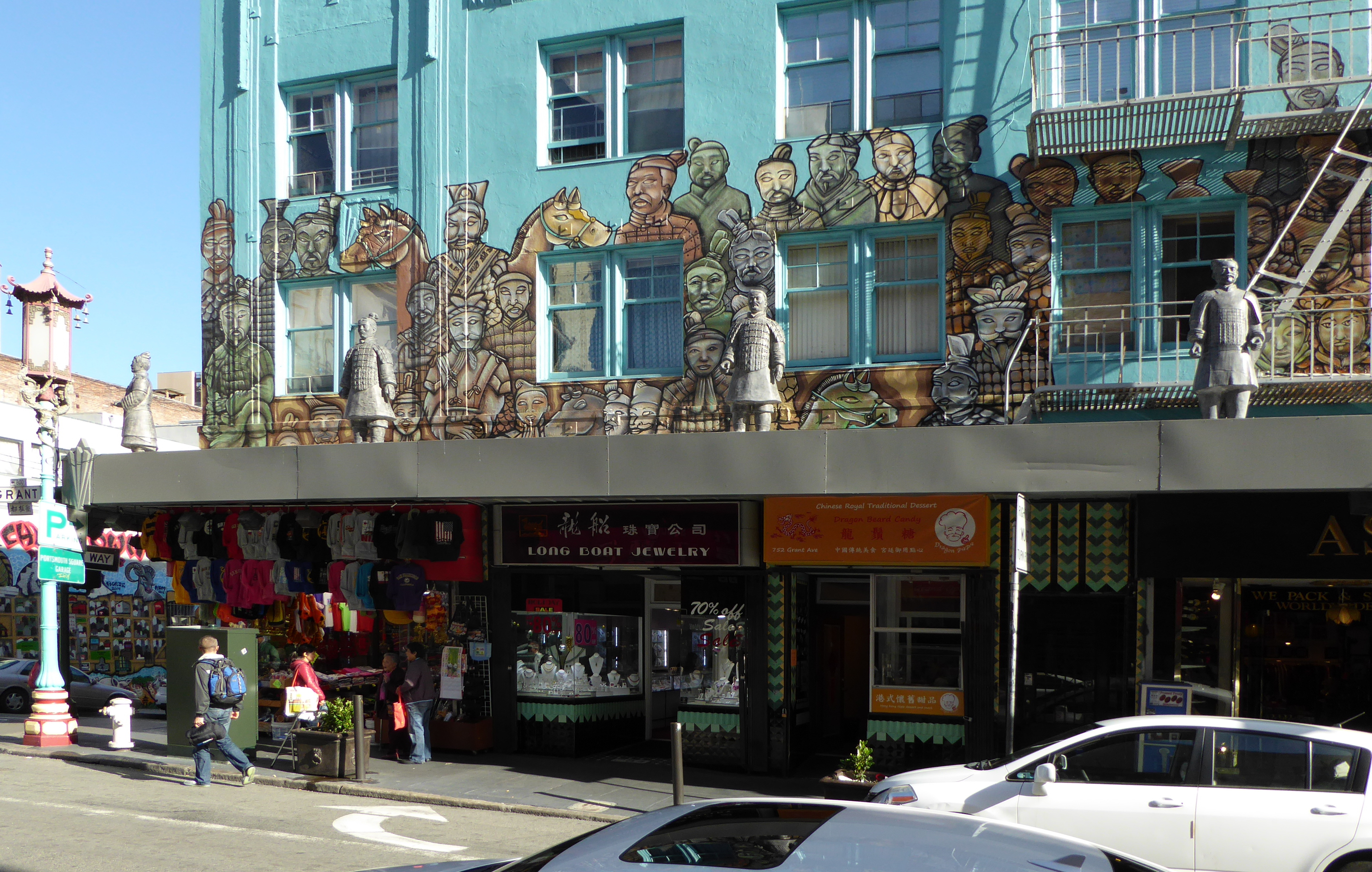
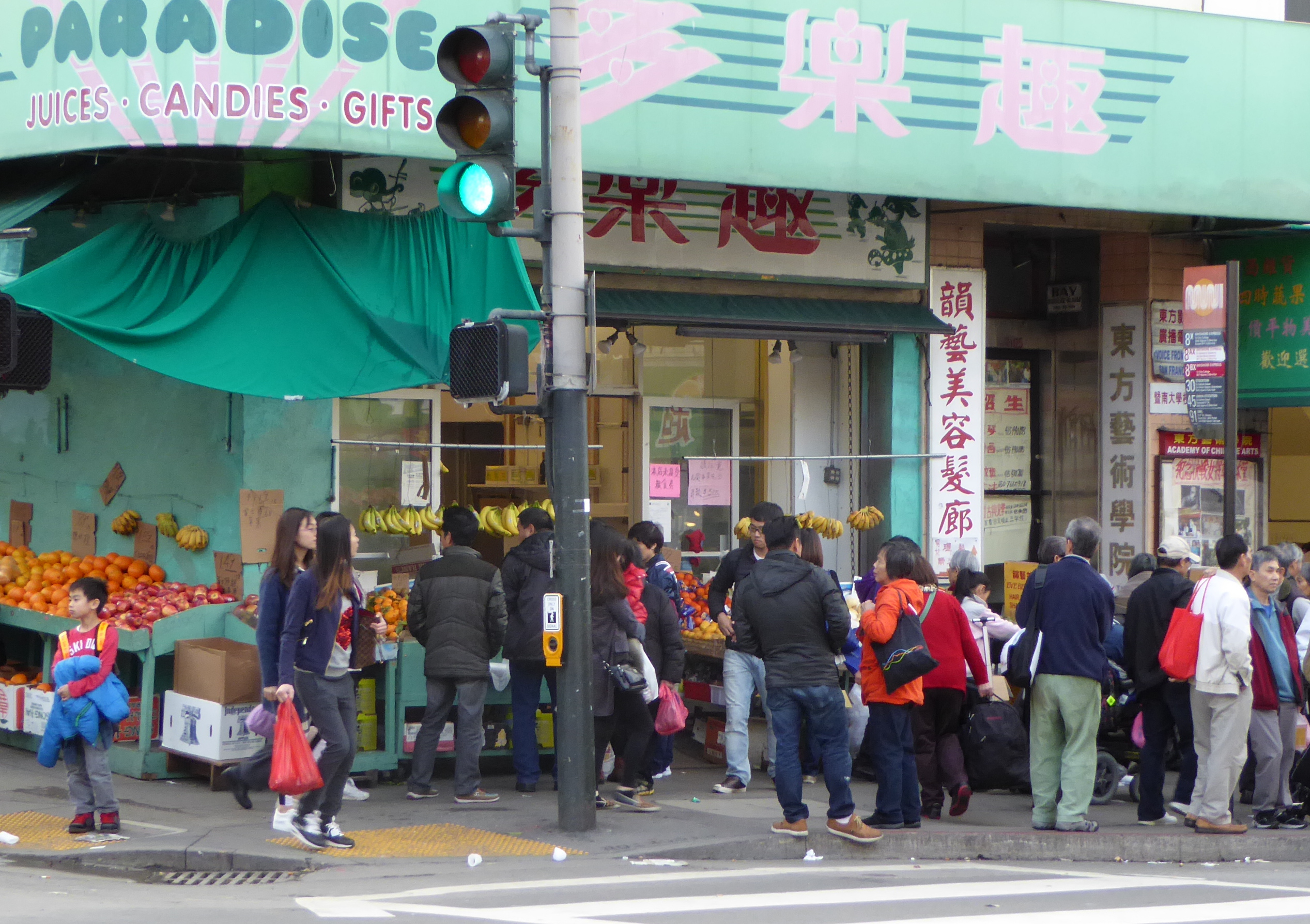
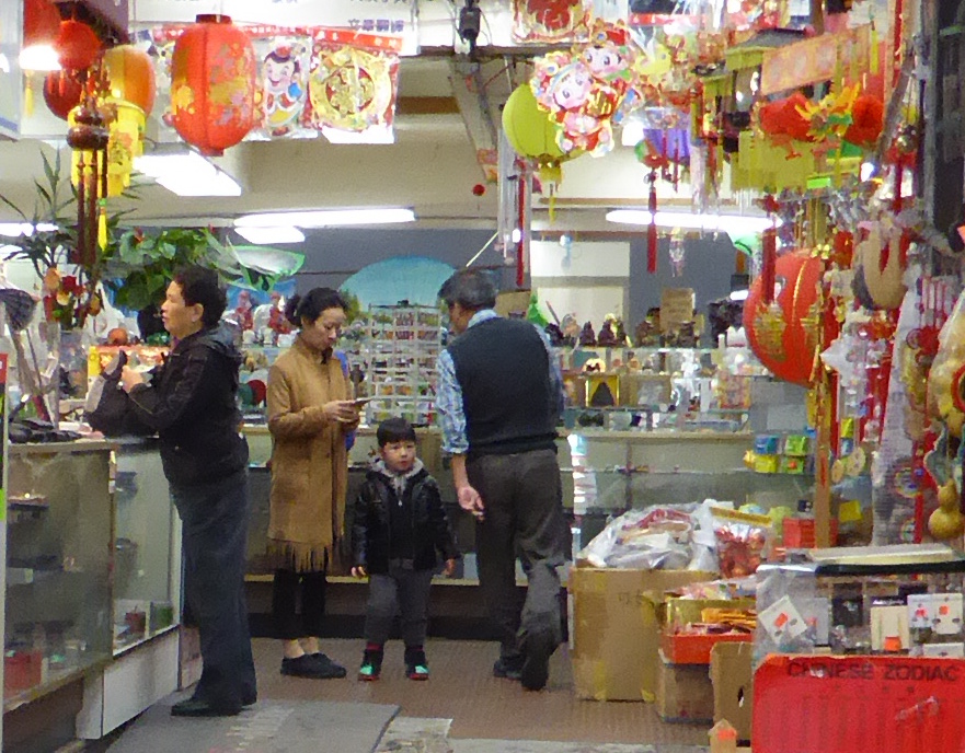
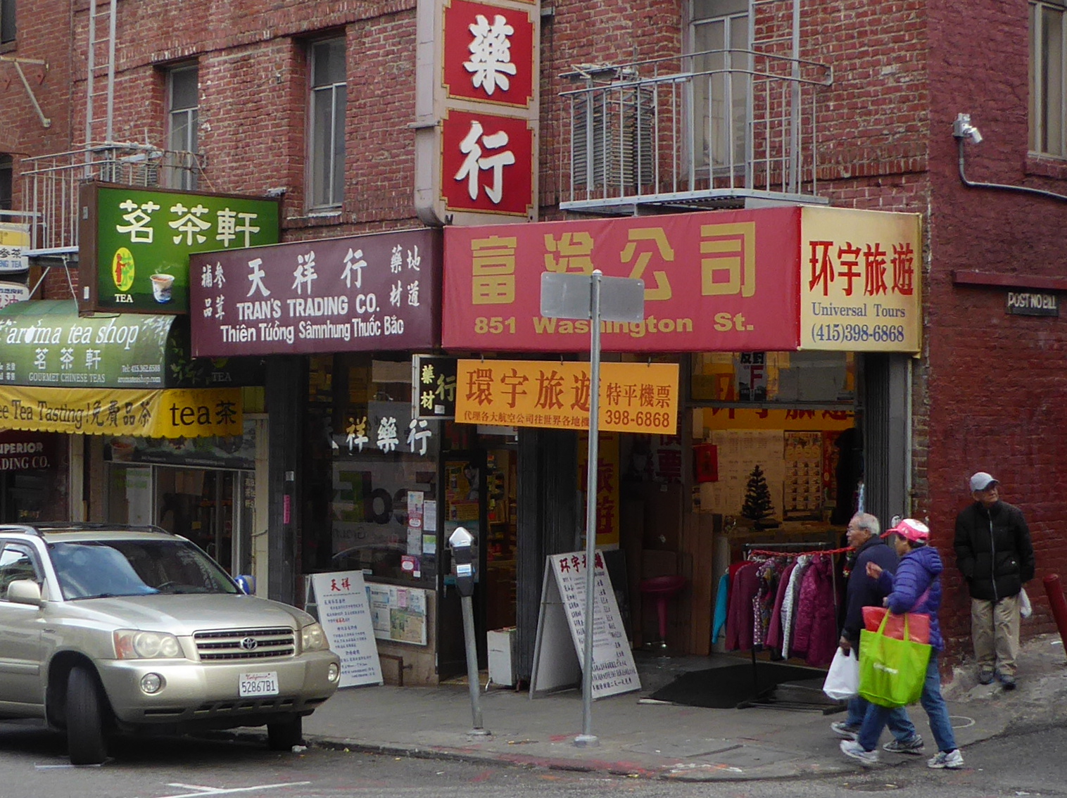
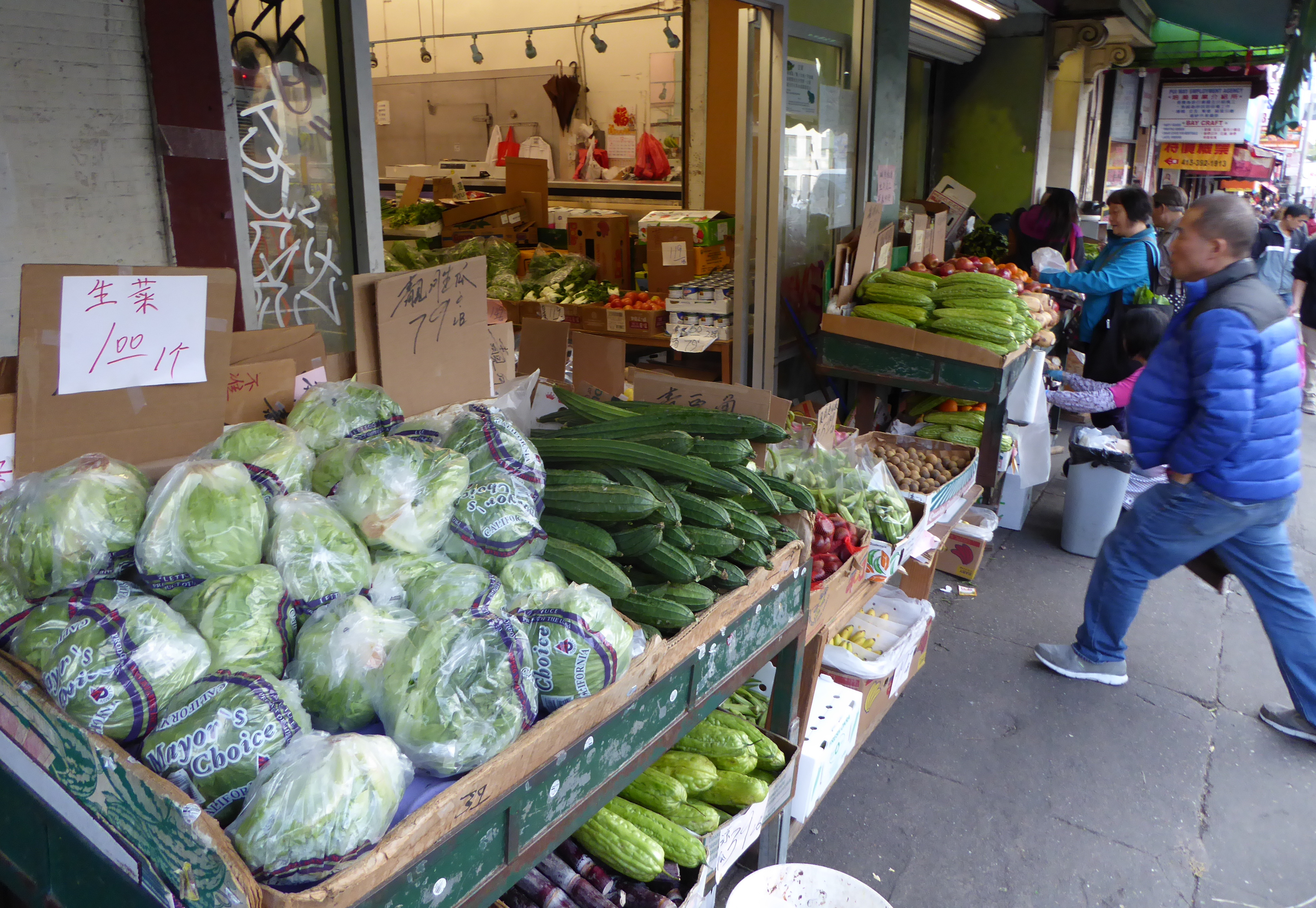
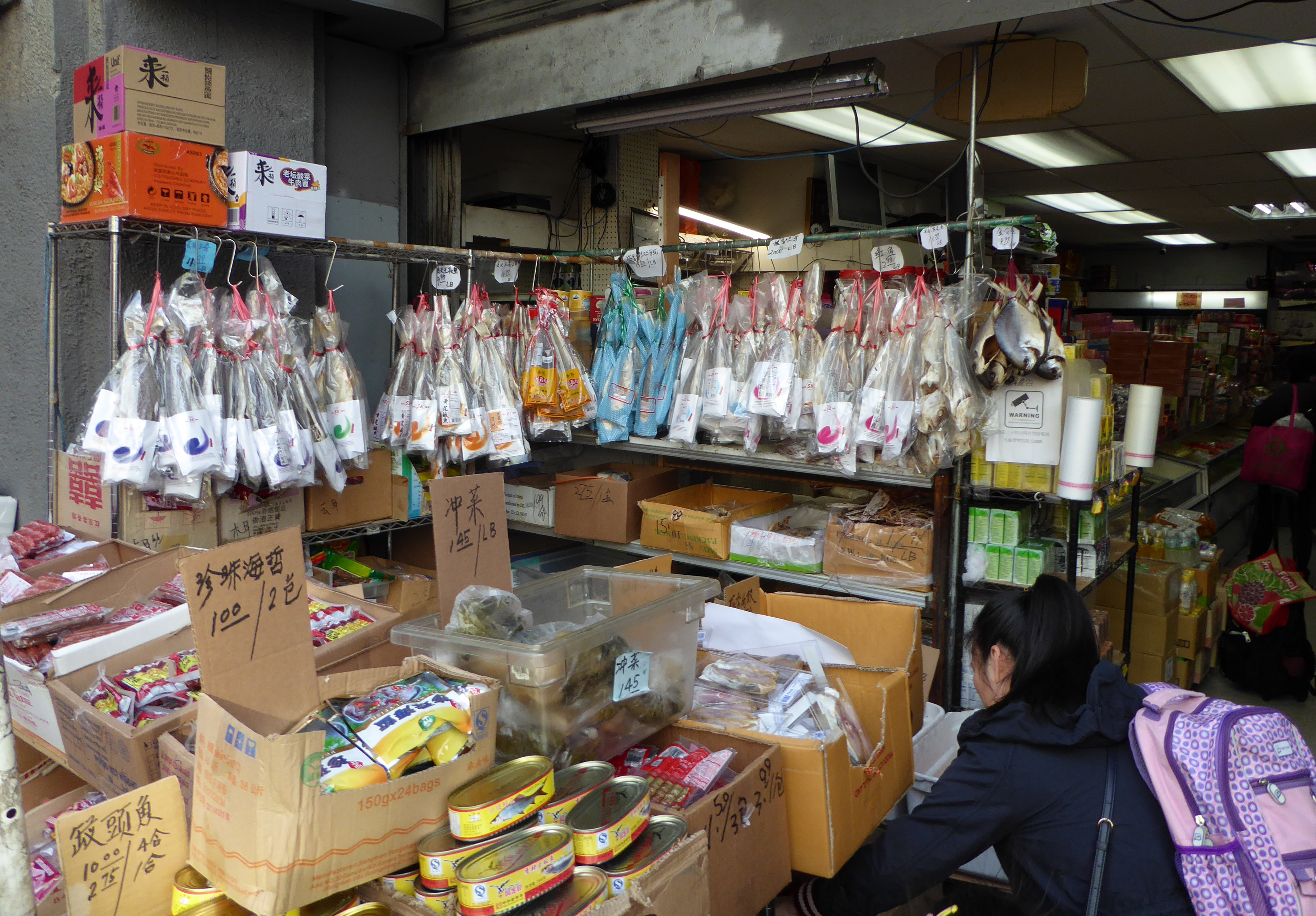
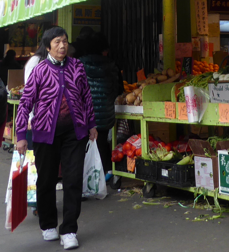
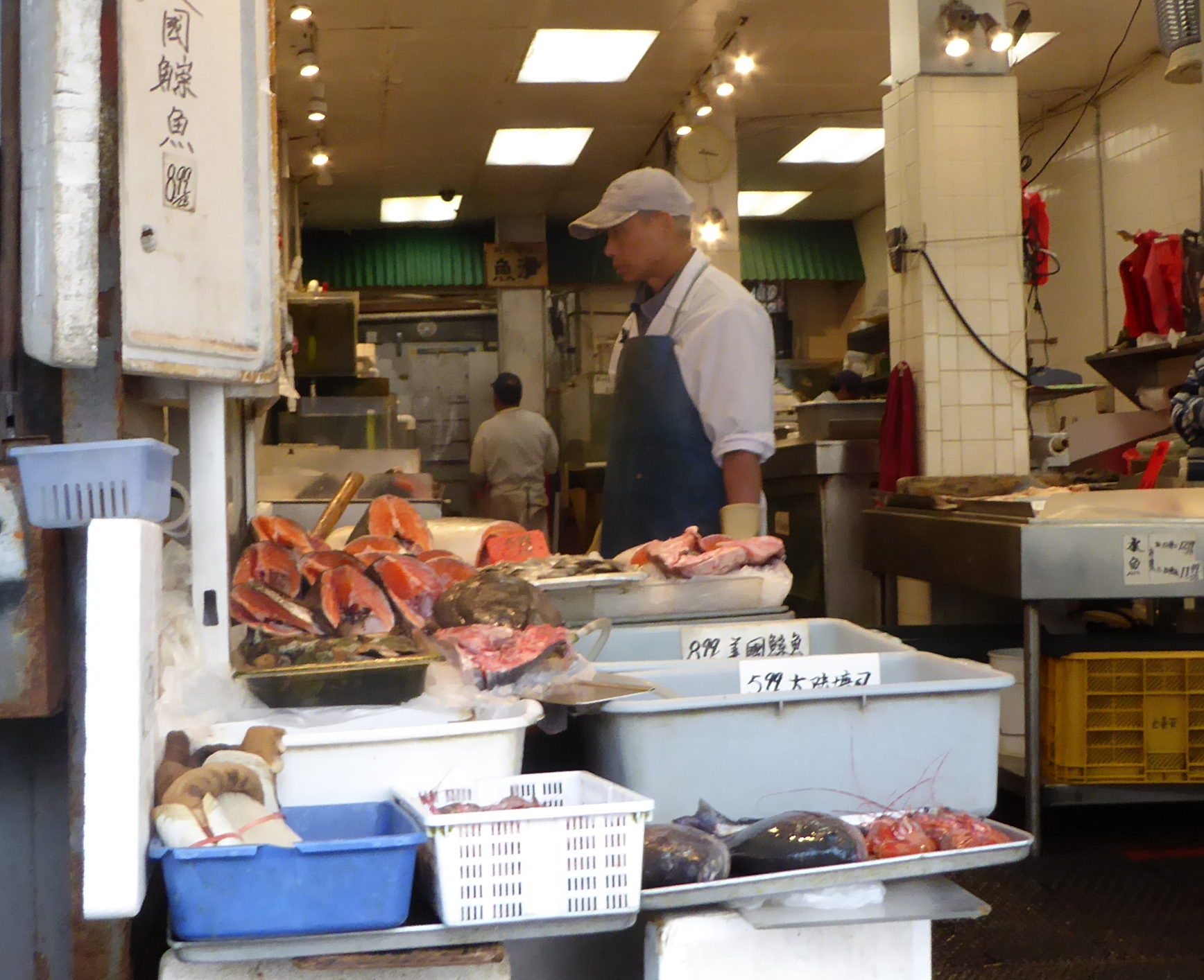
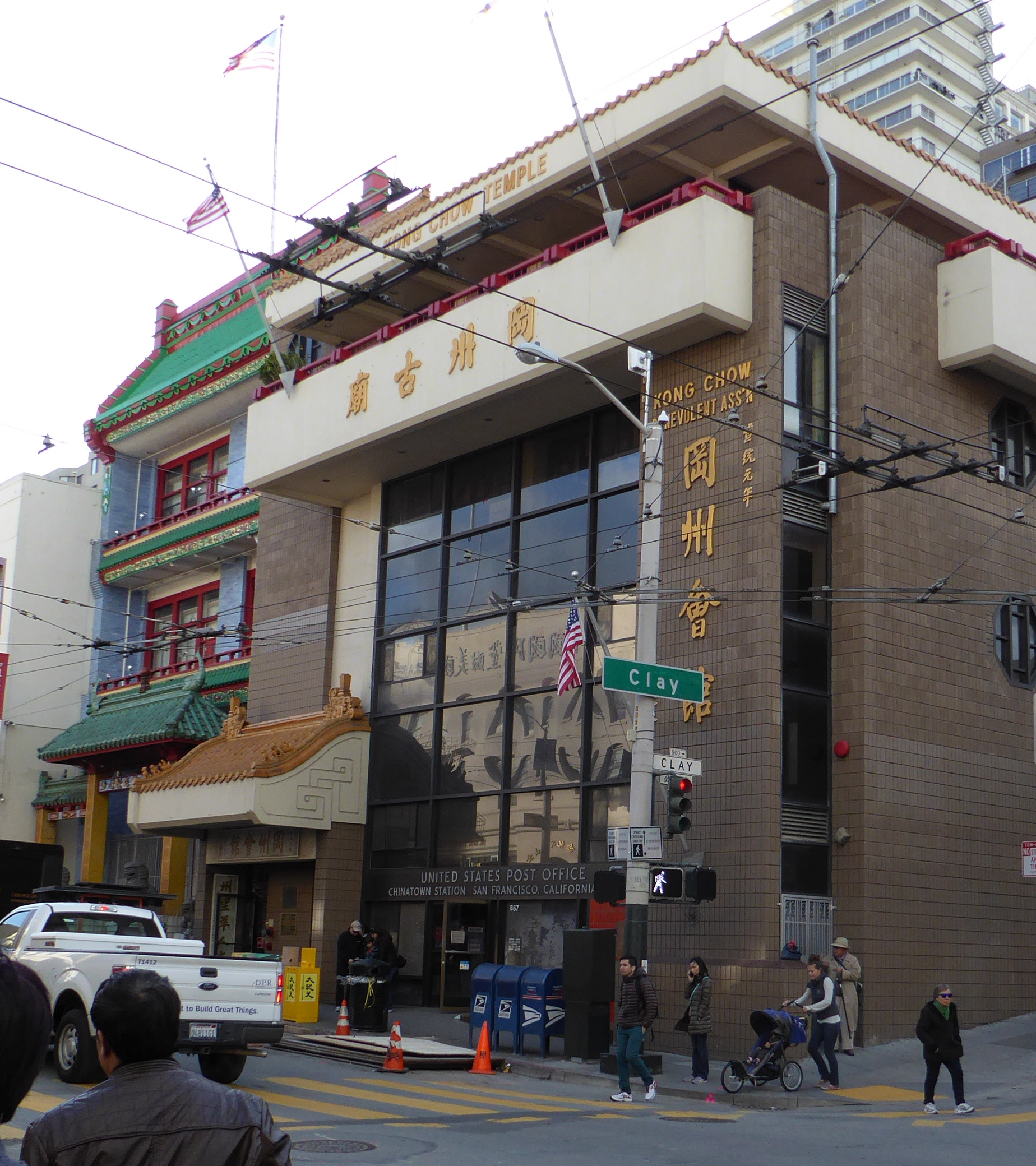
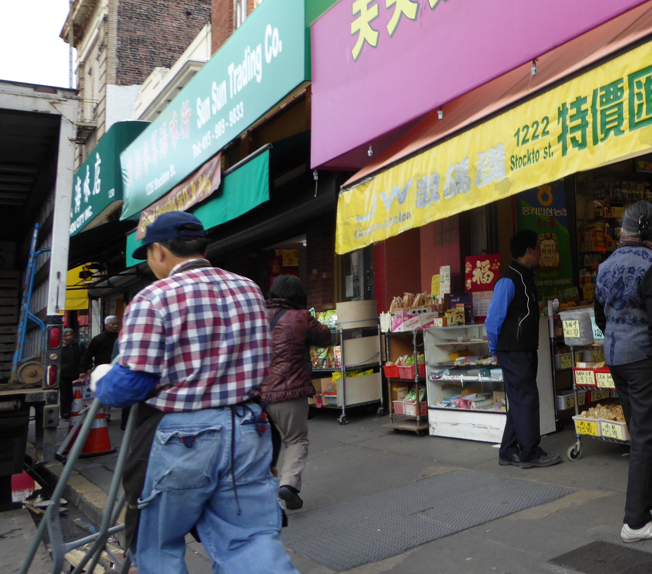
Chinatown
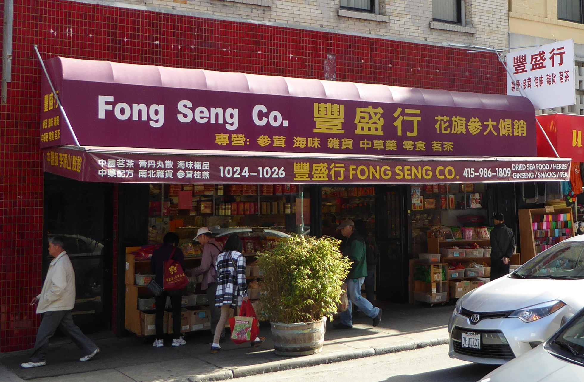
I have been a regular visitor to San Francisco since about 1978. I used to go striding around town, riding every possible form of public transportation, taking photos, and talking to people. San Francisco is a town of wonderful variation, with a neighborhood for everything. Chinatown was a favorite destination of mine. I have fond memories of a shopkeeper there teaching me how to play Chinese Chess (not that I remember now!), just because I kept asking questions. I didn’t even buy a set from him!
Chinatown is more than a tourist destination- it is a vibrant neighborhood / community. 33% of San Francisco’s population is Asian, and Chinatown represents its historical base. Some say Chinatown is the largest Chinese community outside Asia!
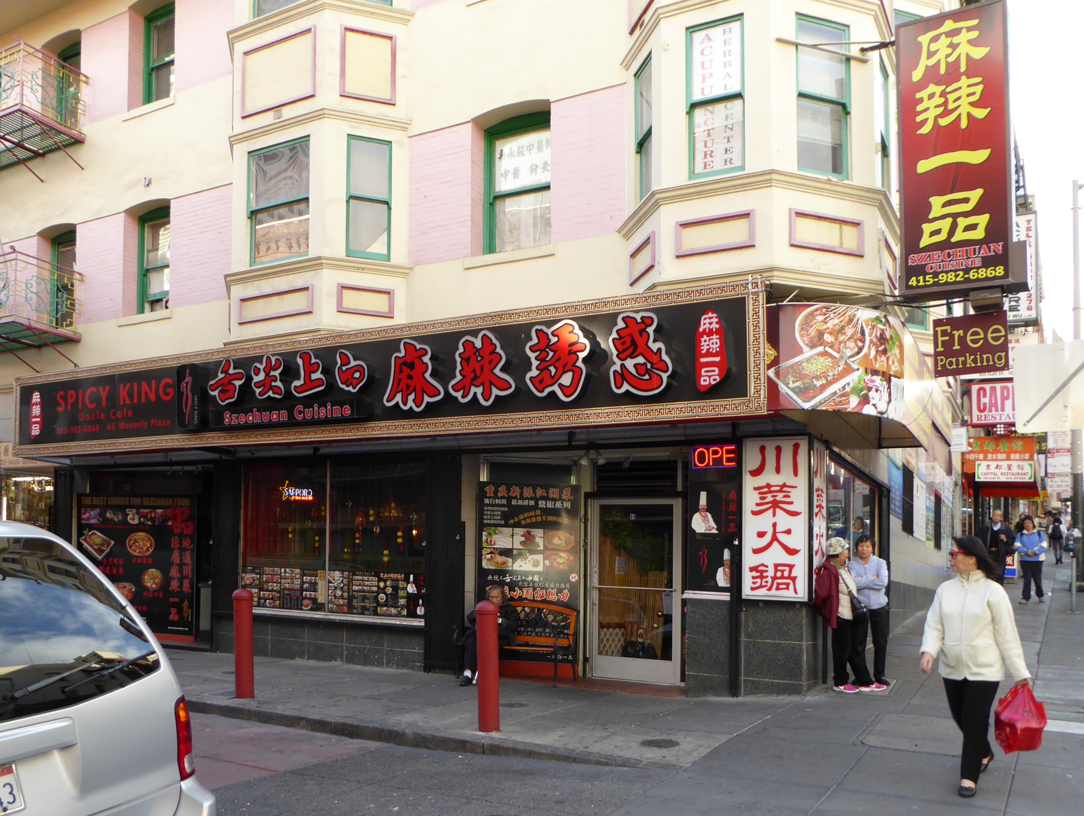
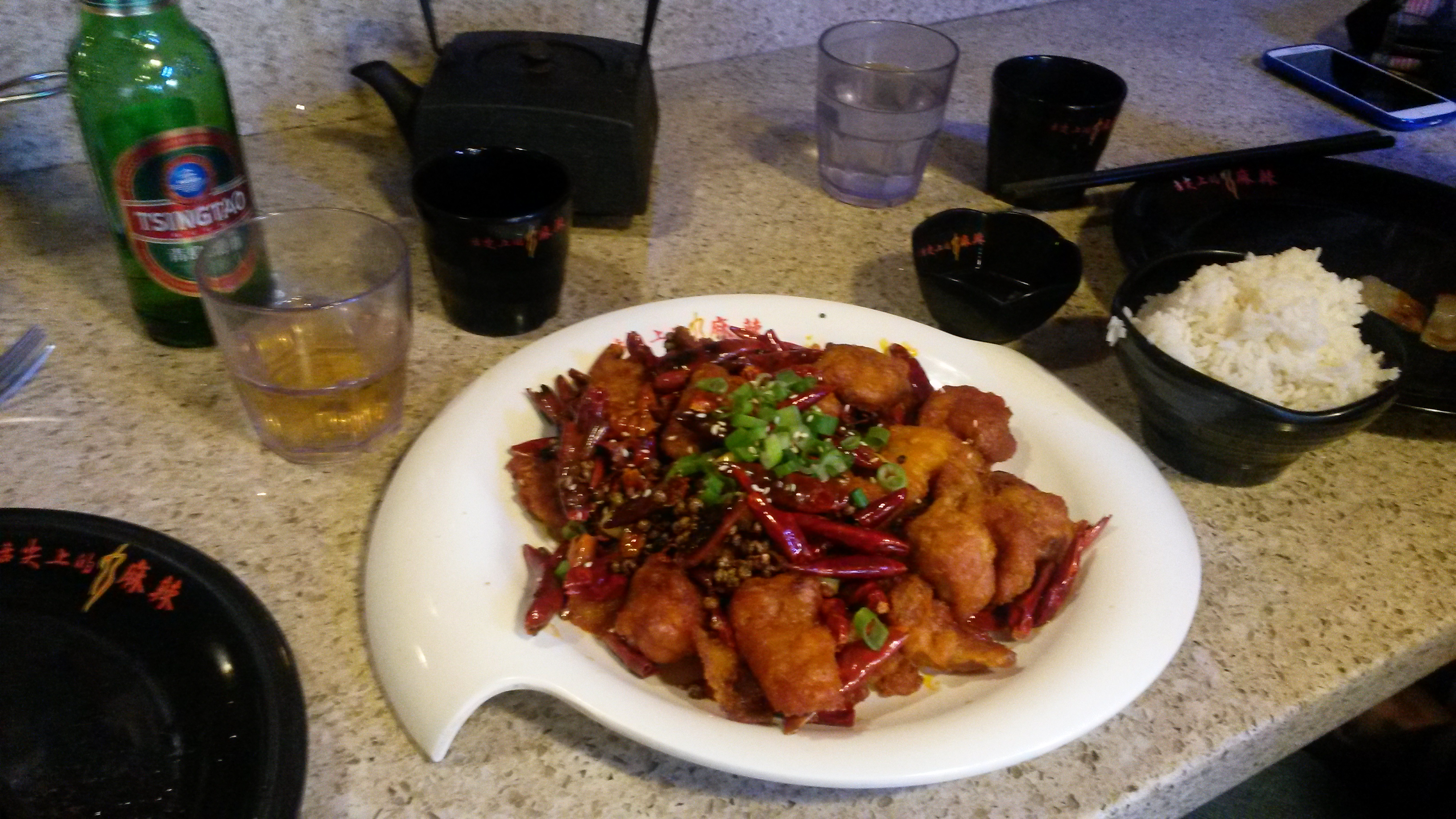
“Spicy King” Szechuan (Sichuan) Restaurant on Waverly Place
Just a bit uphill from the main (tourist) commercial street, we found this restaurant.
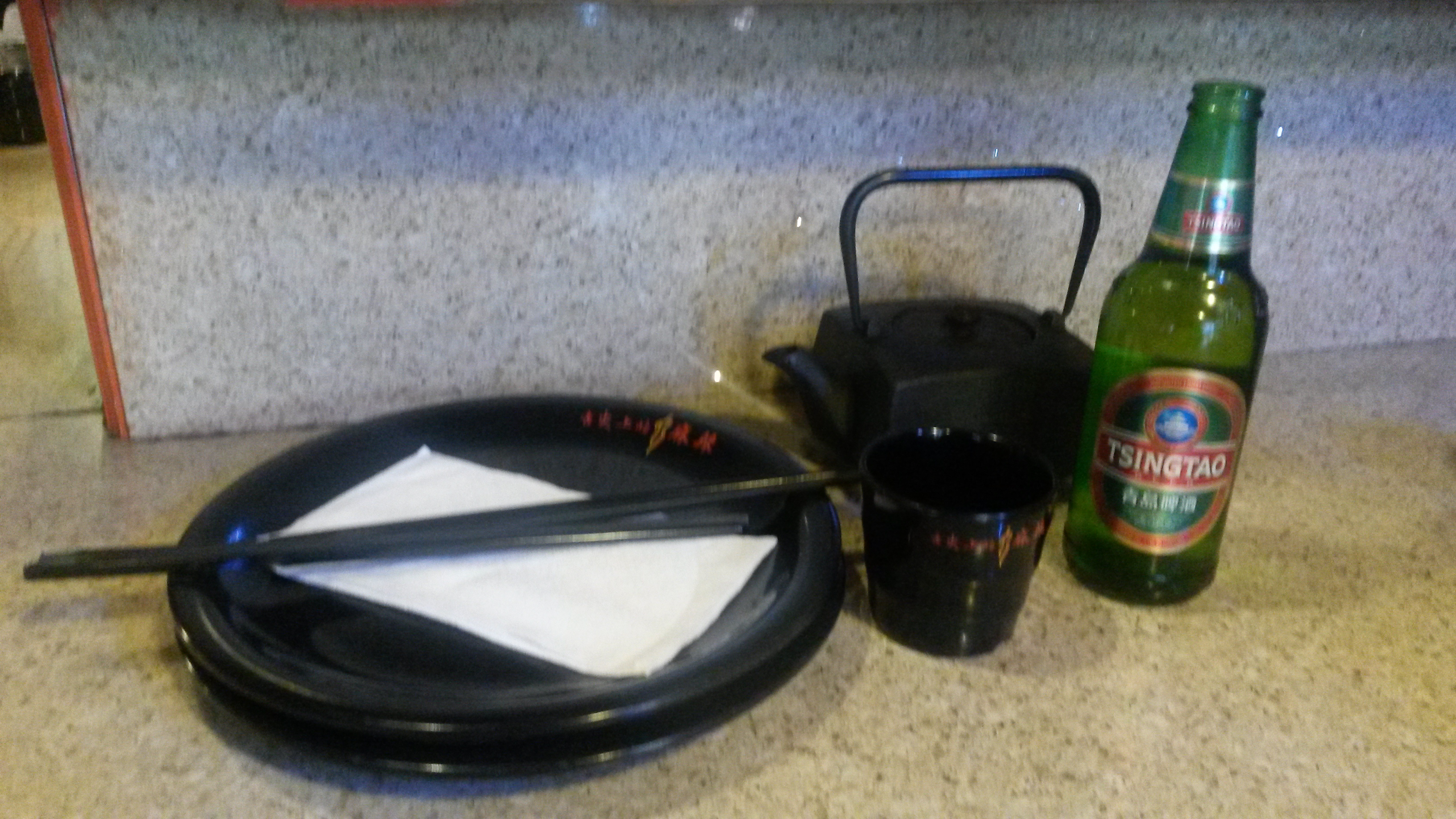
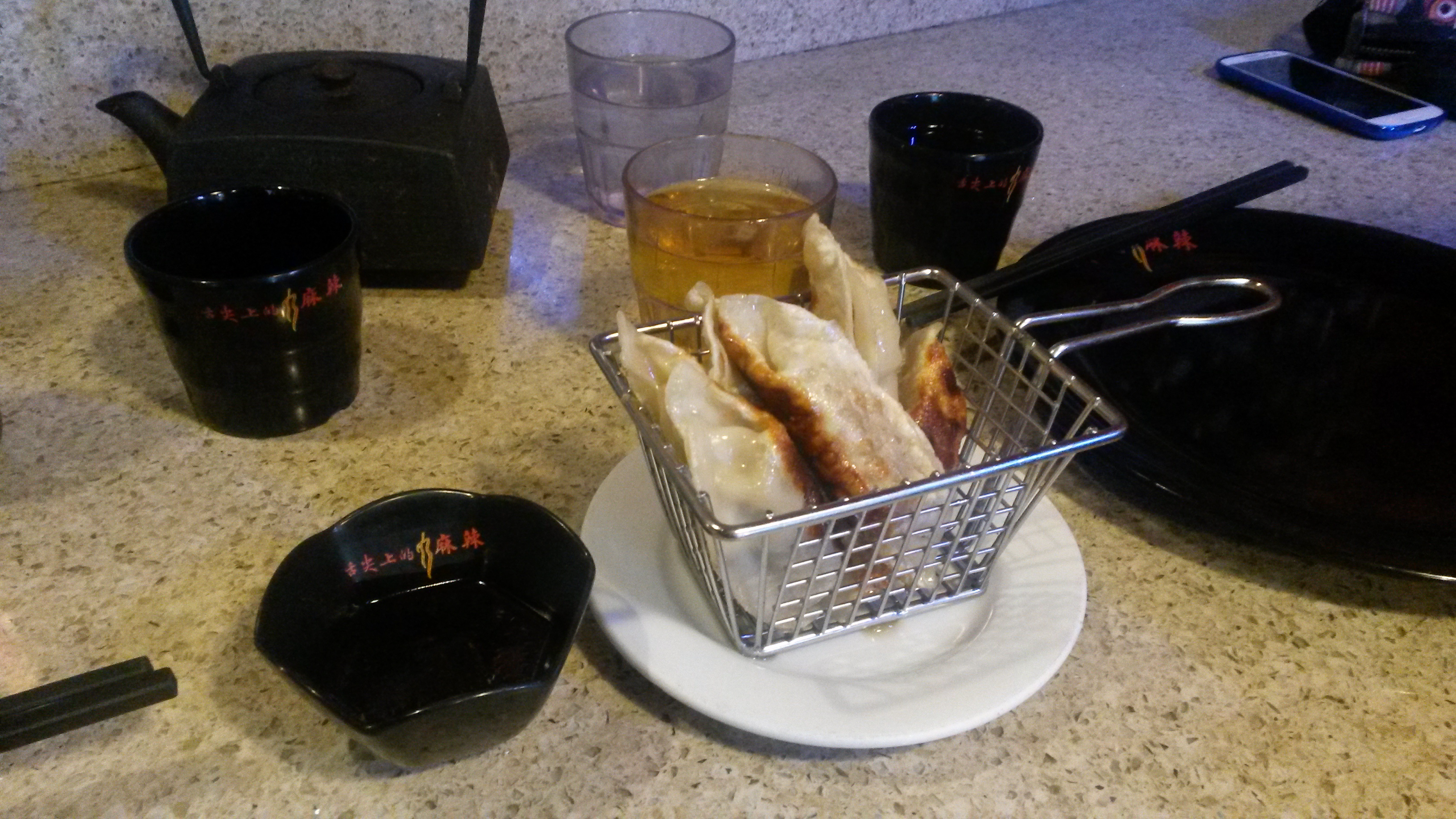
Pot stickers (Fried dumplings)
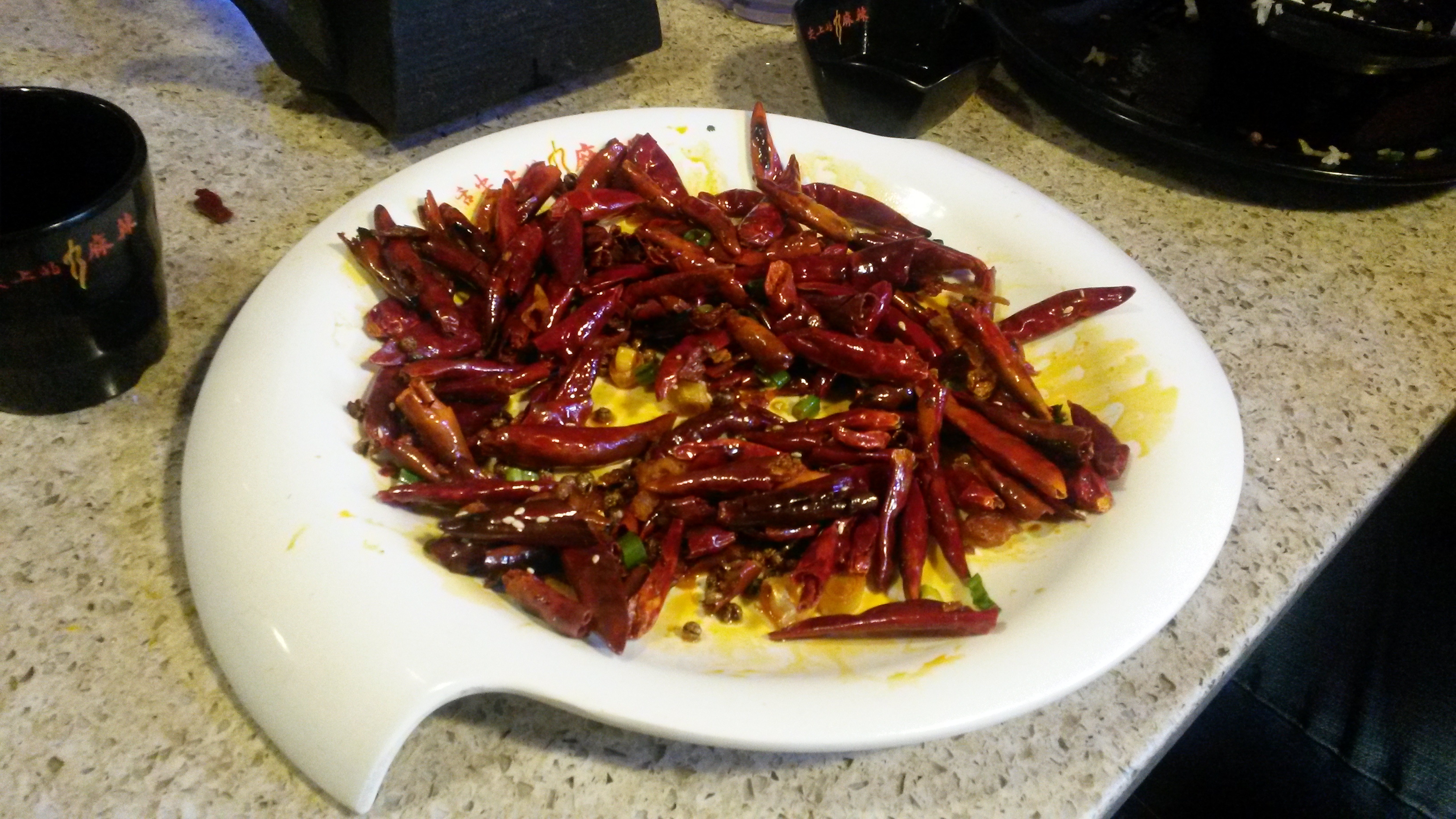
Our selection: “Chicken with Explosive Chili Pepper”
Look at how many peppers went into the seasoning of the plate!
We were glad we found this place!
(Any chance they could open a sister restaurant in Denver??)
After eating we continued our explorations.
Post Office
Eventually it was time to head back toward our hotel.
San Francisco is a wonderful mix of distinct communities and ethnic enclaves Leaving Chinatown we stopped for an espresso in North Beach- SF’s “Little Italy”.
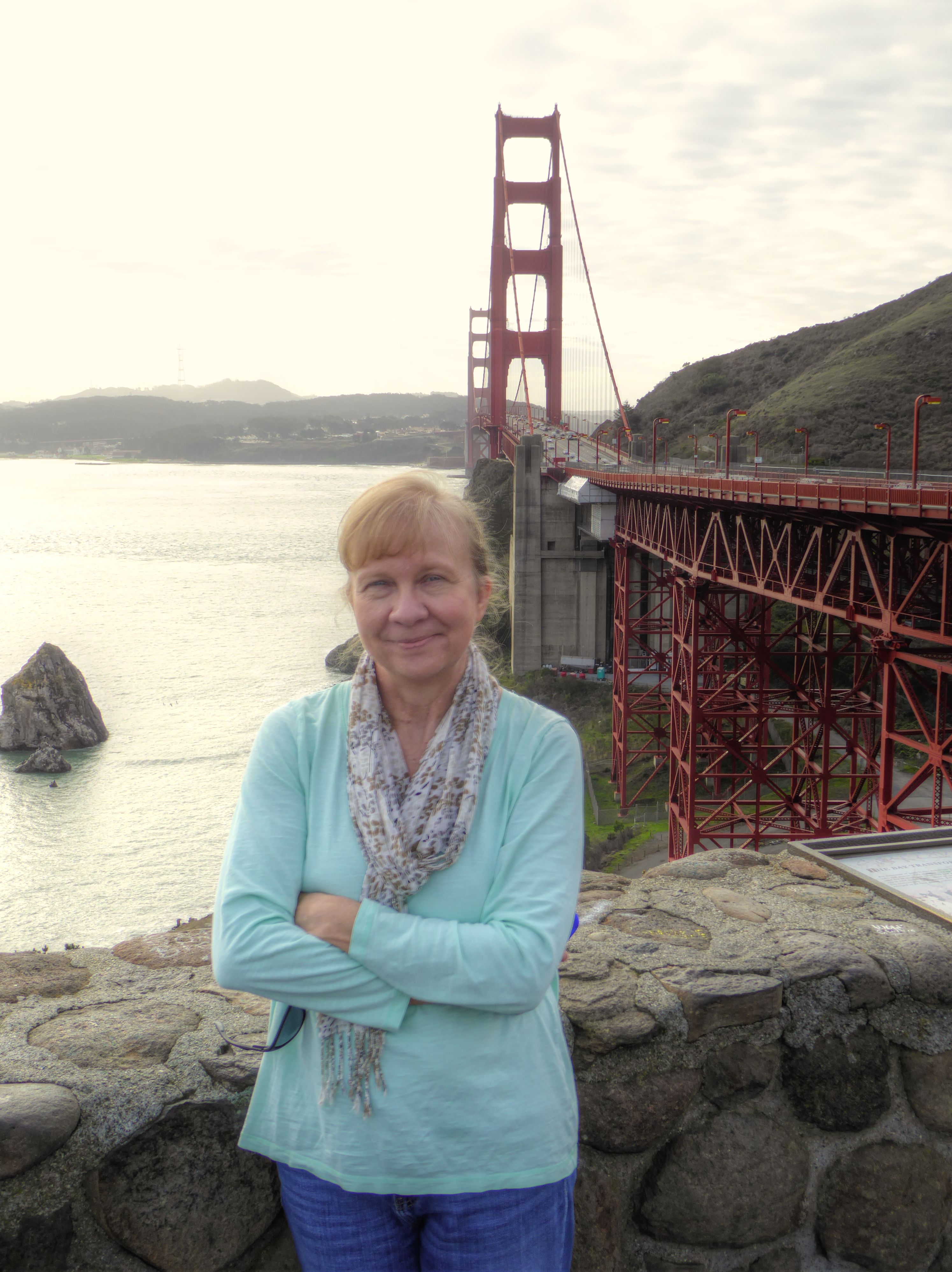
The Golden Gate Bridge and Muir Woods
The next day we picked up a rental car and headed out of the city crossing over the Golden Gate Bridge.
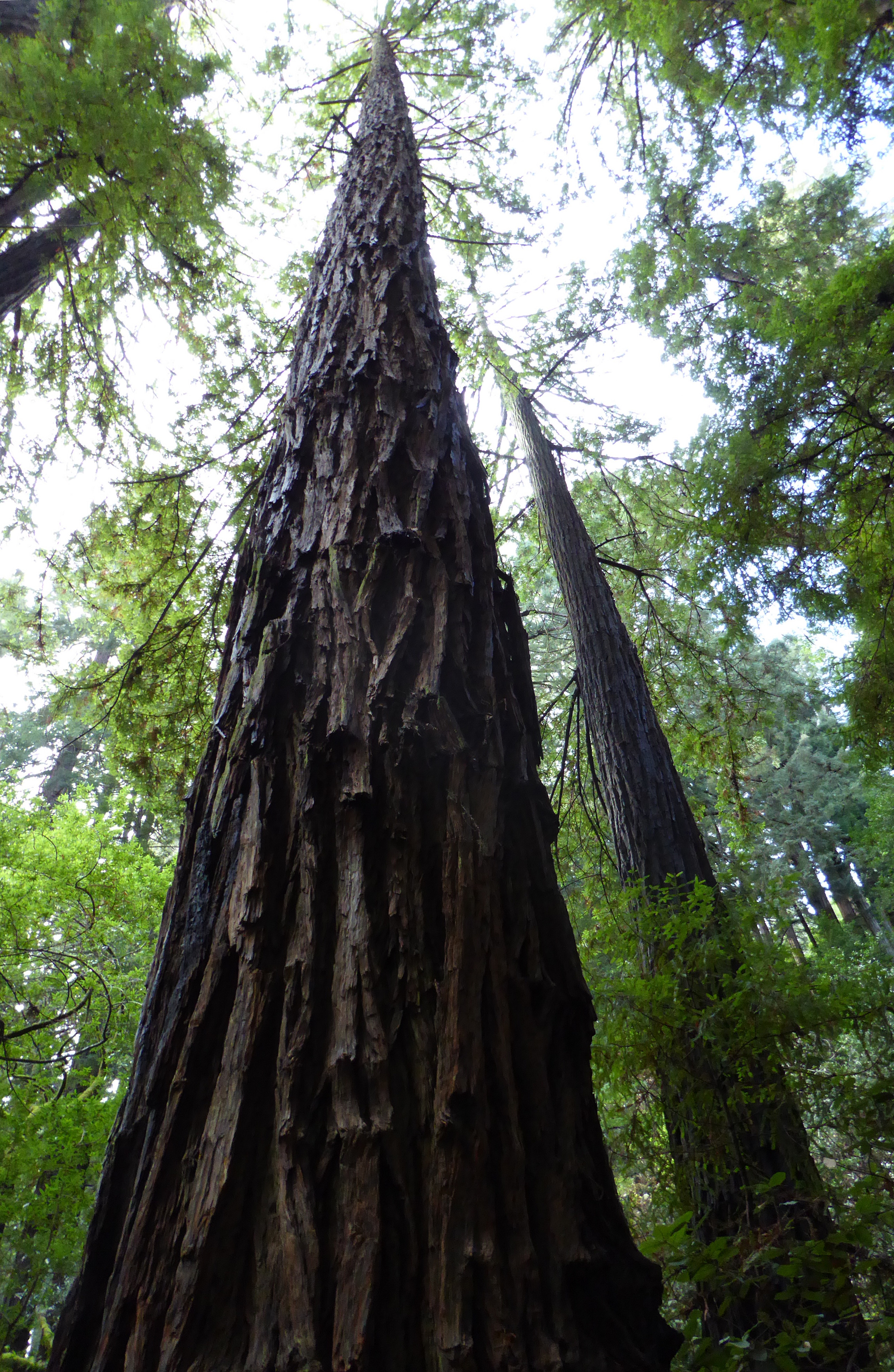
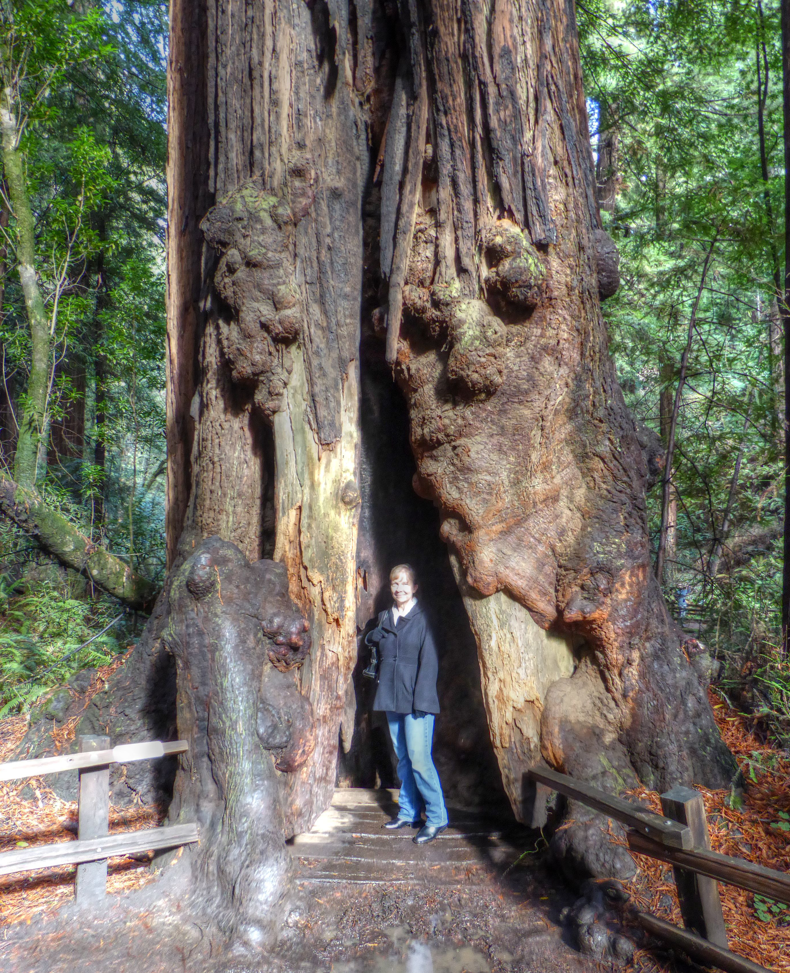
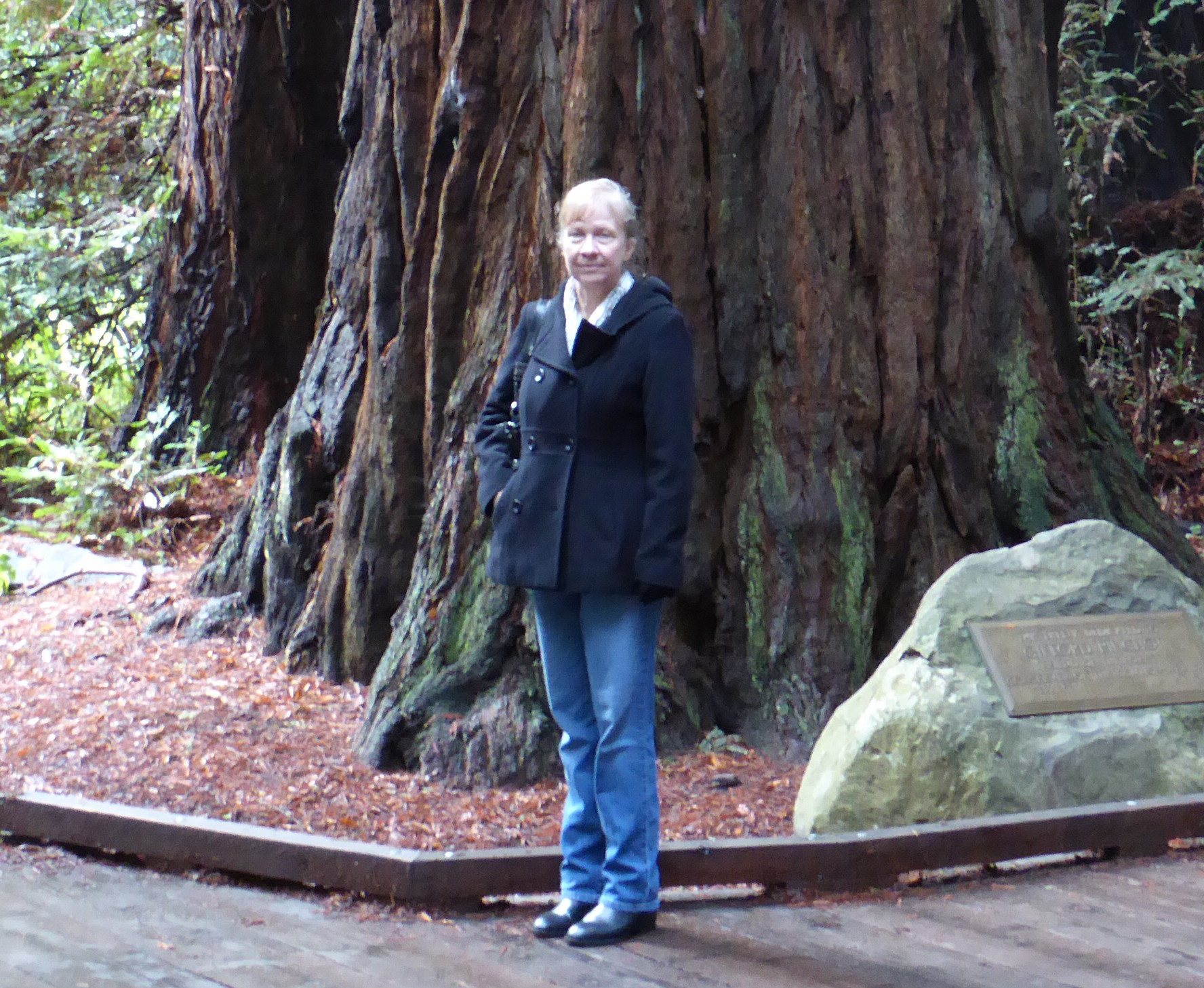
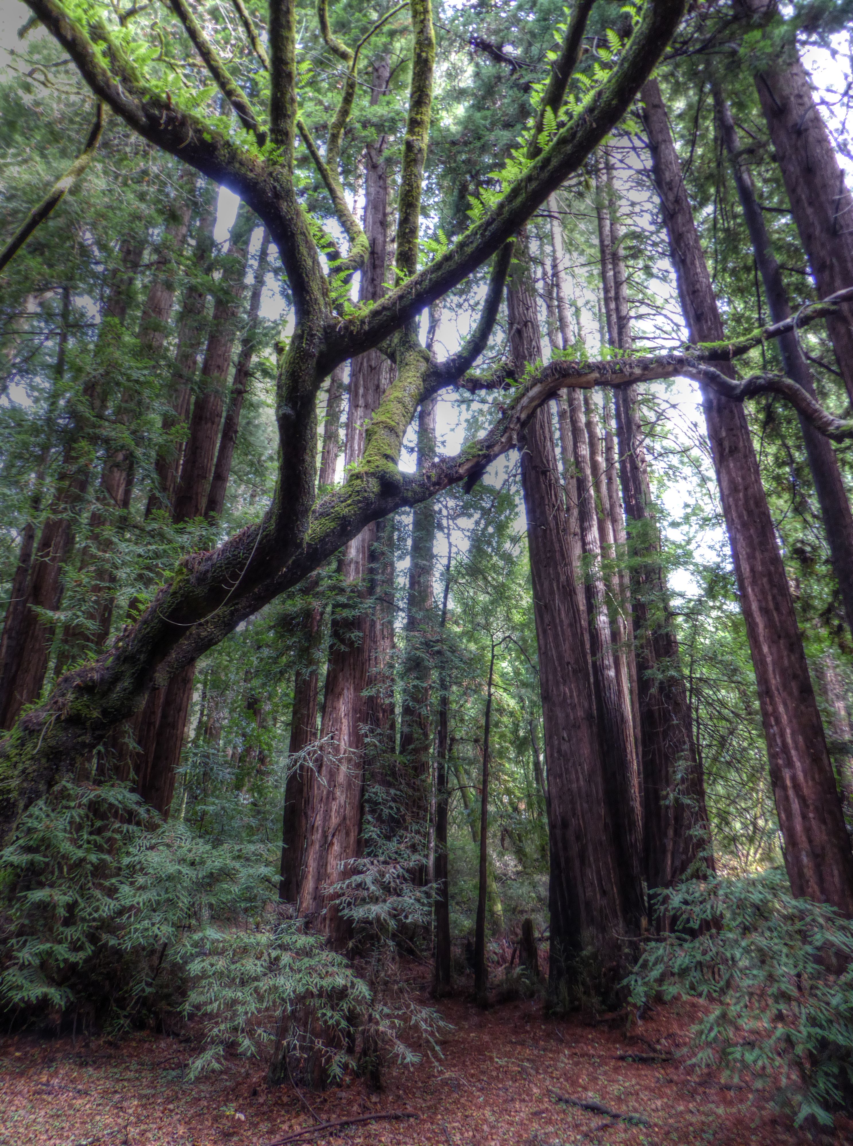
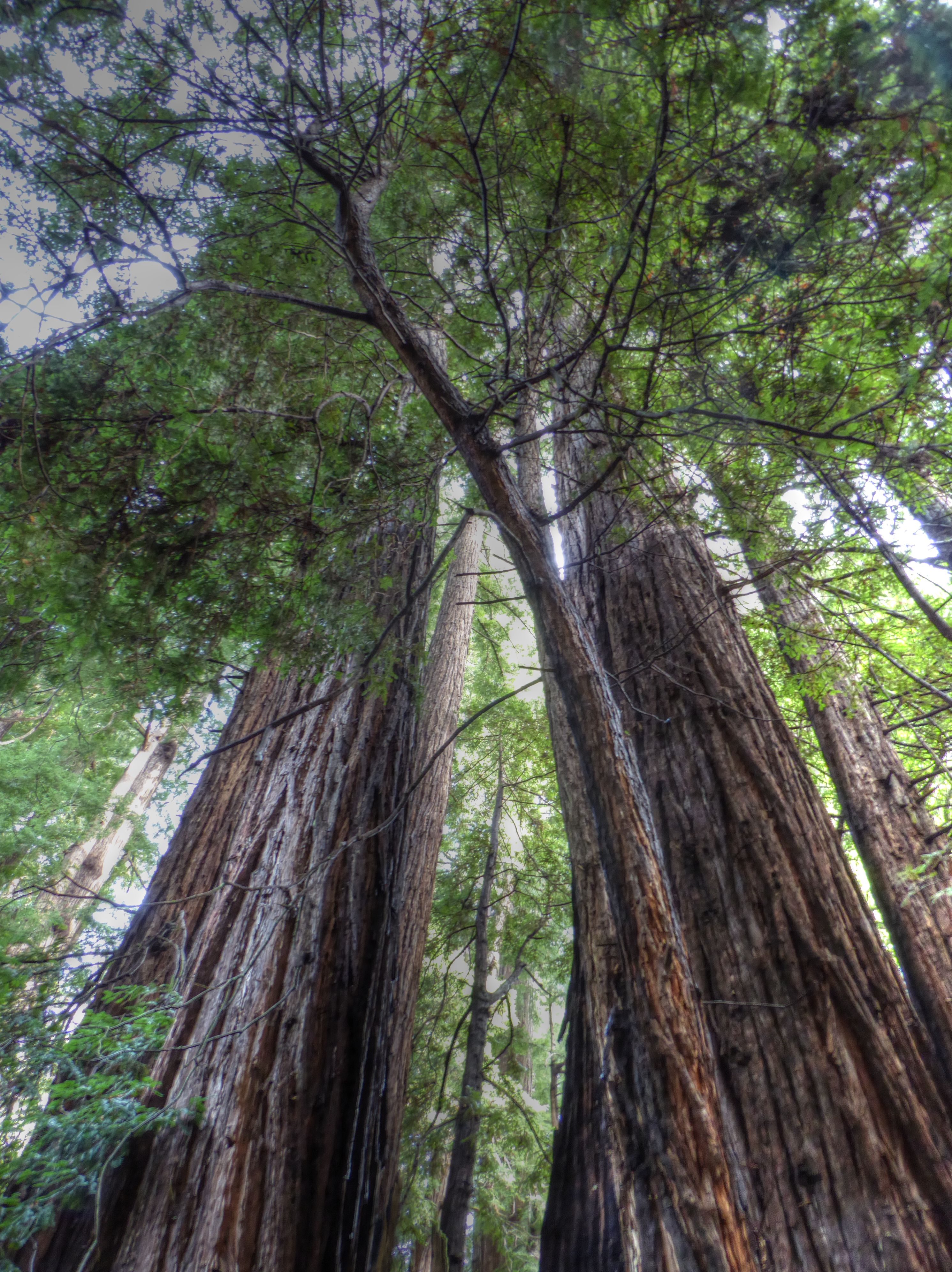
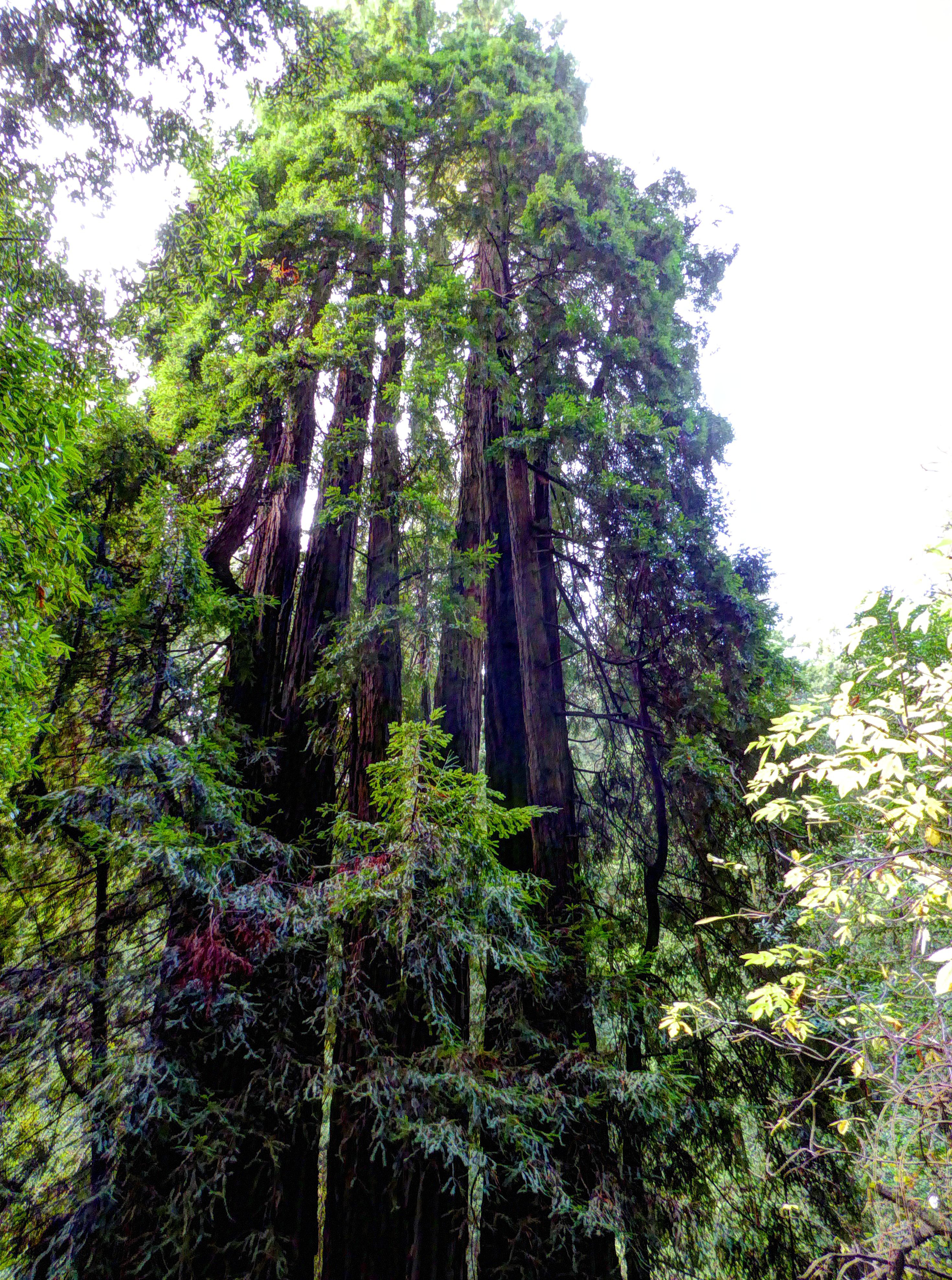
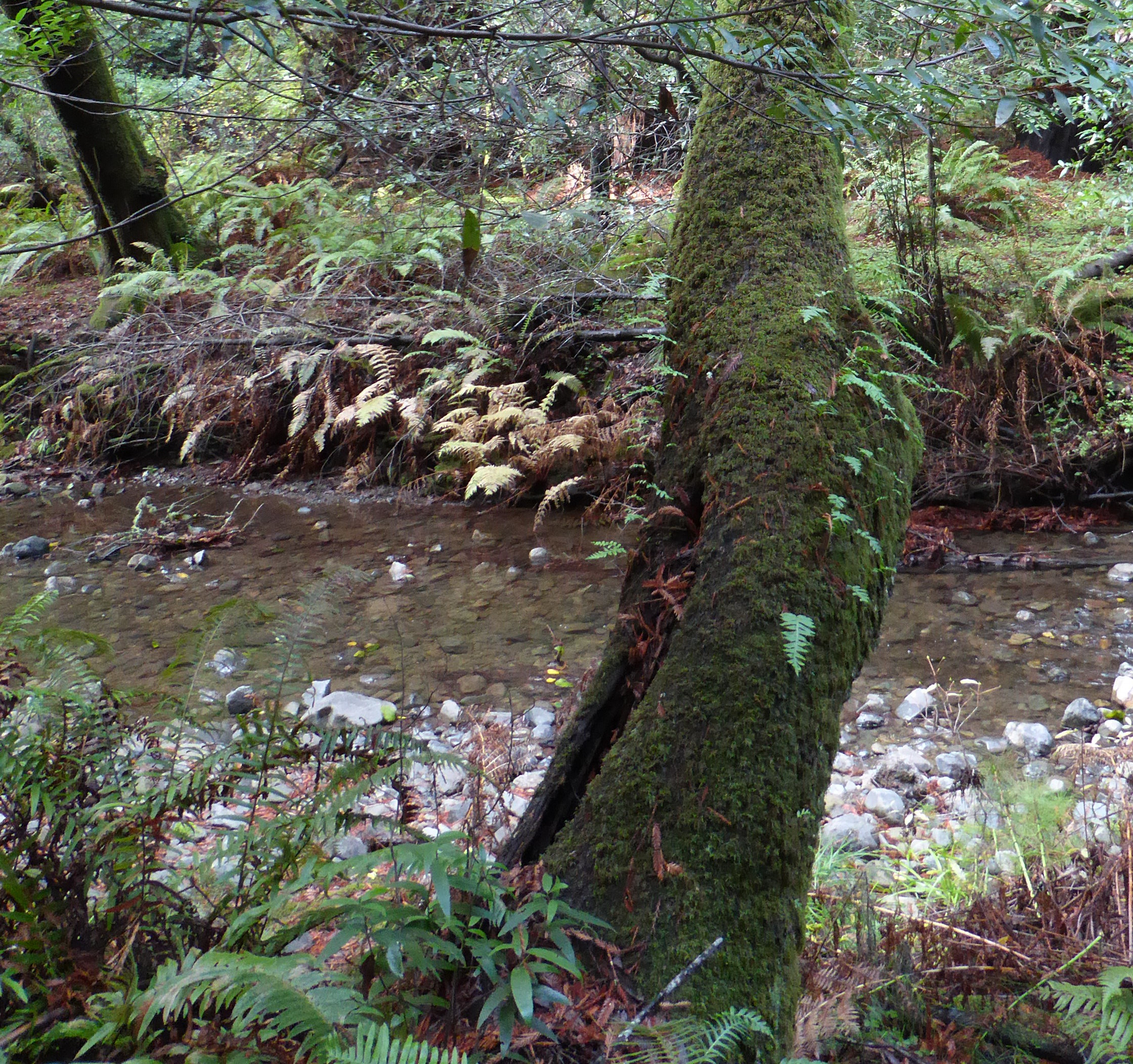
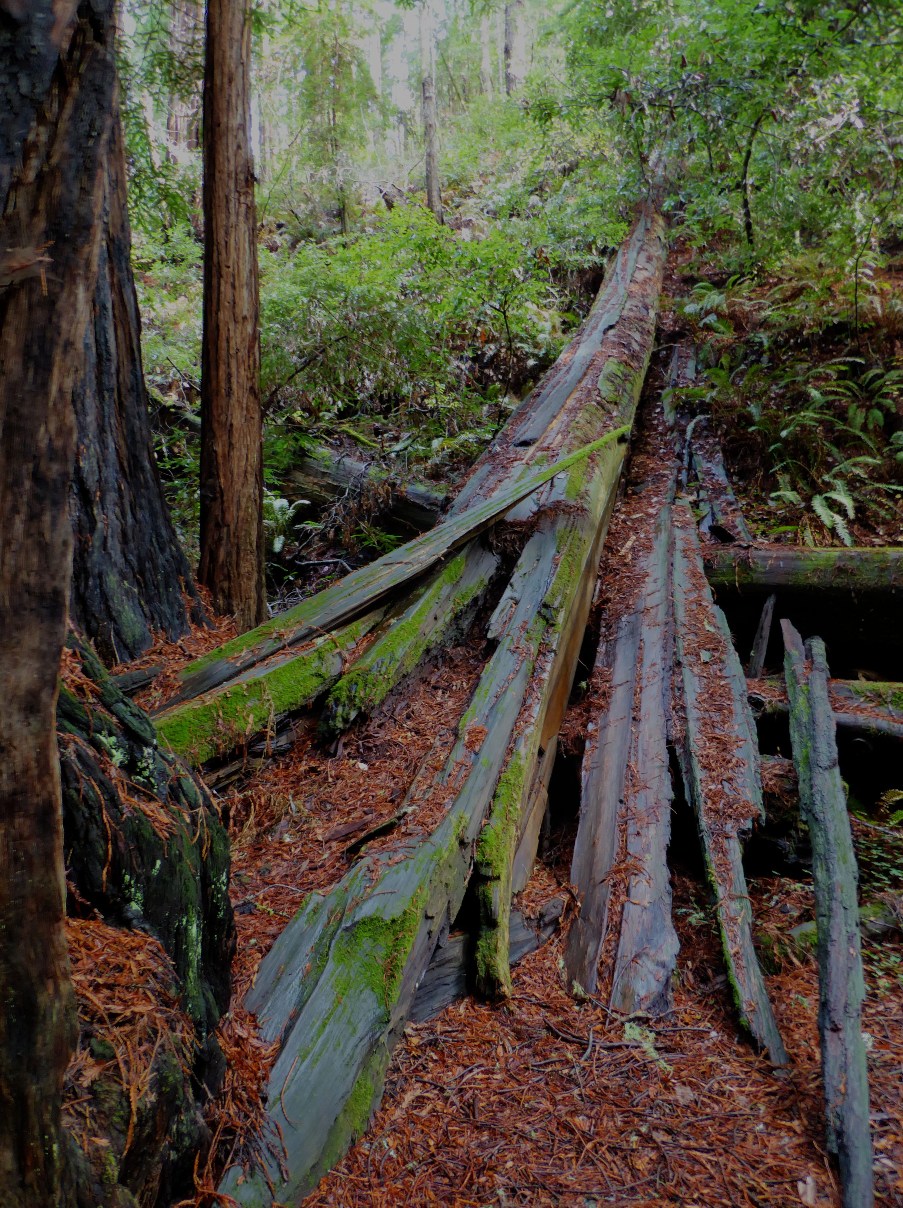
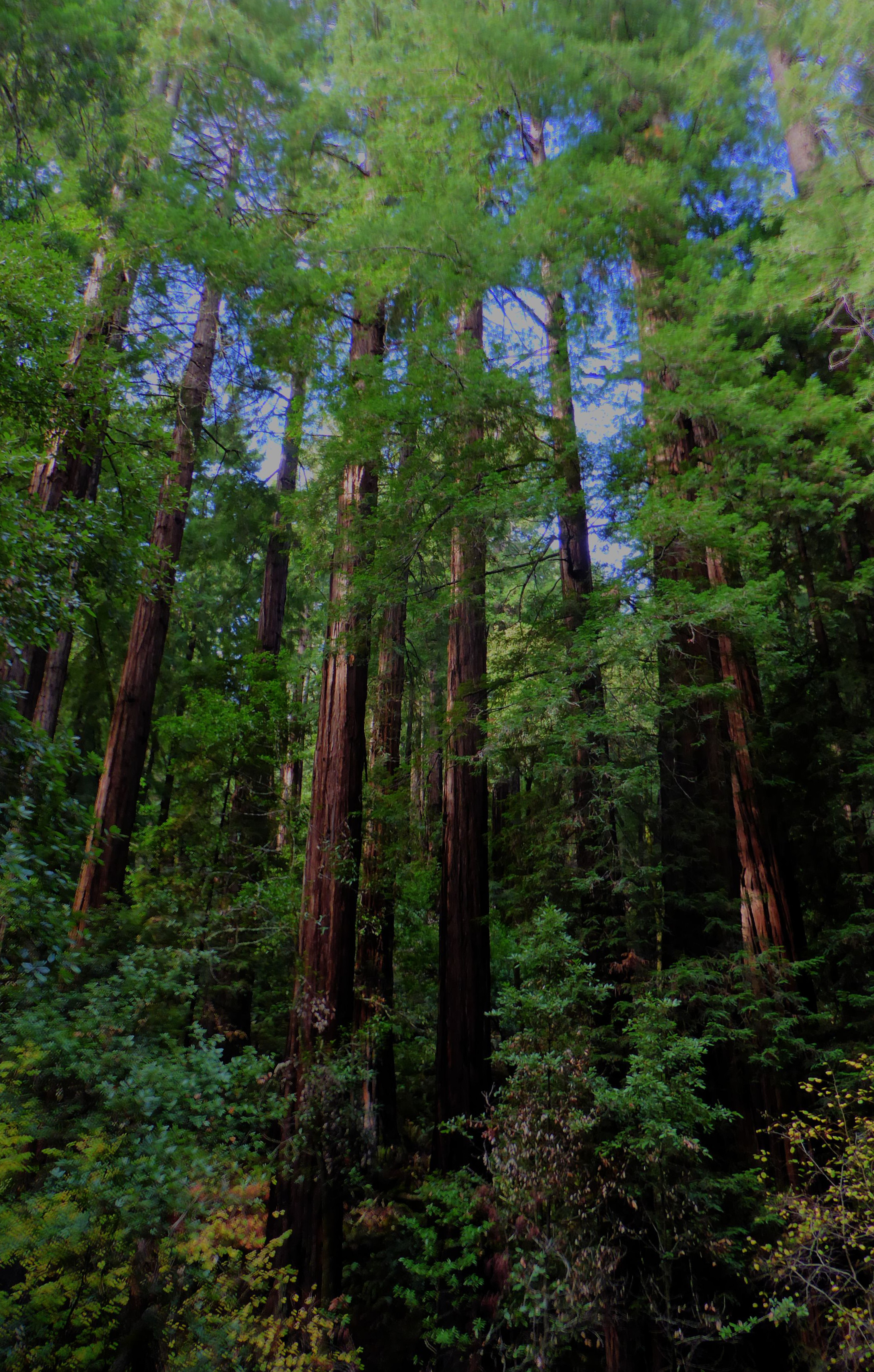
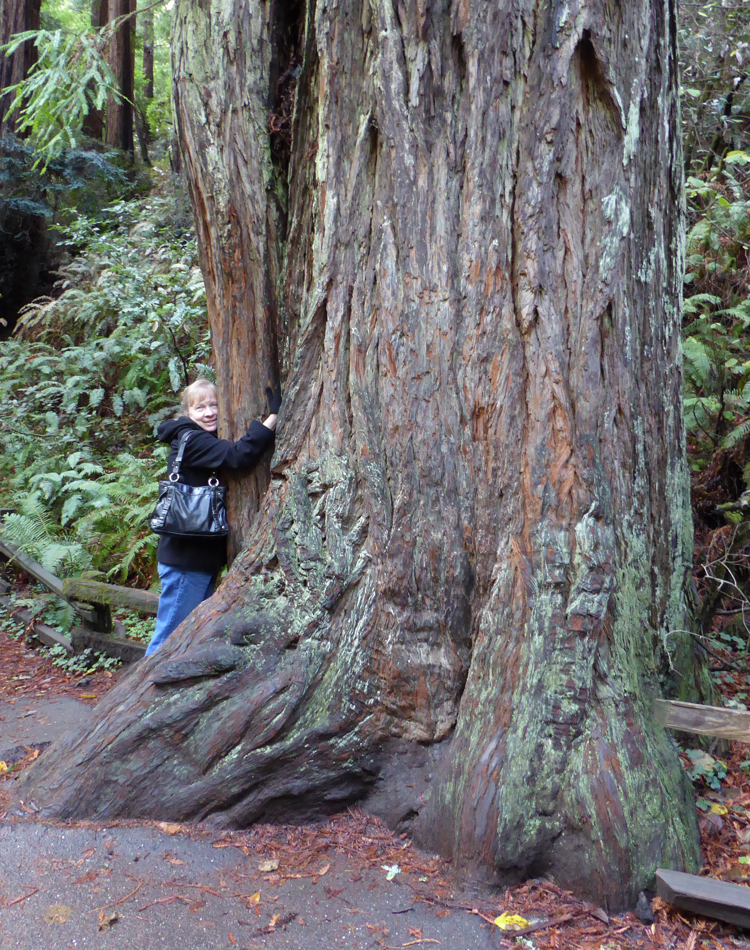
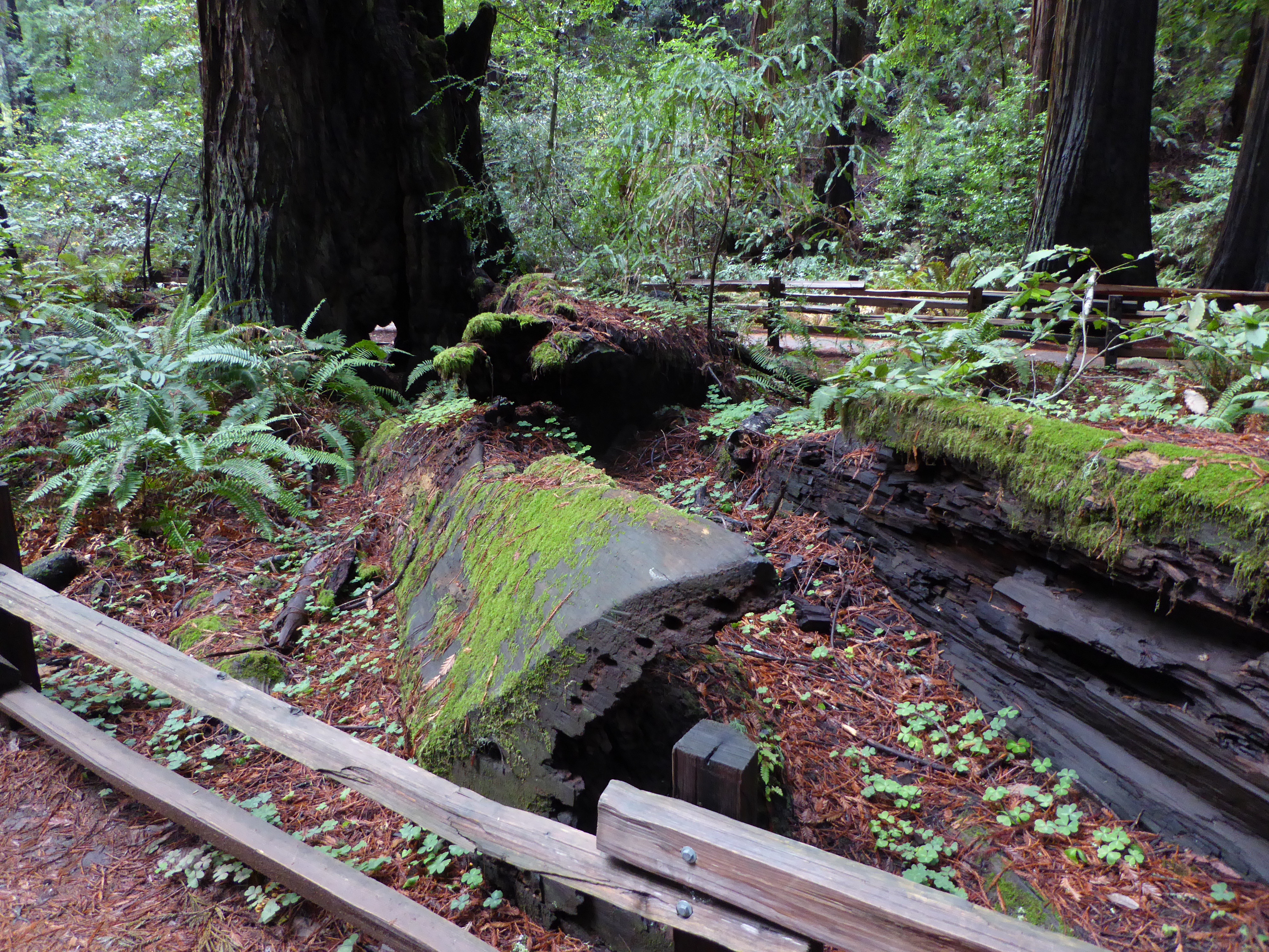
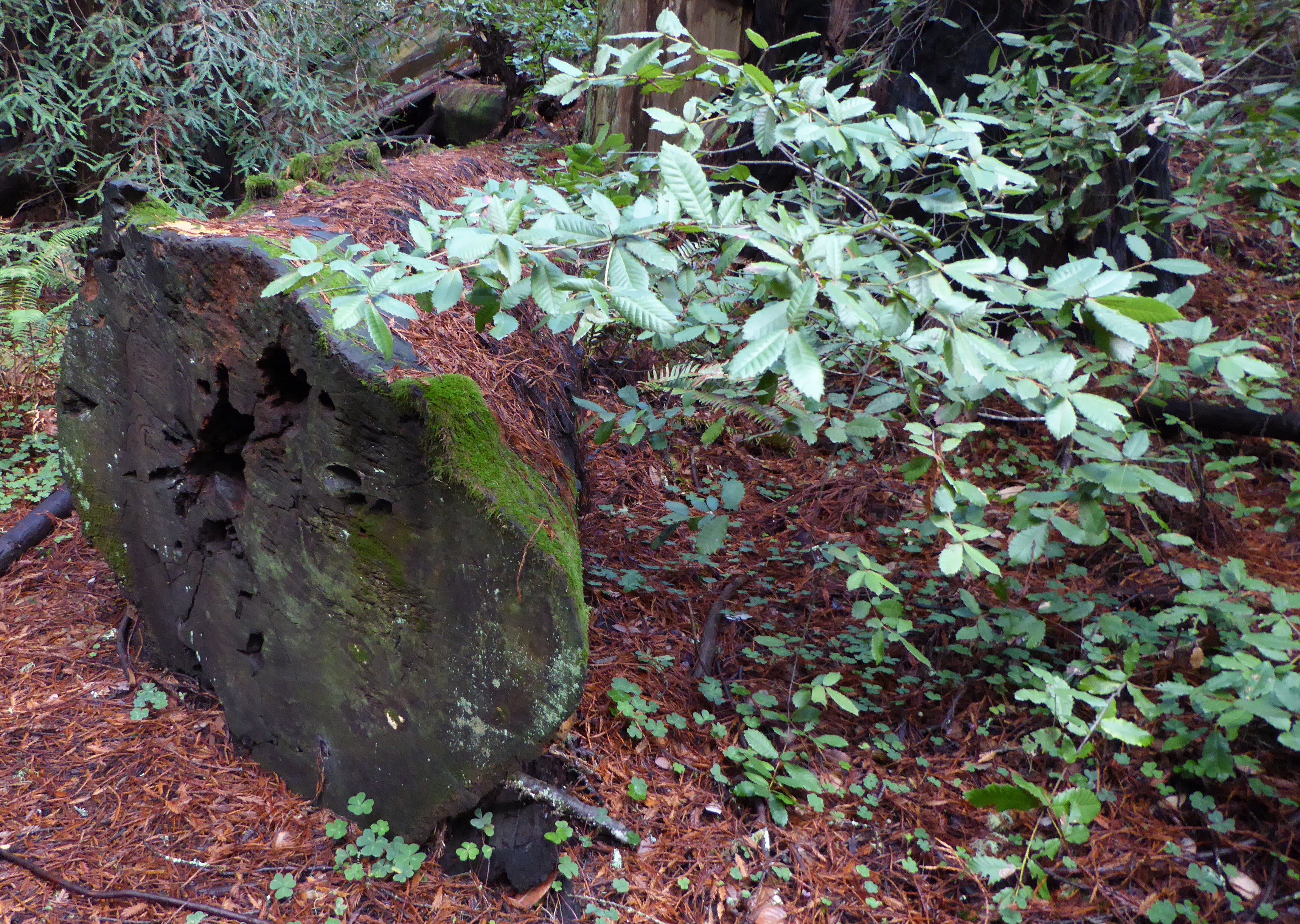
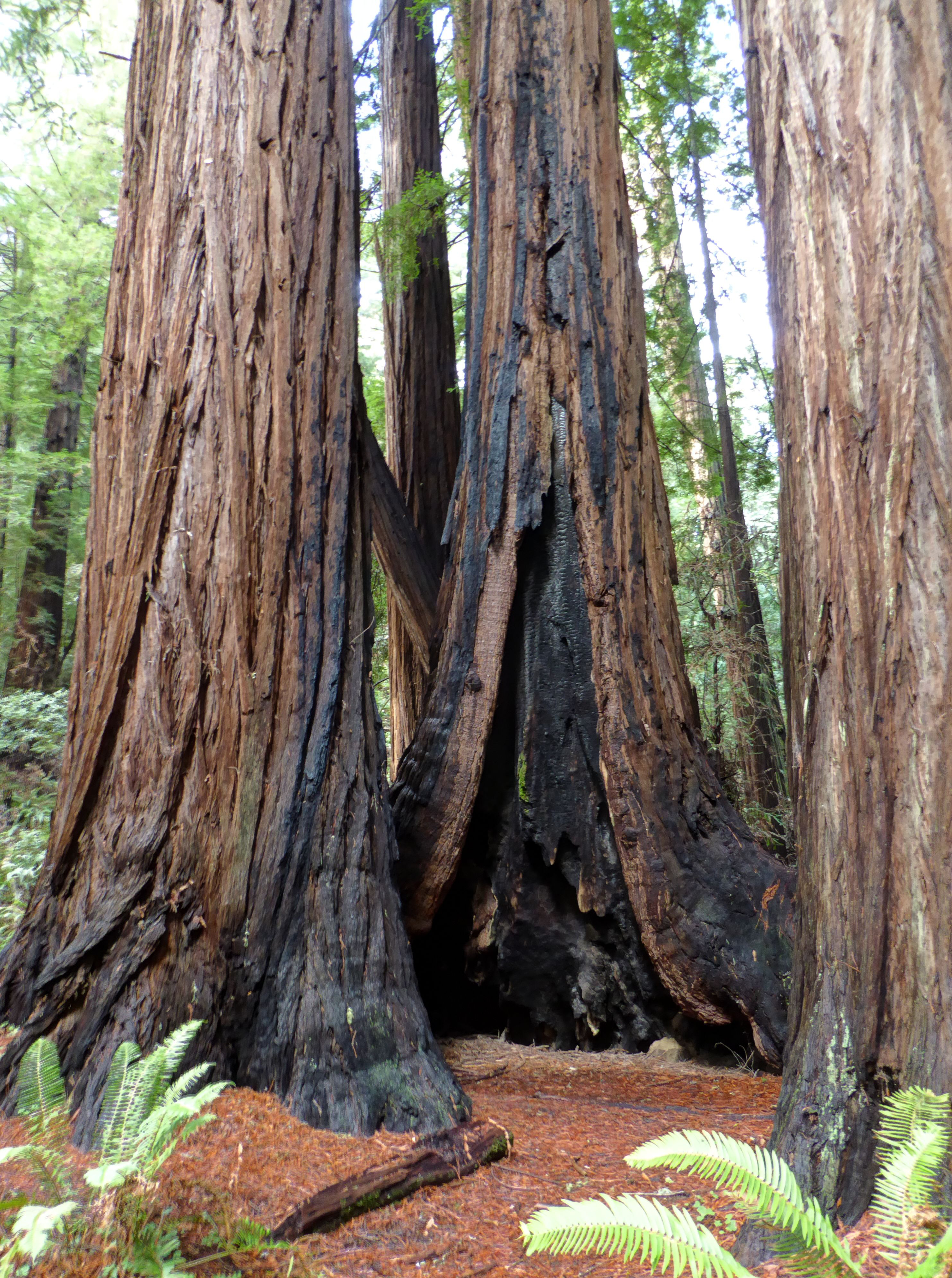
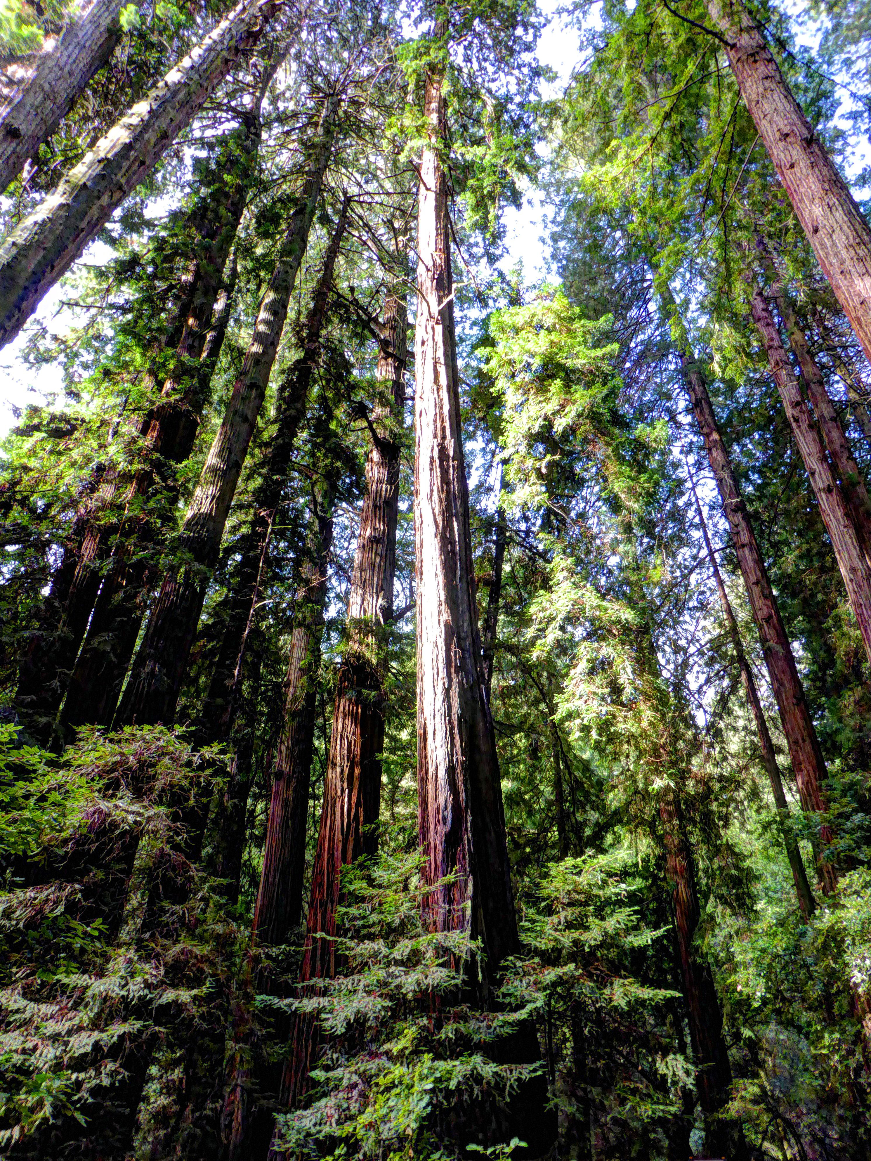
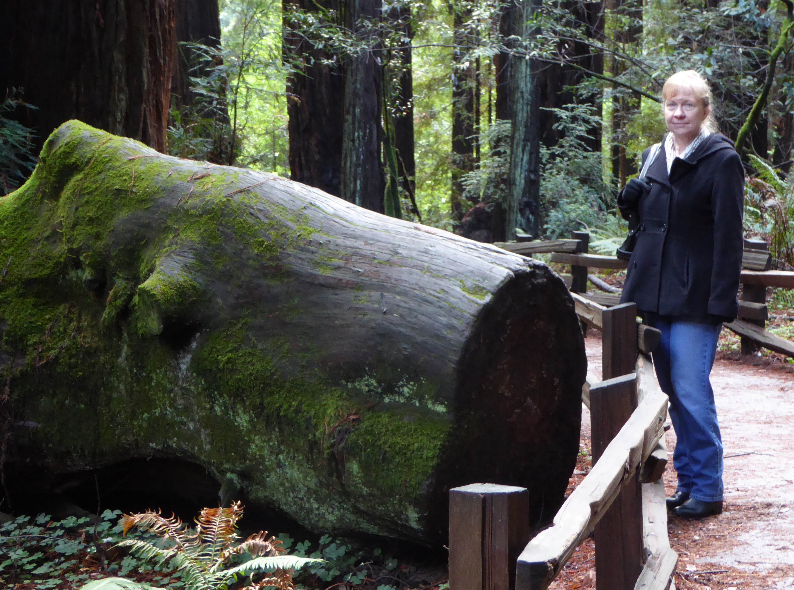
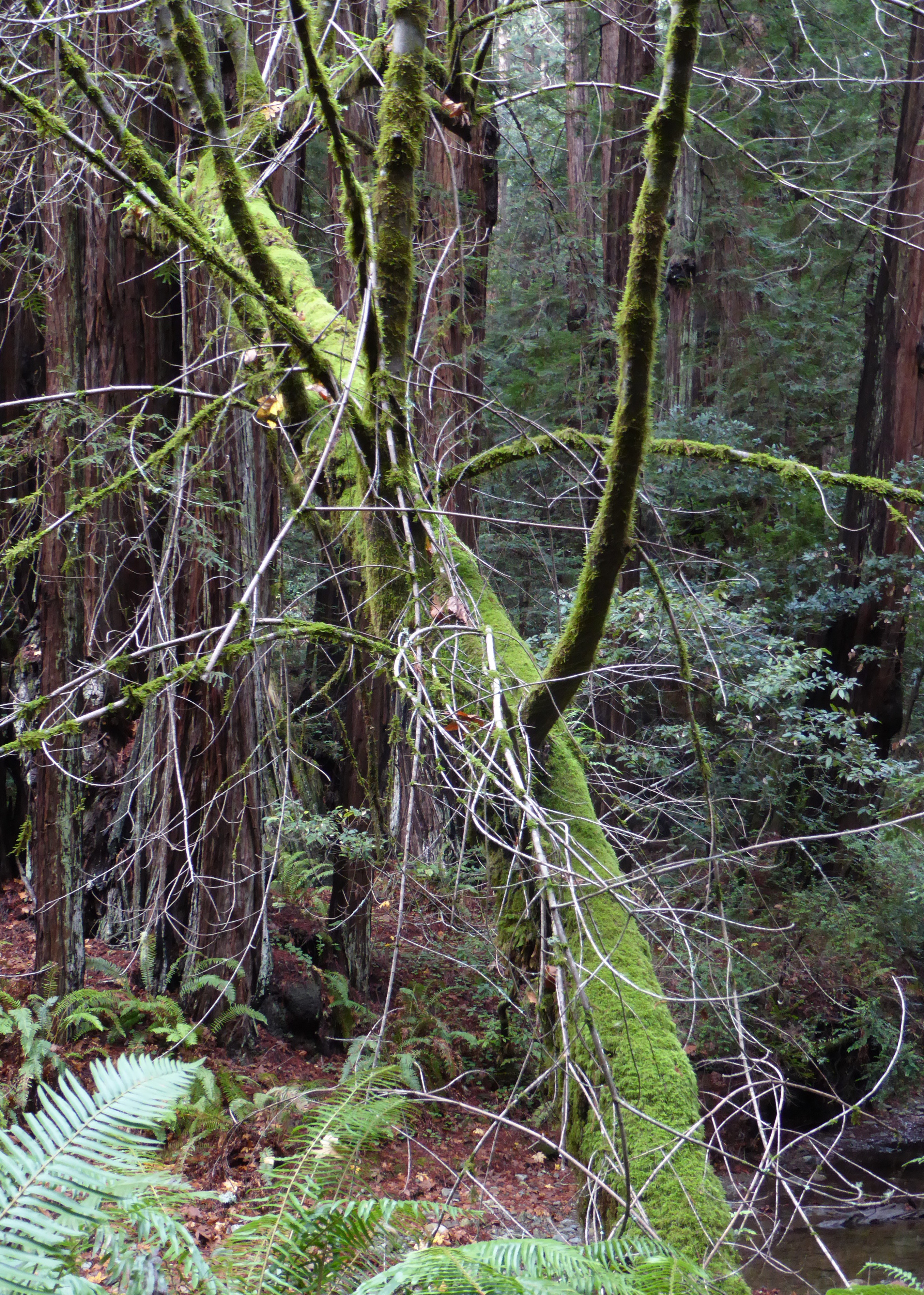
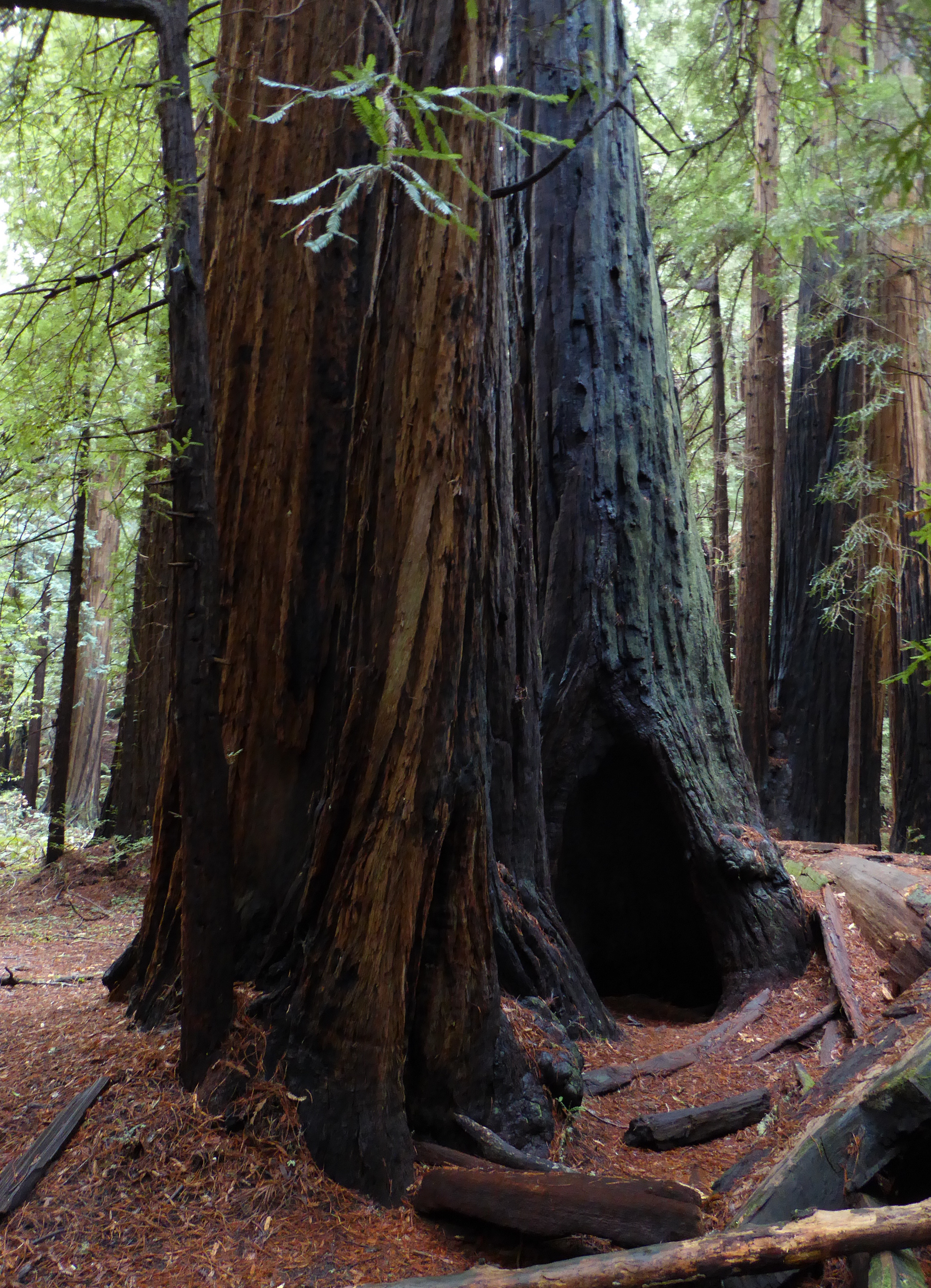
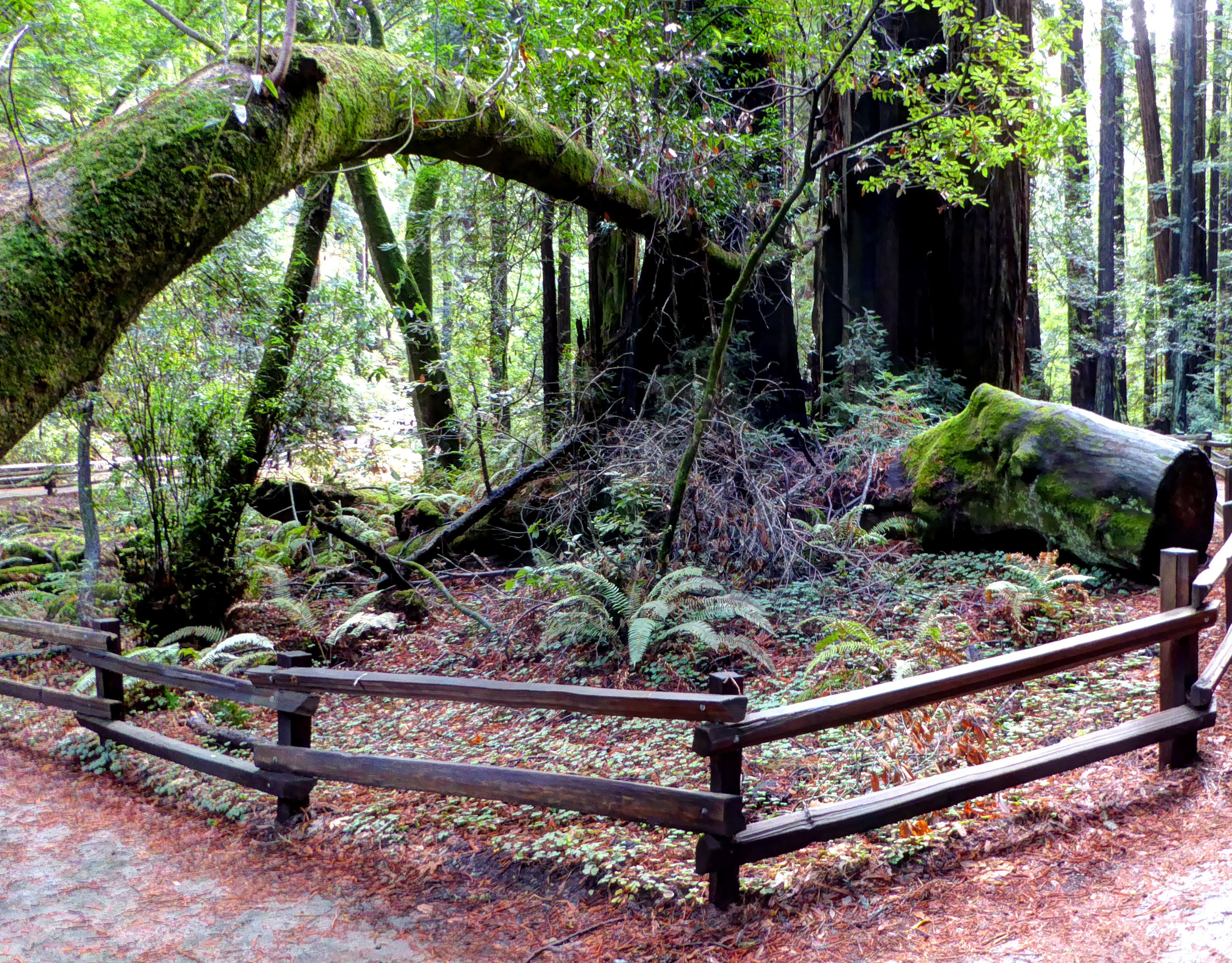
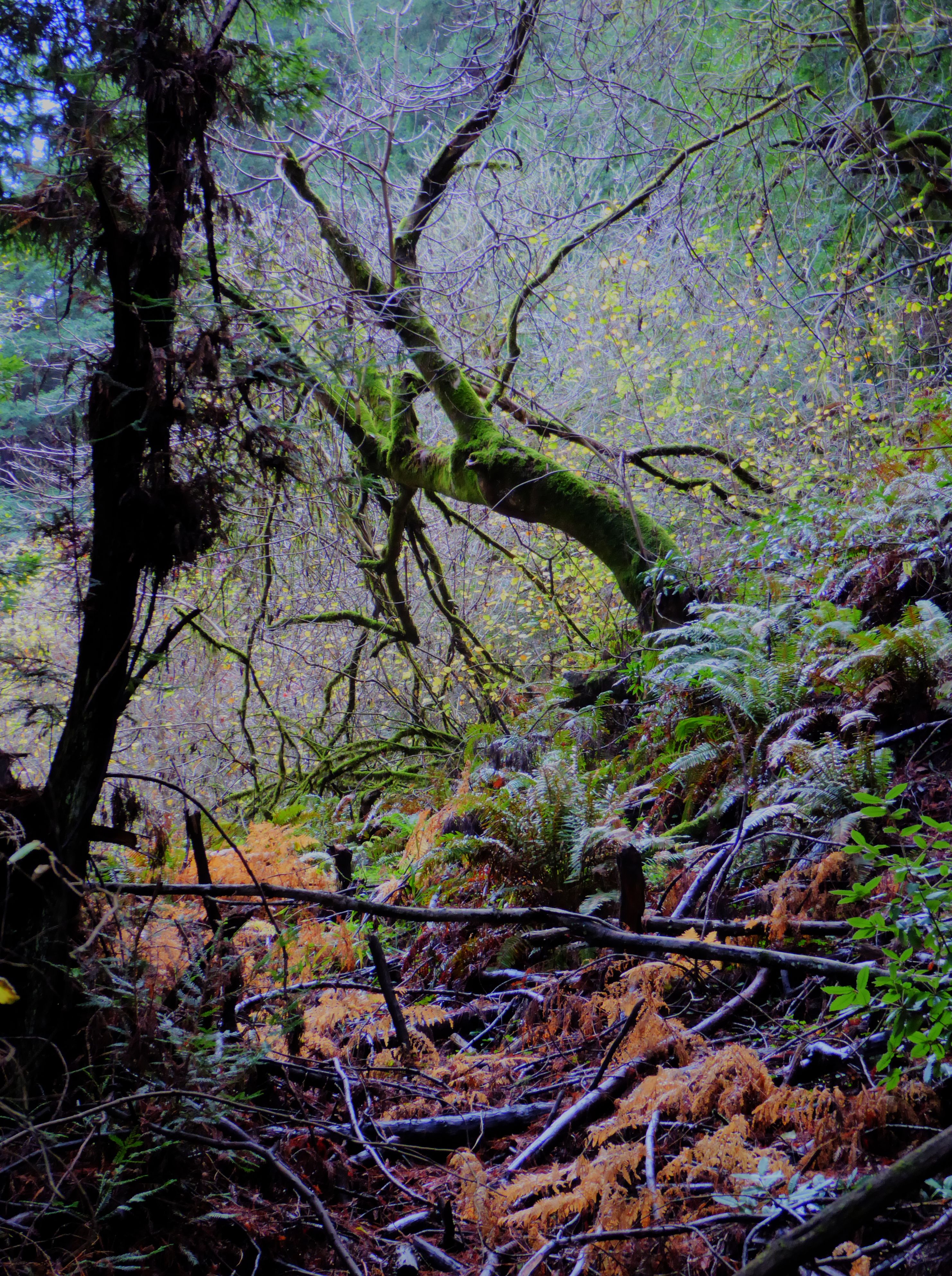
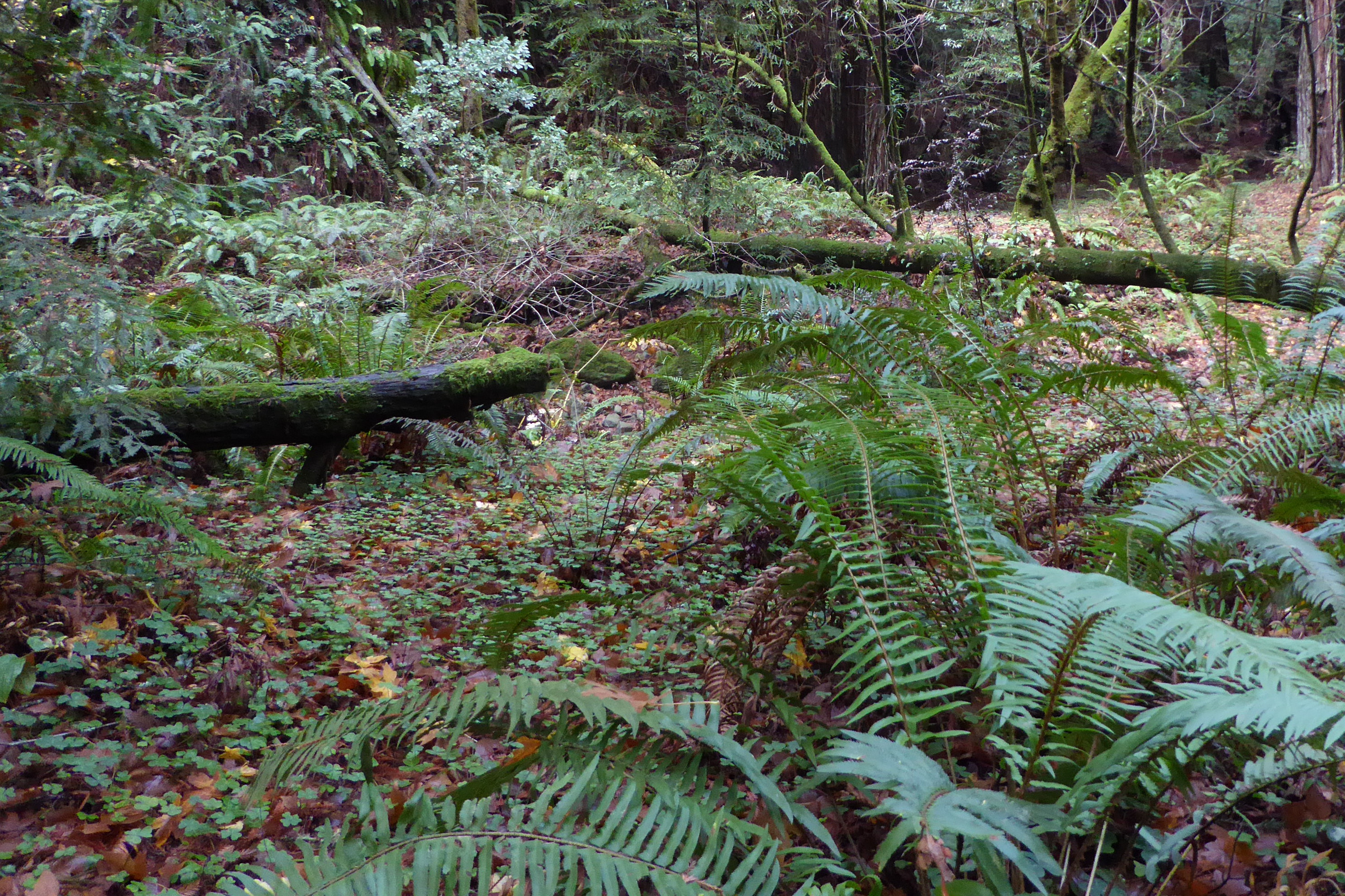
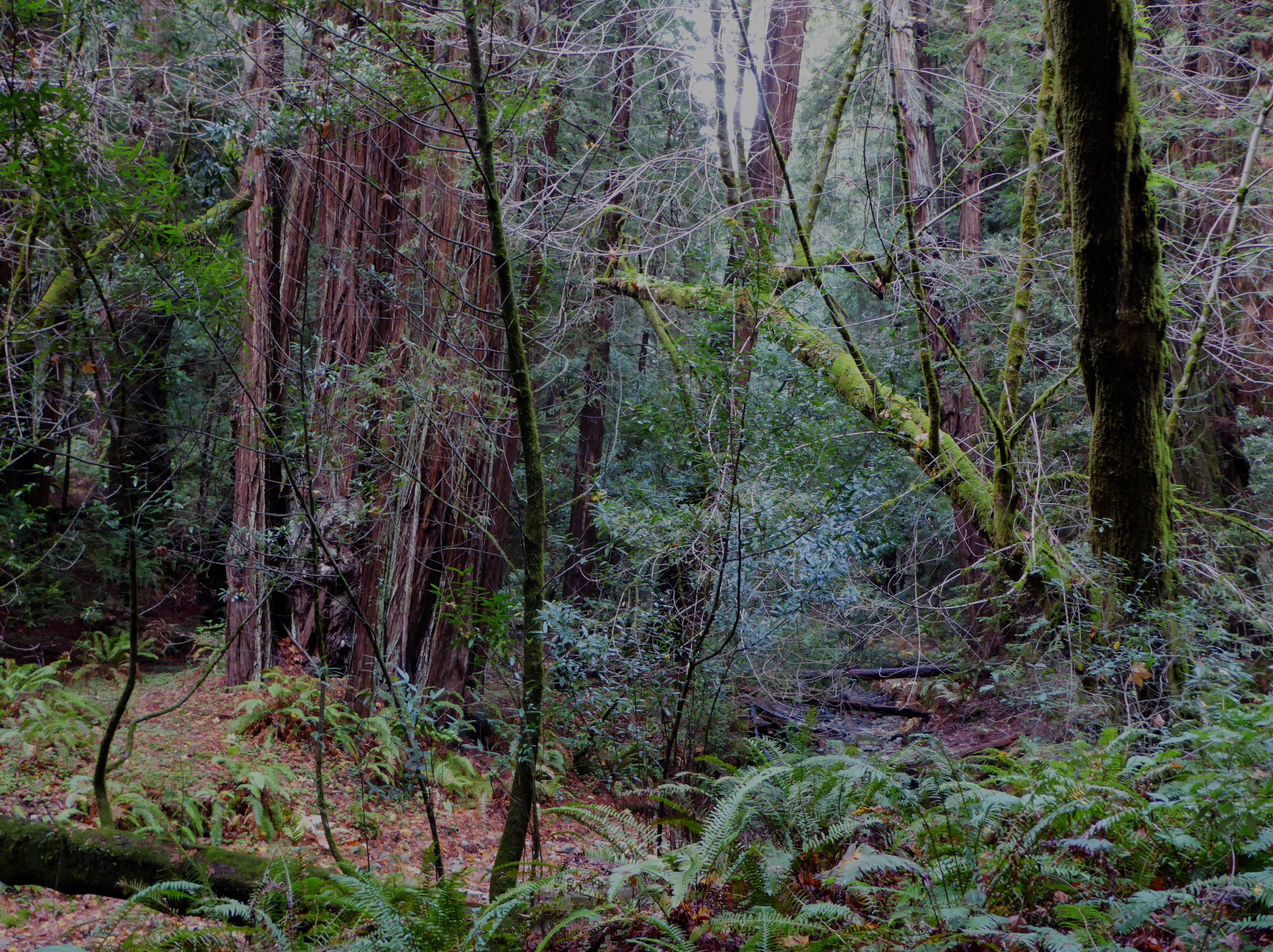
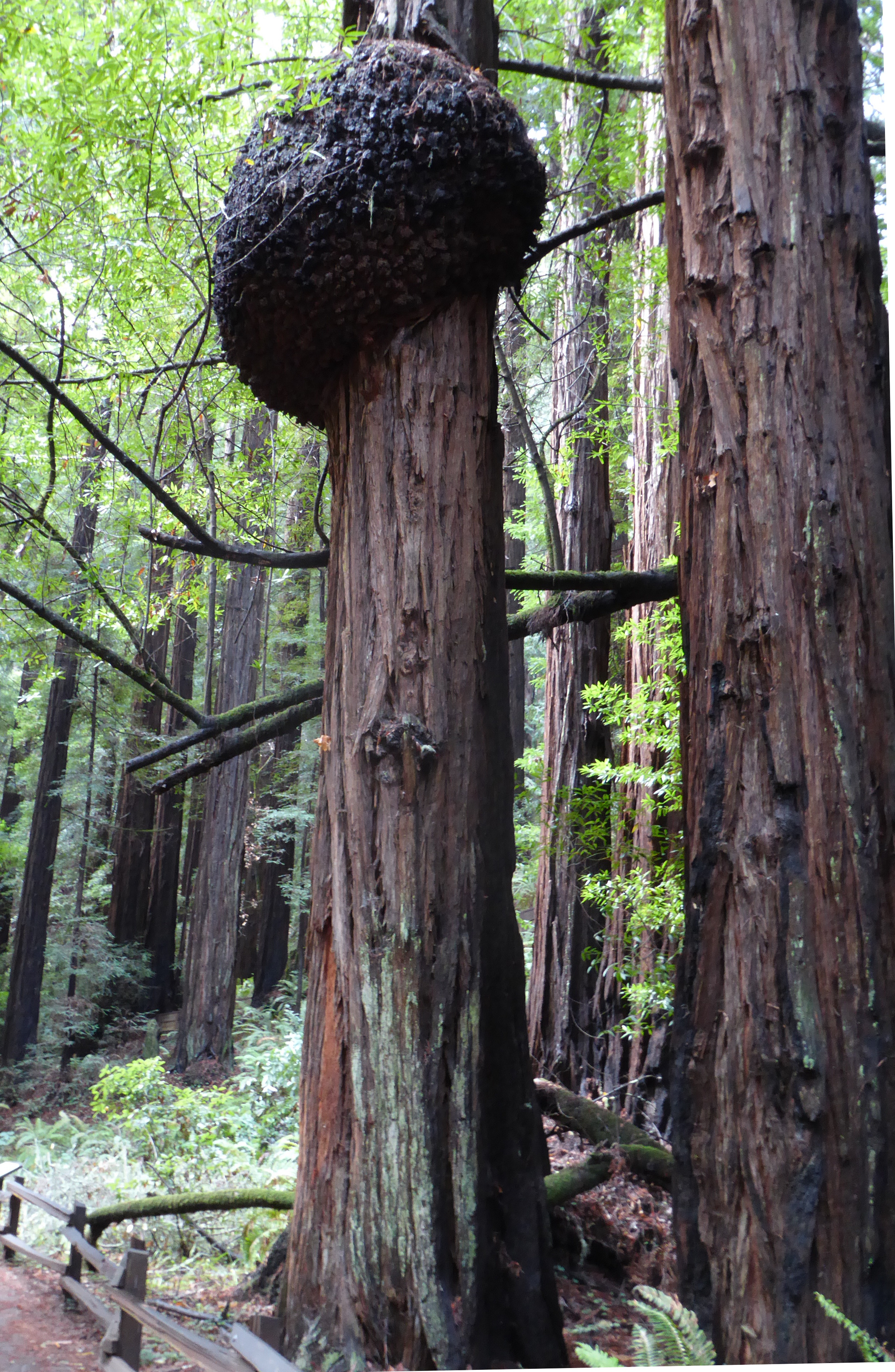
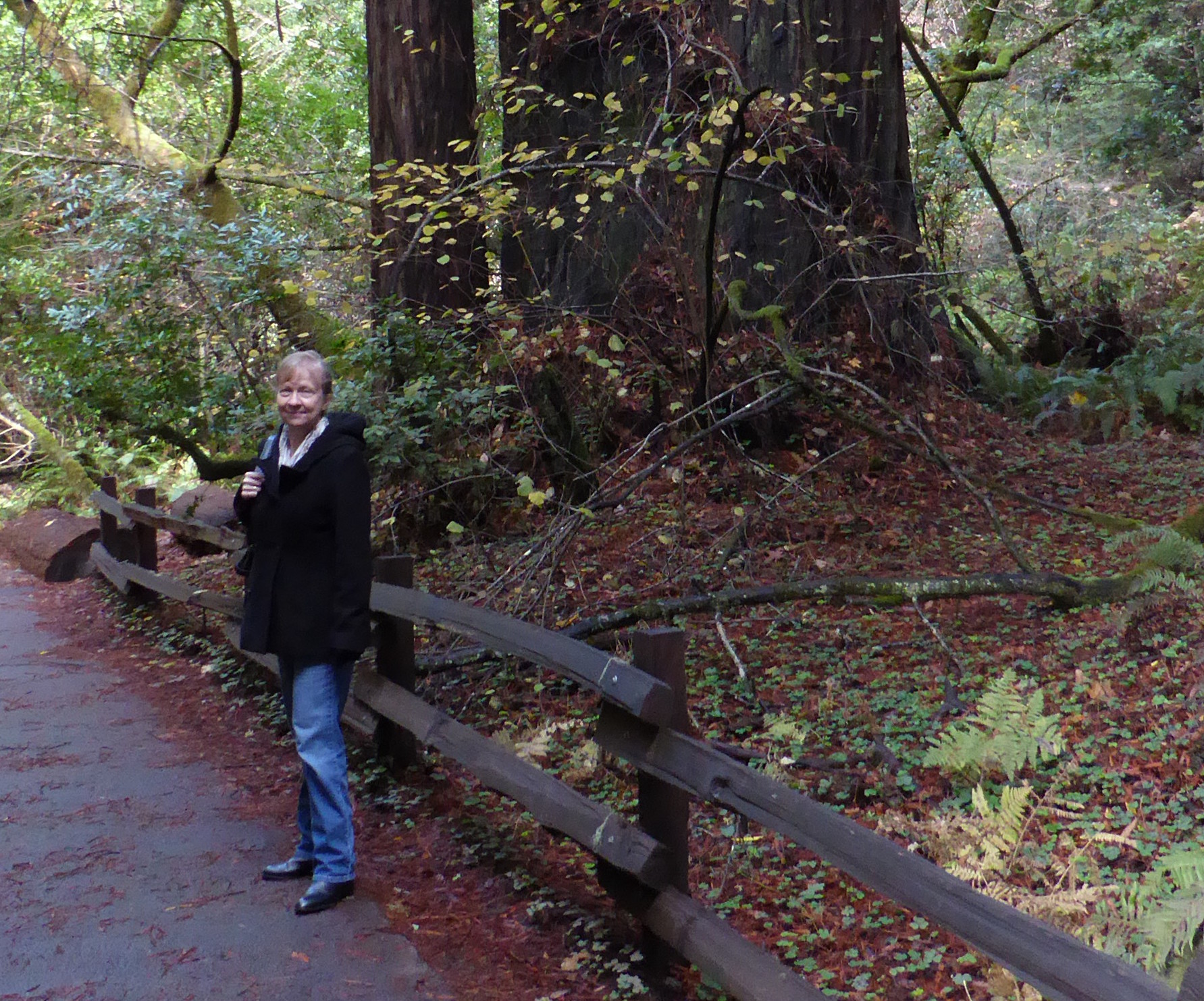
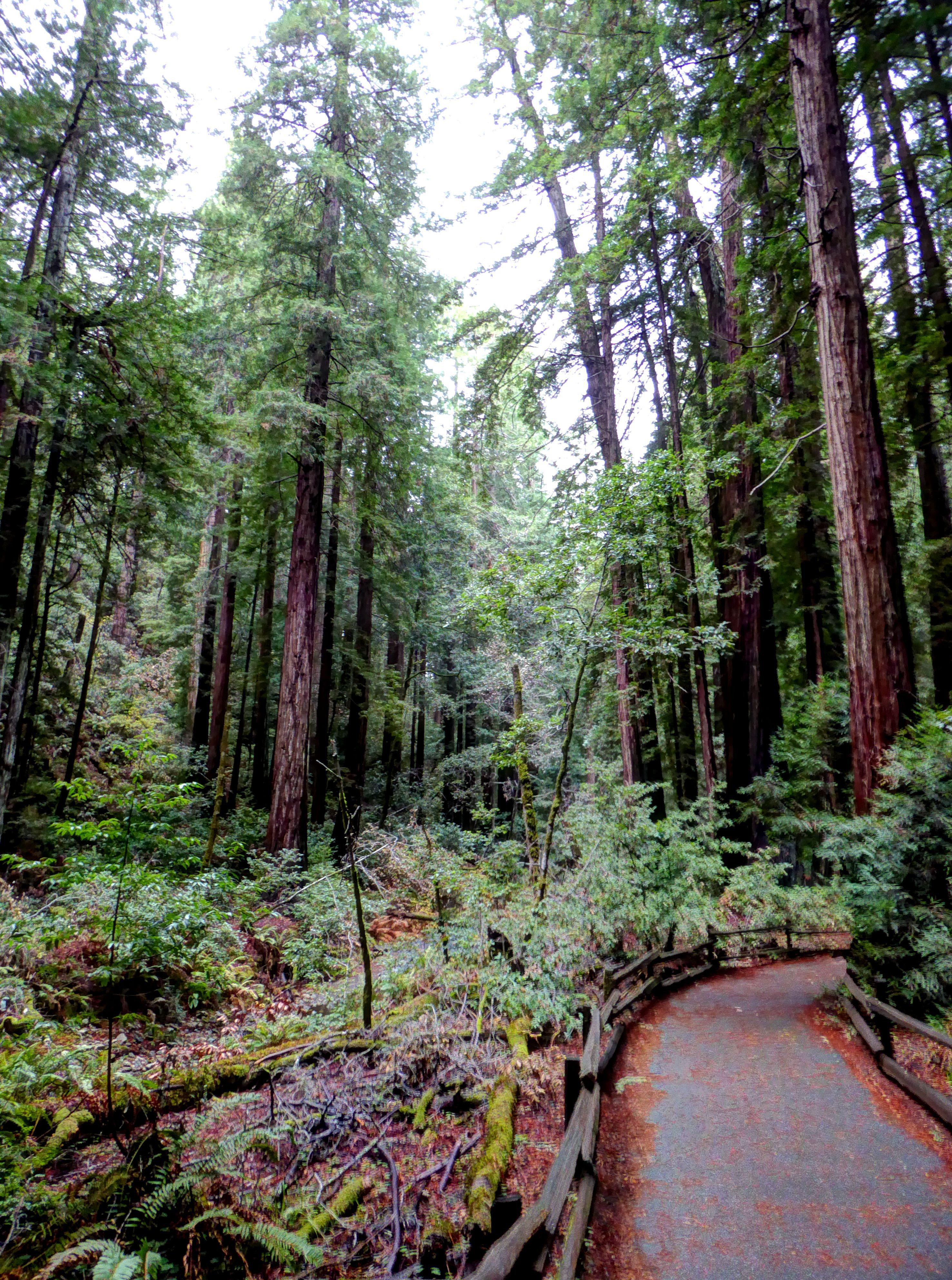
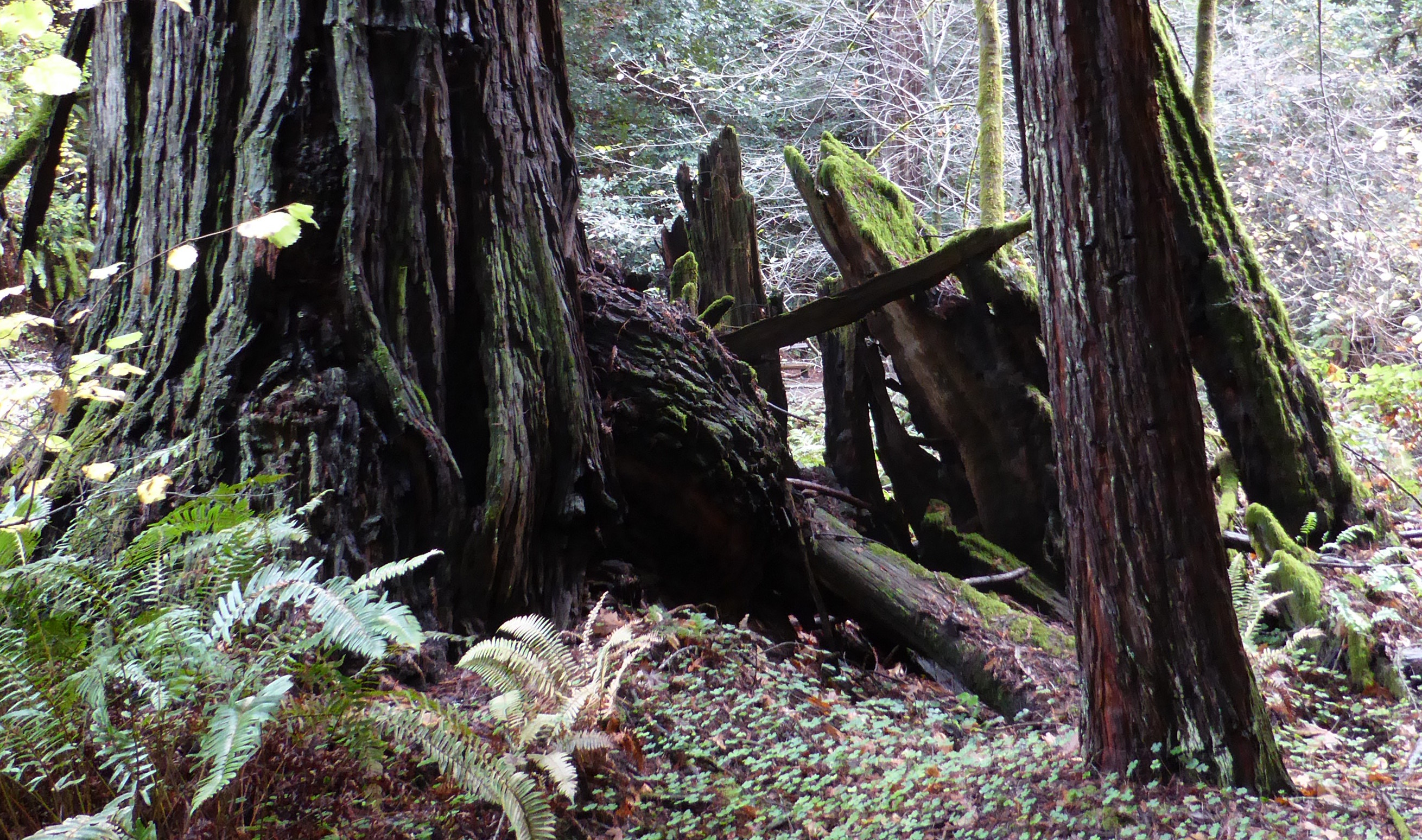
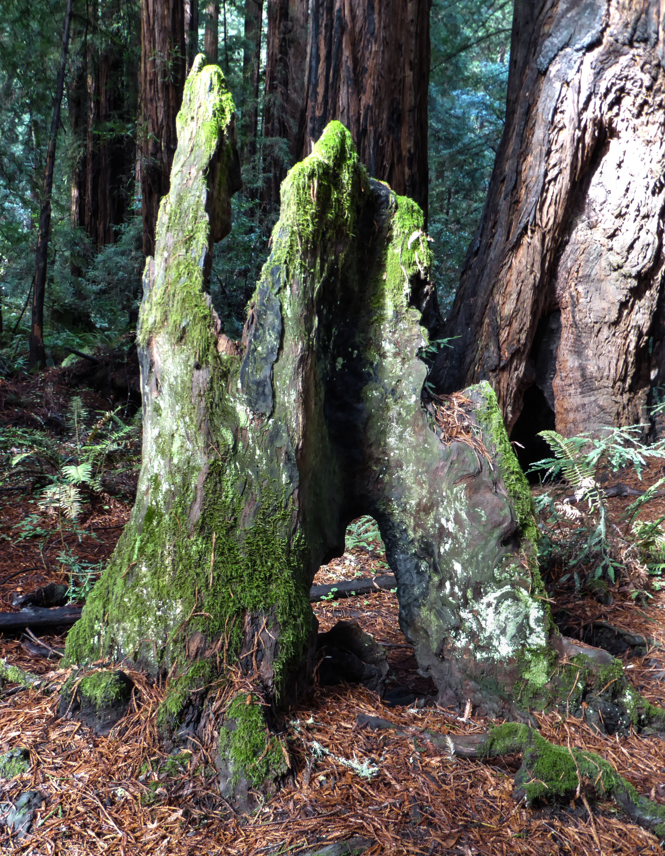
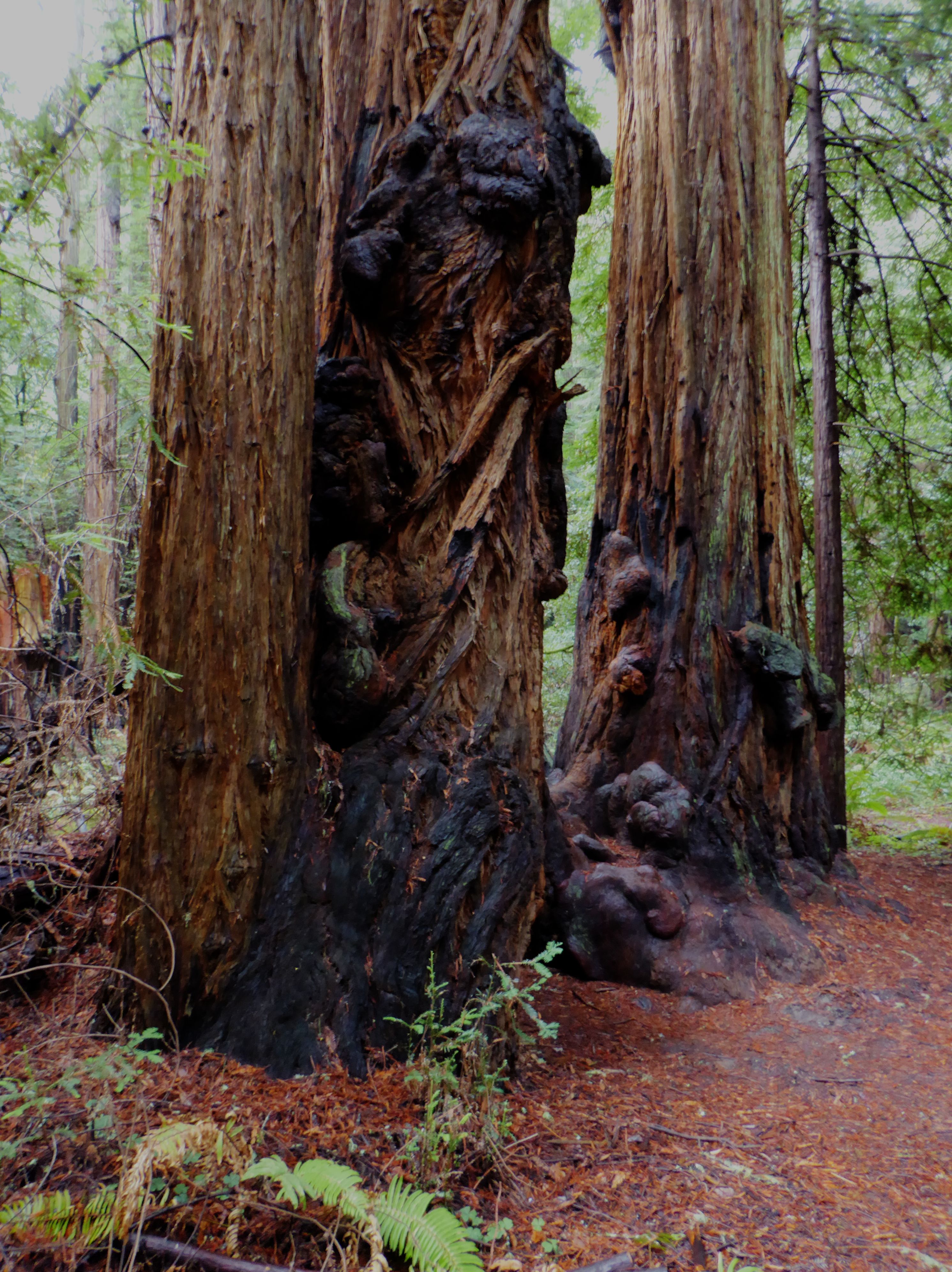
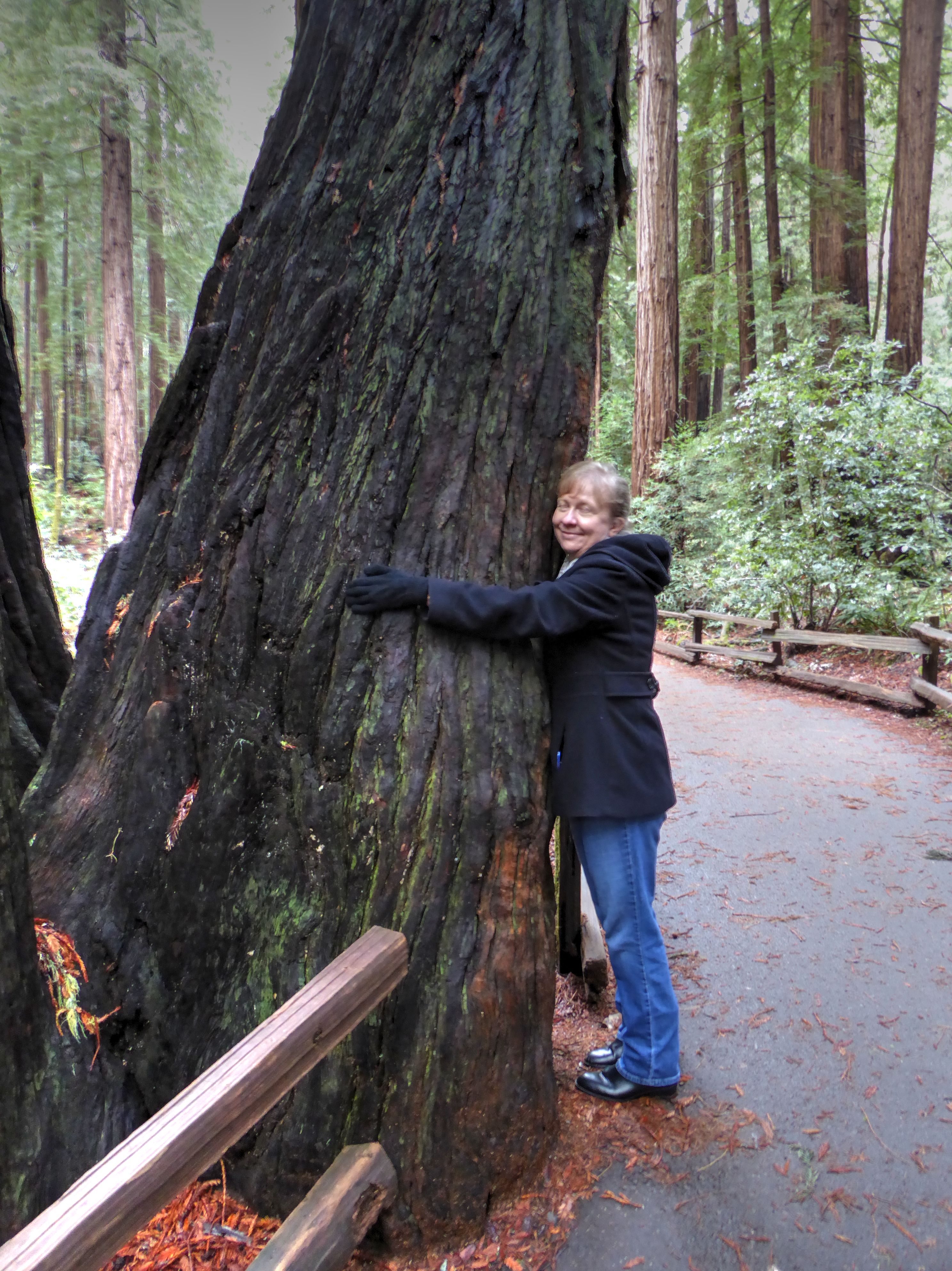
Thoreau wrote “In wilderness is the preservation of the world.” Not far north of the bridge, we arrived at Muir Woods National Monument. This magical area of old-growth redwood forest was named for a pioneer of the movement for environmental preservation.
Redwoods are the tallest and largest trees in the world, some individual trees have been measured to be over 100 meters tall! Nothing gets that big overnight, and most of the redwoods in Muir Woods are said to be 500 to 800 years old, though some are thought to be over 1,000 years old.
OK, now forget the statistics and measurements. It is beautiful, and in spite of all the other tourists, tranquil. It is inspiring. Leave your own tape measure at home. Among the trees you will feel how massive they are.
The forest was so impressive that I have dedicated a separate post here to photos from our visit.
Although we originally had thoughts of also going to Big Basin Redwoods State Park, Sequoia National Park, or even just a leisurely drive down highway 1 along the coast, we had little time, and a long drive just to reach our hotel in Santa Maria. So, leaving Muir Woods behind, we guided the rental car through the hilly madness of the streets of San Francisco and worked our way south on highway 101. After spending the night in Santa Maria we drove to Santa Barbara to drop off the rental car.
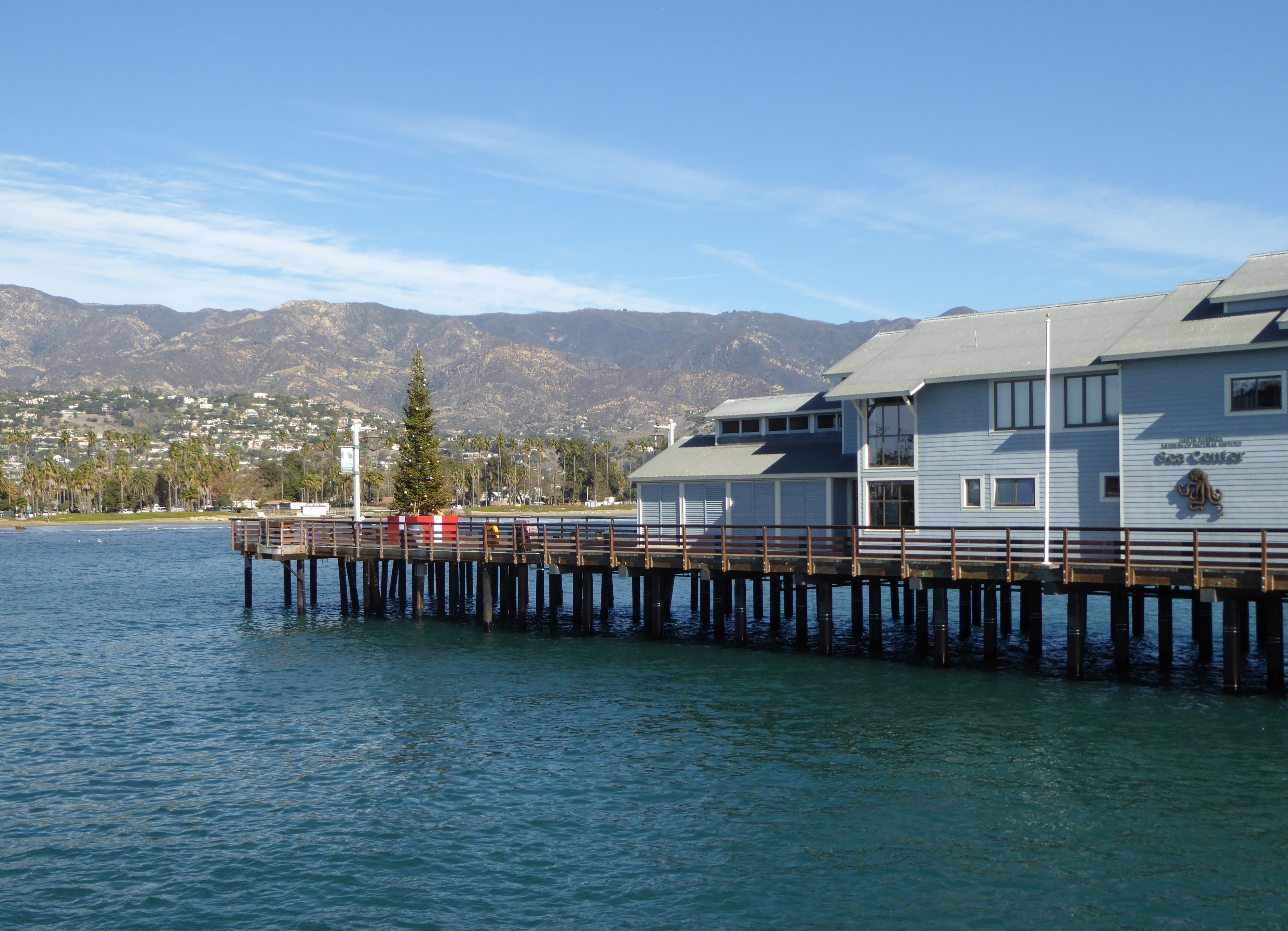
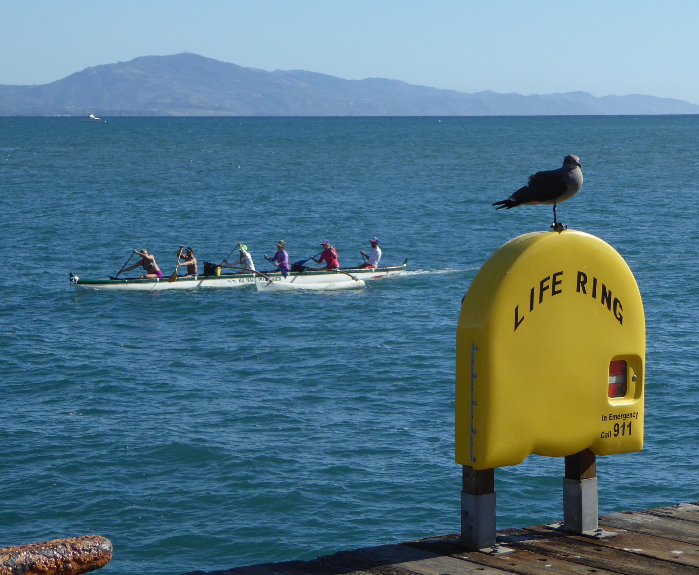
Santa Barbara
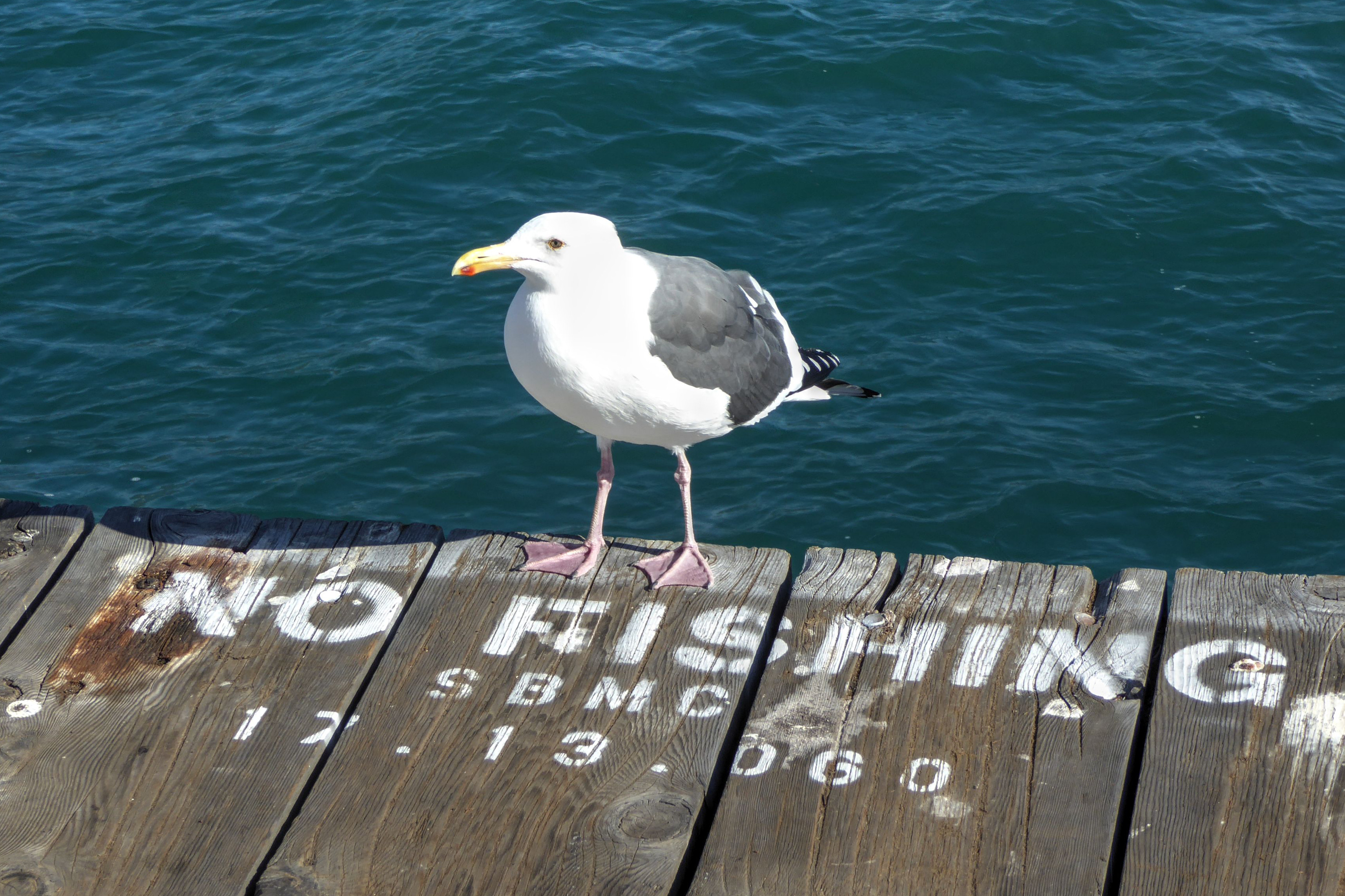
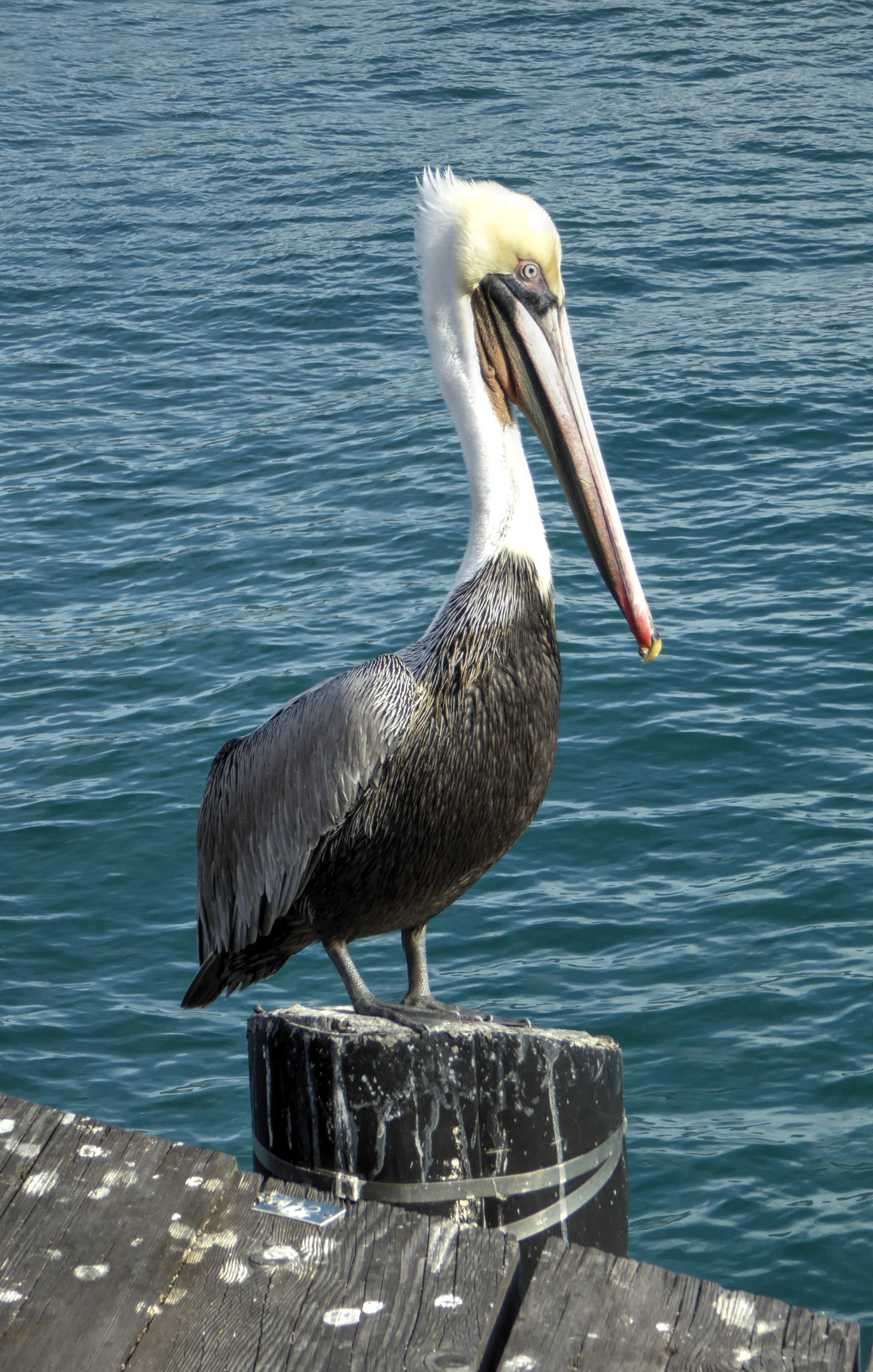
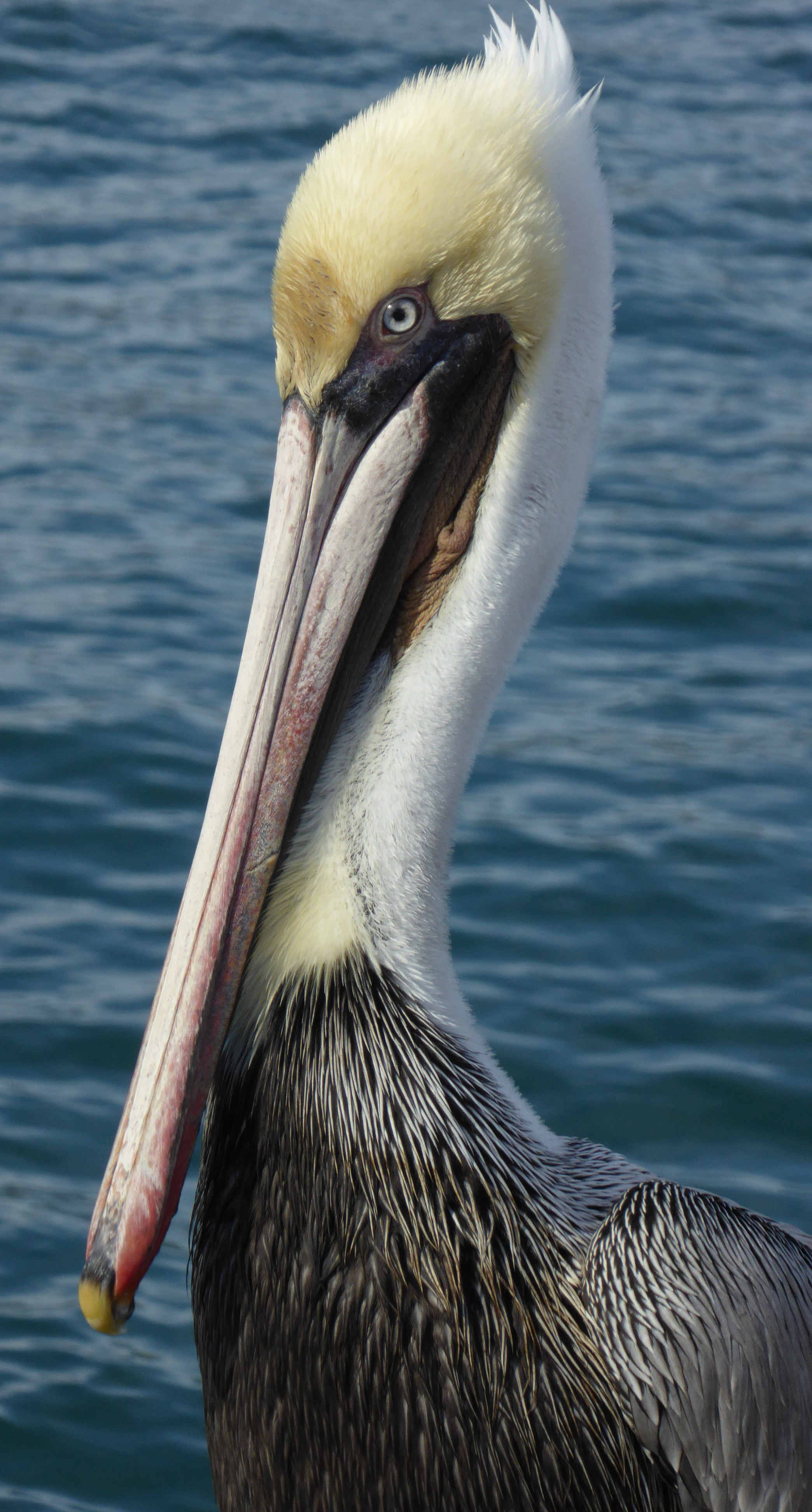
We had a few hours before our train to Los Angeles, so we ate breakfast and then walked out on Stearns Wharf to admire the view of the ocean, seabirds, and in the distance, the Channel Islands.
Prohibited from seeking his own food, this gull has been relegated to panhandling tourists. 🙂
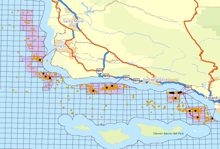
The unmistakable silhouettes of off-shore oil rigs are visible between the coast an the islands. In 1969 a huge oil spill fouled the channel and beaches, and killed numerous seabirds and marine animals. At the time it was the worst spill in U.S. waters (although now it is number 3 behind the Exxon Valdez and Deep Water Horizon disasters).
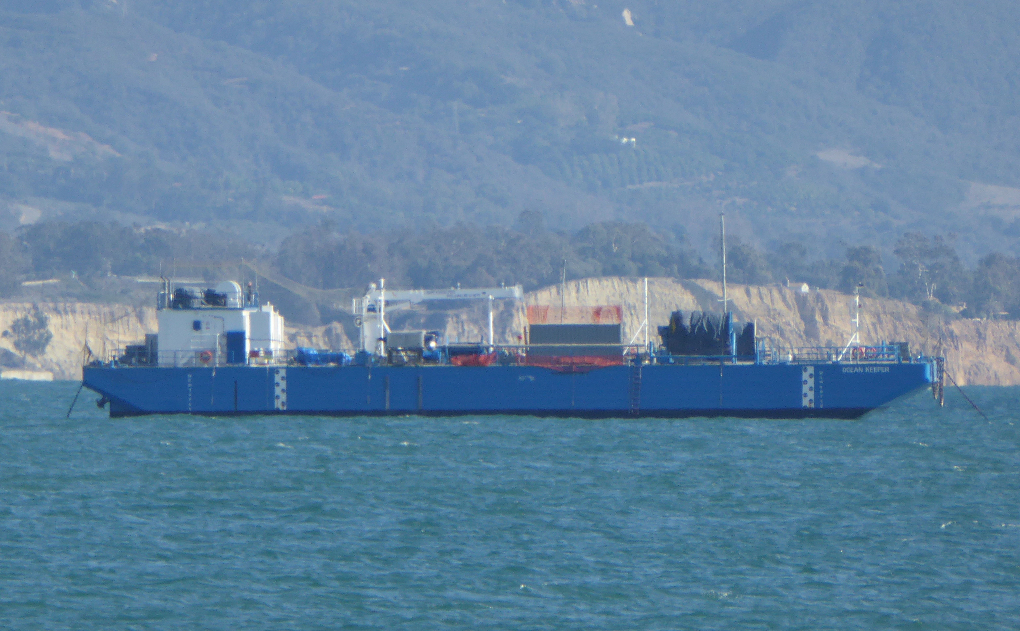
In anticipation of any future problem, anchored close to shore floats the “Ocean Keeper”, an oil recovery vessel.
Map of area offshore oil rigs (from cccarto.com)
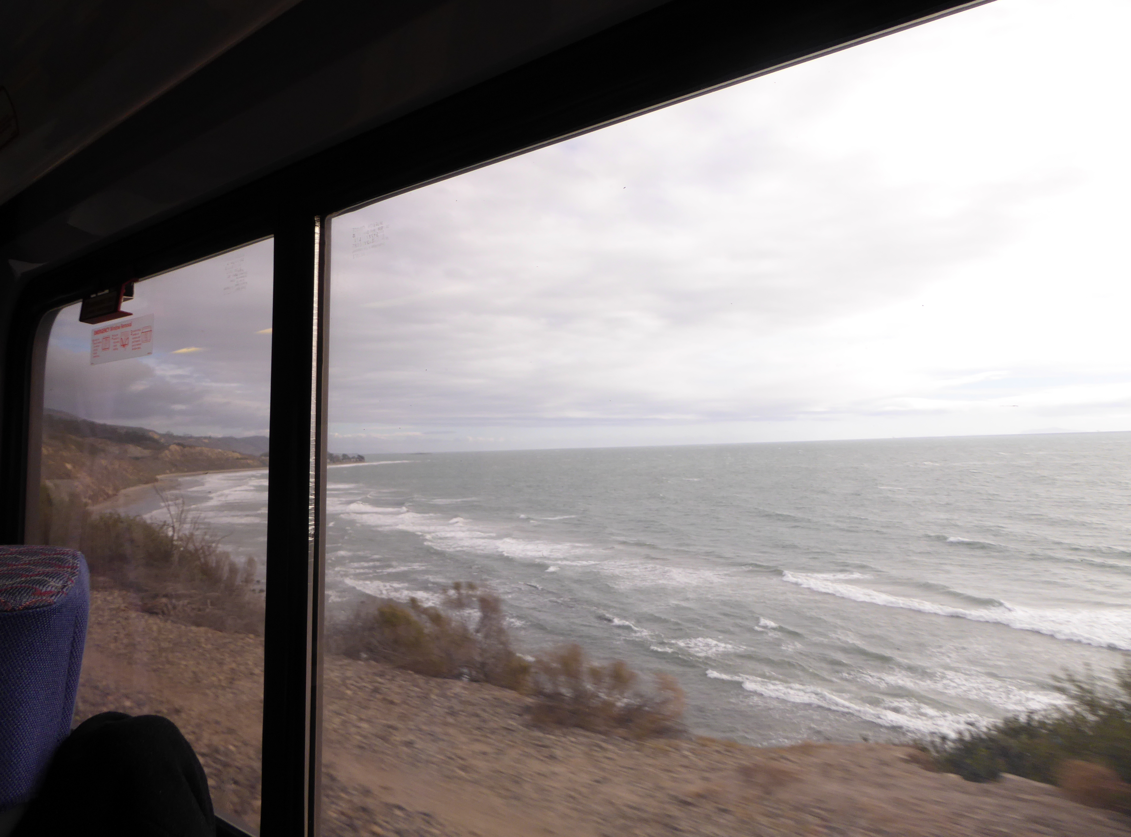
We left Santa Barbara on Amtrak’s “Pacific Surfliner” headed south.
The ride included occasional views of the coast.
Los Angeles
It was dark by the time we reached Union Station in L.A. We left our bags in the passenger lounge check area, and a short walk took us to the large plaza at the south end of Olvera Street. A small band on a stage provided music as a score of couples in their 70s and 80s danced in that shuffling way old people in love do. A gentle rain did not dampen anyone’s spirit. It was so romantic and uplifting. I wanted to cry it was so sweet. After the band finished and passed the hat, we slowly worked our way down Olvera street in search of dinner. This is a pedestrian street, its center housing a series of small stalls selling a variety of hats, t-shirts, dresses, handbags, and crafts.
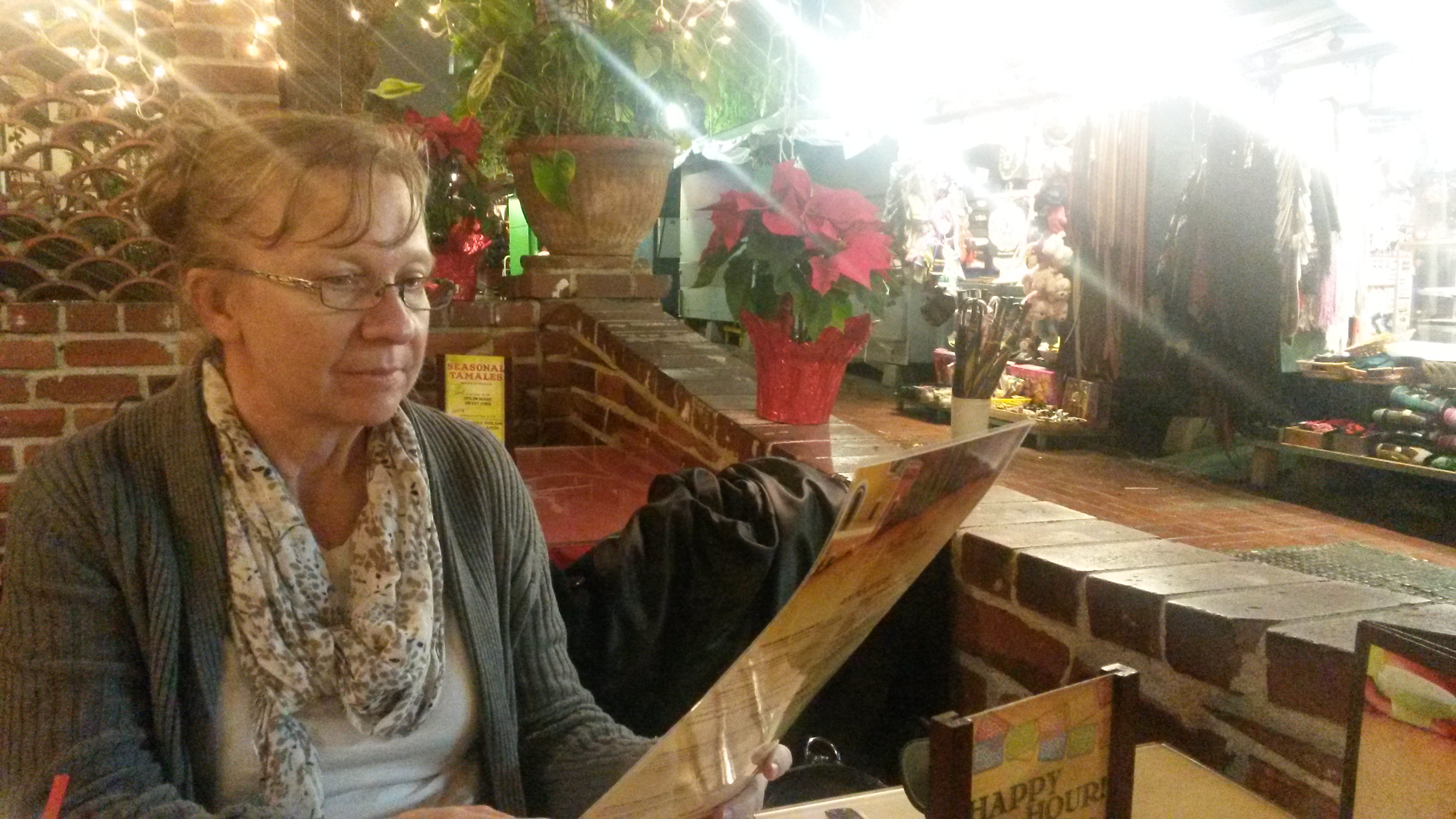
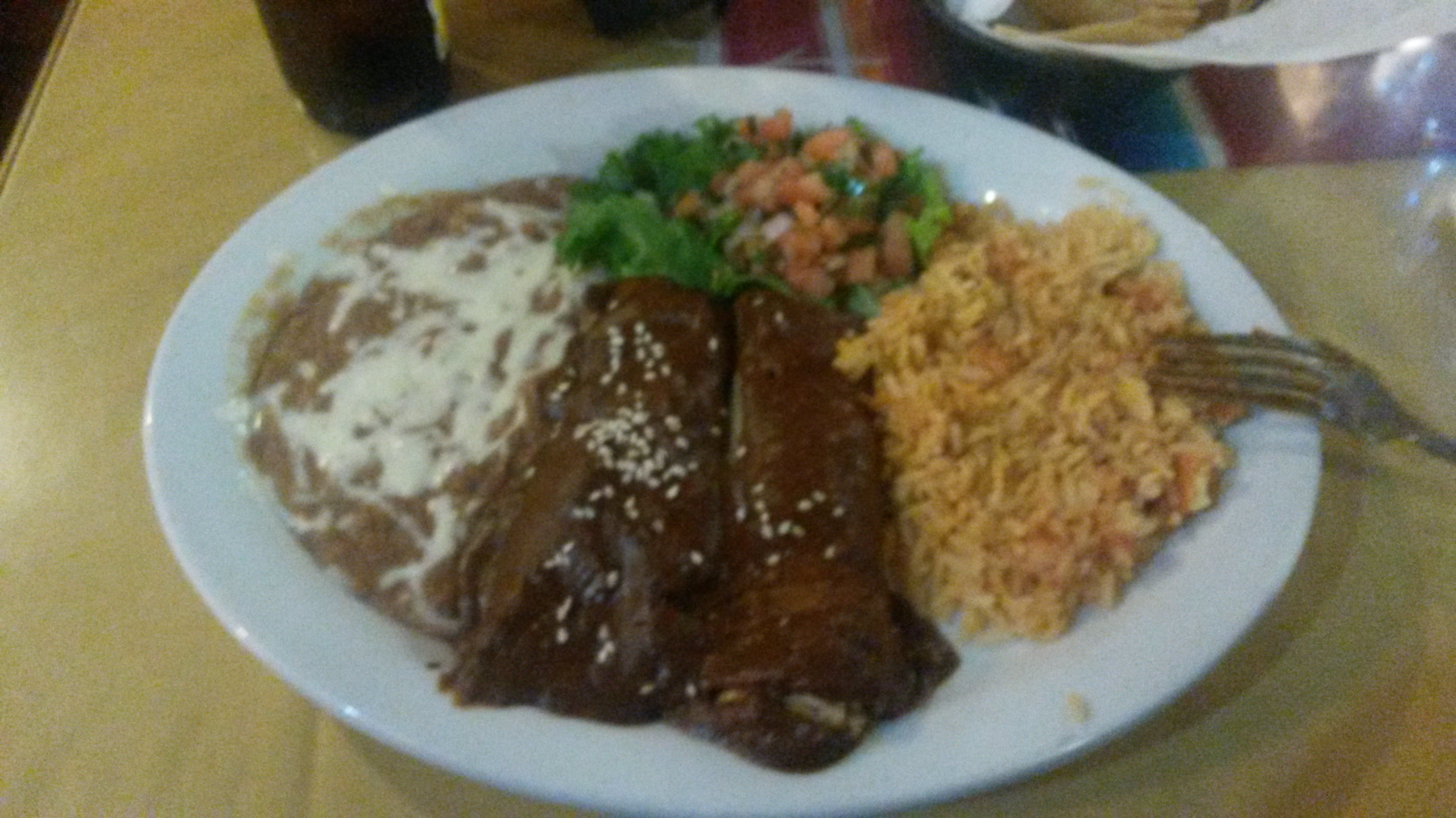
The rain increased, and we had to decide fast where to eat. Clearly the best candidate eatery was a small hole in the wall restaurant bustling with activity, tables crammed close together. But, with the rain we didn’t want to wait for a table.
So we opted for a (pricier!) tranquil place with an available patio table next to the street, under an awning with radiant heaters above. Ahhh… it was cozy, romantic, and the food was great!
After a relaxed meal, umbrellas up, we headed back to the station. Our train, the Sunset Limited, left at 10:00 pm headed for New Orleans.
Sunset Limited
Years ago this train linked the east and west coasts of the country, traveling from Los Angeles to Orlando, Florida. In the aftermath of Hurricane Katrina, Amtrak dropped the New Orleans to Orlando segment. The train only runs three times a week.
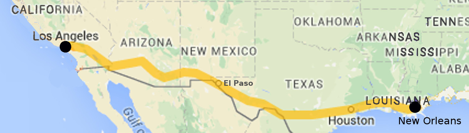
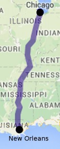
Los Angeles to New Orleans
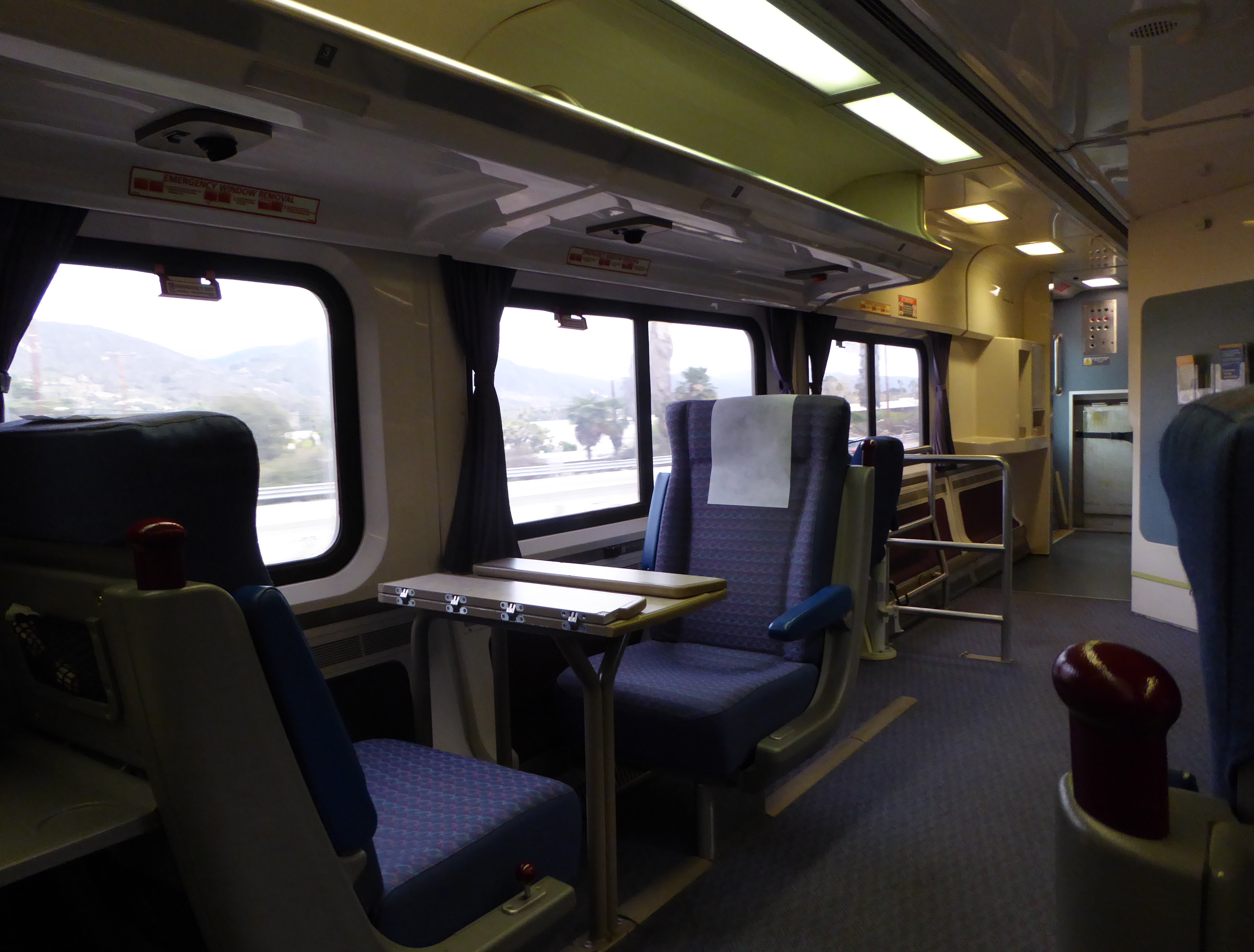
The journey from California to “The Big Easy” in Louisiana covers almost 2,000 miles (3,200 Km), and involves two nights on the train. (Trains in the United States are not fast, and the maximum speed on this is only 80 mph)
El Paso Train Station
For me the high point is the segment that almost touches the border with Mexico near El Paso, Texas. You can look out the window and look into another country, see people working, and children playing.
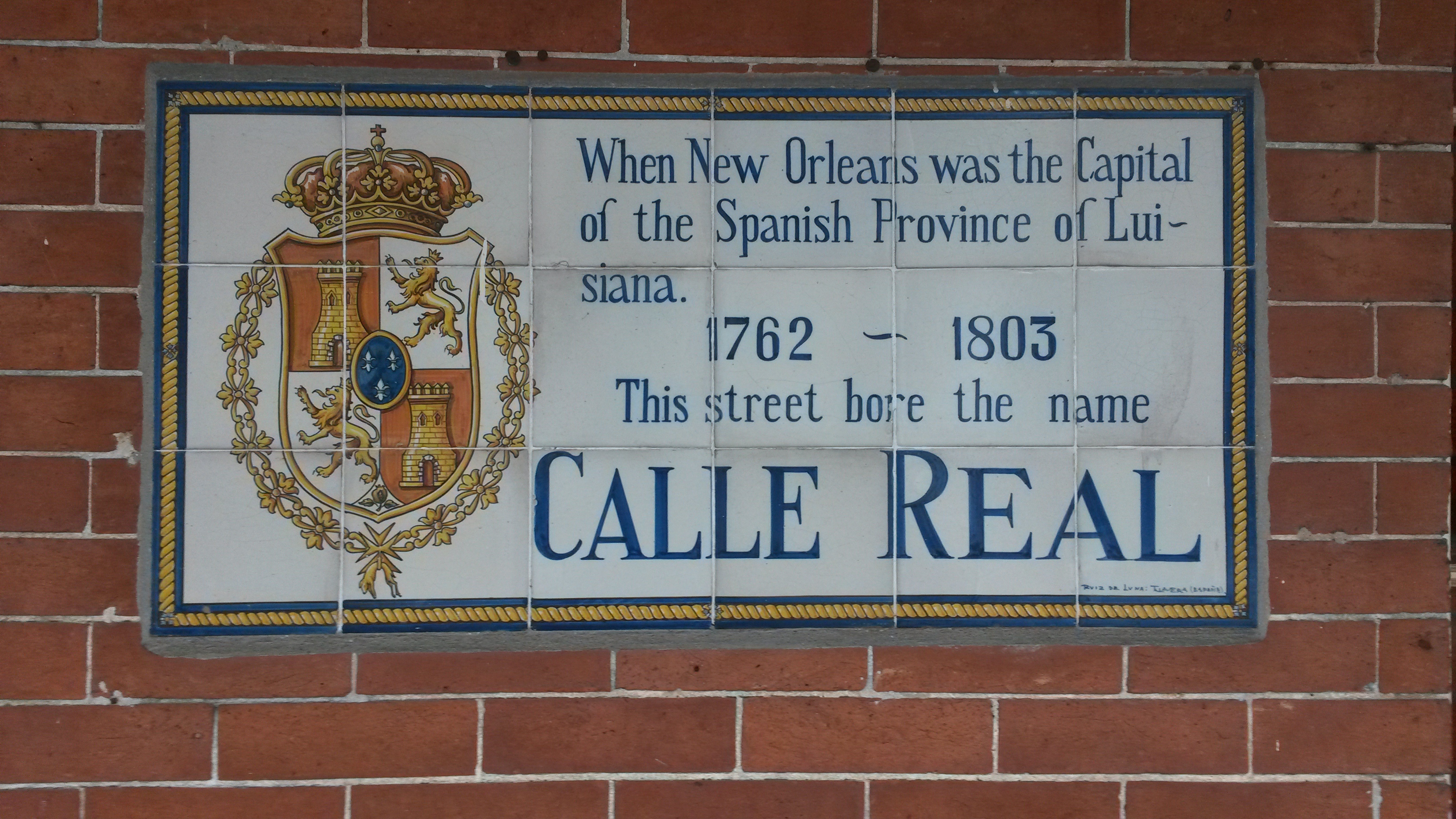
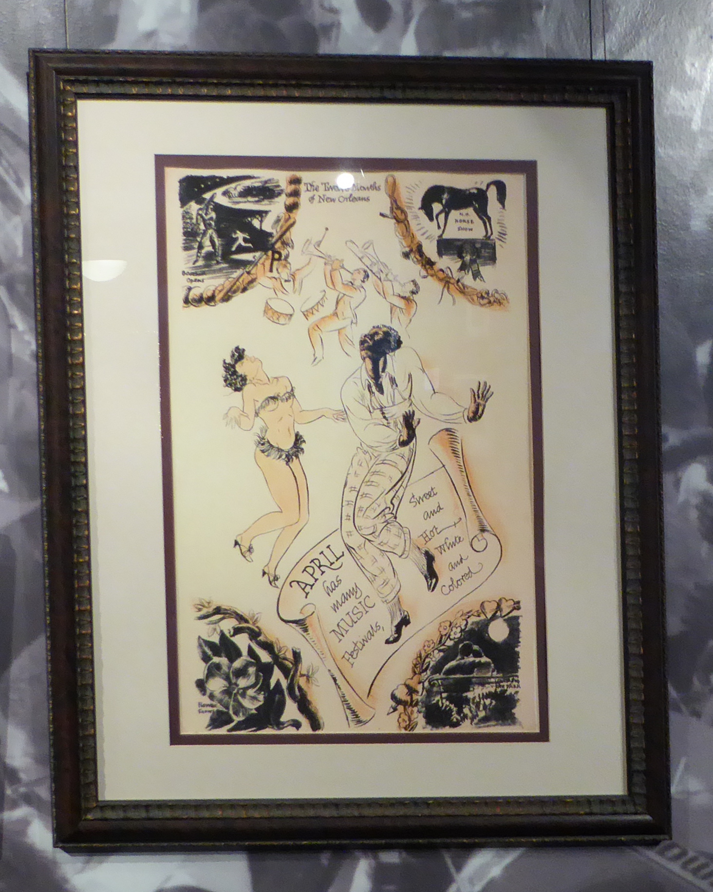
New Orleans
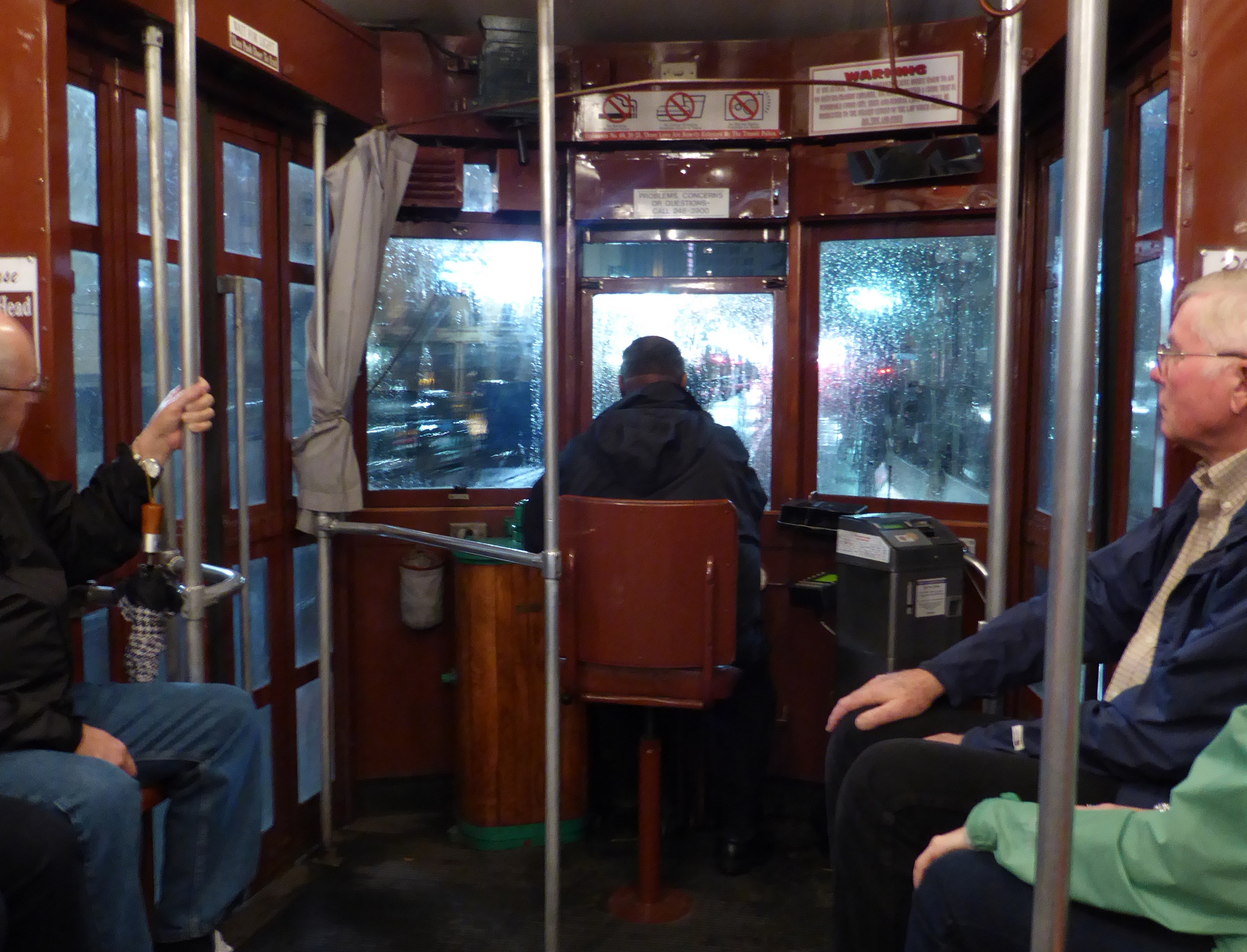
Night ride on the streetcar in the rain
On previous visits, we’ve stayed in the Garden District and the French Quarter. This time we chose a hotel near Lafayette Park, about 8 blocks from the train station. Our quarters were right on the St. Charles streetcar line, so it was easy to move around.
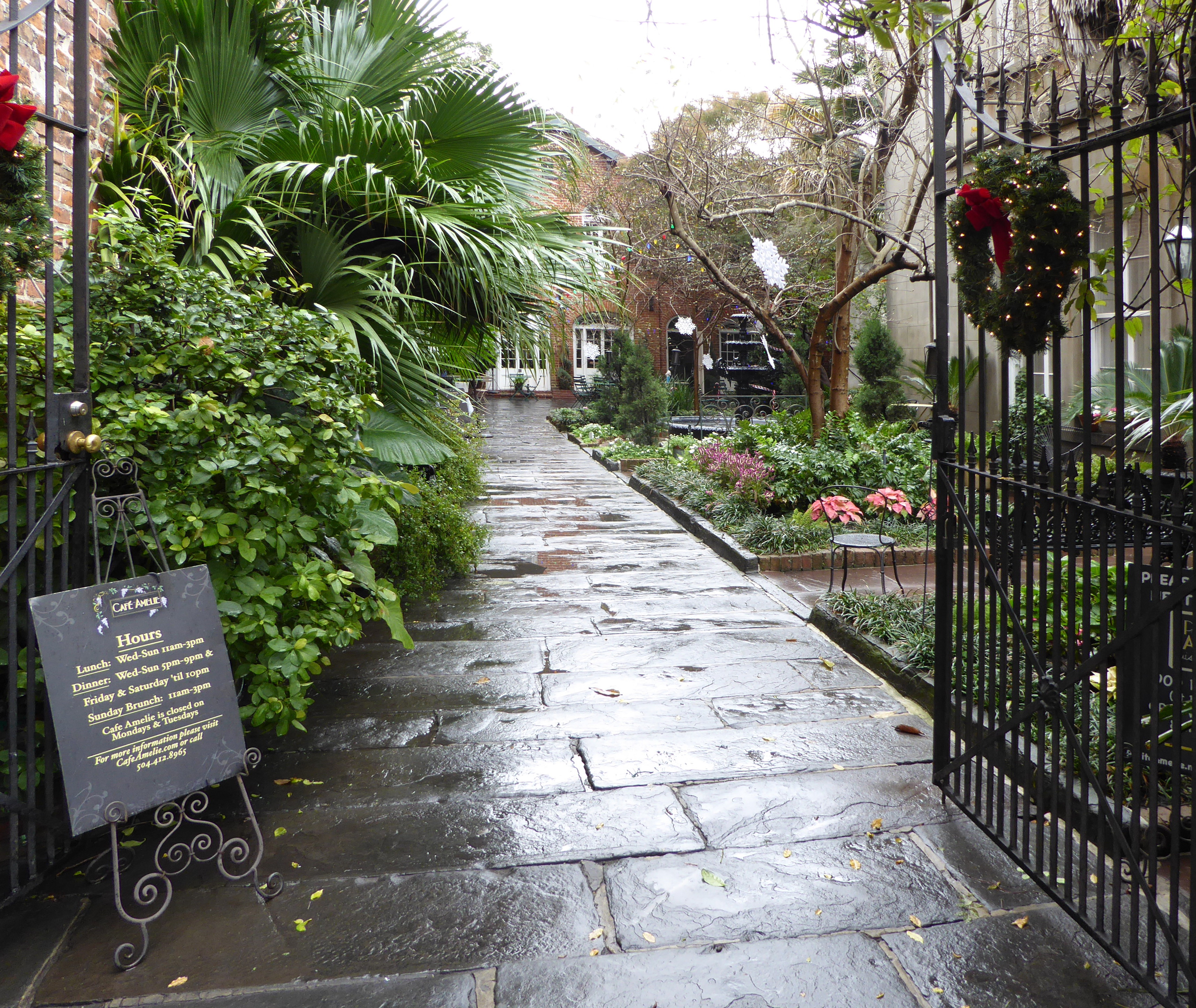
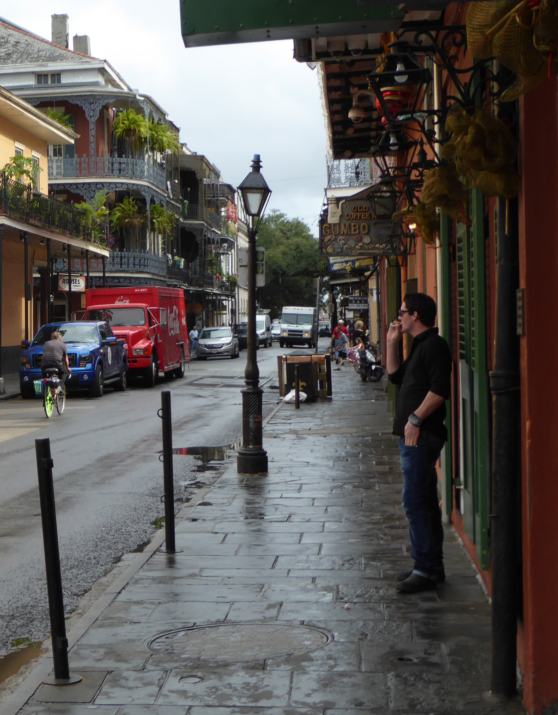
Walking around town
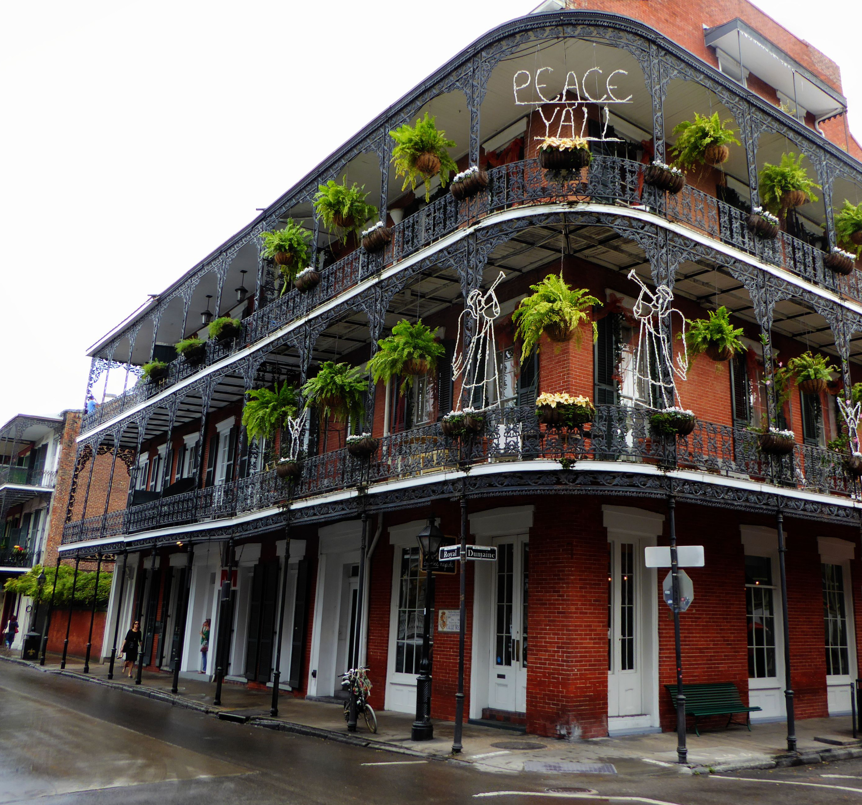
PEACE Y’ALL
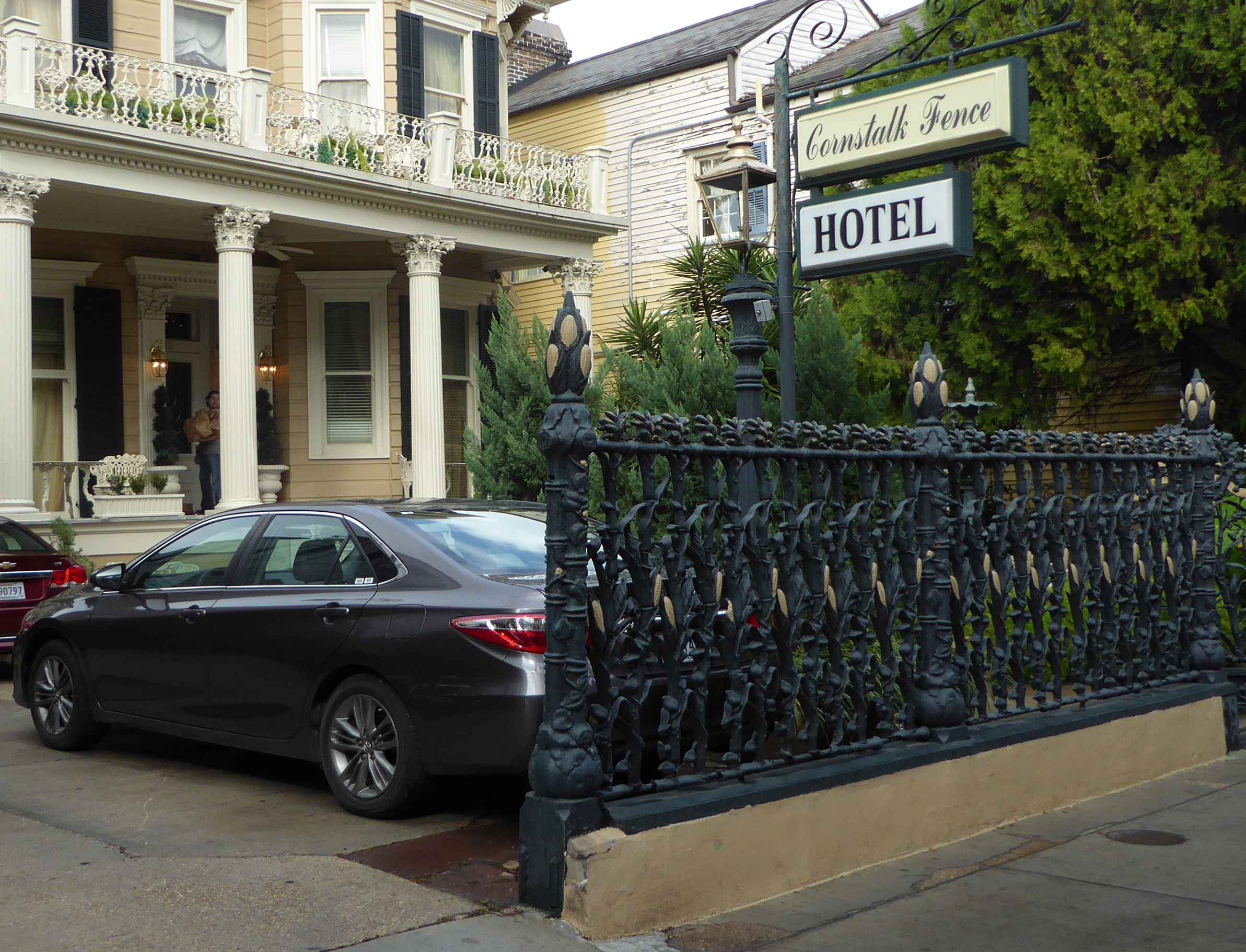
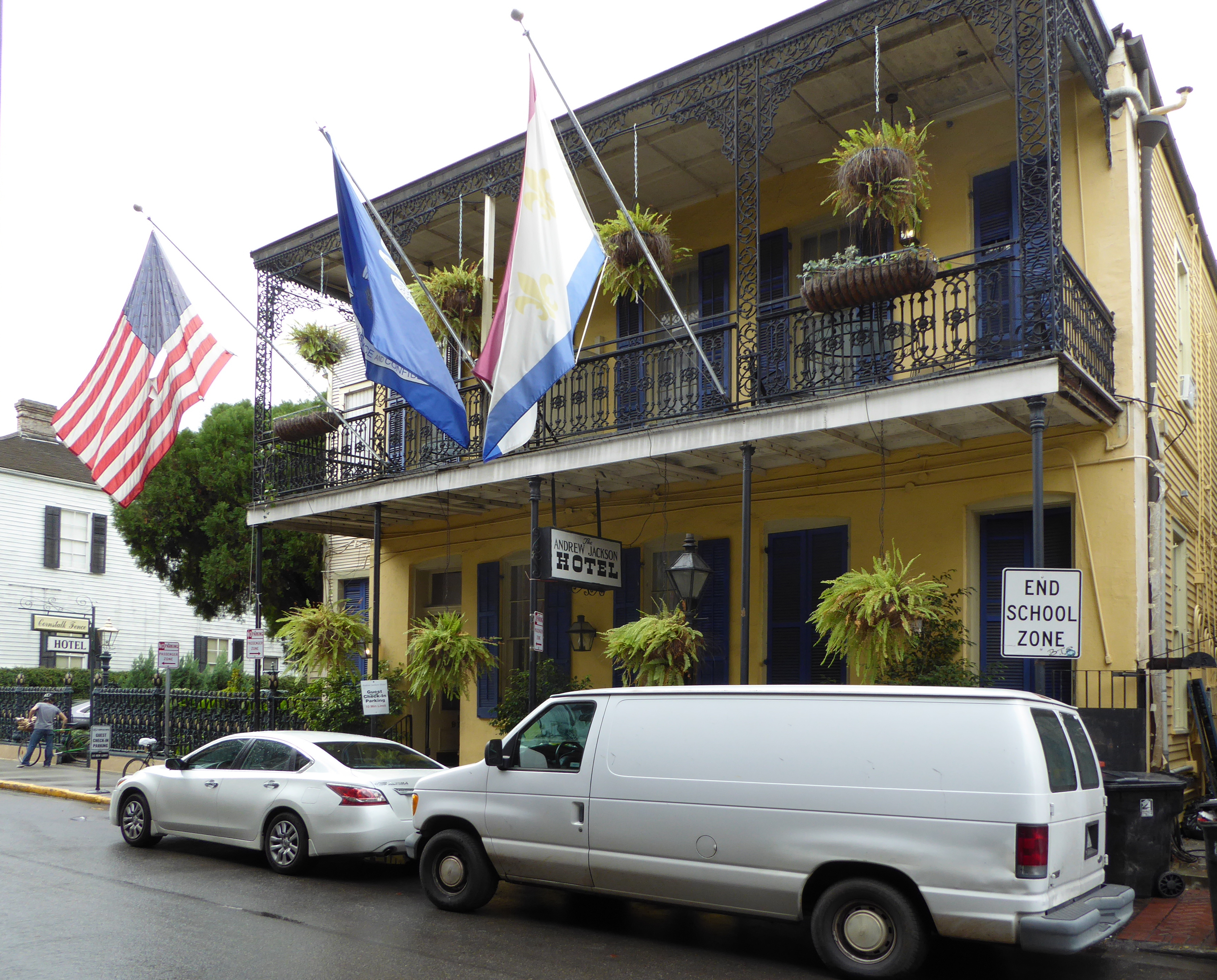
Cornstalk Fence Hotel
Andrew Jackson Hotel
House on corner of Barracks and Royal
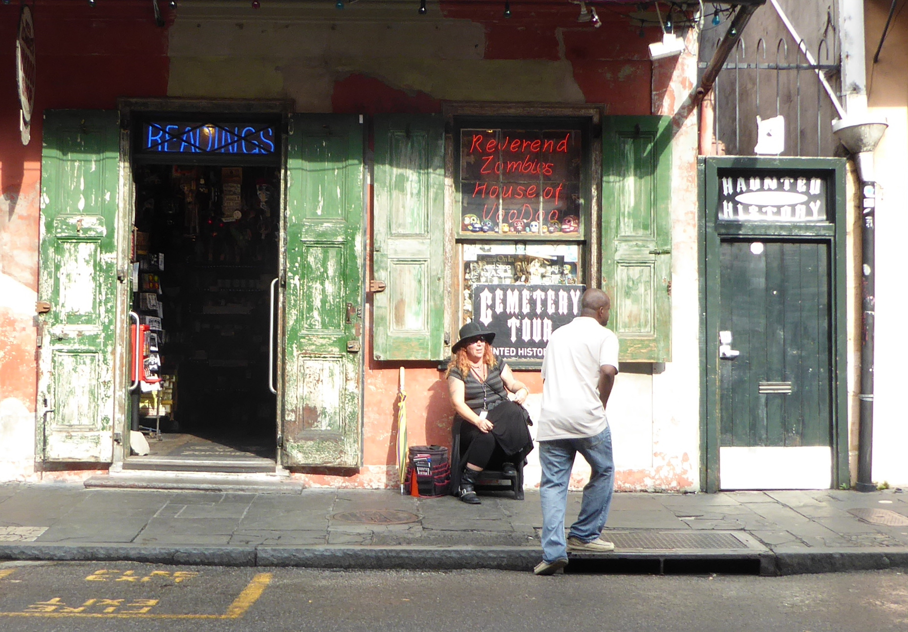
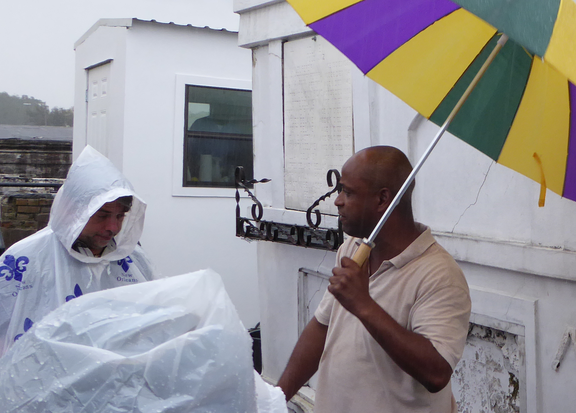
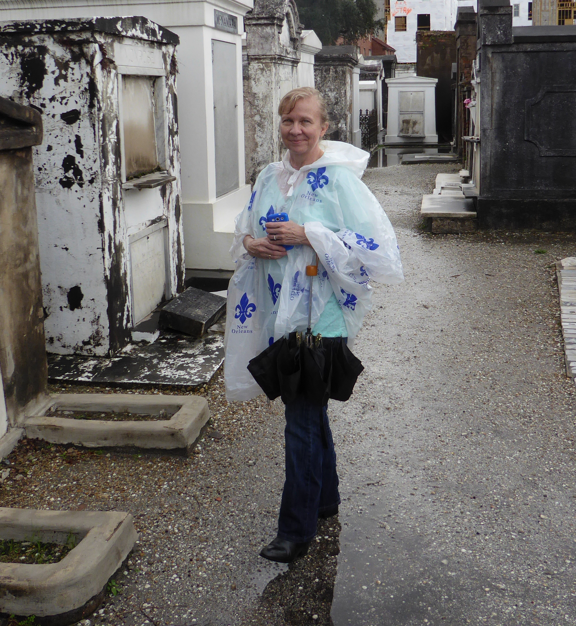
Based on a tip at a tourist information office, we walked to Rev. Zombie’s House of Voodoo to sign up for a tour that would include New Orleans’ famed cemetery. But going to view the collection of above-ground tombs there, the tour took us to see Congo Square near Louis Armstrong Park.
Suddenly a downpour began and we just made it into the Basin Street Visitor Center before we got drenched. (Luckily there was a shop in the building where we all bought cheap ponchos to supplement umbrellas).
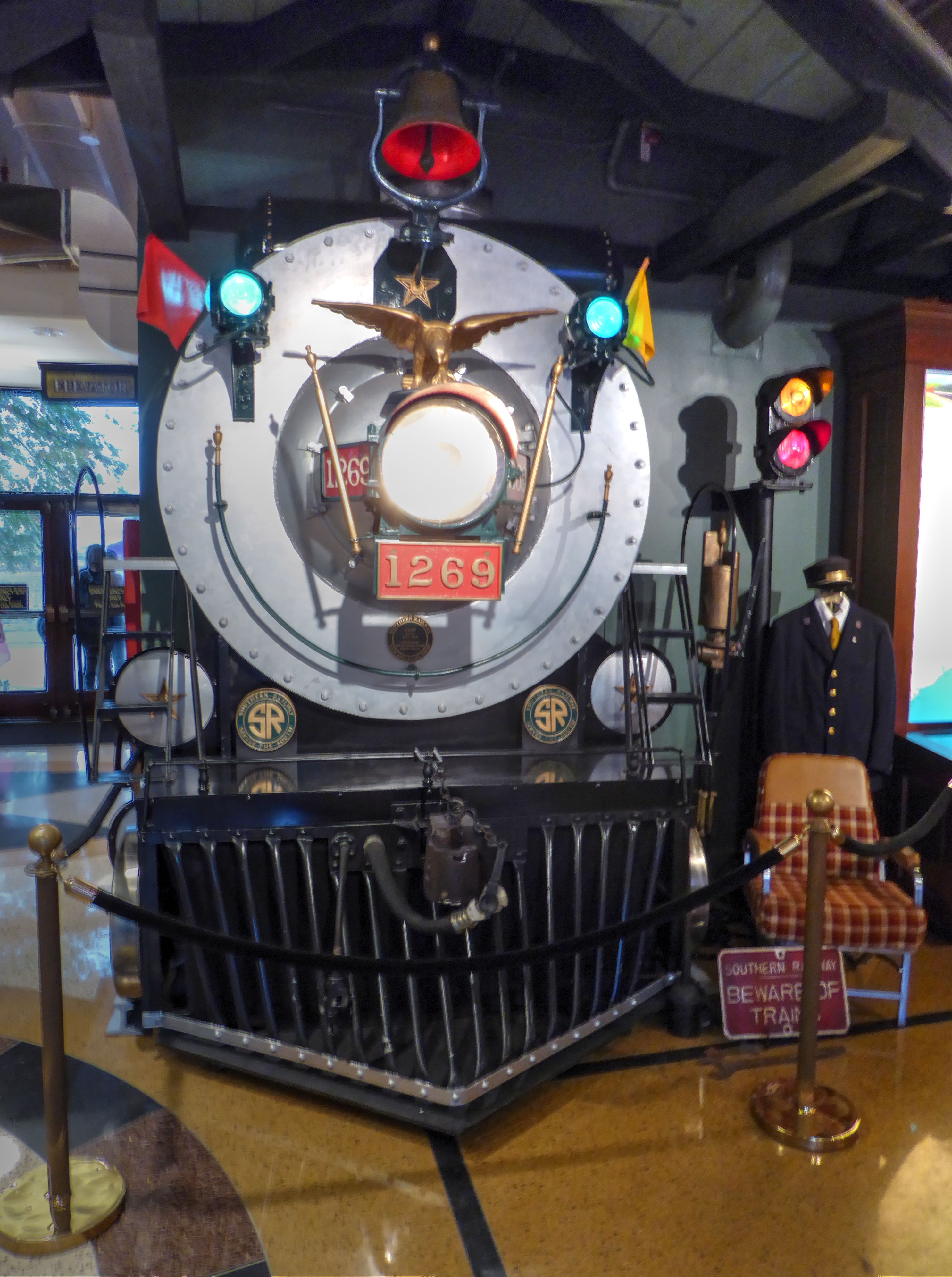
The visitor center building is a bit of a cultural sleight of hand. Huge engraved lettering across the front of the building proclaim it to be the “Basin St. Station”.
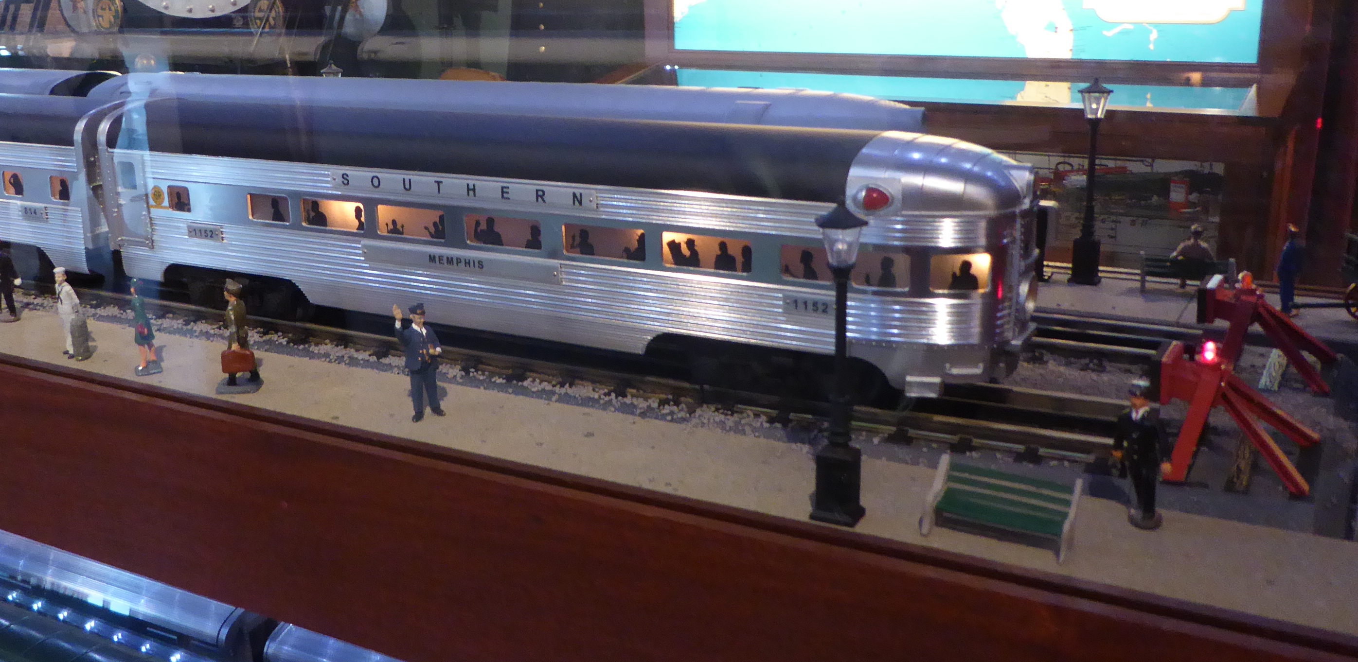
The main level includes a museum area embellished with models and artifacts related to the Southern Railway. There is even a mocked up re-creation of the front of a locomotive to help lead your mind to the conclusion that this was an old train station. The building has its own web site whose carefully crafted imprecision promotes the aura of authenticity. Well, the building is owned by the Valentino family and houses the headquarters and offices of the chain of five “Valentino New Orleans Hotels.” The building, built on land identified at the time as useless swamp is historic, originally constructed in 1904.
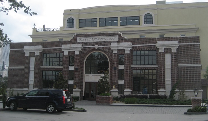
But it was never a train station. Before its abandonment in 1975, it served as offices of the Southern Railway and the “New Orleans Terminal Company”, another railway. The Valentino company did a nice remodel job and recast it as the Basin St. Station whose façade (per their web site) “emulates the exterior of the original New Orleans Southern Railway Passenger Station”.
Basin Street “Station” (Photo from wikicommons)
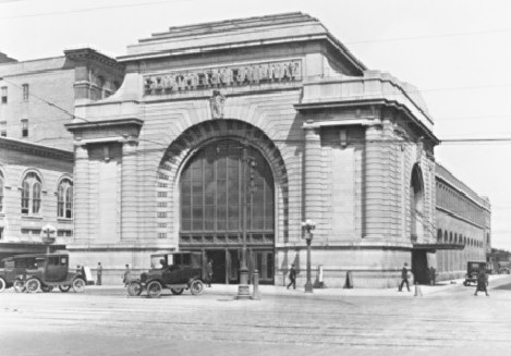
The real train station (torn down 70 years ago)
The owners obviously did a pretty good job as there is no shortage of visitors who are convinced that the Valentino office building used to be a train station!
The visitor center was a wonderful refuge from the rain, and had nice exhibits on a variety of topics. It also provided our guide with an opportunity to use a huge back-lit map on a wall to explain a number of historical items of interest related to the city.
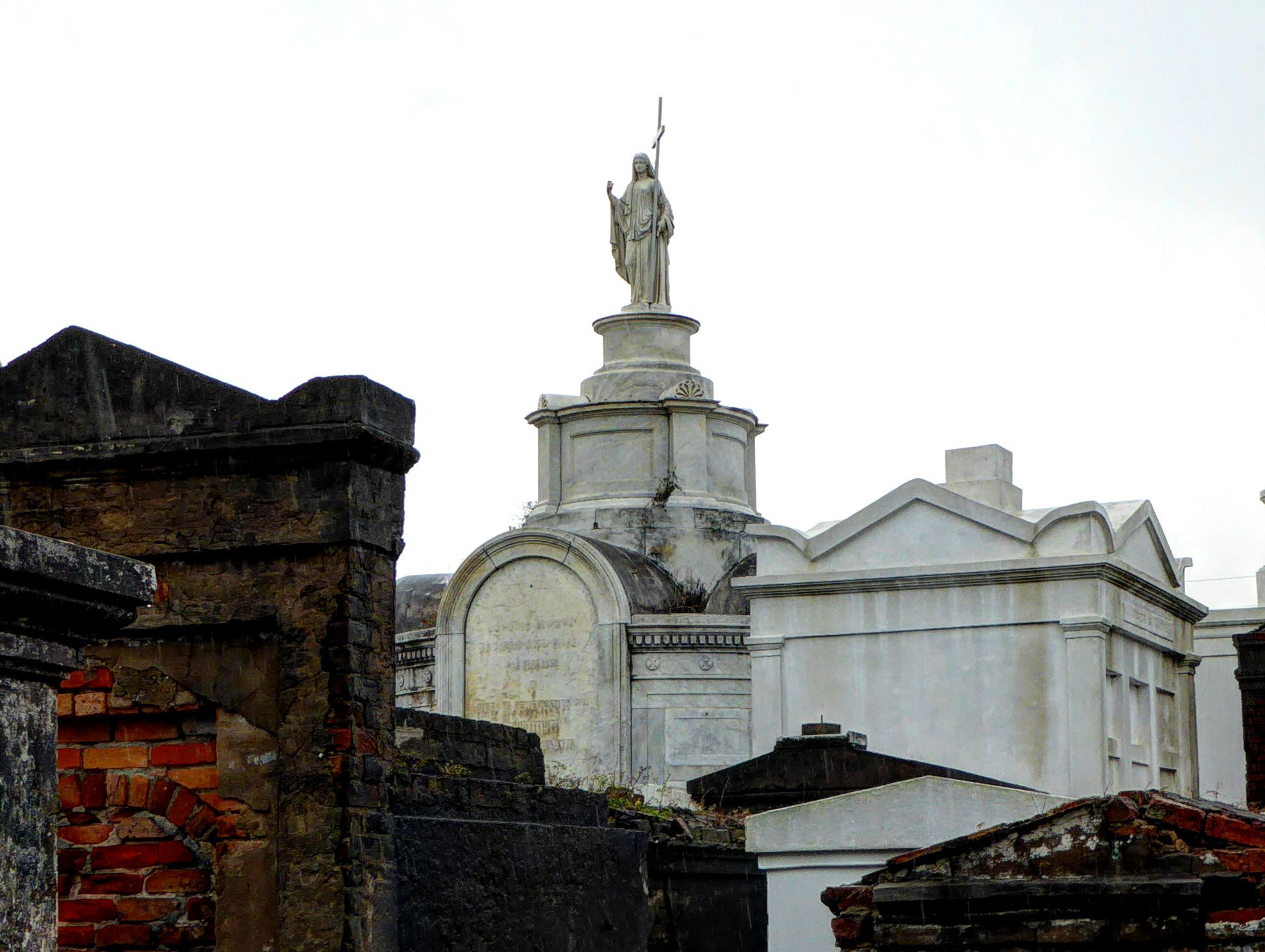
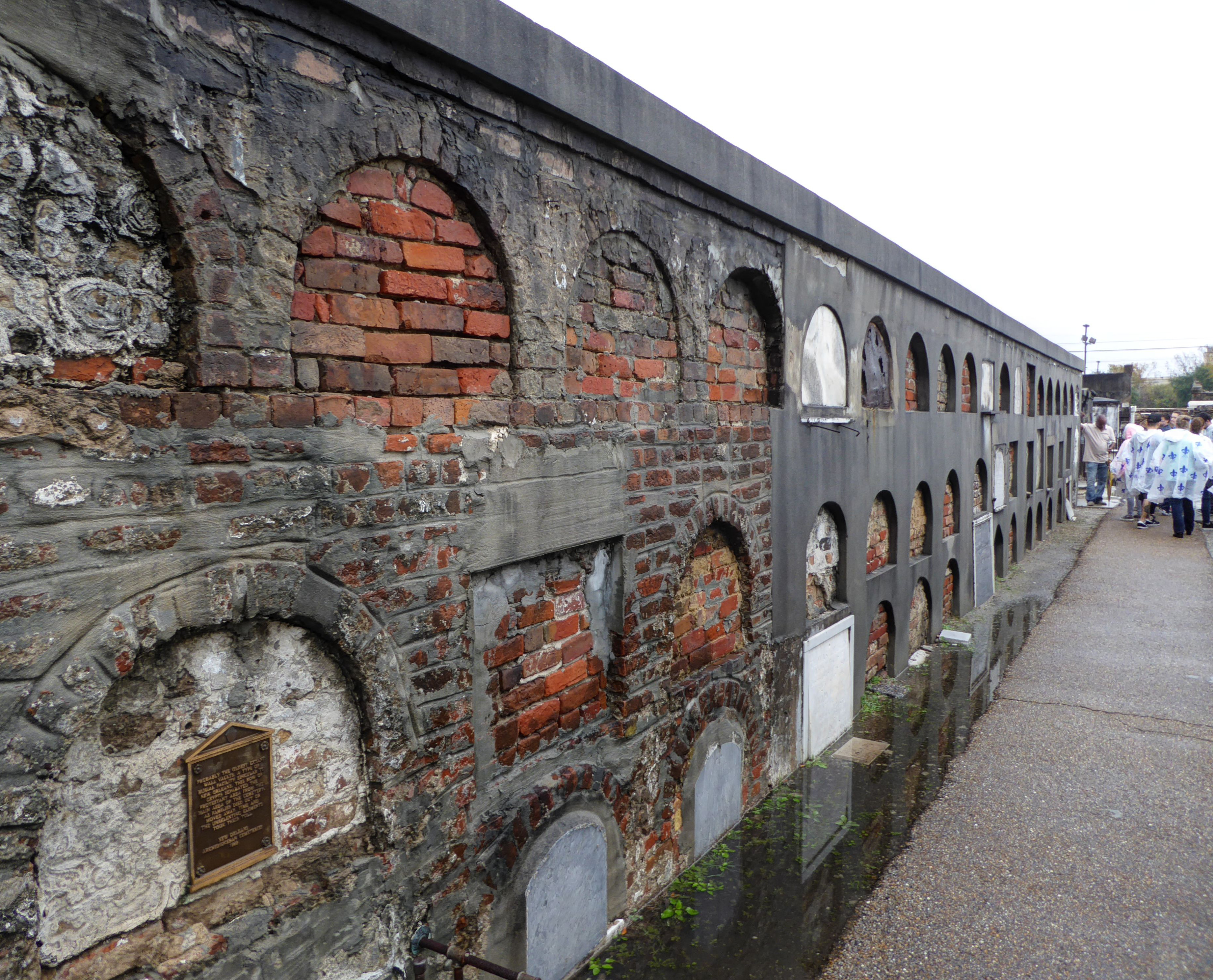
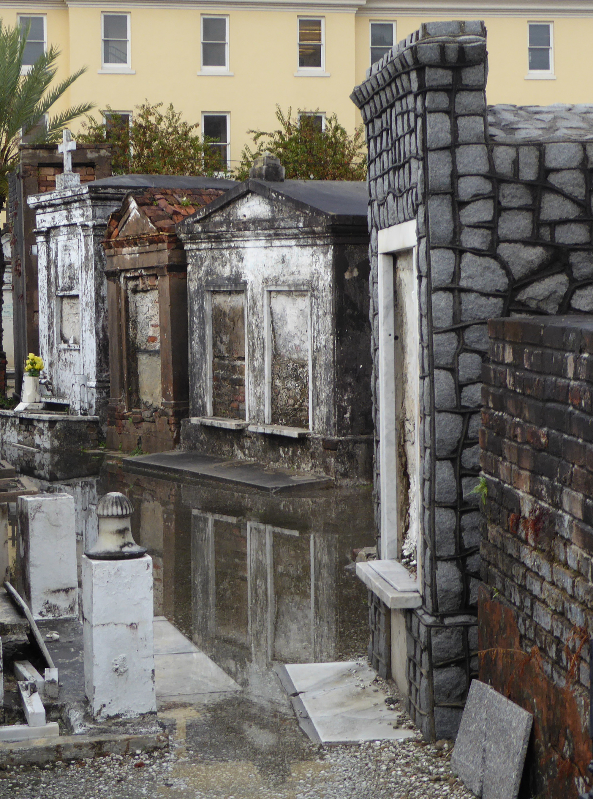
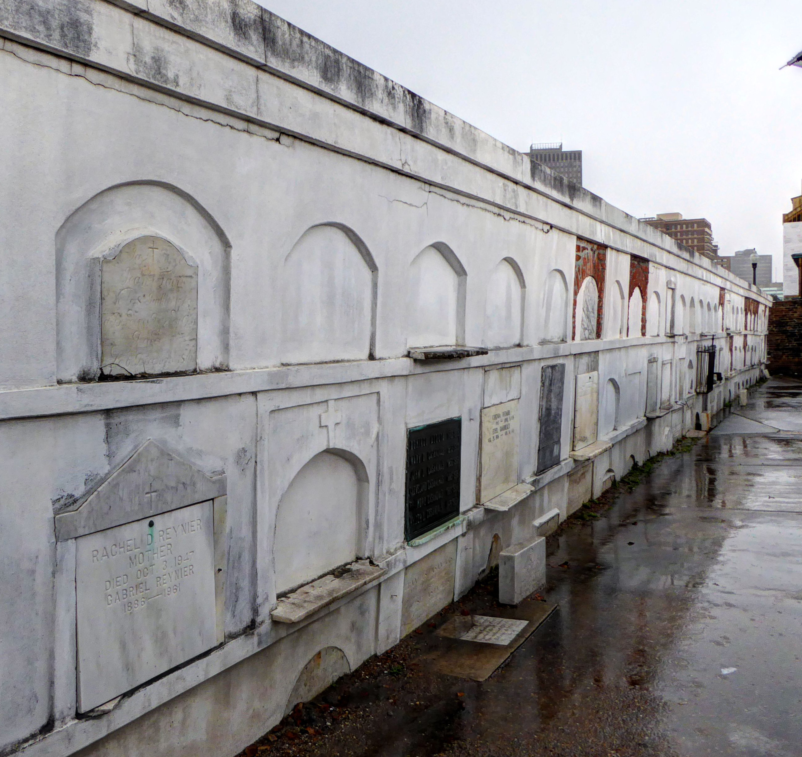
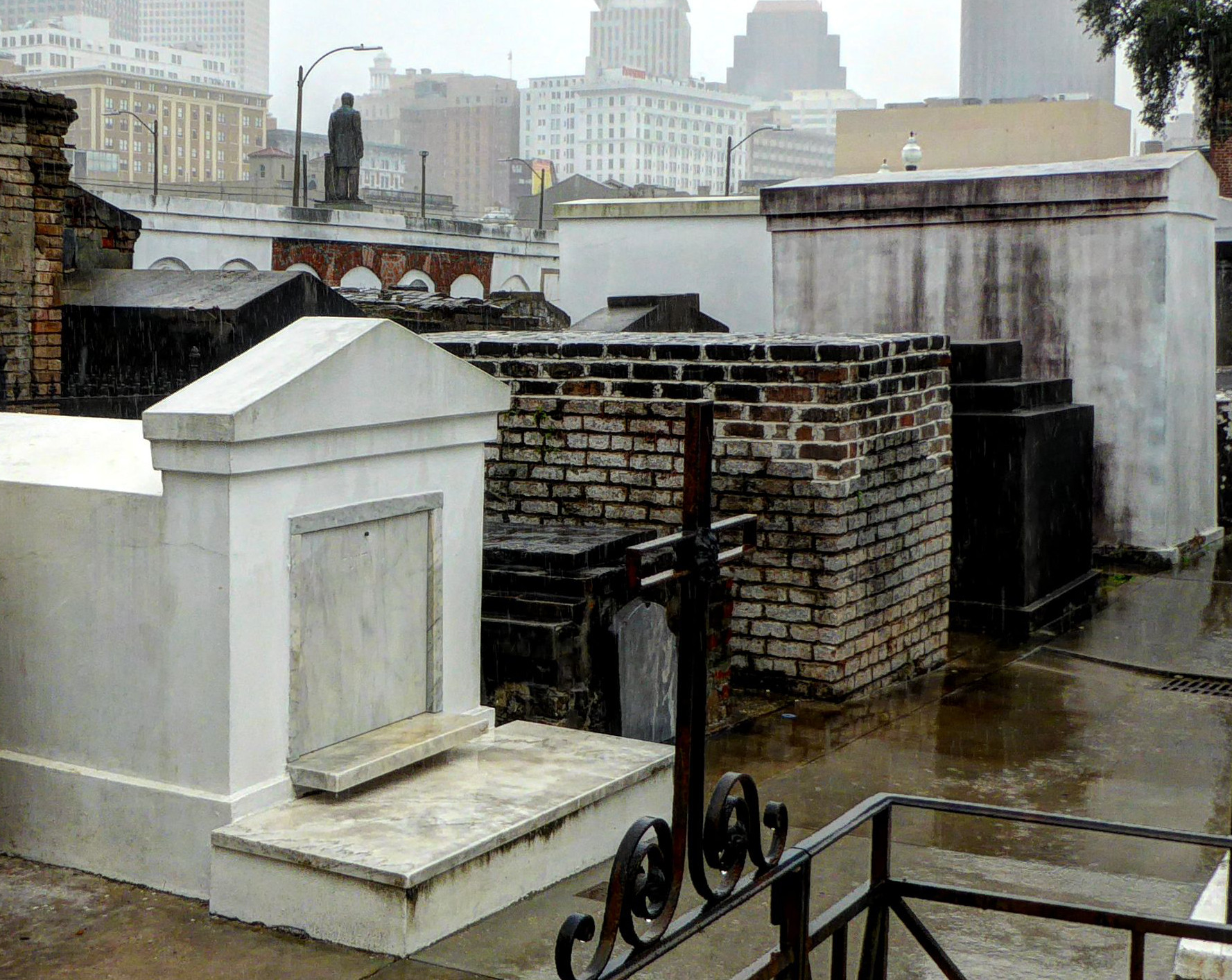
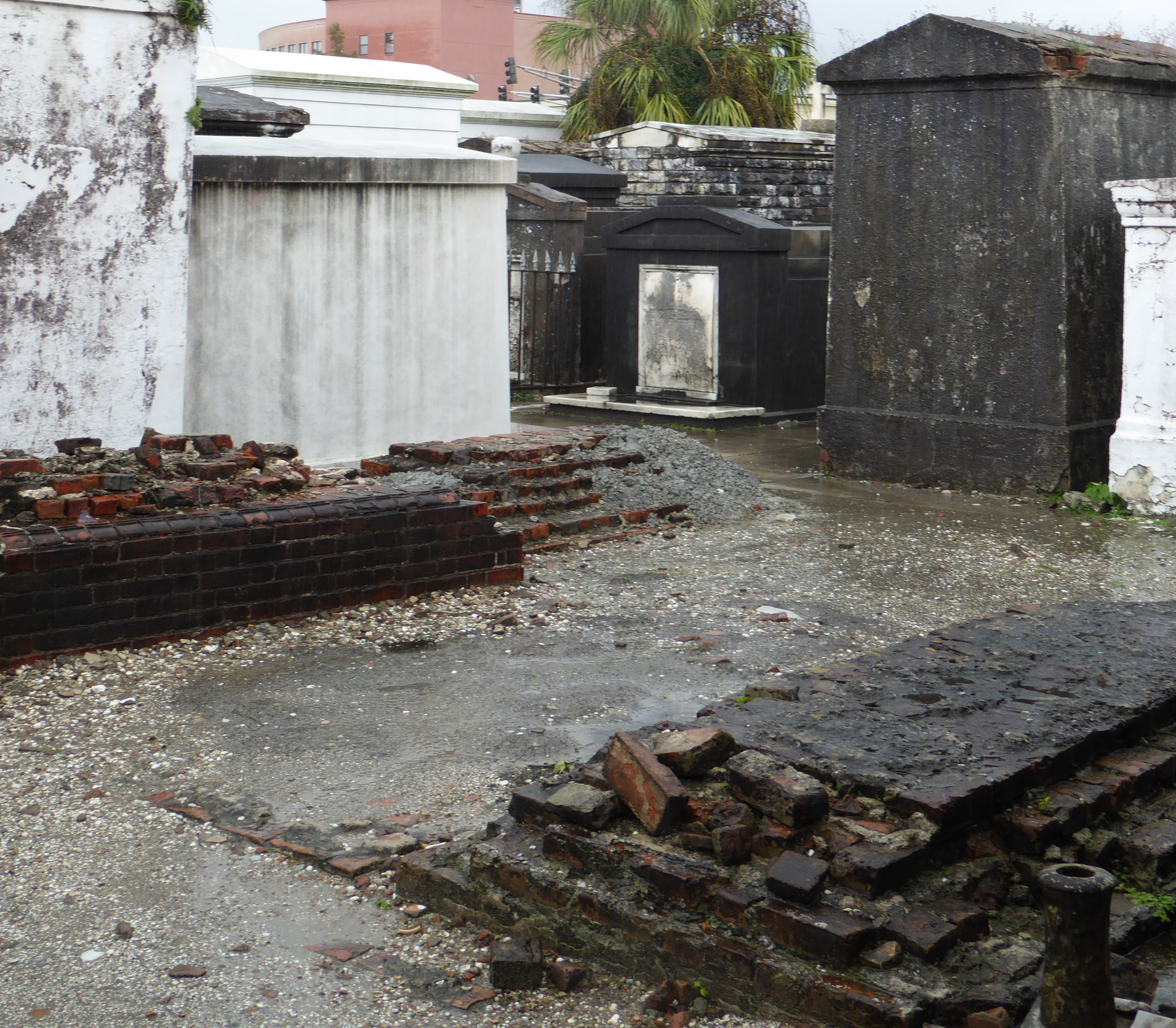
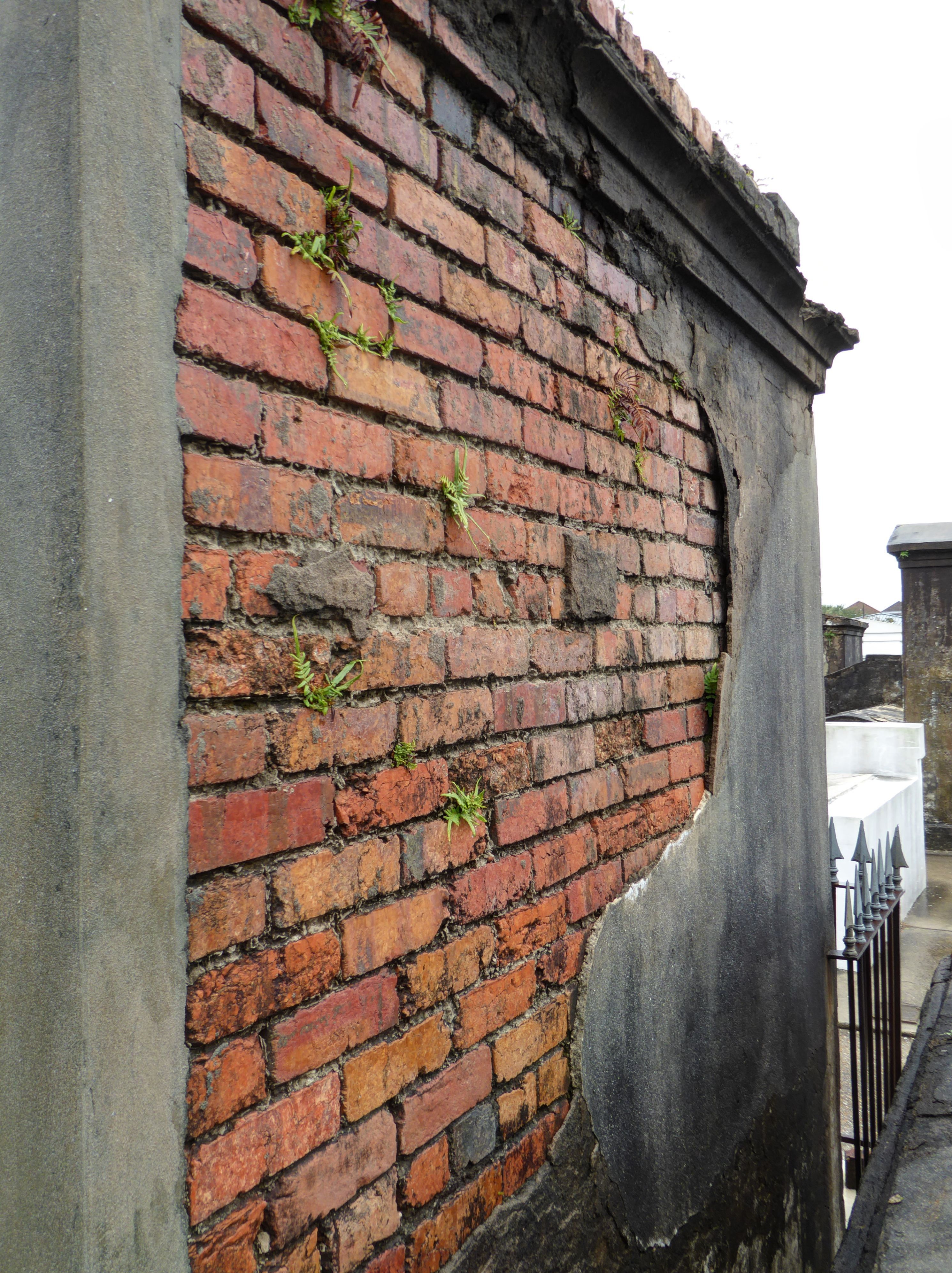
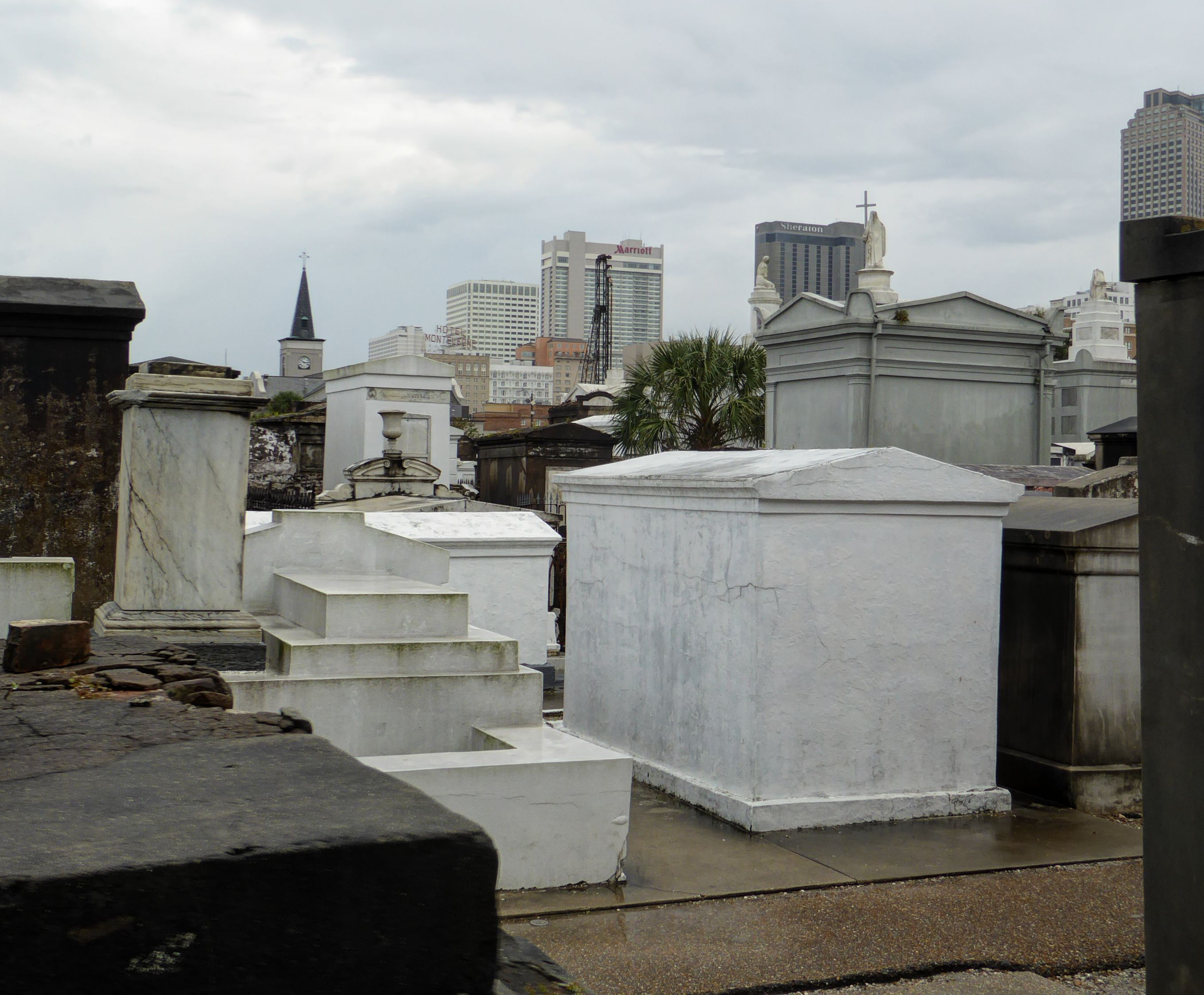
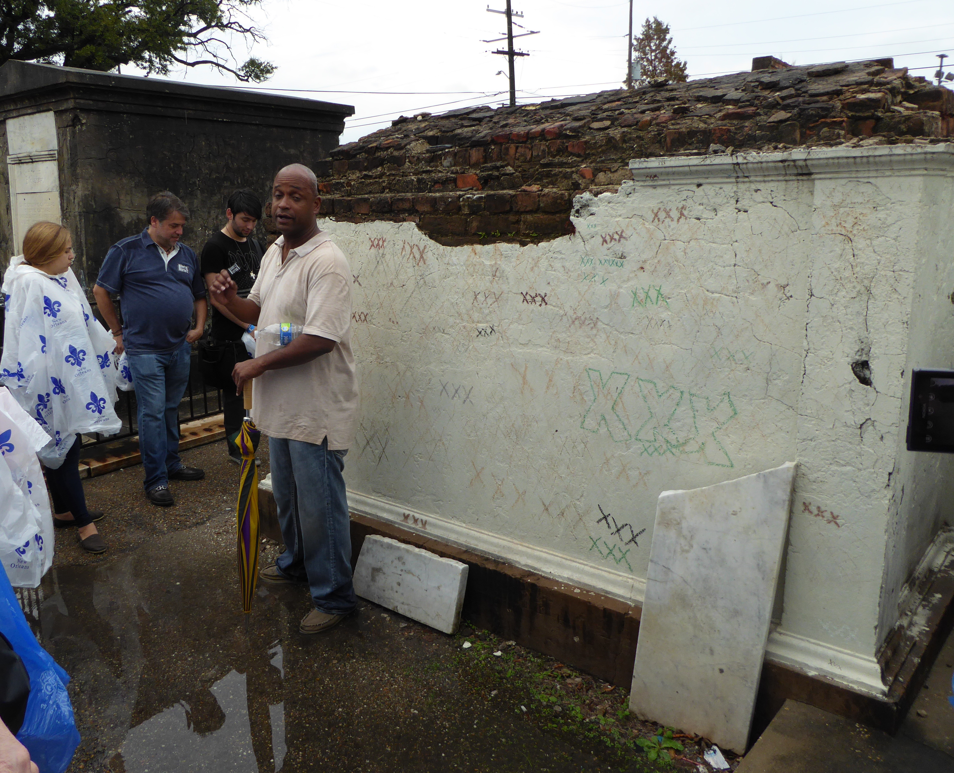
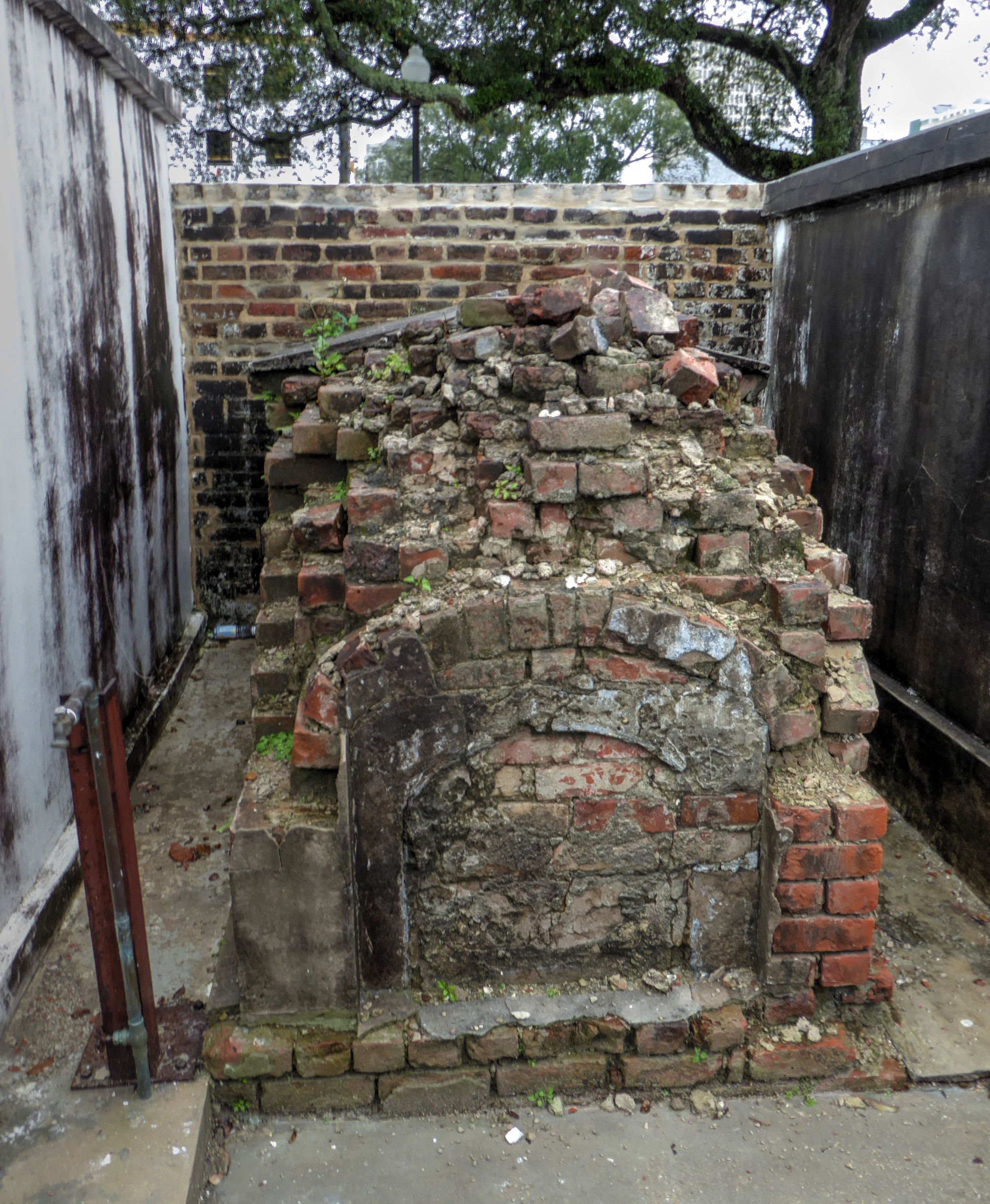
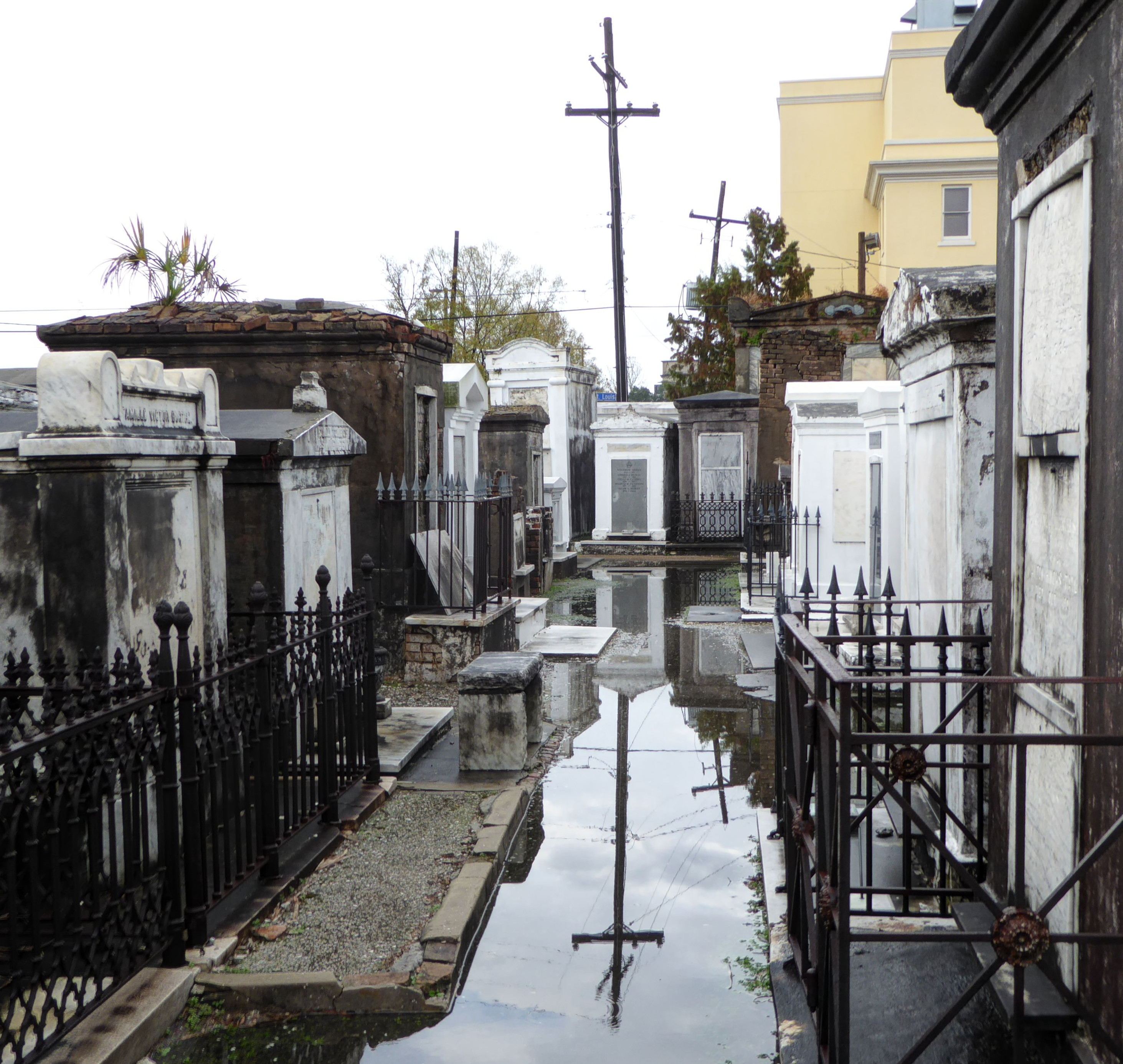
Saint Louis Cemetery Number One
There are interesting historical issues related with the treatment in New Orleans of the remains of their deceased residents. The high water table that made some areas of the city virtual swampland create challenges for burials. This combined with French and Spanish traditions have caused most burials to be in above-ground tombs of one variety or another. City expansion, a fire, and overcrowding let to the closing of the older graveyard on St. Peter Street. Remains from that location were moved to a new site known as St Louis cemetery. That site, opened in 1789 ran out of space and St Louis Cemetery #2 was opened in 1823 (without closing St Louis Cemetery #1). St Louis Cemetery #3 followed in 1854.
Our tour was of cemetery #1, the most visited of the three. Our guide riveted our attention with stories of the history of the site, and the somewhat surprising customs of how the various crypts undergo continuous reuse as the need comes up for new burials.
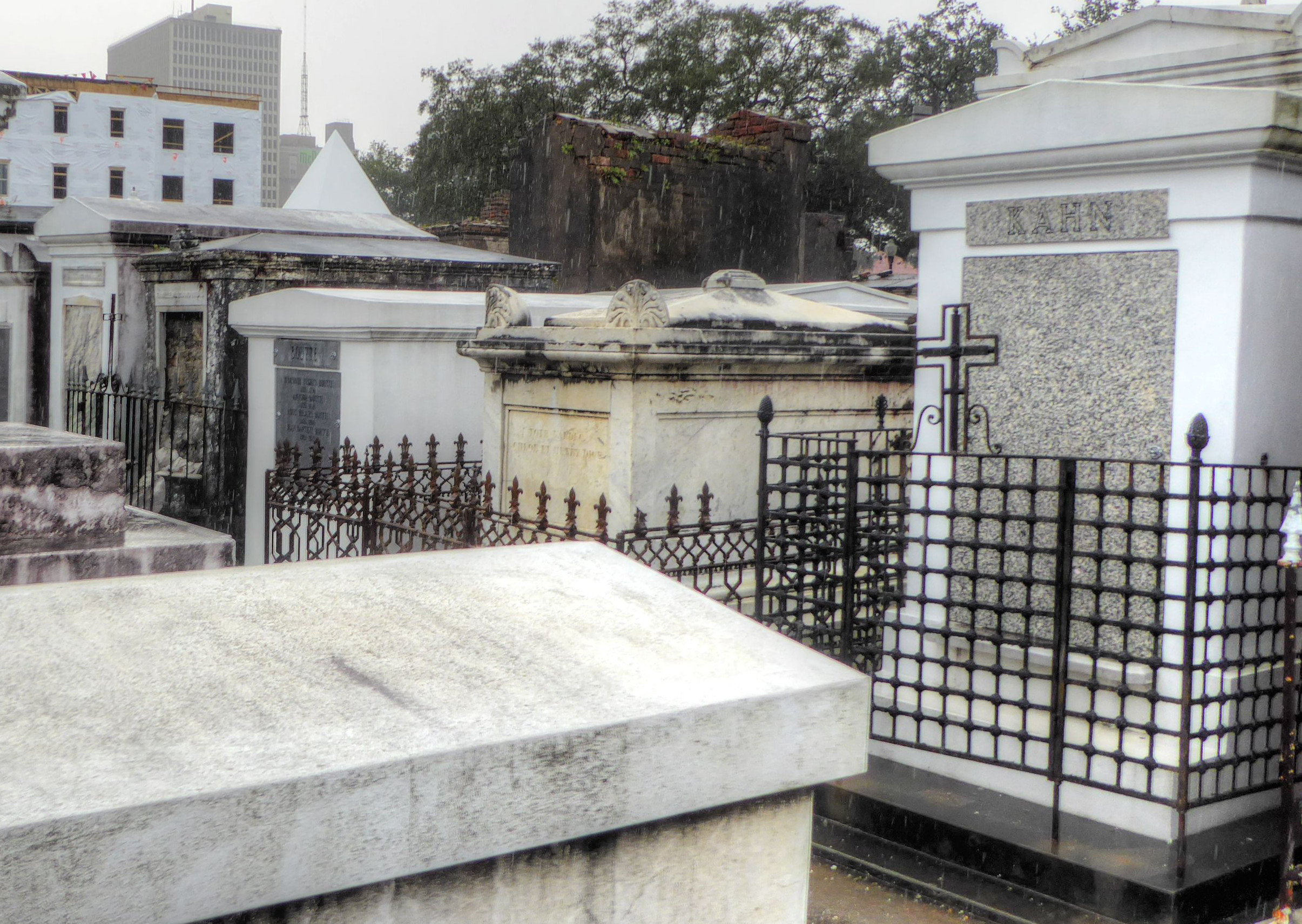
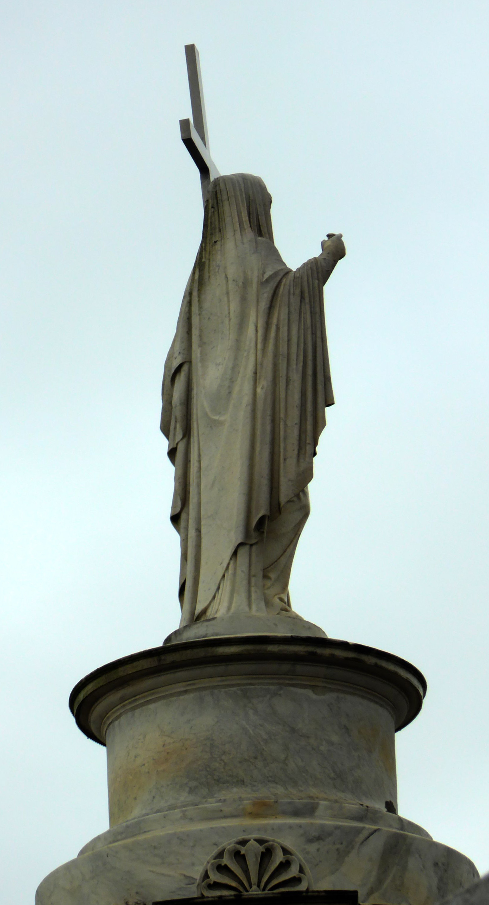
The tombs of a variety of famous people from New Orleans are not suprisingly found in the Cemetery (As well as the bizarrely designed future tomb of Nicholas Cage).
Some remains are put into wall crypts
Others are in individual, family, or group tombs.
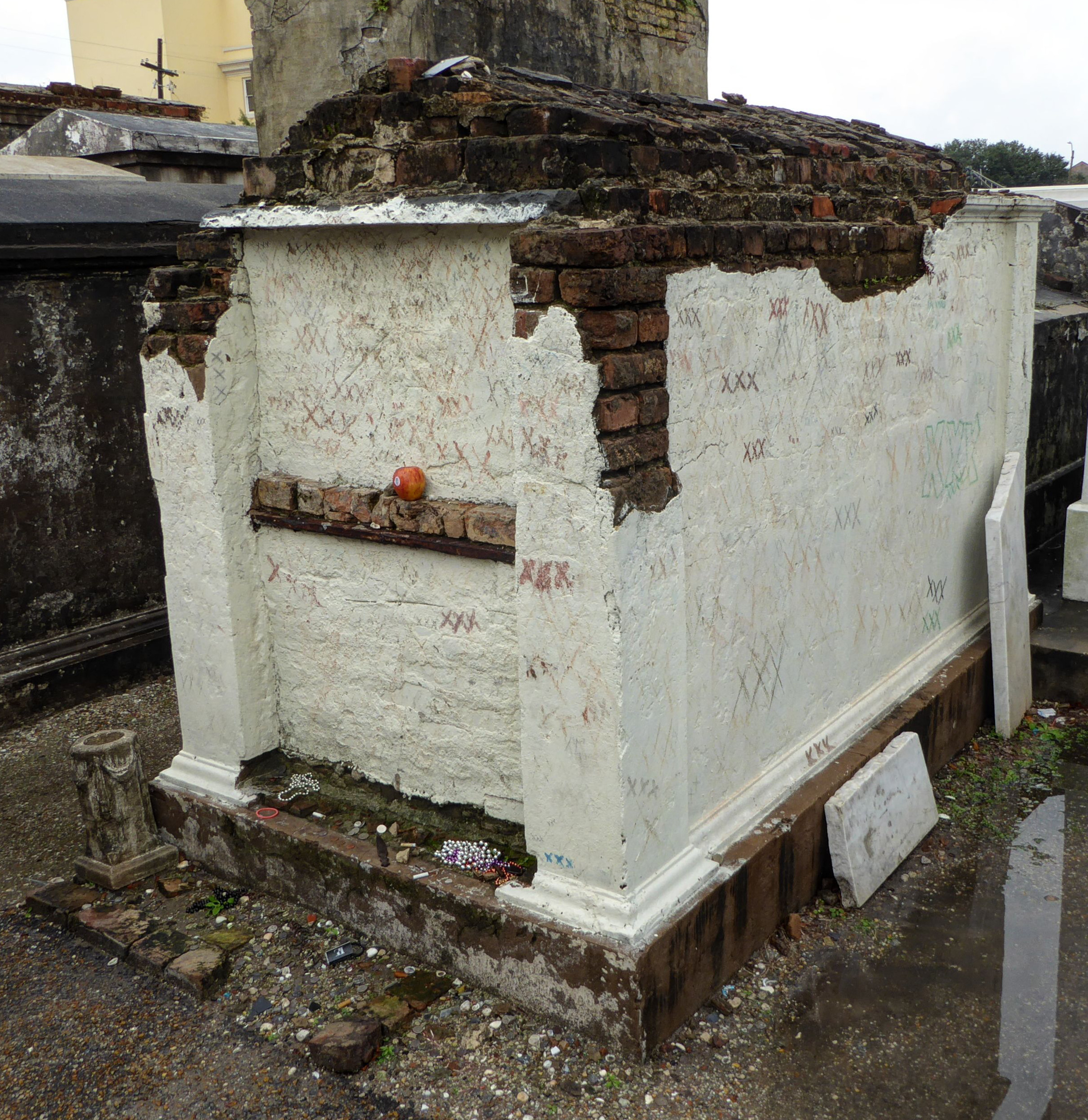
If Leveau is buried in the Glapion tomb, then who is buried here?
Final resting places of various dignitaries, statesmen, and businessmen aside, one of the most interesting interments is that of the remains of Marie Laveau, the famous voodoo queen/priestess. Within the cemetery a plaque has been attached to the Glapion family crypt indicating that it is the “reputed” site of Laveau’s remains. Well, since there was no “official” burial of Laveau, there is some controversy about the true location, and some think the Glapion crypt is a ruse to throw people off the scent of her real resting place.
Eventually the rain let up, although we still had to wad through deep puddles. Thank goodness for boots!
If you’d like to see our full set of cemetery photos, click HERE.
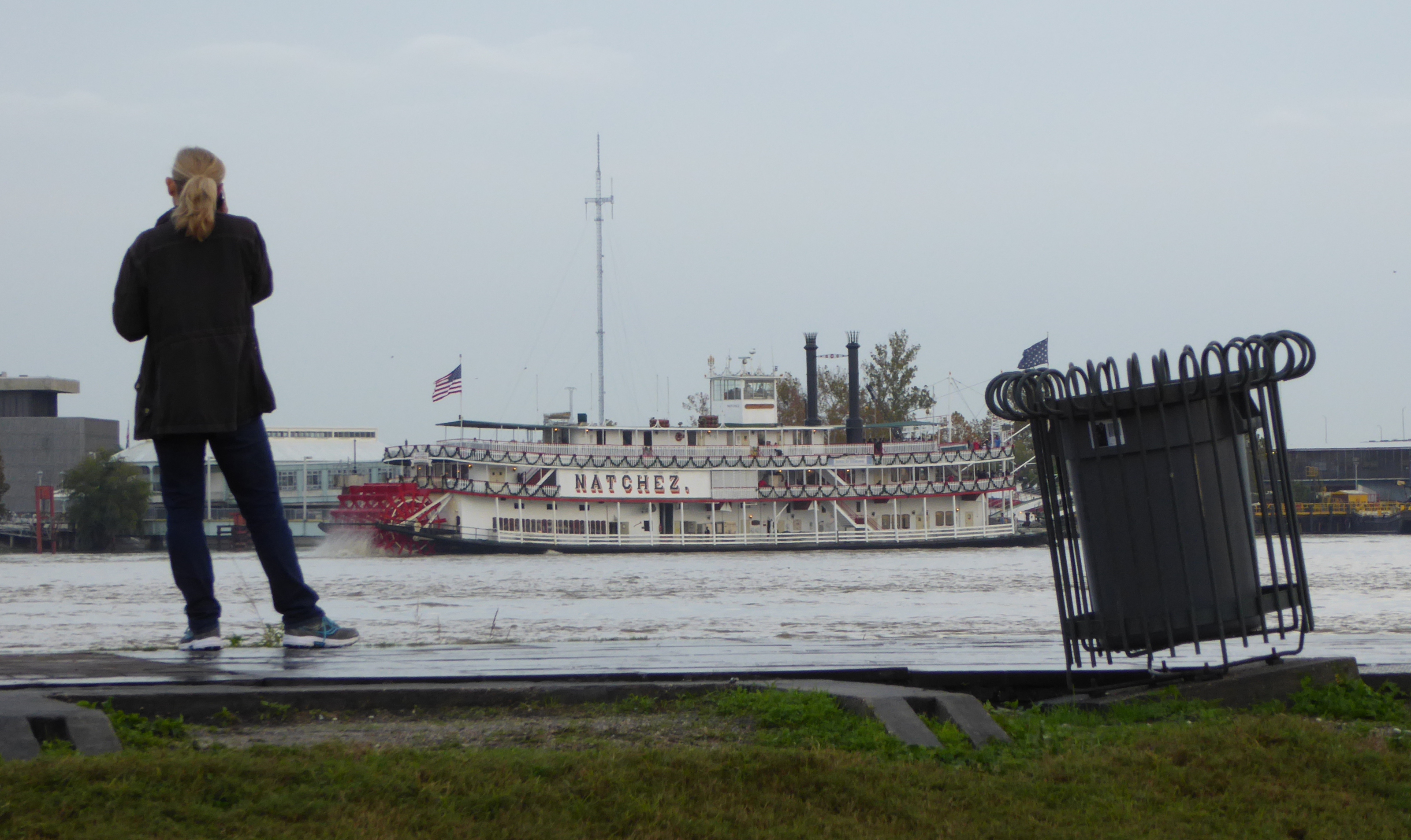
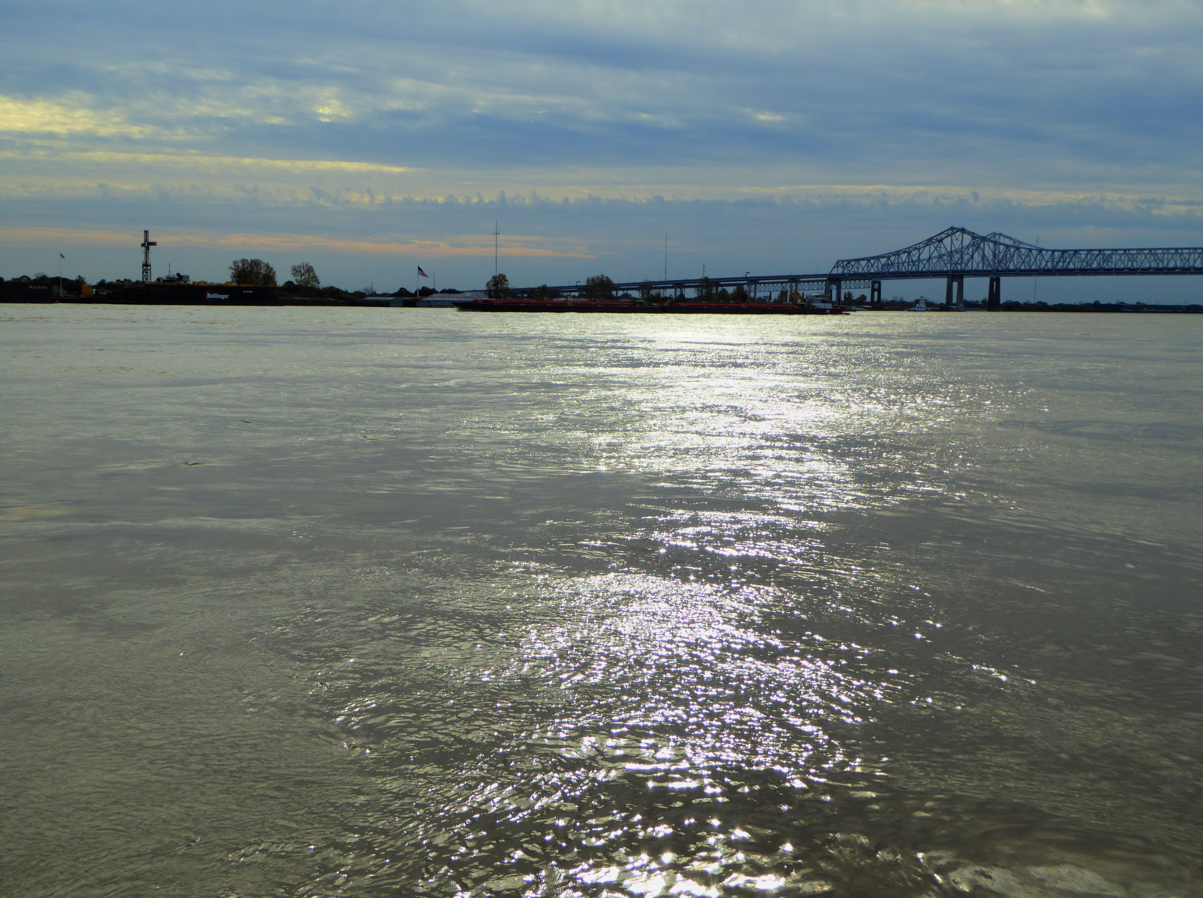
The Mississippi River
Woman watching the “Natchez” on the Mississippi
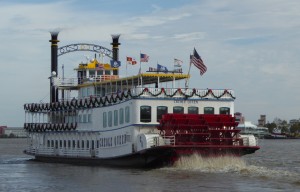
The Creole Queen paddlewheeler. Click the photo to see video
New Orleans, which straddles the winding Mississippi River, is in very many ways defined by the river, and its position at the mouth of the river. The river brought life to New Orleans,
In the city the cardinal points on a map are not North, South, East, and West, but rather Upriver, Downriver, Lakeside, and Riverside.
It’s the train they call the “City of New Orleans”…
Leaving New Orleans we took an Amtrak train north to Chicago. This is the train that Arlo Guthrie sang about- “The City of New Orleans”.
Sadly it does not just follow alongside the river, that would have been a wonderful view. But given the possibilities of flooding, probably dangerous. On a past occasion when we rode the train, we spotted alligators sunning themselves as the train passed over some swampy terrain. On this trip we had no such luck.
Chicago
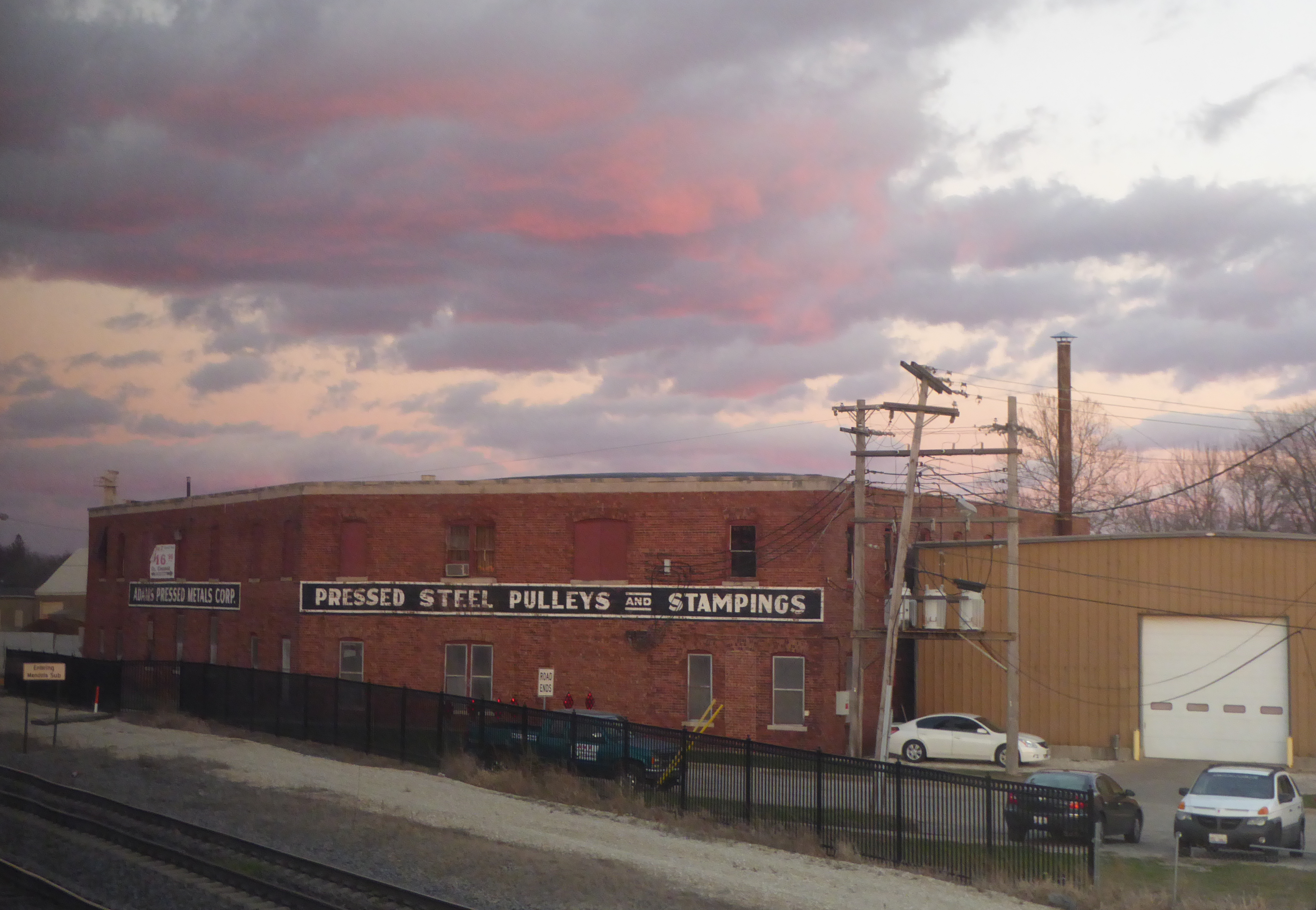
I lived in Chicago for a couple of years when I was a very young boy, and have been back with some regularity, although mostly just “passing through.” The city, true to its nickname of the “Windy City” seems to always have wind howling through it off Lake Michigan. (Covering 58,000 square Km / 22,000 sq Miles it is one of the “Great Lakes”.)
When I think of Chicago, I tend to think of steel, iron, and rust. Yet we were looking forward to a several hour layover in Chicago because of the “Metro Deli” a great restaurant/bar near the “Great Hall” of the train station. We have eaten there several times and had great food and great beer. And best of all, we did not have to exit the station and face the howling winds!
But what a disaster! The station is undergoing a massive remodel and they have closed our restaurant! The replacement is not yet open but looks to be plastic and bland. sigh…
Cutting our losses we headed out into the wind and went to Giordano’s about five cold, cold, cold blocks away. There we had our anniversary dinner.
We ordered the stuffed deep dish “Classic Chicago” pizza. It was delicious!
Our waiter had formerly lived in a variety of towns in Colorado including Basalt and Carbondale. We asked him how people could stand to live with the cold in Chicago. He quietly told us that he has sworn to himself that this would be his last winter in Chicago. When we left he said- “Maybe I’ll see you in Colorado”.
Back on the Zephyr heading west: Across the plains and back to Denver
Well, all journeys eventually come to an end. We once again rode the “California Zephyr” train on which we began this vacation. This time it was taking us from Chicago home to Colorado.
After our arrival in Denver, we took RTD “light rail” and then a bus back to our apartment.
Then a nice long nap!!
Closing Thought:
Dumplings in Chengde
A note to any other “foodies”: We enjoyed the food we ate in San Francisco’s Chinatown very much. I wish I could find as Chinese food that was as good in Denver!
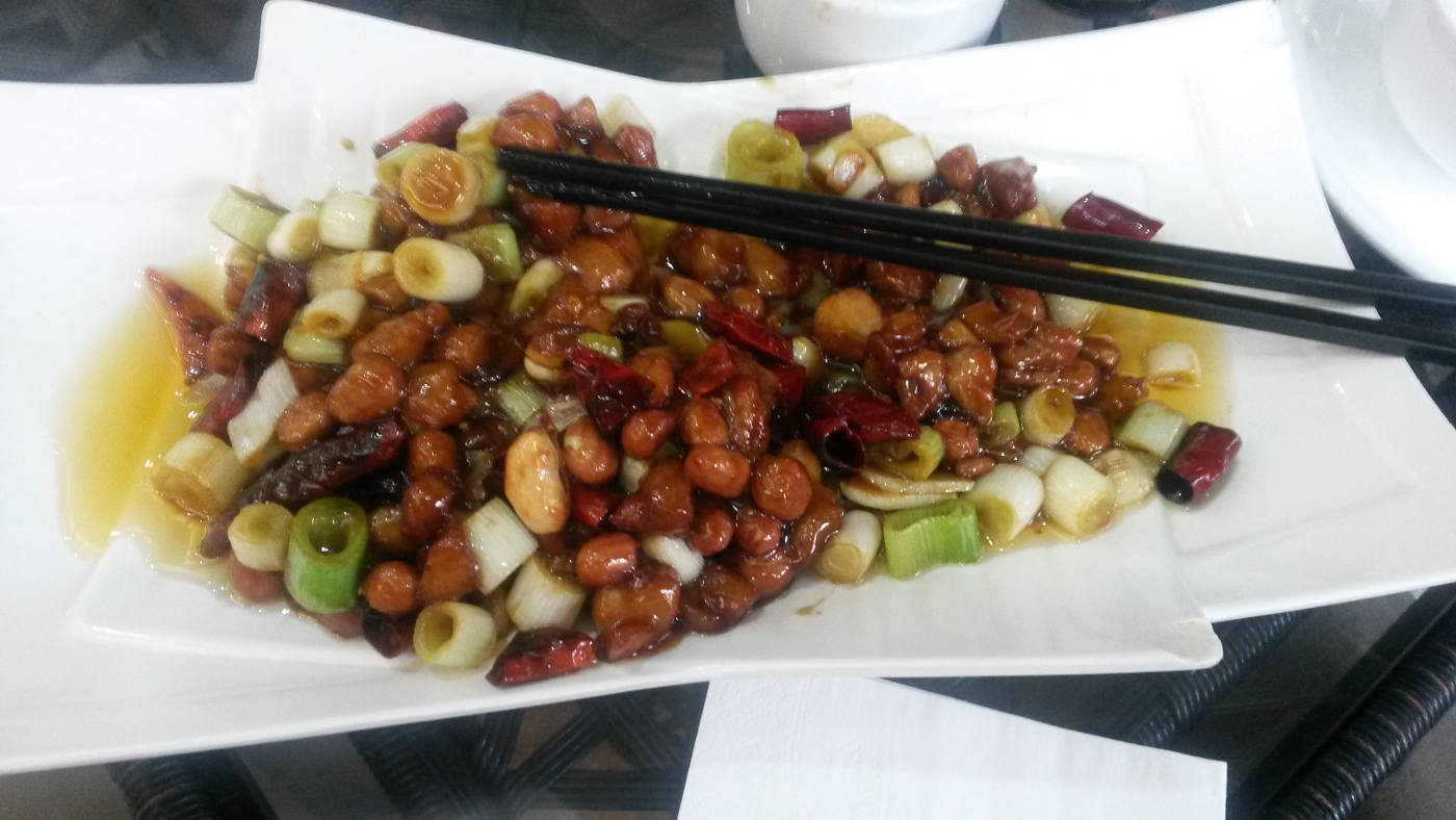
Spicy Chicken in Chengdu
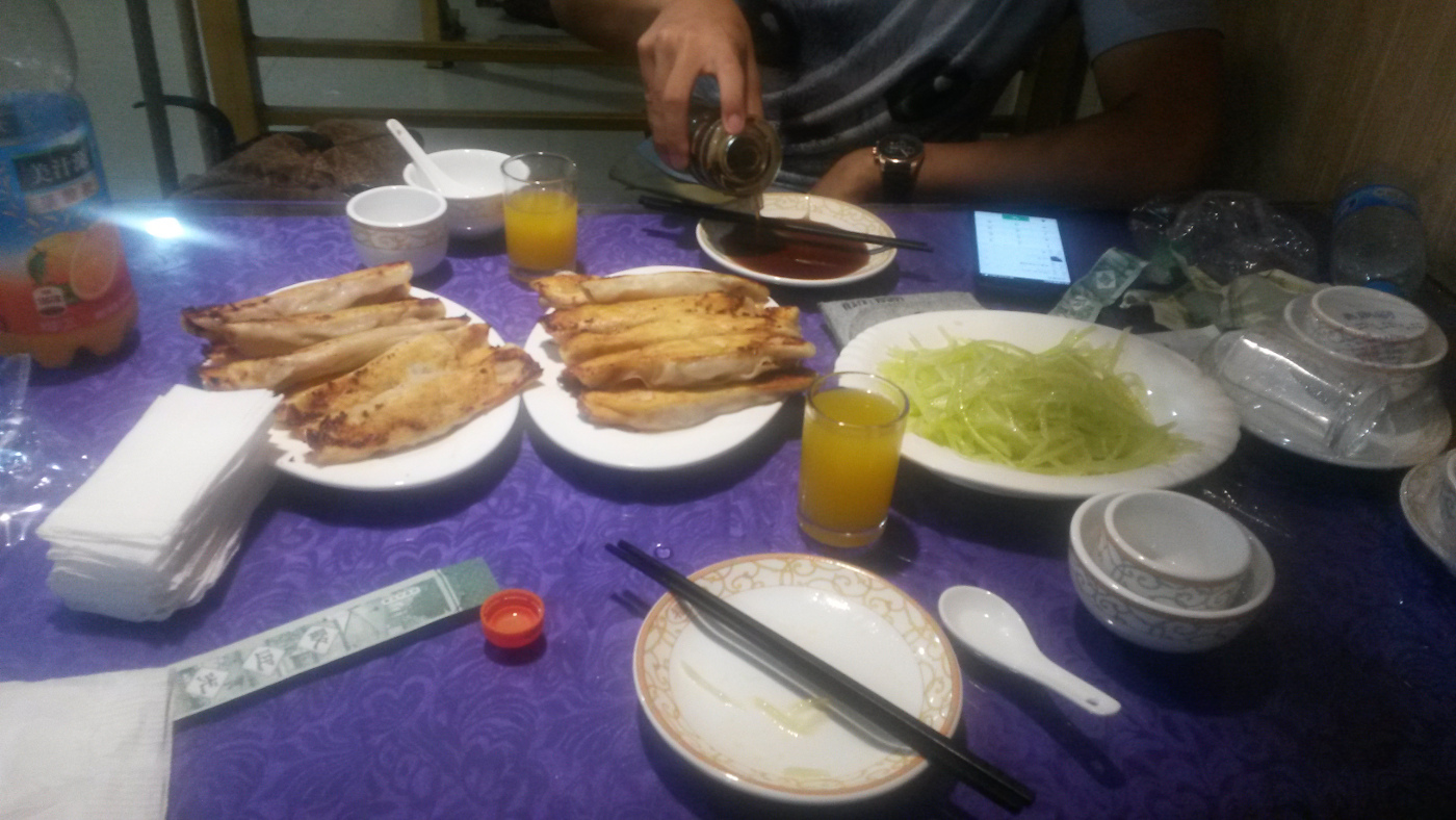
But honestly the dumplings did not compare with those I had in Chengde (Hebei province) and the chicken dish was no match for what I ate in Chengdu (Sichuan province). So if you ever get a craving to try the real thing… hop on a plane for a looooog flight to China!
Well, I finally got around to sorting through some of my photos from my 2015 trip to China. You can take a peek at the overview by clicking on this link: China-2015.
During our December 2015 trip to New Orleans we took a guided tour of “St Louis Cemetery #1”, the most visited of the city’s three “St Louis” burial places
Under partly cloudy skies, our tour had commenced in front of “Rev Zombie’s House of Voodoo” on St Peter Street. A bit further up that street was the site of an earlier city cemetery, abandoned due to a fire, city expansion and redevelopment.
Remains from the St Peter cemetery were moved to the “new” cemetery when it opened in 1789. Well…not all was moved. From time to time construction activity on the older site uncovers remains that missed out on the big move.
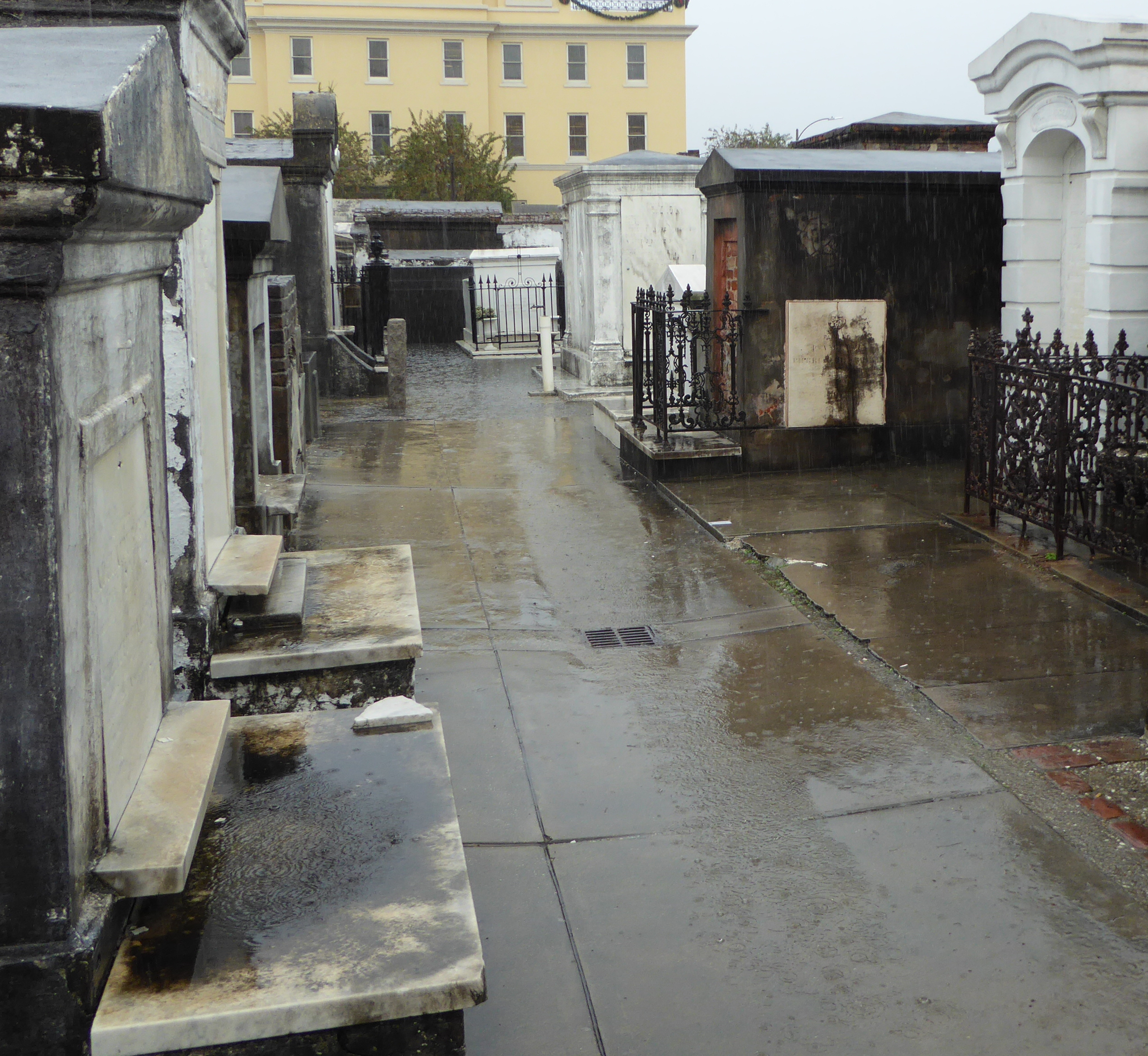
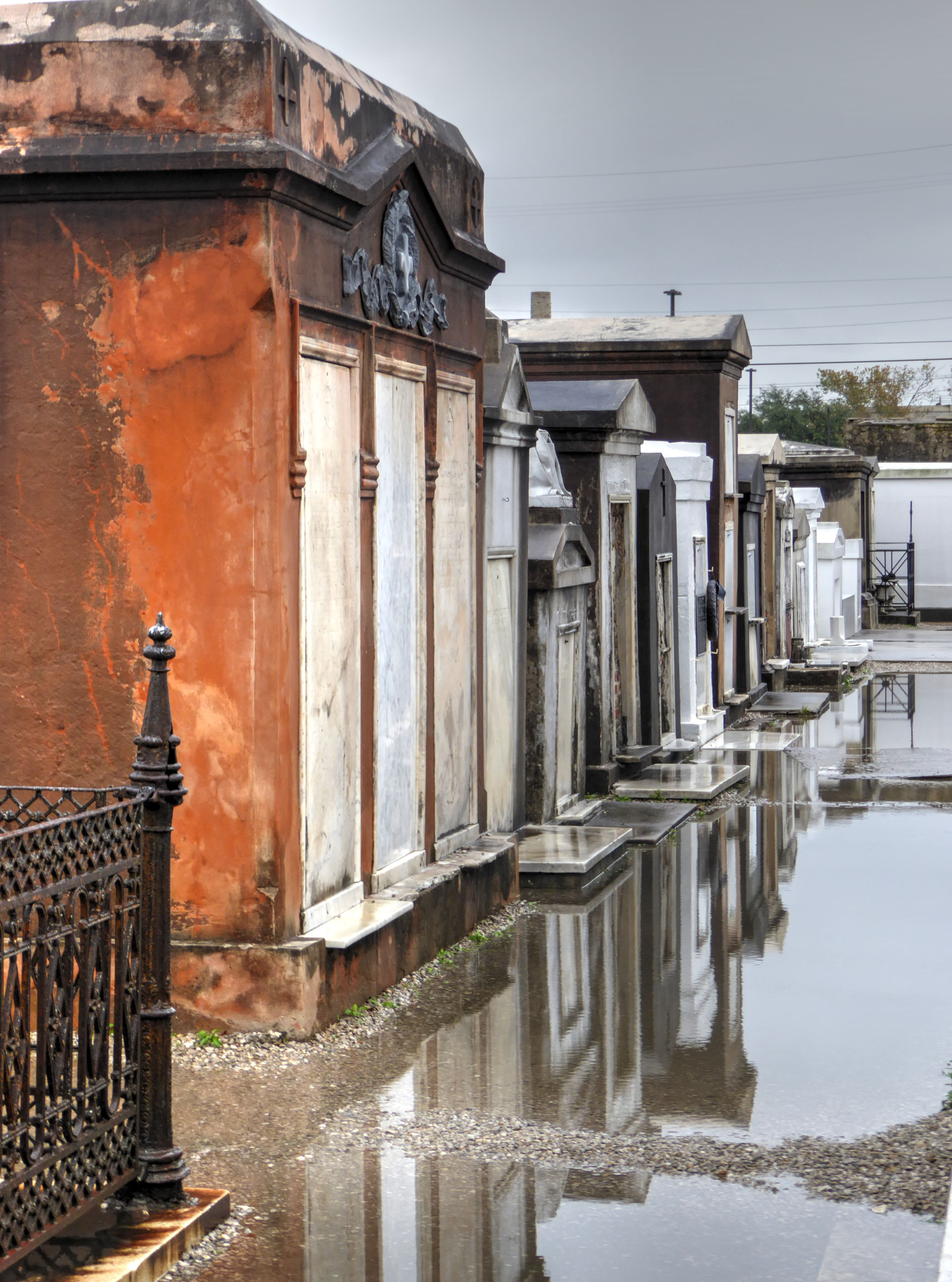
One form of burial in New Orleans involves crypts set into a large wall.
Most of the tombs are free-standing structures for individuals, families, or groups.
Our guide made sure we understood the strange mechanics behind the normal cemetery practices in which crypts are continually reused, with each becoming available to receive new remains a year and a day after a burial. He shared the somewhat gruesome details about the role the hot summers play in decomposition of remains in an above ground crypt.
Although it was raining hard during the first part of our time in the cemetery, eventually the rain diminished and then stopped. That left only the huge puddles to deal with.
Thankfully both Rhonda and I were wearing boots!
This crypt has three above ground slots.
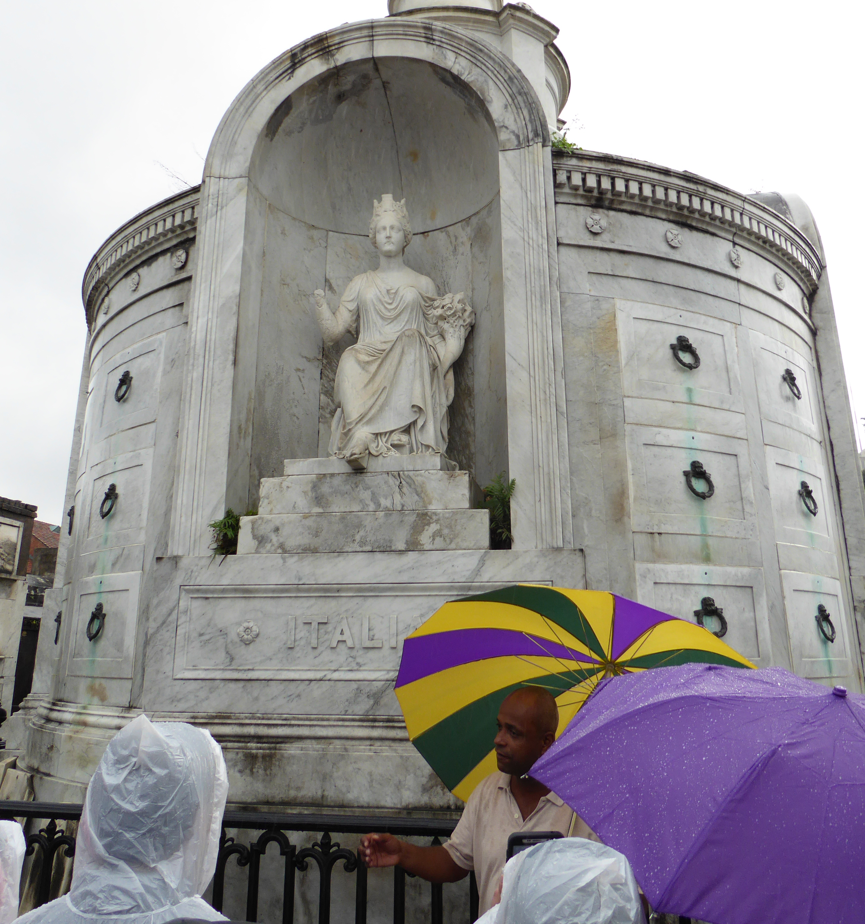
Italian Benevolent Society Tomb
Many of the tombs have multiple slots available for burials. Most also include a below-ground spot. As the tomb is used for additional burials, and remaining coffin is removed, and the decomposed remains from previous burials get pushed backward which sometimes causes them to fall down to the lowest level.
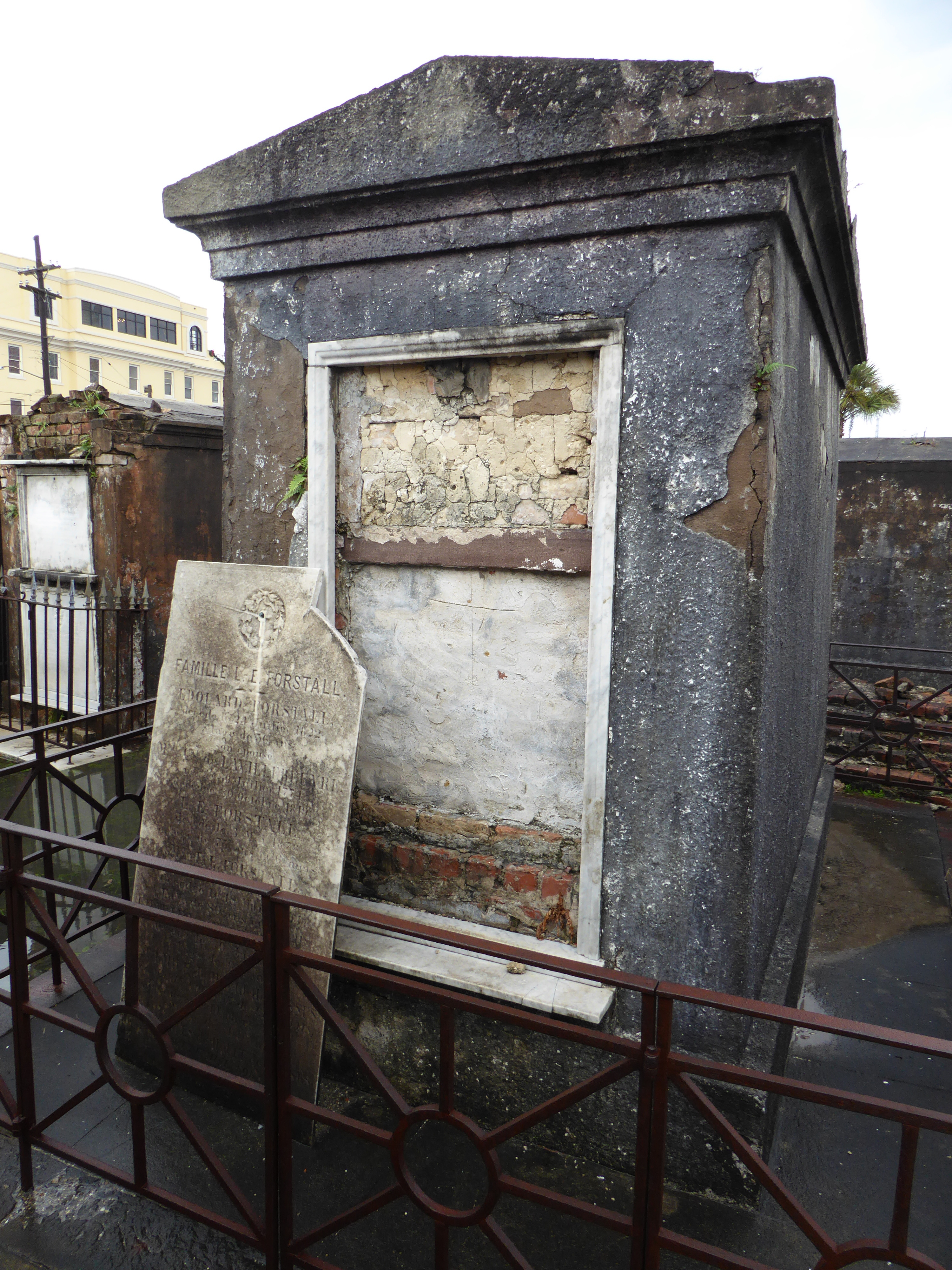
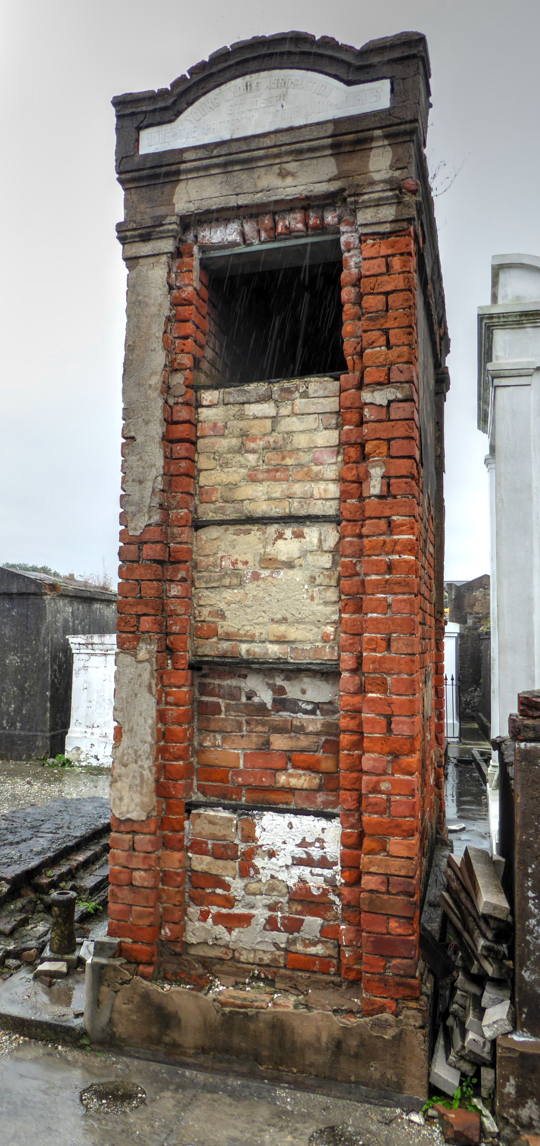
Tomb belonging to the “Young Ladies Association of St. Joseph”
Alternate crypt claimed by some to hold Marie Laveau’s remains.
As expected, the cemetery holds the remains of quite a number of New Orleans notables. Special mention should be made of the understanding that the city’s famed voodoo queen/priestess- Marie Laveau was interred here. The specific location of her burial was not publicly documented. It is widely believed that her remains were placed in the Glapion family crypt. (She was related by marriage to the Glapion family). A metal plaque attached to that tomb reinforces the claim. But followers / believers in her powers are not in agreement as to her final resting place. Visitors seeking good luck make three x marks on the tomb they believe to belong to Laveau.
Not all tombs are in good shape.
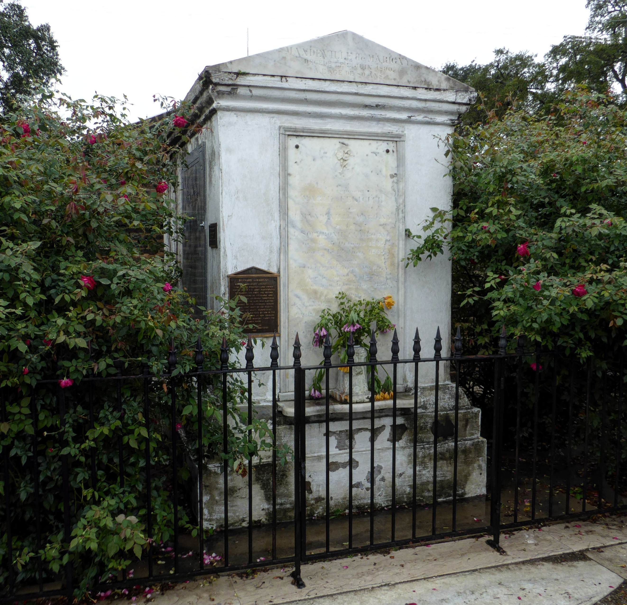
Tomb of Bernard de Marigny
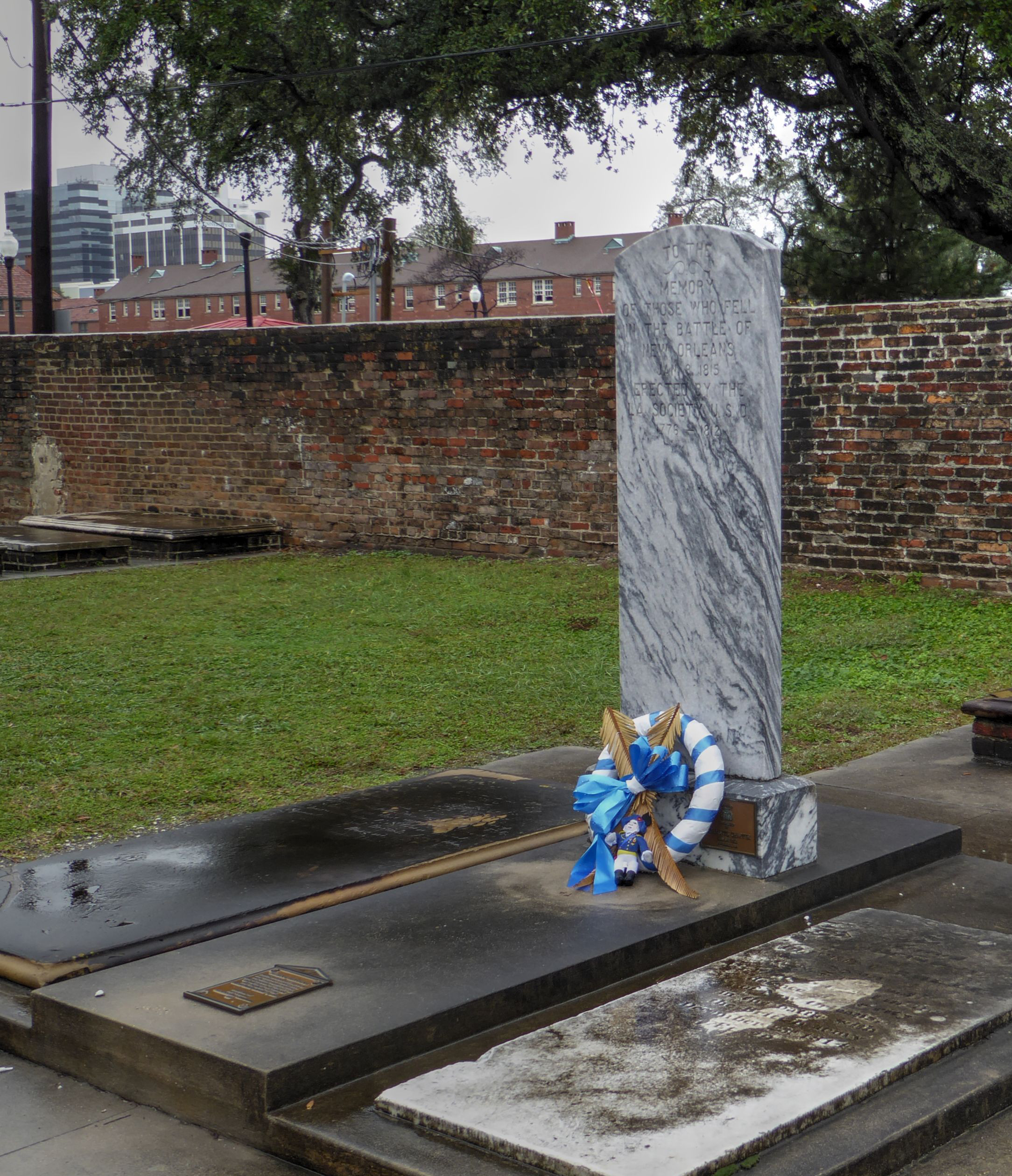
Memorial to the American soldiers who fell in the Battle of New Orleans
The “Battle of New Orleans” was the final armed struggle of the War of 1812, considered by some to be the a “second war of independence”. In this conflict, the United States struggled to fend off incremental erosion of the young republic’s sovereignty by the British. This is the war that saw England invade the U.S., capturing and burning Washington D.C.
The commemorated battle actually took place after a treaty to end the war had been signed, but before it was ratified.
Muir Woods is a beautiful place to enjoy the redwood forests of California.
It is just a short drive north of San Francisco over the Golden Gate Bridge. We found it an oasis of nature that was difficult to leave. Here are some photos that help us remember our time there. (as always, you can click on any photo to see a larger version.)


 Leaving New Orleans we took an Amtrak train north to Chicago. This is the train that Arlo Guthrie sang about- “The City of New Orleans”.
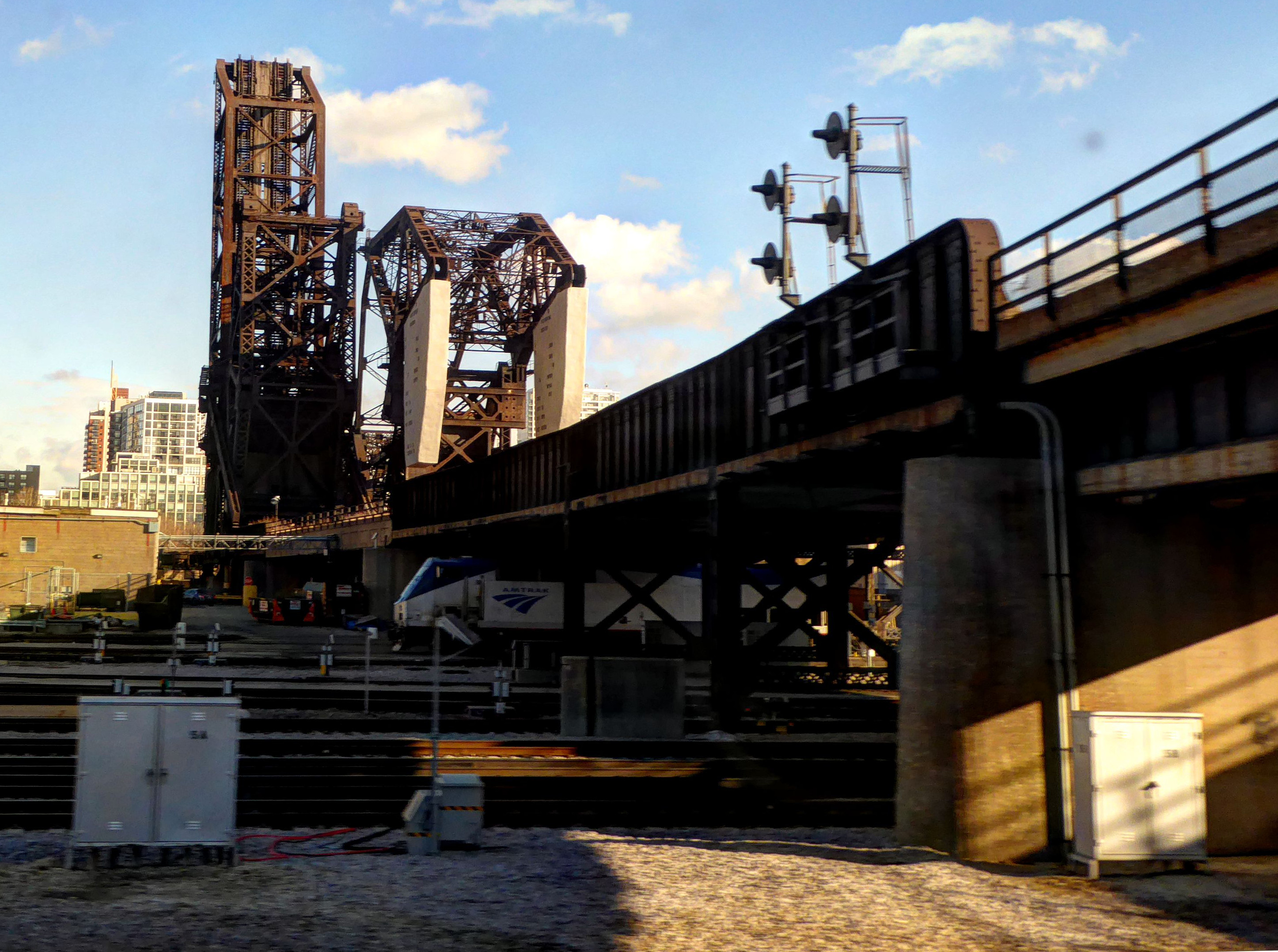
